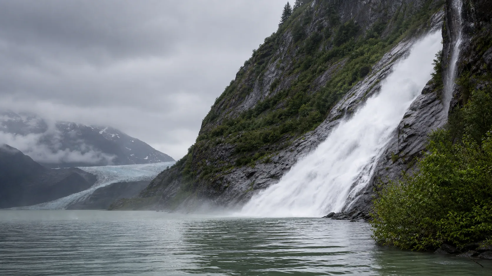
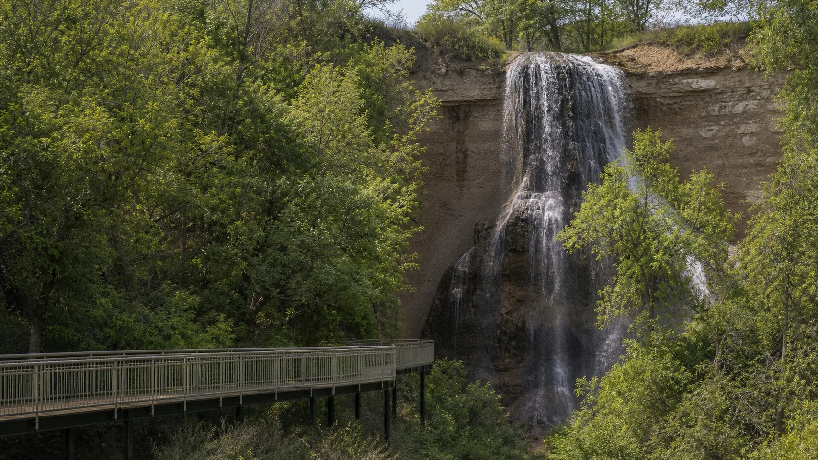
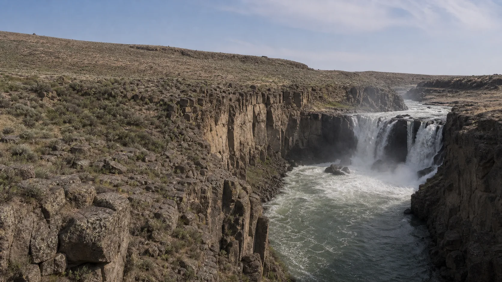
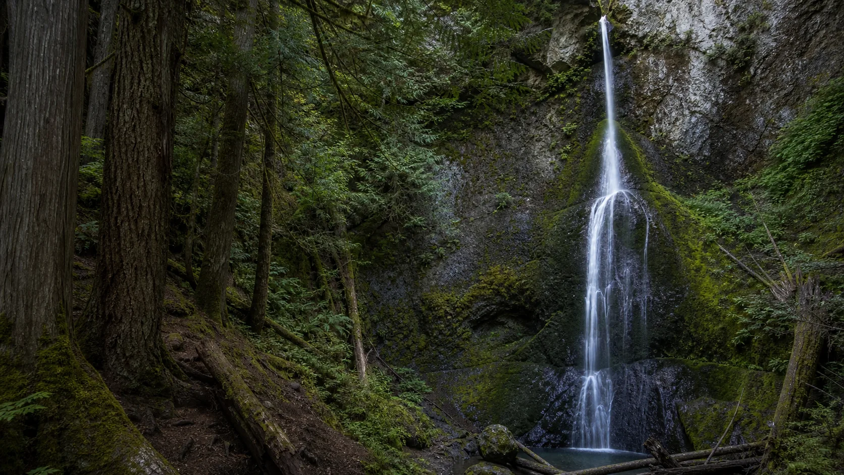
Juneau, Alaska
Nugget Falls
Plan Nugget Falls near Juneau, Alaska: 2 mi route details, parking and directions, best time to visit, safety notes, and 10 waterfall photos.
377 ft2 mi10 photos
Waterfall photography guides with working viewpoints, named light directions, season-specific shot planning, and permit rules. Practical advice for the falls actually on this list, not a generic photo blog.
Every guide on this list ships with a hero plus a four-frame editorial pack, so the bar for inclusion is not whether a fall can be photographed; it is whether the working position is obvious, the light direction is named, and the season changes the shot enough to matter. That is the cut this page tries to make.
The pillar advice in waterfall photography is older than digital: a tripod, a circular polarizer, a 2- to 6-stop ND filter for the silky-curtain look, and a long-exposure shutter between 0.5 and 4 seconds. None of that is unusual. What is harder to find is the actual orientation of the cliff face you are shooting at and the time of day the back wall stops fighting you. A 16-mile detour to a north-facing amphitheater you intend to shoot at noon will produce a flat, contrasty file regardless of which camera body you are carrying.
The list below is organized by what the picture actually looks like at the working viewpoint. East-facing curtains like Minnehaha are a morning shoot; the curtain catches direct light head-on and the glen is in the right kind of soft shade by 10 a.m. North-facing walls like Latourell, Hickory Nut, and Nooksack sit in shade most of the day and reward overcast or late golden hour. Slot canyons like Zapata are a different problem entirely: deep shade all day, ice in winter, and a wade in summer.
Crowd timing is the other variable. The most photographable falls in the country are also the most photographed; weekday mornings before 9 a.m. is the universal answer for a clean railing at Minnehaha, Latourell, Sliding Rock, and Hamilton Pool (the last requires a reservation). For permits, drone rules, and commercial-shoot policy, the individual guide is always the source of truth; rules vary by ranger district and by state park.
Light direction, quick reference. East-facing curtains: Minnehaha in Minneapolis is a morning shoot, with direct light catching the curtain head-on through about 10 a.m. before the glen flattens out. The opening of the Hamilton Pool grotto faces north but takes a wedge of morning sun through the open side at the 9 a.m. reservation slot; that is the brochure frame.
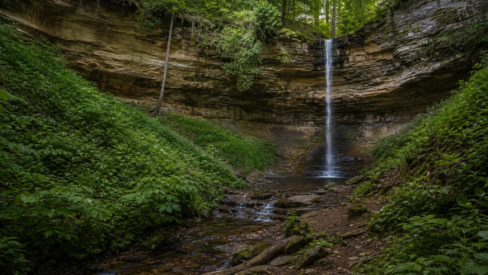
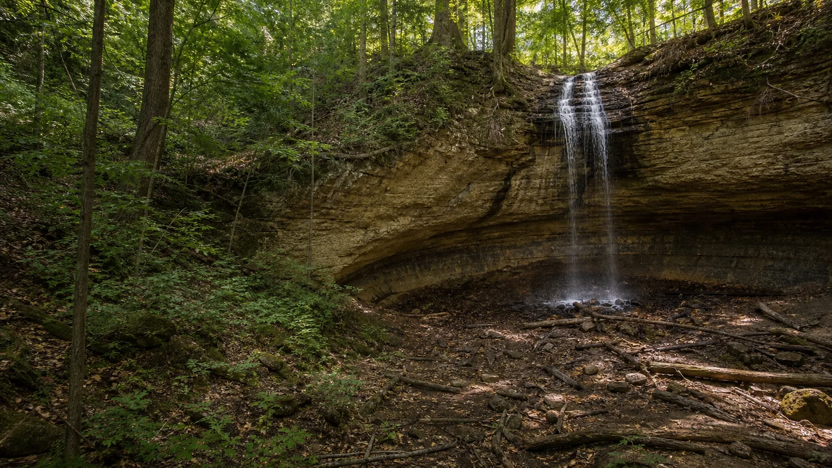
North-facing walls. Latourell, Hickory Nut, and Courthouse sit in shade most of the day. That is good news. Overcast is the cleanest light, and the last hour before sunset gives a warm-sky bounce without ever putting direct sun on the dark rock.
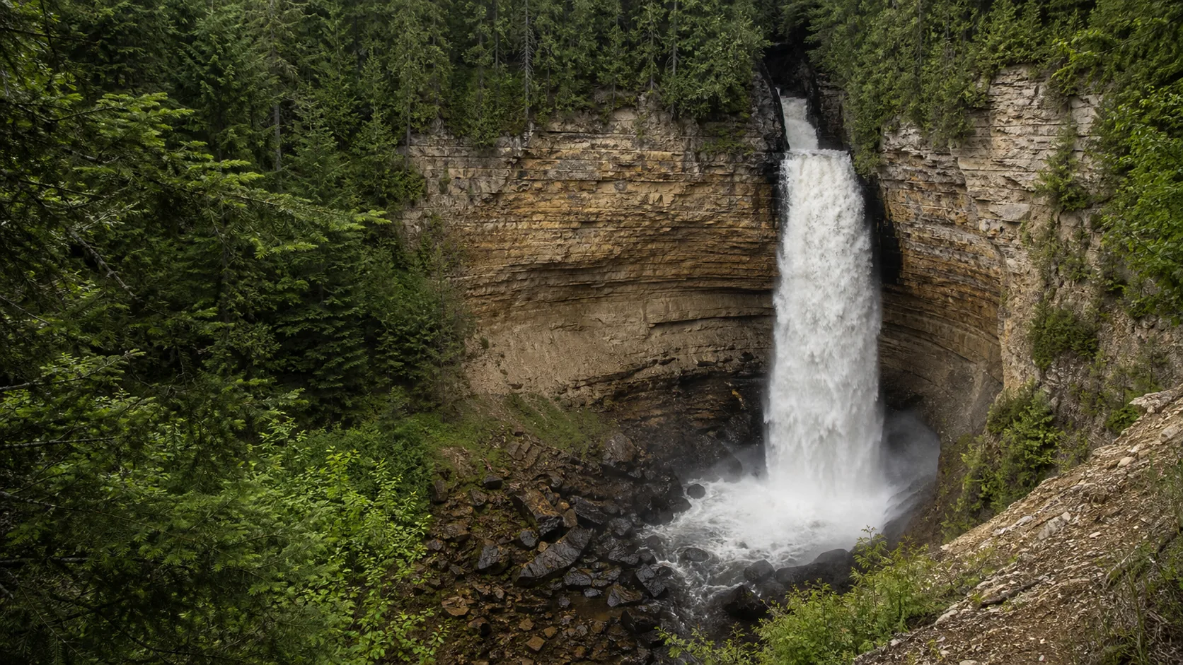
Overcast is the universal answer. Basalt amphitheaters specifically reward heavy overcast: Toketee (Umpqua columnar basalt), Nooksack (Glacier Peak basalt gorge), and Latourell (Grande Ronde basalt) all blow out under direct sun and hold detail under cloud.
Season changes the shot entirely. Minnehaha in January is a hollow ice column you can walk behind via the south stairs; the same falls in May is a 53-foot soft curtain. Zapata in February is a blue-on-blue ice cone in a slot canyon; in July it is a wade. Hamilton Pool after a heavy rain is a real waterfall (and a closed swim hole); in August it is a misty seep over the limestone dome. Plan the trip to the season.
It depends on which way the cliff faces. East-facing curtains like Minnehaha are a morning shoot, with the curtain in direct light through about 10 a.m. North-facing walls like Latourell, Hickory Nut, and Courthouse work best at golden hour or under heavy overcast, because direct sun never hits the curtain anyway. Midday is the worst slot at almost every waterfall because contrast between lit forest and shaded chute is too high to recover. The per-fall guide names the orientation and the working window for each location.
If you want the silky-curtain look, yes. A 2- to 6-stop neutral-density filter lets you hold the shutter open between 0.5 and 4 seconds in daylight without blowing the highlights. A circular polarizer (about 1.5 stops on its own) cuts wet-rock glare and saturates the surrounding moss, and is the one filter you should not leave home without. On heavy-overcast days at a shaded falls (Toketee, Courthouse, Latourell in winter), you can often get the long shutter without an ND at all.
Tripod whenever you are going below about 1/30 of a second, which means most waterfall work outside of mid-summer direct light. The exceptions are crowded overlooks where a tripod blocks the railing (Toketee's fixed platform, Nooksack's narrow south rim, Sliding Rock's deck during open hours); at those sites, brace against a post or use a tabletop tripod on the railing. Personal-use tripods do not require a permit at any fall on this list, but commercial shoots almost always do; check the per-fall guide.
A wide zoom (around 16-35mm full-frame equivalent) covers the standard amphitheater frame at most of the falls on this list. A short telephoto (70-200mm equivalent) is the second lens, used for tight detail of the curtain texture, lichen on the back wall at Latourell, or compressed multi-tier shots at Toketee and Hickory Nut. Skip the ultra-wide unless you are inside a tight slot canyon like Zapata, where 12-16mm full-frame becomes useful and the close walls leave no other option.
Between 0.5 and 4 seconds is the working range. Half a second keeps some texture in the water; 1 to 2 seconds is the canonical look, with the curtain reading as a single soft sheet; 4 seconds and up starts to lose the falling shape entirely and the file goes mushy. Mossbrae Falls (raft only, west-facing) is the textbook 1- to 4-second target because the multi-source fan collapses cleanly into a single curtain. Heavy-flow falls like Nooksack hold detail better at shorter speeds because there is enough water mass to read at 1/4 of a second.
Latourell Falls in late October frames the 249-foot plunge against yellow bigleaf maple and vine maple in the Columbia River Gorge. Hickory Nut Falls in mid-October fills the Hickory Nut Gorge with red and yellow against the gray Henderson Gneiss wall. Arethusa Falls in the White Mountains and Diana's Baths in New Hampshire hit peak color the first week of October most years. In the Smokies, Madison Creek Falls peaks mid-October to early November. The Ozark falls (Hemmed-In Hollow, Cane Creek) hold color into early November. Check the per-fall guide for the local peak window.
Almost always. National Forest sites (Toketee, Nooksack, Courthouse, Hickory Nut on adjacent USFS land, Sliding Rock) require a USDA Forest Service Special Use Authorization for any commercial shoot. State park sites (Latourell, Minnehaha, Cummins, White River Falls) require a state-specific Special Use Permit, with fees that start around $50 and rise with crew size. BLM sites (Zapata, parts of Hemmed-In Hollow) clear through the local field office. The per-fall guide names the permit issuer and the contact number; do not just show up with a crew.
Often no. National Park units (Plaikni in Crater Lake, Moose Falls in Yellowstone, Madison Creek in Great Smoky Mountains, Marymere in Olympic) ban drone takeoff, landing, and operation everywhere within the park boundary. National Forest sites generally allow recreational drone use under FAA Part 107 but discourage it at developed recreation sites and ban it over wilderness boundaries. State parks vary widely: Oregon requires park-specific approval (Latourell), Minneapolis Park and Recreation Board charges $75 (Minnehaha), Texas state and county parks largely prohibit it. Always check the per-fall guide before flying.
Plan Nugget Falls near Juneau, Alaska: 2 mi route details, parking and directions, best time to visit, safety notes, and 10 waterfall photos.
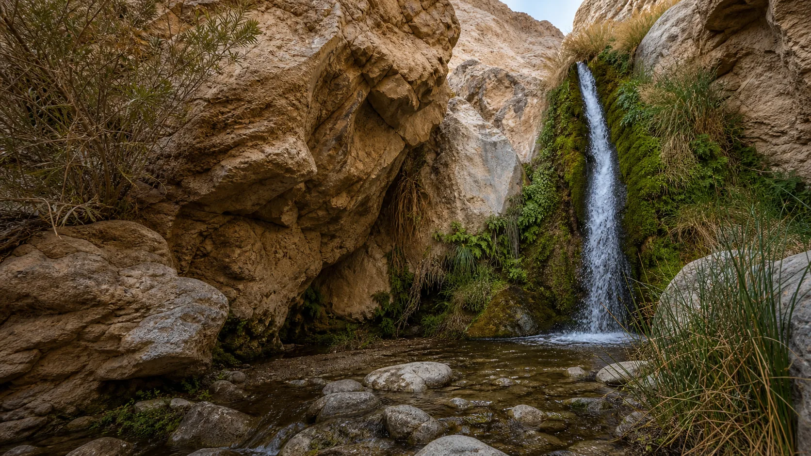
Plan Darwin Falls in Inyo County, California: 2 mi route details, parking and directions, best time to visit, safety notes, and 8 waterfall photos.
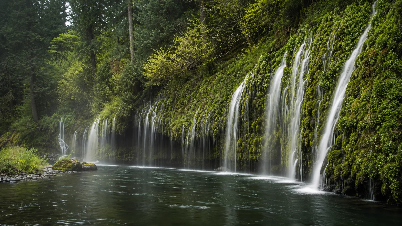
Plan Mossbrae Falls in Siskiyou County, California with waterfall photos, map context, parking checks, directions, access notes, and best-time guidance.
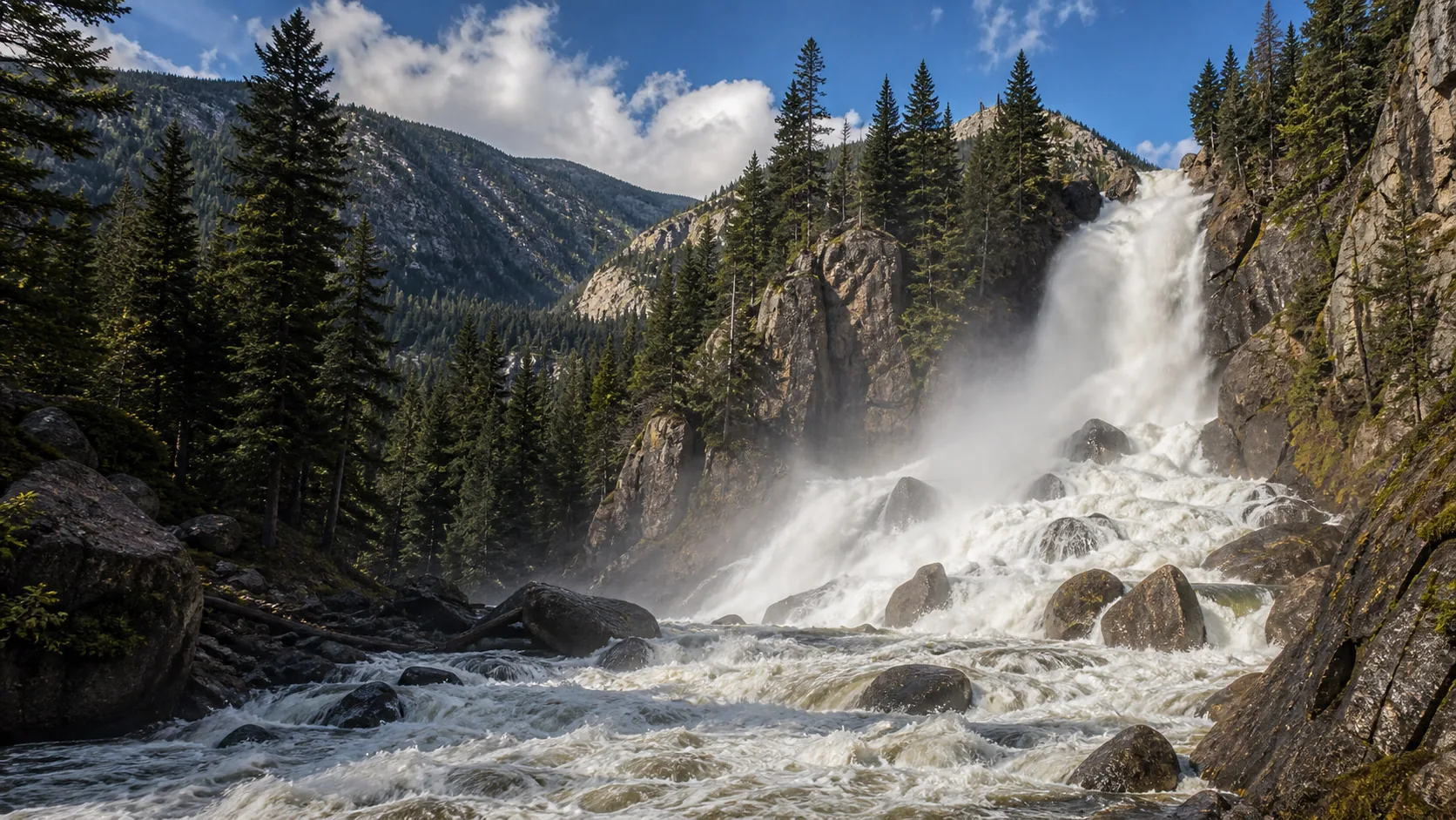
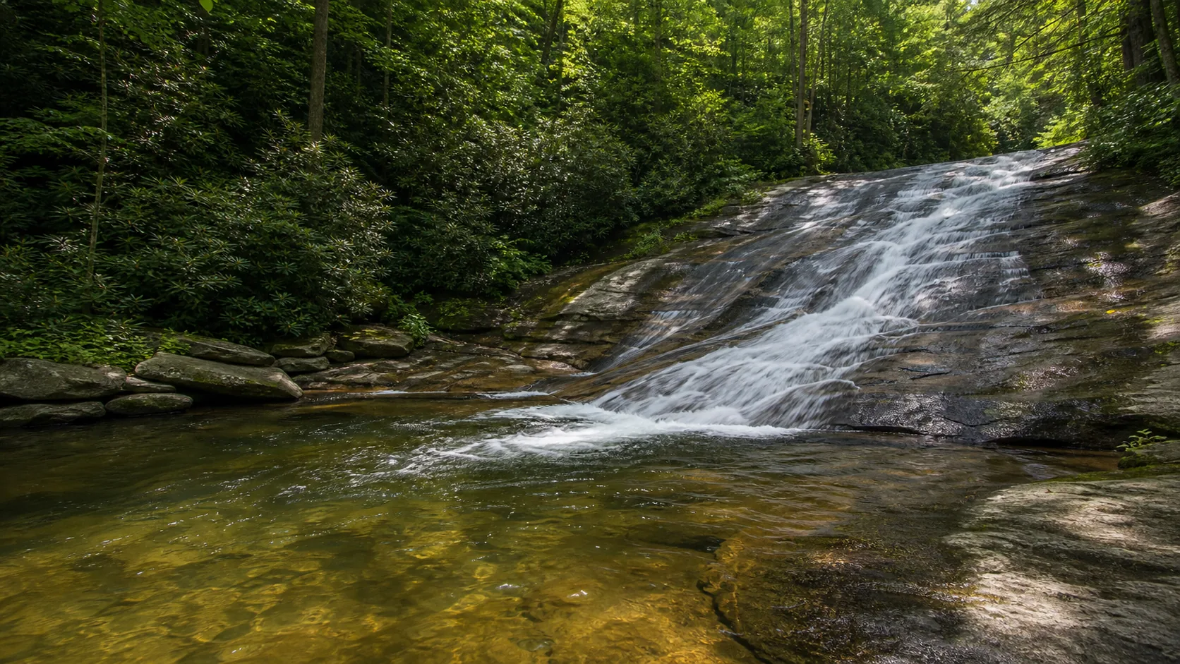
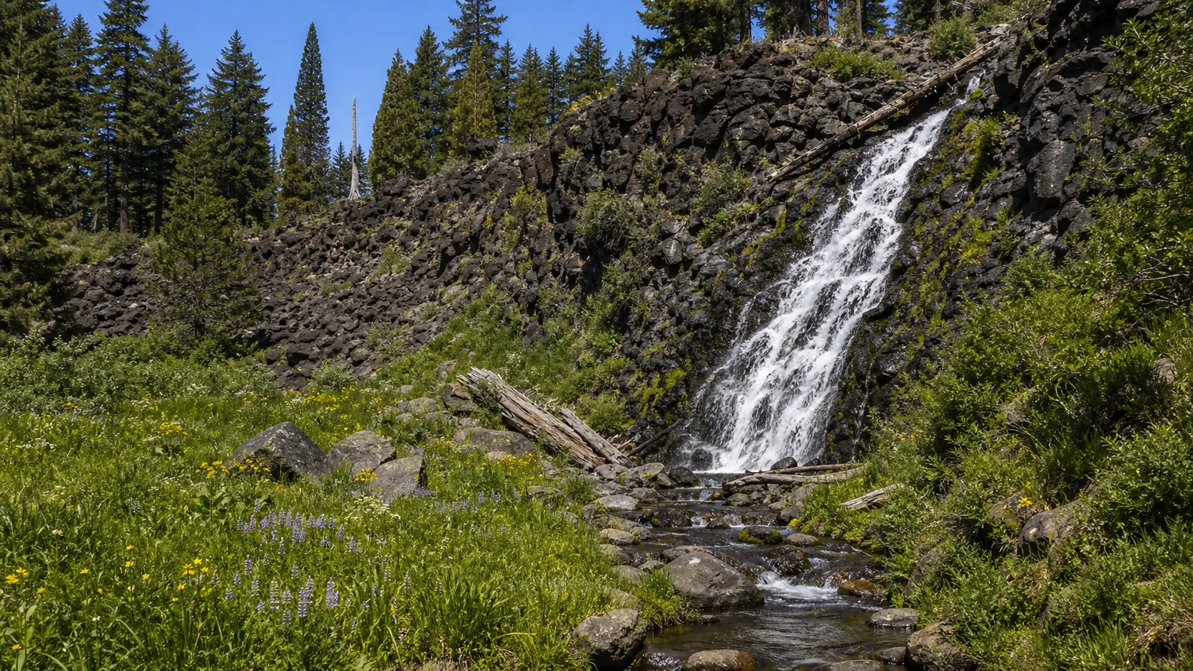
Plan Fish Creek Falls in Routt County, Colorado: 0.5 mi route details, parking and directions, best time to visit, safety notes, and 8 waterfall photos.
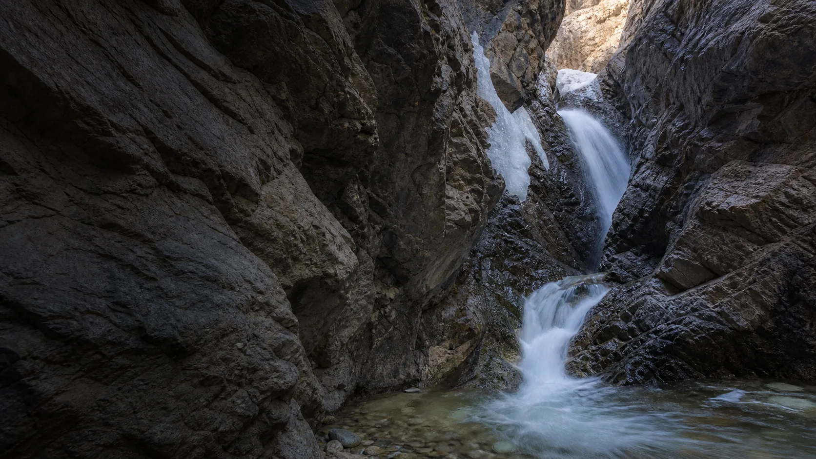
Plan Zapata Falls in Alamosa County, Colorado: 0.8 mi route details, parking and directions, best time to visit, safety notes, and 8 waterfall photos.
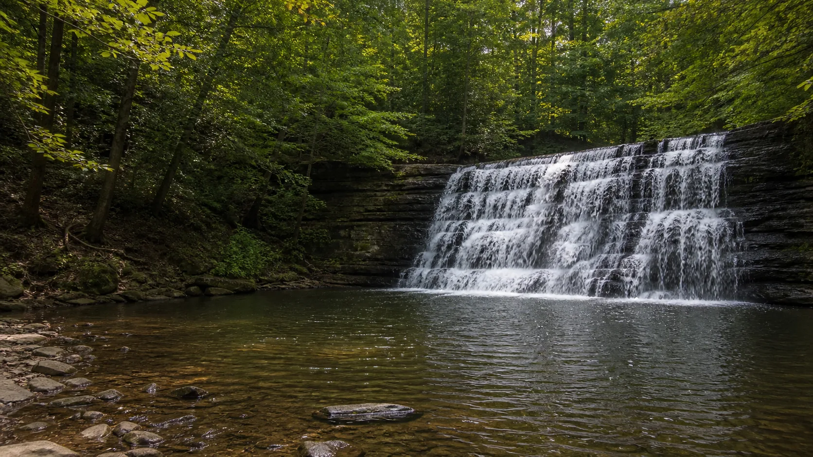
Plan Wadsworth Falls State Park near Middletown, Connecticut: 0.6 mi route details, parking and directions, best time to visit, safety notes, and 8 waterfall photos.
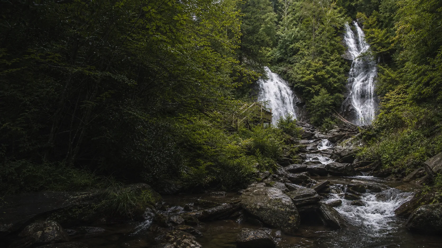
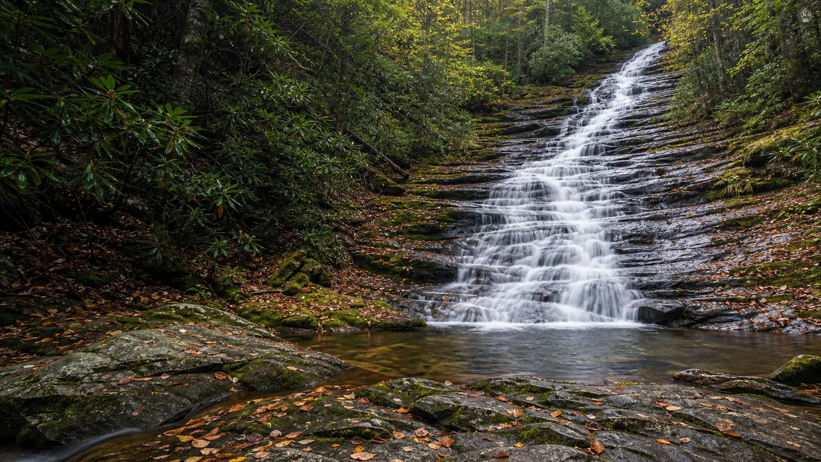
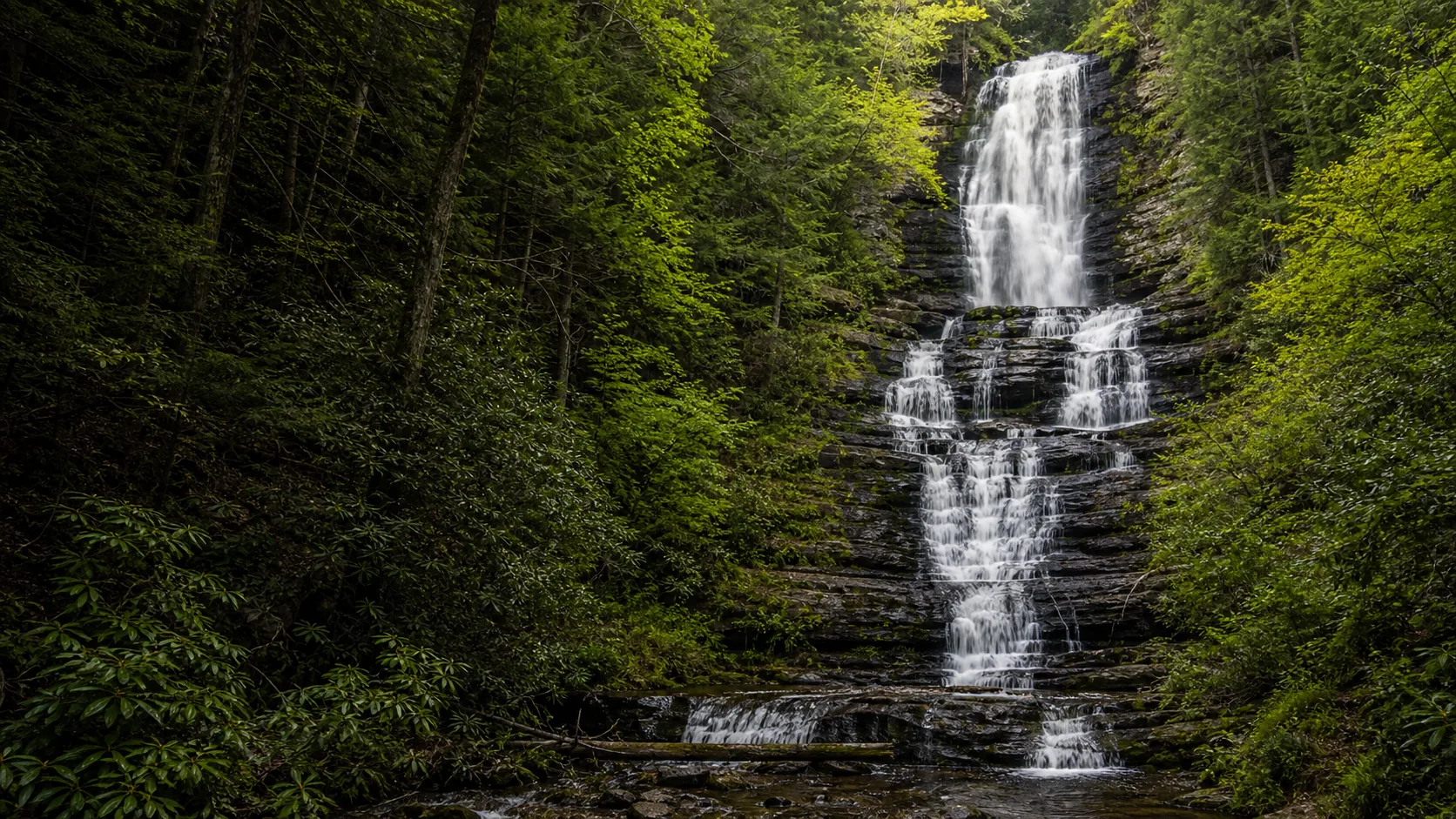
Plan Anna Ruby Falls in White County, Georgia: 0.8 mi route details, parking and directions, best time to visit, safety notes, and 8 waterfall photos.
Plan DeSoto Falls in Lumpkin County, Georgia: 2.2 mi route details, parking and directions, best time to visit, safety notes, and 8 waterfall photos.
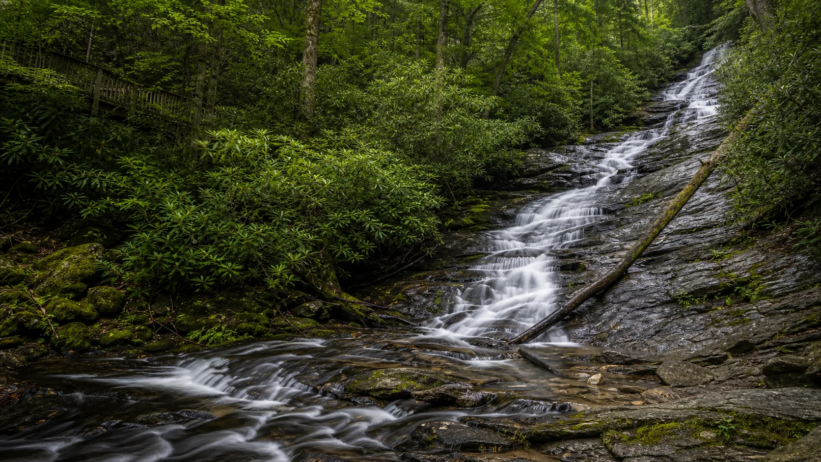
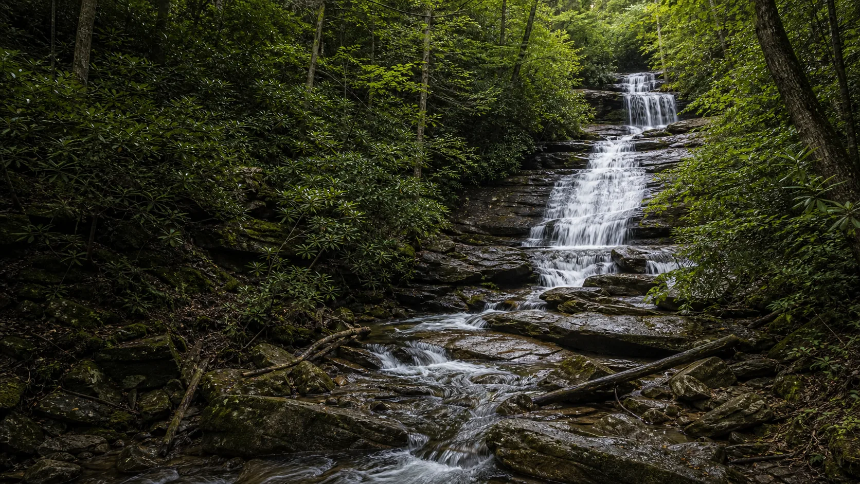
Plan Dukes Creek Falls near Helen, Georgia: 1 mi route details, parking and directions, best time to visit, safety notes, and 8 waterfall photos.
Plan Miners Falls near Munising Township, Michigan: 1.2 mi route details, parking and directions, best time to visit, safety notes, and 8 waterfall photos.
Plan Munising Falls near Munising, Michigan: 0.4 mi route details, parking and directions, best time to visit, safety notes, and 8 waterfall photos.
Plan Tannery Falls near Munising, Michigan: 0.4 mi route details, parking and directions, best time to visit, safety notes, and 8 waterfall photos.
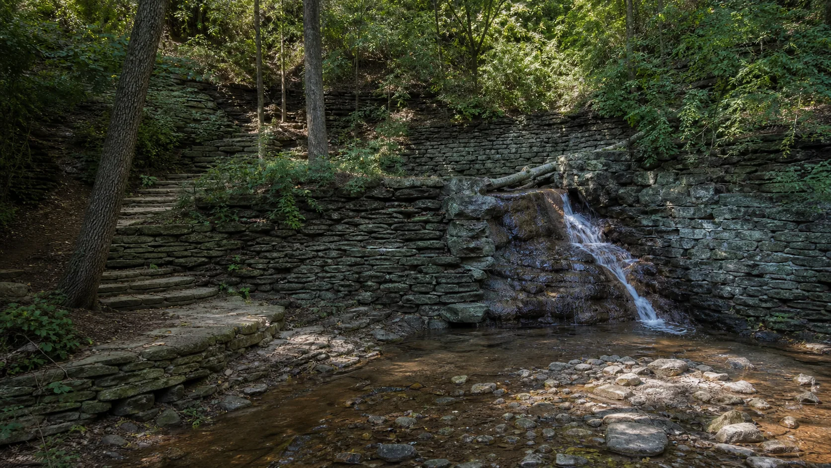
Plan Hidden Falls near Saint Paul, Minnesota: 1.4 mi route details, parking and directions, best time to visit, safety notes, and 7 waterfall photos.
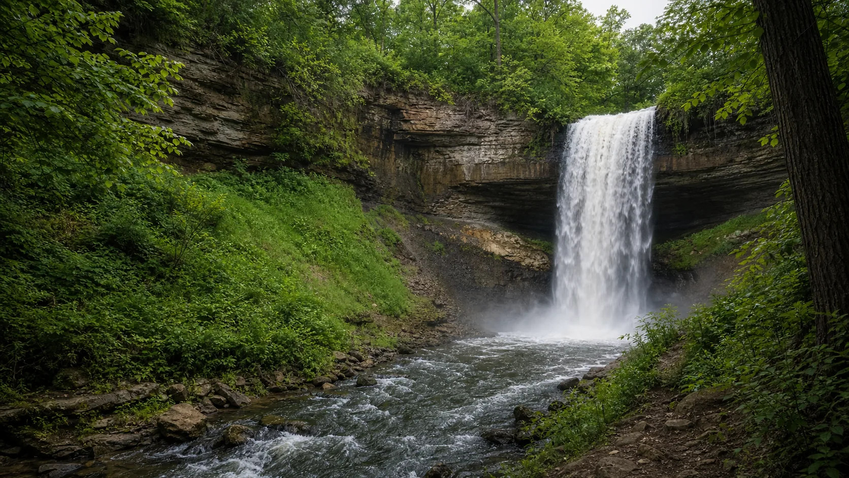
Plan Minnehaha Falls near Minneapolis, Minnesota: 0.9 mi route details, parking and directions, best time to visit, safety notes, and 8 waterfall photos.
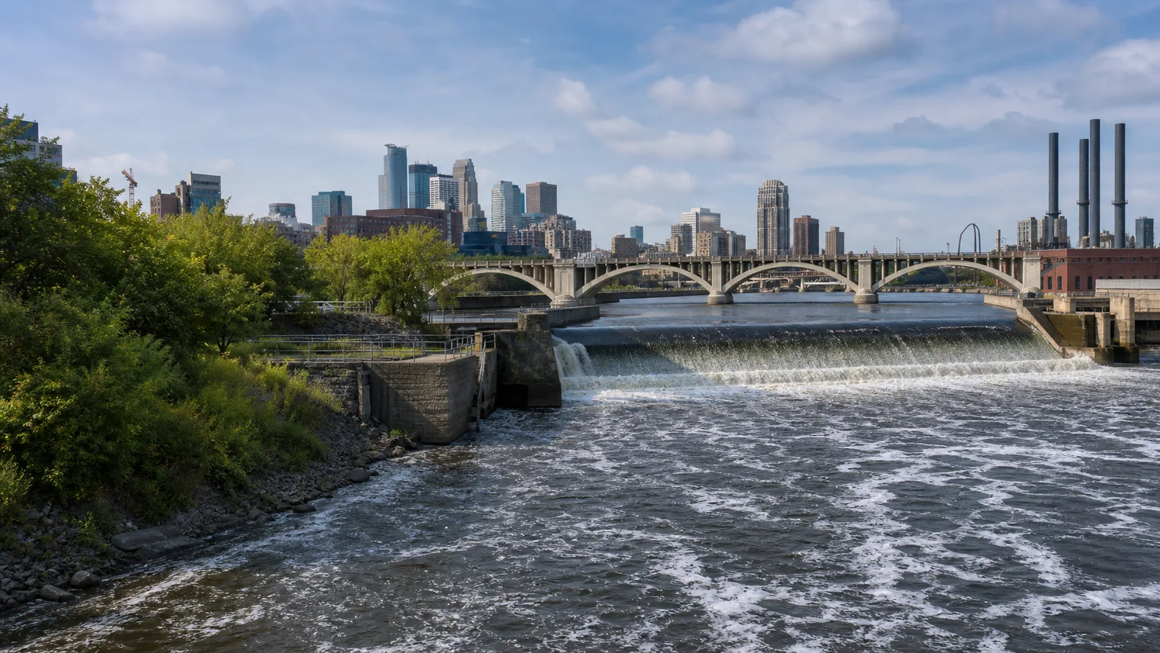
Plan St. Anthony Falls near Minneapolis, Minnesota: 1.8 mi route details, parking and directions, best time to visit, safety notes, and 7 waterfall photos.
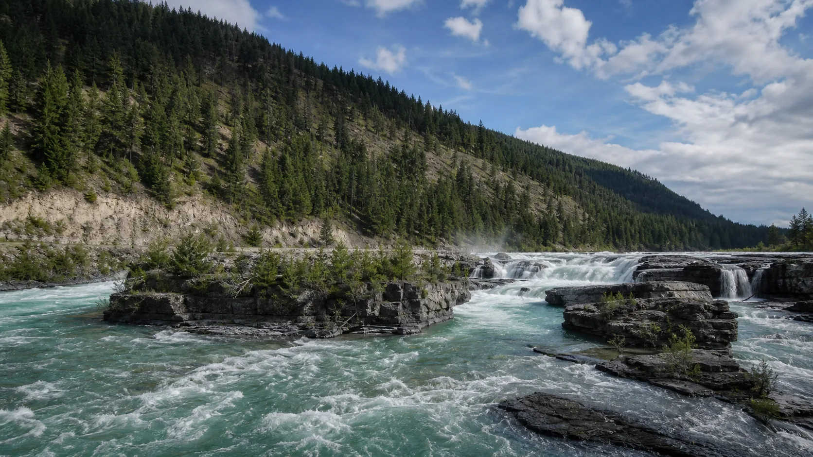
Plan Kootenai Falls in Lincoln County, Montana: 0.9 mi route details, parking and directions, best time to visit, safety notes, and 8 waterfall photos.
Plan Smith Falls in Cherry County, Nebraska: 0.8 mi route details, parking and directions, best time to visit, safety notes, and 8 waterfall photos.
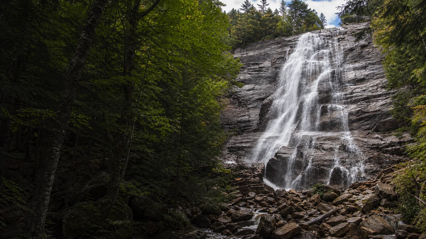
Plan Arethusa Falls near Harts Location, New Hampshire: 2.6 mi route details, parking and directions, best time to visit, safety notes, and 8 waterfall photos.
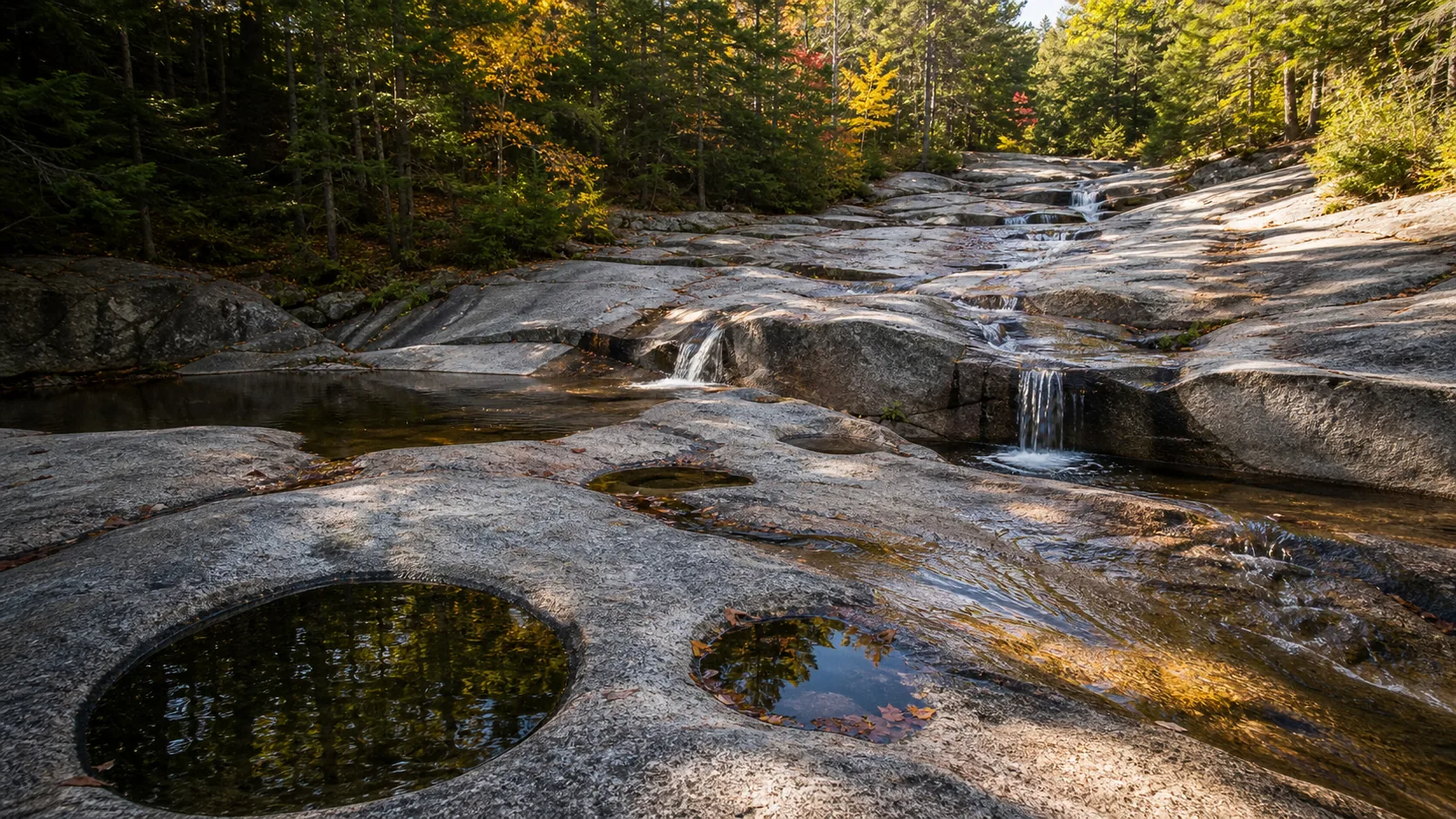
Plan Diana's Baths near Bartlett, New Hampshire: 1.2 mi route details, parking and directions, best time to visit, safety notes, and 8 waterfall photos.
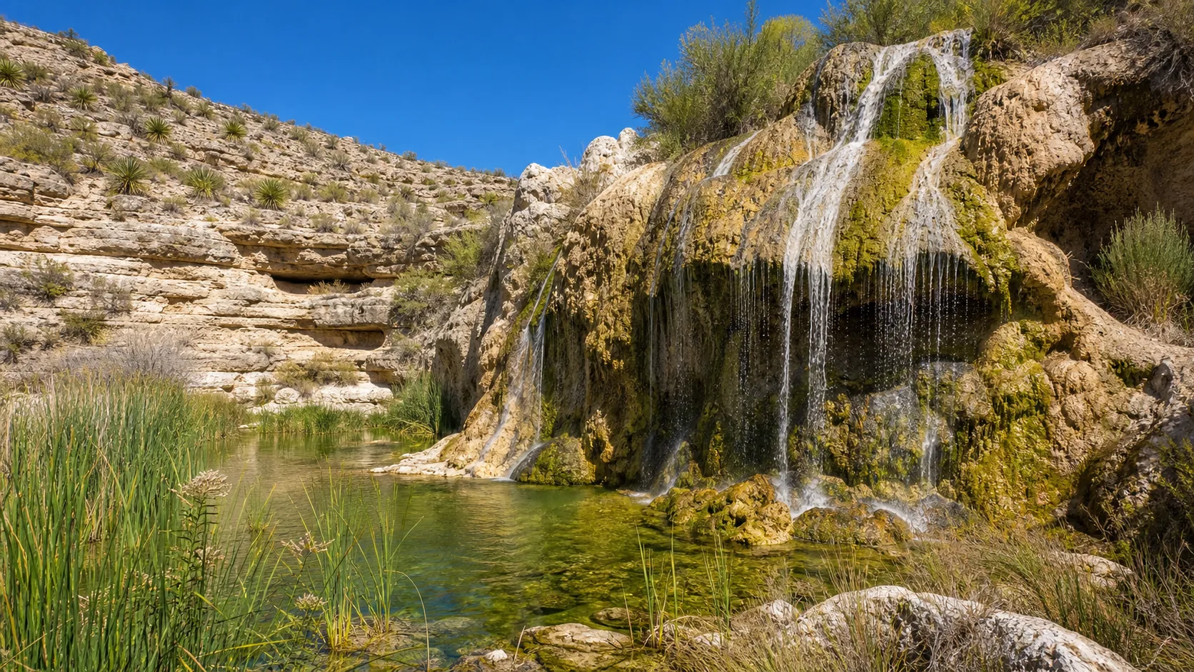
Plan Sitting Bull Falls near Carlsbad, New Mexico: 0.2 mi route details, parking and directions, best time to visit, safety notes, and 8 waterfall photos.
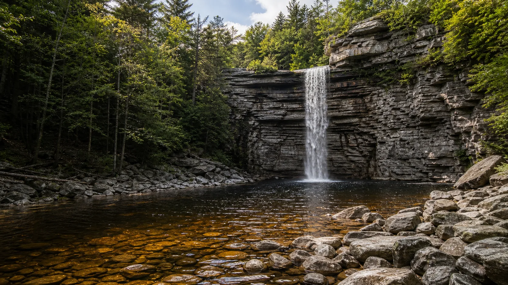
Plan Awosting Falls near Kerhonkson, New York: 0.5 mi route details, parking and directions, best time to visit, safety notes, and 8 waterfall photos.
Plan Roaring Fork Falls in Yancey County, North Carolina: 0.6 mi route details, parking and directions, best time to visit, safety notes, and 8 waterfall photos.
Plan Sliding Rock in Transylvania County, North Carolina: 0.1 mi route details, parking and directions, best time to visit, safety notes, and 8 waterfall photos.
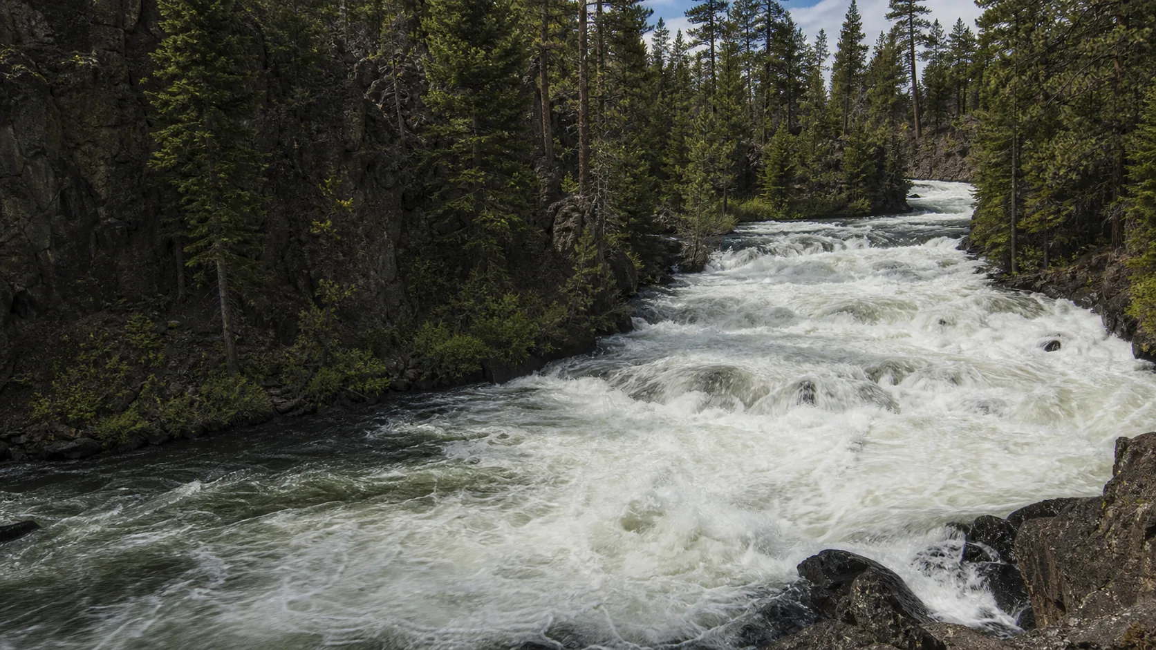
Plan Benham Falls near Sunriver, Oregon: 1.4 mi route details, parking and directions, best time to visit, safety notes, and 8 waterfall photos.
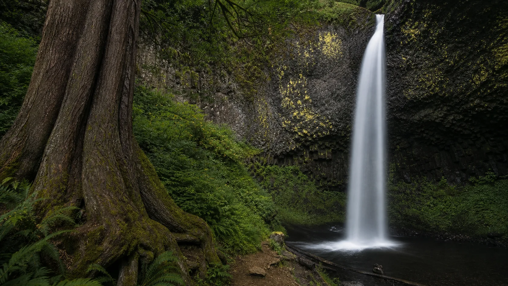
Plan Latourell Falls in Multnomah County, Oregon: 2.4 mi route details, parking and directions, best time to visit, safety notes, and 8 waterfall photos.
Plan Plaikni Falls near Crater Lake National Park, Oregon: 2 mi route details, parking and directions, best time to visit, safety notes, and 8 waterfall photos.
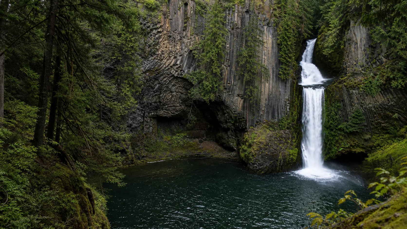
Plan Toketee Falls near Idleyld Park, Oregon: 0.8 mi route details, parking and directions, best time to visit, safety notes, and 8 waterfall photos.
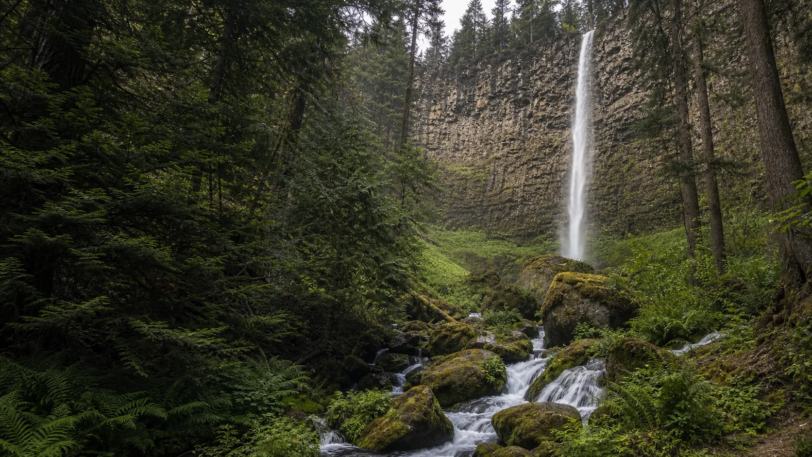
Plan Watson Falls in Douglas County, Oregon: 0.6 mi route details, parking and directions, best time to visit, safety notes, and 8 waterfall photos.
Plan White River Falls near Tygh Valley, Oregon: 0.9 mi route details, parking and directions, best time to visit, safety notes, and 8 waterfall photos.
Plan Dingmans Falls near Dingmans Ferry, Pennsylvania: 0.4 mi route details, parking and directions, best time to visit, safety notes, and 8 waterfall photos.
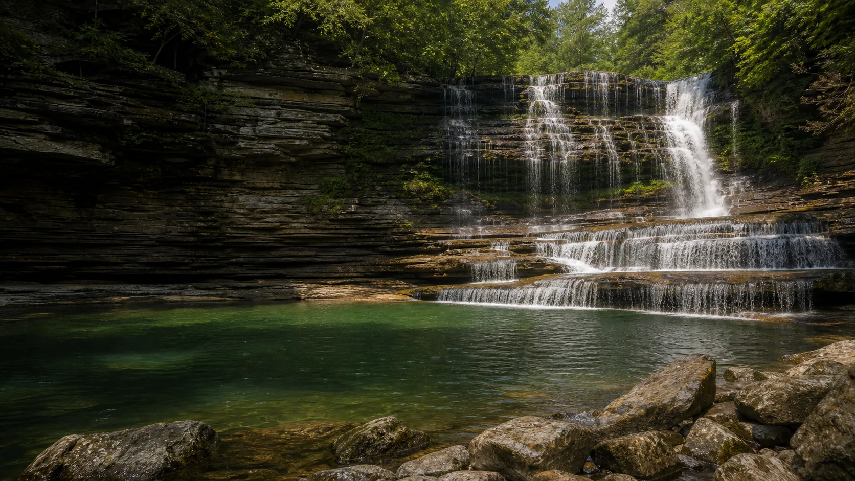
Plan Cummins Falls in Jackson County, Tennessee: 1.5 mi route details, parking and directions, best time to visit, safety notes, and 8 waterfall photos.
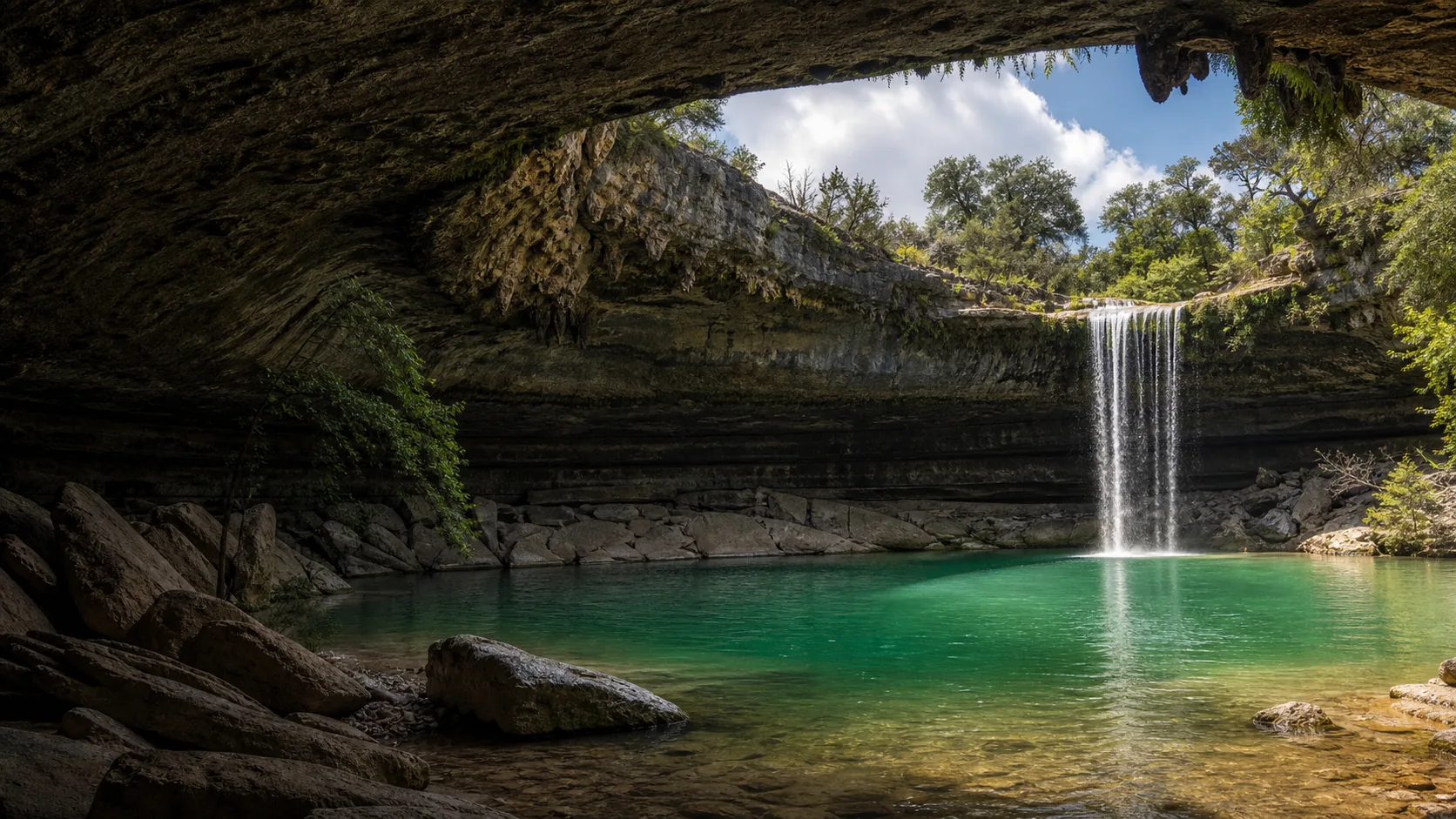
Plan Hamilton Pool Preserve in Travis County, Texas: 0.5 mi route details, parking and directions, best time to visit, safety notes, and 8 waterfall photos.
Plan Marymere Falls in Clallam County, Washington: 1.8 mi route details, parking and directions, best time to visit, safety notes, and 8 waterfall photos.
Plan Nooksack Falls near Glacier, Washington: 0.1 mi route details, parking and directions, best time to visit, safety notes, and 8 waterfall photos.
Plan Moose Falls in Teton County, Wyoming: 0.1 mi route details, parking and directions, best time to visit, safety notes, and 8 waterfall photos.