50-foot Miners Falls plunge over Cambrian Munising Formation sandstone in Pictured Rocks National Lakeshore, Michigan
Munising Township, MI

Miners Falls

Miners Falls is a 50-foot single-tier plunge where the Miners River drops over the Cambrian-age Munising Formation sandstone inside Pictured Rocks National Lakeshore. The NPS calls it the park's most powerful waterfall, and the Miners River carries enough volume that the falls reads as a full curtain even in late summer, when most Upper Peninsula falls thin to ribbons. Reach it by a 1.2-mile out-and-back forested trail with 64 steps to the lower viewing platform; the trailhead sits a short drive from Miners Castle, the most photographed cliff in the lakeshore.

Last verified May 12, 2026 Visited Desk-verified May 2026 8 sources checked
Trail 1.2 mi 1.5 mi extended
Time 30-75 min Easy
Best season Apr-Nov (trail); Late Apr-May (peak flow); Jan-Feb (ice, limited access) Late Apr - May
Parking Free unpaved trailhead lot off Miners Castle Road. No Pictured Rocks entrance fee. The lot is small and fills before 11 a.m. on summer weekends; the Miners Castle lot 1.5 miles north is the overflow option. Pictured Rocks National Lakeshore
Quick answer

Is Miners Falls worth visiting?

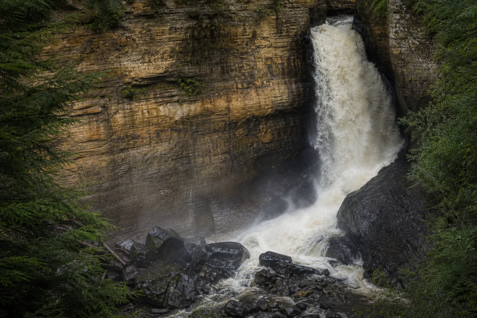
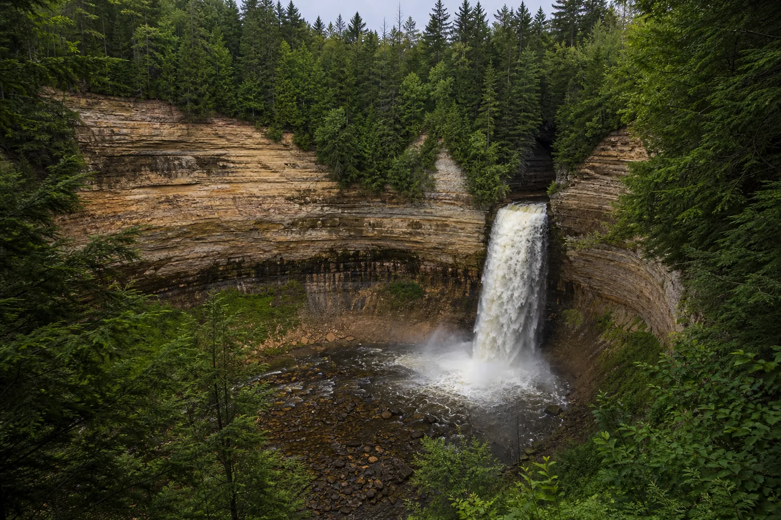
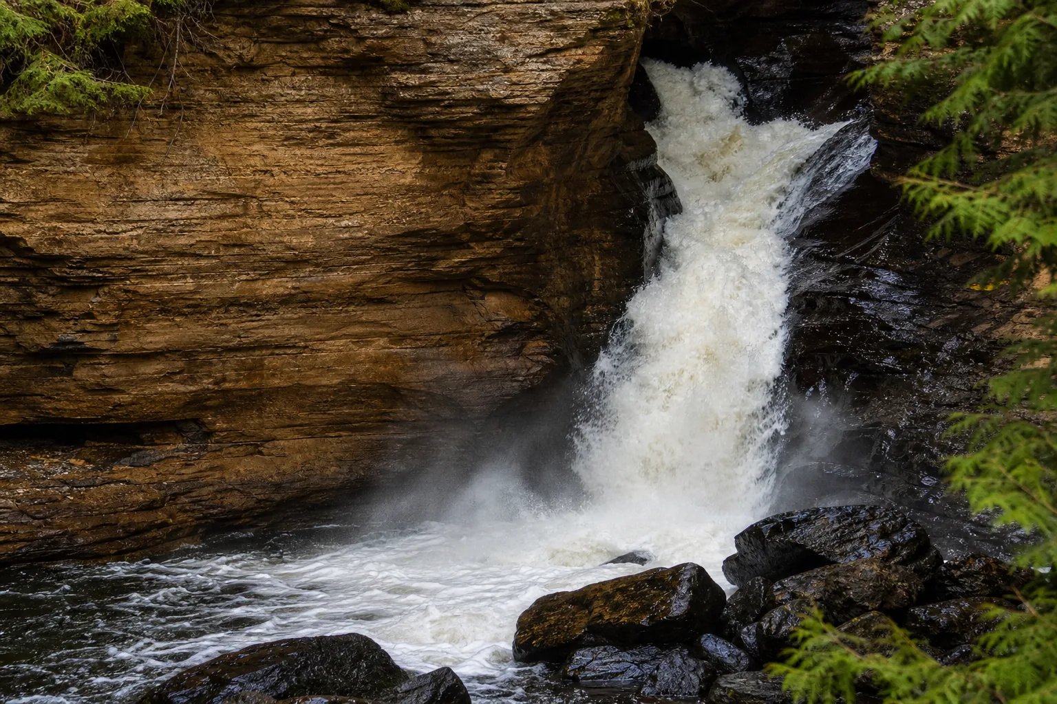
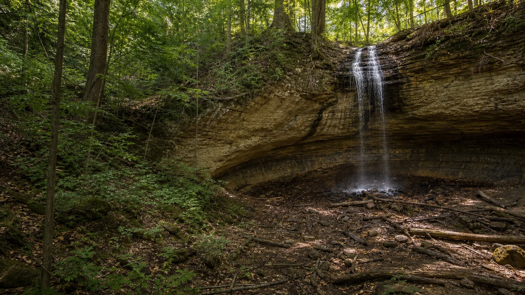
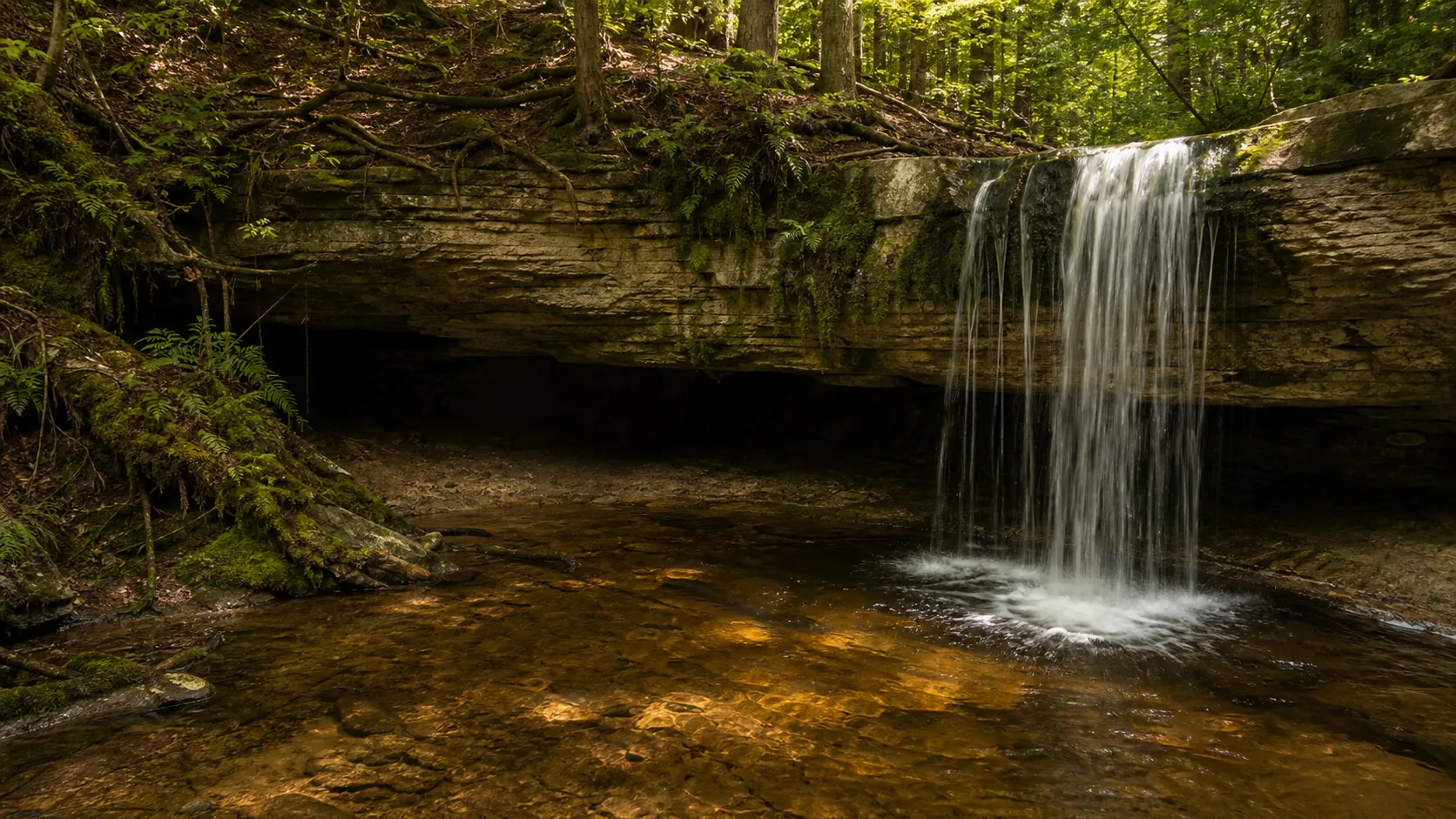
Yes. Miners Falls is the heaviest-flowing waterfall in Pictured Rocks National Lakeshore and one of the most reliable curtain-style plunges in the Upper Peninsula because the Miners River drains a much larger watershed than the small creeks behind Munising, Tannery, and Scott Falls. Practical: free entry, free trailhead lot off Miners Castle Road, 1.2-mile round trip on a forested dirt path with 64 steps to the lower viewing platform, dogs allowed on leash, walk-behind access is not possible (it is a true plunge, not an undercut alcove). Pair it naturally with Miners Castle 6 minutes north for the iconic Pictured Rocks cliff view.

  • 50-foot plunge over Cambrian Munising Formation sandstone
  • 1.2 mi forested out-and-back; 64 steps to the lower deck
  • Trailhead off Miners Castle Road, Pictured Rocks NL
  • Peak flow: late April through May
  • Ice column: late January through mid-February (limited road access)
  • Pair with Miners Castle, 6 minutes north on the same road
  • Free entry, free parking, no pass required
  • Live USGS gauge 04044755 on the Miners River itself
Last verified May 12, 2026 Visited Desk-verified May 2026 8 sources checked
Distance 1.2 mi 1.5 mi extended
Round trip 30-75 min 1.2 mi out-and-back on a forested dirt-and-gravel path with 64 steps down to the lower viewing platform.
Difficulty Easy 1.2 mi out-and-back on a forested dirt-and-gravel path with 64 steps down to the lower viewing platform.
Location Munising Township, MI Pictured Rocks National Lakeshore
Parking Free unpaved trailhead lot off Miners Castle Road. No Pictured Rocks entrance fee. The lot is small and fills before 11 a.m. on summer weekends; the Miners Castle lot 1.5 miles north is the overflow option. NPS
Transit No fixed-route transit Drive to the Miners Falls trailhead off Miners Castle Road · 0 ft
Drive 12 mi 20 min from downtown
Best season Apr-Nov (trail); Late Apr-May (peak flow); Jan-Feb (ice, limited access) Late Apr - May
Miners Falls the lower viewing platform at the base, reached by 64 steps; the miners river carries more water than any other pictured rocks waterfall.
Photo guide

Two angles inside a 1.2-mile loop.

Upper platform first (over-the-shoulder, no stairs), lower platform second (head-on, 64 steps down). The captions tell you what each frame is doing so you can decide before you walk.

50-foot Miners Falls plunge over Cambrian Munising Formation sandstone in Pictured Rocks National Lakeshore, Michigan
Miners Falls, hero composition
Miners Falls 50-foot plunge over Cambrian sandstone in Pictured Rocks National Lakeshore
The Miners River plunging 50 feet over the Cambrian Munising Formation sandstone, the park's most powerful single-tier waterfall.
Miners Falls lower viewing platform at the base of the 50-foot Miners River plunge
The lower viewing platform at the base, reached by 64 steps; the Miners River carries more water than any other Pictured Rocks waterfall.
Detail of Miners Falls water over Cambrian Munising Formation sandstone
Cambrian Munising Formation sandstone at the lip; the same warm-banded rock that produces the painted cliffs at Pictured Rocks.
01Is Miners Falls flowing right now?

Live data: USGS gauge 04044755 (Miners River near Munising) ↑. Park status: nps.gov/places/miners-falls ↑. The 30-year daily-discharge median is 30 cfs; the 75th percentile is 47 cfs; the 90th percentile is 80 cfs; the highest recorded reading is 421 cfs after a 2018 spring rain-on-snow event. Period of record: 1996 to present, about 2,930 days of usable data.

02How long is the walk?

1.2 miles round trip on a forested dirt-and-gravel out-and-back, with 64 steps down to the lower viewing platform near the end. AllTrails records about 157 feet of elevation gain on the round trip. The Munising Visitor Bureau describes the same trail as a 1.25-mile self-guided interpretive route; the small difference is rounding.

03How do you get there?

Trailhead: Miners Falls trailhead, short spur road off Miners Castle Road, Munising Township, MI 49862. From downtown Munising, head east on H-58, then north on Miners Castle Road; about 20 minutes by car. From Marquette (Sawyer International Airport, SAW), about 75 minutes east on M-28, then north on H-58 and Miners Castle Road. The falls is often confused with Munising Falls at the Munising Falls Visitor Center in town and with Tannery Falls inside the city limits; all three sit on different watersheds and use different trailheads.

04Is there free parking?

Free unpaved lot at the trailhead, with shoulder overflow if the lot fills. No Pictured Rocks entrance fee. The lot is small (around 25 spaces) and fills before 11 a.m. on summer weekends; the Miners Castle lot 1.5 miles north is the typical overflow option, with a 1.5-mile road walk back to the trailhead if every space is gone.

05Does it cost money?

Free. Pictured Rocks National Lakeshore does not charge an entrance fee. The trailhead, the parking lot, and the falls itself are all free year-round.

06Trail variants

Standard out-and-back 1.2 mi round trip, 30-60 min, forested dirt path; 64 steps drop to the lower viewing deck.
Upper viewing platform only 1.2 mi round trip, 30-45 min, skip the lower deck stairs for an over-the-shoulder frame.
Miners Castle pairing drive plus 0.5 mi walking at Miners Castle, 2-3 hr combined, the iconic Pictured Rocks cliff is 6 minutes down Miners Castle Road.
Winter snowshoe varies; road closed past gate, 2-4 hr, Miners Castle Road is unplowed in winter; add the road distance to the trail distance.

Detailed maps and recent reviews: Falls route on AllTrails · Creek route on AllTrails

07Can you swim?

No. The Miners River plunge pool is fenced off from the lower viewing platform and the river above the falls runs fast and cold. For a real swim on the same Miners River system, drive 5 miles to Miners Beach on Lake Superior at the river's mouth.

08Are dogs allowed?

Yes, on a leash up to 6 feet. The Miners Falls trail is one of the pet-friendly day-use trails inside Pictured Rocks; dogs are not allowed on most backcountry trails or on the Pictured Rocks Cruises boat tour. Pack out waste; there are no pet stations at the trailhead.

09Is it accessible?

No. The forested dirt trail has roots and uneven footing and the lower viewing platform is reached by 64 wooden steps. The upper viewing platform is closer to the lot but still involves natural footing. For ADA-accessible Pictured Rocks waterfall viewing, use Munising Falls at the visitor center, which has a paved out-and-back to the lower platform.

Field notes

Miners Falls at a glance.

50-foot single-tier plunge over Cambrian Munising Formation sandstone, 1.2 mi forested out-and-back with 64 steps, Pictured Rocks National Lakeshore, Alger County, Michigan. Free entry, free parking, dogs allowed on leash. Sourced from the NPS Miners Falls place page and AllTrails.

Height 50 ft USGS 3DEP
Type Plunge (single tier) USGS
County Alger Munising Township, MI
Managed by National Park Service NPS
Water source Miners River USGS
Elevation 722 ft USGS NED
Park area 73,236 acres NPS
Hours Trail open 24 hours year-round; the Miners Castle Road plowing window typically runs late April through late November. NPS
When to visit

Two windows that justify the trip, one that keeps the falls reliable all summer.

Late April through May for spring runoff and the loudest curtain. Late January through mid-February for a frozen ice column when the road is passable. June through October the Miners River holds enough volume that the falls reads as a full curtain even in dry weeks, which is unusual for the Upper Peninsula and the practical reason Miners is the most reliable summer waterfall stop in Pictured Rocks.

PEAK FLOW

Peak flowLate Apr - May
Ice / low flowLate Jan - Feb
Most crowdedWeekends and midday
Best photosSunrise or weekdays

Live water context

Discharge data -- Live reading from Miners River near Munising, MI (USGS 04044755) refreshes on the next build. Open the gauge link below for the current cubic-feet-per-second reading.

USGS 04044755 · Miners River near Munising, MI

Why is it called Miners Falls?

The Miners in Miners Falls, Miners River, Miners Castle, and Miners Beach traces to the early-1770s prospecting expeditions on the Lake Superior shore, when an Alexander Henry party searched the cliffs and river mouths for copper and silver under the British Crown. The mineralization the party hoped to find never materialized at commercial scale, but the name stuck through the General Land Office surveys of the 1840s and on into NPS-era maps. Local oral tradition sometimes adds a connection to the later 19th-century iron-furnace boom around Munising (the Schoolcraft furnace, the Bay Furnace ruins at Christmas), but the name predates that industry by about a century. The Ojibwe place names for this stretch of shoreline are separate; Minising, place of the great island, refers to Grand Island offshore and gave the city of Munising its modern name.

What else to do at Pictured Rocks National Lakeshore

Miners Falls sits in the western half of Pictured Rocks National Lakeshore, a 73,000-acre federal lakeshore that stretches 40 miles east along the Lake Superior shoreline from Munising to Grand Marais. The Miners Falls trailhead is on a short spur off Miners Castle Road, the same road that leads to Miners Castle (the iconic Pictured Rocks promontory) and Miners Beach. Most visitors who drive to the falls add Miners Castle on the same trip; the two are 6 minutes apart by car and together cover the most-photographed scenery in the western half of the lakeshore. The Munising Falls Visitor Center, the park's main entry point, is 9 miles southwest in the town of Munising.

  • Miners Falls trailhead lot. Free unpaved lot on the short spur off Miners Castle Road. No restrooms; the closest are at Miners Castle 6 minutes north and at the Munising Falls Visitor Center 15 minutes south.
  • 1.2-mile forested out-and-back. Dirt-and-gravel path through second-growth northern hardwood and hemlock; the Munising Visitor Bureau describes it as a 1.25-mile self-guided interpretive route, with the NPS rounding to 1.2.
  • 64 steps to the lower viewing platform. Wooden staircase drops from the upper deck to a railed platform at the base of the 50-foot plunge; the upper deck stays at trail grade and is the option if you cannot do the stairs.
  • Miners Castle (6 minutes north). The most photographed cliff in Pictured Rocks, an orange-and-tan sandstone promontory rising above Miners Beach with a paved overlook and a steeper path to a lower viewpoint.
  • Miners Beach (8 minutes north). Half-mile sand-and-rock beach on Lake Superior at the mouth of the Miners River, the same river that drops over the falls upstream.

Why it looks this way

Miners Falls drops over the Munising Formation, a Cambrian-age (roughly 500-million-year-old) sandstone that the USGS Geolex describes as fine to medium quartz sandstone with thin shale interbeds, laid down along the shoreline of a warm tropical sea. The lip of the falls sits on a more resistant cap; the face below it weathers back faster. The Miners River wears the lower rock back, the cap overhangs slightly, and once the overhang outruns its own structural strength a slab breaks off into the plunge pool. That mechanic is the same one at Munising Falls a few miles southwest, but Miners drains a much larger watershed and carries far more water, which is why the NPS calls Miners the park's most powerful waterfall. The Pictured Rocks themselves are part of the same regional Cambrian package; the painted cliffs draw their colors from mineral-laden groundwater seeps in the sandstone face, which the Miners Falls amphitheater above the lake does not produce.
Field guide deep dive

What the NPS page does not tell you about Miners Falls.

Cambrian sandstone, the actual difference between Miners and Munising Falls, the live USGS gauge that makes this page one of the few honest flow chips in the region, and how to pair the falls with Miners Castle on the same drive. Skim the headers, read what you need.

How Miners Falls formed

Miners Falls is cut into the Munising Formation, a Cambrian-age sandstone the USGS Geolex dates to roughly 500 million years ago. The rock at the lip and the face is fine to medium quartz sandstone with thin shale interbeds, the same package that produces the painted cliffs at Pictured Rocks themselves a few miles north on Lake Superior. The sandstone was laid down along the shoreline of a warm shallow sea that covered much of what is now the Upper Peninsula; the flat-bedded structure visible in the side walls of the amphitheater is the depositional signature of that ancient shoreline.

The mechanic that produces the falls is soft-rock undercutting. A more resistant cap sits at the lip; the sandstone face below it weathers back faster than the top, so the Miners River wears the lower wall away and the curtain develops a small overhang. Once the overhang outruns its structural strength, a slab breaks off into the plunge pool. The bowl-shaped amphitheater is the visible cumulative result of that undercut. The same mechanic produces neighboring Munising Falls a few miles southwest and the smaller alcove behind Scott Falls on M-28; the difference at Miners is the Miners River drainage, which is substantially larger than the creeks behind the other Alger County falls. More water carrying more sediment cuts faster, which is why the NPS calls Miners the park's most powerful waterfall.

Miners Falls vs Munising Falls: stop confusing them

The single most common mix-up in the Pictured Rocks waterfall list is Miners Falls vs Munising Falls. The names sound similar, both are 50-foot plunges in the same national lakeshore over the same Cambrian sandstone, and both share the Munising area for trip-planning purposes. They are not the same waterfall. The correct disambiguation:

  • Miners Falls (this page). 50-foot plunge on the Miners River. Trailhead off Miners Castle Road, 12 miles east-northeast of Munising. 1.2-mile forested dirt out-and-back with 64 steps to the lower platform. No walk-behind. The most powerful waterfall in the park by volume.
  • Munising Falls. 50-foot plunge on Munising Creek. Trailhead at the Munising Falls Visitor Center, 1505 Sand Point Road, inside the city of Munising. 0.4-mile paved ADA out-and-back. Summer walk-behind path inside a soft-rock alcove. The park's main entry point, not its biggest waterfall.

If your map app routes you to a Munising-area waterfall, check the road name. Sand Point Road means Munising Falls. Miners Castle Road means Miners Falls. The two are 15 to 20 minutes apart by car. Tannery Falls on Washington Street inside the city is a third, separate waterfall on Tannery Creek with a 40-foot multi-step drop; Scott Falls on M-28 in Au Train Township is a fourth, with a 20-foot roadside drop and an informal walk-behind. The four together are the Alger County waterfall cluster and can fit in a single day with the Pictured Rocks boat tour.

The Pictured Rocks waterfall cluster: Miners plus three others

The Alger County waterfall cluster is one of the densest in the Midwest. Inside a 15-mile drive of downtown Munising you can stand at the base of four named waterfalls on the same Cambrian sandstone, all free, all reached by short trails. The natural sequence from west to east:

  • Scott Falls. Roadside on M-28 in Au Train Township, 10 miles west of Munising. About 20 feet, two-minute walk from the highway pullout, informal walk-behind in low flow. Worth a 15-minute stop on the drive in or out.
  • Tannery Falls. Inside the city of Munising on Washington Street. About 40 feet in two short steps on Tannery Creek. Free, short, easy to add to a city stop on the way to or from the visitor center.
  • Munising Falls. At the visitor center on Sand Point Road. 50-foot plunge, 0.4-mile paved ADA trail, summer walk-behind. The fastest waterfall stop in the lakeshore.
  • Miners Falls (this page). On Miners Castle Road in the western half of Pictured Rocks. 50-foot plunge, 1.2-mile forested trail, 64 steps to the lower deck. The most powerful waterfall in the park.

A reasonable full-day order is Scott on the way in, Tannery and Munising in town in the morning, lunch at the Munising waterfront, Miners Falls and Miners Castle in the early afternoon, and the Pictured Rocks Cruises boat tour out of the city dock in the late afternoon. The boat tour is bookable in advance and sells out a week or more ahead on summer weekends.

Reading the live USGS gauge on the Miners River

The Miners Falls page is one of the few Upper Peninsula waterfall guides that publishes a live discharge chip backed by a gauge on the same river. USGS station 04044755 sits on the Miners River near Munising and has recorded daily values since 1996, with about 2,930 usable days through 2026. The long-term daily statistics from those values: median 30 cfs, 25th percentile 20 cfs, 75th percentile 47 cfs, 90th percentile 80 cfs, maximum recorded 421 cfs after a 2018 spring rain-on-snow event.

The visual transitions that matter at the falls: at 20 cfs (the 25th percentile) the curtain is intact but thin and you can hear the falls before you see it but not from the trailhead. Around 30 cfs (the long-term median) it reads as a full single-curtain plunge, which is the brochure look most photos in circulation actually capture. From 50 to 80 cfs (the 75th to 90th percentile band) the curtain widens, the lower platform gets misty, and the spray feels real in a way the median flow does not. Above 80 cfs the spray reaches the upper deck and the trail near the lower platform gets wet. The 2018 record reading of 421 cfs is roughly 14 times the median; on that day the entire amphitheater was inside the spray cloud. The chip on the right of this page reads the same gauge in real time, which lets you decide whether the falls is worth a special trip or a quick stop on the way through.

The 1.2-mile forested trail

The Miners Falls trail is a 1.2-mile out-and-back on a graded dirt-and-gravel path through second-growth northern hardwood and hemlock. The Munising Visitor Bureau describes it as a 1.25-mile self-guided interpretive route, with the NPS rounding to 1.2; the small difference is rounding rather than disagreement. AllTrails records about 157 feet of elevation gain across the round trip, almost all of it as a gentle rise from the trailhead and then a drop into the river canyon near the end. The trail is rated easy by AllTrails reviewers, with the most common complaint being roots and uneven footing rather than the climb.

The trail ends at an upper viewing platform at the canyon rim, with a 64-step wooden staircase dropping to a lower viewing platform at the base of the falls. The upper deck stays at trail grade and is the option if the stairs are not in your day; the lower deck is the head-on shot from the base of the 50-foot cliff. Neither platform is ADA accessible. The trail is open year-round but Miners Castle Road is unplowed in winter past the seasonal gate, so reaching the trailhead between roughly late November and late April requires snowshoes or skis along the road and the trail combined. In summer, plan 30 to 60 minutes for the round trip; in shoulder seasons add 15 to 30 minutes if the trail surface is wet.

Pair Miners Falls with Miners Castle on the same drive

The single best Pictured Rocks day-trip pairing in the western half of the lakeshore is Miners Falls with Miners Castle, the iconic orange-and-tan sandstone promontory 6 minutes north on the same road. The two share the Miners River drainage (Miners Castle sits where the river meets Lake Superior, the falls sits upstream in the forest) and the same Cambrian Munising Formation sandstone, and the back-to-back contrast is one of the cleanest geology readings in the lakeshore. At Miners Falls you watch the river cut downward through the sandstone; at Miners Castle you watch Lake Superior cut sideways into the same sandstone at its lakeshore edge.

The natural sequence is the falls first (30 to 60 minutes including the trail) and Miners Castle second. Miners Castle has a paved upper overlook reachable in about 5 minutes from the lot, plus a steeper unpaved path to a lower viewpoint that gets you closer to the cliff face; an iconic feature called the Turret collapsed in 2006, so what you see today is the post-collapse profile that has become the new Pictured Rocks postcard. Total time for the pairing is 2 to 3 hours including the drive and a stop at Miners Beach at the river's mouth, 8 minutes farther north and the only sand beach inside the western half of the lakeshore. The whole loop is free.

Map and route

Twenty minutes from downtown Munising; 6 minutes from Miners Castle.

Trailhead: Miners Falls trailhead, short spur road off Miners Castle Road, Munising Township, MI 49862. From downtown Munising, head east on H-58, then north on Miners Castle Road; about 20 minutes by car. From Marquette (Sawyer International Airport, SAW), about 75 minutes east on M-28, then north on H-58 and Miners Castle Road. The falls is often confused with Munising Falls at the Munising Falls Visitor Center in town and with Tannery Falls inside the city limits; all three sit on different watersheds and use different trailheads.

Photography and weddings

North-facing amphitheater, two working positions, no drones inside the lakeshore.

There are two working positions at Miners Falls: the upper viewing platform at trail grade and the lower viewing platform reached by 64 steps. The upper deck gives the over-the-shoulder frame looking down at the plunge; the lower deck gives the head-on shot from the base of the cliff. The Cambrian sandstone reads warm-orange in sunlight and turns chocolate brown when wet, so the same falls looks like two different waterfalls depending on weather.

The amphitheater faces roughly north, which keeps direct sun off the curtain for most of the day. Midday between 11 a.m. and 2 p.m. is the brightest window for the lower platform; soft overcast and the last hour of daylight in early October are the strongest atmospheric frames. Fall color along the Miners Castle Road corridor peaks in the first or second week of October in normal years.

Personal photography from the public platforms does not require a permit. Drones are prohibited inside Pictured Rocks National Lakeshore under 36 CFR 1.5, with violations enforced. Commercial filming, weddings, and any setup that blocks the trail require an NPS Special Use Permit.

Permits

Weddings and engagements

Miners Falls is occasionally used for small ceremonies, but the lower platform is narrow and the upper deck is busy in summer; the easier permit-friendly choices in the lakeshore are Munising Falls and the Miners Castle overlook.

NPS Special Use Permits at Pictured Rocks start at a $100 non-refundable application fee plus a cost-recovery component that varies by group size. Apply through the park's permits office at least 6 to 8 weeks before the date.

Plan around the summer day-use crowds (between 10 a.m. and 4 p.m.) and the limited trailhead parking. The Miners Castle overlook is the easier setting for a Pictured Rocks ceremony with a paved viewpoint and a wider sightline.

Nearby waterfalls

Four Pictured Rocks waterfalls and the iconic cliff overlook.

Miners Falls pairs naturally with the three other Alger County waterfalls on the same Cambrian sandstone (Munising Falls at the visitor center, Tannery Falls inside the city of Munising, and Scott Falls on M-28 west of town) and with the Miners Castle overlook 6 minutes north on the same road. All four falls are free; Miners Castle is the most photographed feature in the lakeshore.

Related questions

More questions visitors ask before driving to Miners Falls.

Hike length, height, the Munising Falls disambiguation, dogs, fees, winter access, and the worth-visiting answer. The full set is indexed in the FAQ schema for AI answer engines.

01How tall is Miners Falls?

50 feet. The Miners River drops as a single-tier plunge over the Cambrian Munising Formation sandstone. The NPS calls it the park's most powerful waterfall by volume because the Miners River drains a much larger watershed than the creeks behind Munising, Tannery, and Scott Falls in the same county.

02Is Miners Falls the same as Munising Falls?

No. They are two different waterfalls in Pictured Rocks National Lakeshore. Miners Falls is on the Miners River with a 1.2-mile forested trailhead off Miners Castle Road, 12 miles east-northeast of town. Munising Falls is on Munising Creek with a 0.4-mile paved ADA trail at the Munising Falls Visitor Center at 1505 Sand Point Road inside the city. Both are 50-foot plunges over the same Cambrian sandstone, which is why the names get confused.

03Is Miners Falls free to visit?

Yes. Pictured Rocks National Lakeshore does not charge an entrance fee. The trailhead lot, the trail, and the falls itself are all free year-round. No pass, reservation, or parking fee is required.

04What is the best time to visit Miners Falls?

Late April through May for the loudest spring runoff (gauge readings often run above the 75th percentile of 47 cfs and sometimes above 80 cfs). Late January through mid-February for the full 50-foot ice column when Miners Castle Road is passable to skis or snowshoes. The Miners River carries enough volume that the falls reads as a full curtain through summer too, which is unusual for the Upper Peninsula.

05Is Miners Falls open in winter?

The trail itself is open year-round, but Miners Castle Road is unplowed past the winter gate, typically from late November through late April. Reaching the trailhead in winter requires snowshoes, skis, or a fat bike along the road and then the trail; round-trip distance from the gate is several miles depending on which year's gate position is in use. The 50-foot ice column is reliable in late January and February but the access is the limiting factor.

06Is Miners Falls worth visiting?

Yes. Miners Falls is the most powerful waterfall in Pictured Rocks National Lakeshore and one of the few Upper Peninsula falls that holds a full curtain through summer because the Miners River drains a substantial watershed. The 1.2-mile forested trail is easy, the lower viewing platform is dramatic, and the falls pairs naturally with Miners Castle (the iconic Pictured Rocks cliff) 6 minutes north on the same road. Free entry, free parking, dogs allowed on leash.

Sources and data

Where the Miners Falls guide gets its facts.

NPS Miners Falls place page and the Pictured Rocks waterfalls roundup for height, trail length, and step count. AllTrails for trail metrics. USGS NWIS gauge 04044755 for live and historical Miners River discharge. The Munising Visitor Bureau and the Lake Superior Circle Tour for cross-referenced trail and viewpoint details. The USGS Geolex Munising Formation entry for the Cambrian sandstone story.

USGS Streamflow: 04044755 Miners River near Munising, MI waterdata.usgs.gov
NPS: Pictured Rocks National Lakeshore nps.gov
Access, parking, and permit rules: nps.gov
USGS / Michigan Geological Survey: Munising Formation (Cambrian sandstone) lexicon entry: Munising Township bedrock ngmdb.usgs.gov
NOAA / NWS Marquette forecast grid MQT 182,69 noaa.gov
USGS National Elevation Dataset 3DEP
Google Maps: embedded map and directions maps.google.com
Google Places: nearby restaurants and hotels places API
National Park Service: Miners Falls (places page) nps.gov
National Park Service: Pictured Rocks waterfalls overview nps.gov
Wikipedia: Miners Falls en.wikipedia.org
AllTrails: Miners Falls Trail (1.2 mi, 157 ft gain, easy) alltrails.com
Munising Visitor Bureau: Miners Falls munising.org
Lake Superior Circle Tour: Miners Falls lakesuperiorcircletour.info
USGS National Water Information System: gauge 04044755 (Miners River near Munising) waterdata.usgs.gov
Wikimedia Commons: Miners Falls image category commons.wikimedia.org
Fact checks
Height and geology audit: the 50-foot height and Cambrian Munising Formation sandstone are confirmed against the NPS Miners Falls place page, Wikipedia, the Lake Superior Circle Tour, and the USGS Geolex Munising Formation entry.
Trail audit: the 1.2-mile round trip, 157 ft elevation gain, and 64-step descent to the lower viewing platform are confirmed against AllTrails and the NPS Pictured Rocks waterfalls overview; the Munising Visitor Bureau lists the same trail as a 1.25-mile self-guided interpretive route.
Flow audit: 30-year daily-discharge values were computed directly from USGS NWIS gauge 04044755 daily values, water years 1996-2026 (median 30 cfs, p75 47 cfs, p90 80 cfs, maximum 421 cfs). The gauge is on the Miners River itself, not a regional proxy.
Disambiguation audit: Miners Falls and Munising Falls are repeatedly confused; this guide flags the difference in the dek, FAQ, and long-form essay with the trailhead, road, and watershed for each.
Corrections: [email protected]