Hidden Falls waterfall and surrounding setting
Saint Paul, MN

Hidden Falls

Hidden Falls is a small 18-foot drop tucked into a wooded ravine inside Hidden Falls Regional Park along the Mississippi River in Saint Paul, Minnesota. The waterfall lands in a quiet Mississippi side channel just below Lock and Dam 1, essentially marking the geological old position of Minnehaha Falls before 12,000 years of upstream retreat. This is not the larger Hidden Falls in Wyoming's Grand Teton National Park or the bigger California park of the same name; it is a free Saint Paul city park, year-round, often a thin trickle in summer and most visible after spring snowmelt.

Last verified May 12, 2026 Visited 6 sources checked
Trail 1.4 mi 3.0 mi extended
Time 35-75 min Easy
Best season Apr–Oct, May–Jun for strongest spring flow May–Jun
Parking Free parking at the entrance lot · Quiet residential roads nearby Hidden Falls Regional Park
Quick answer

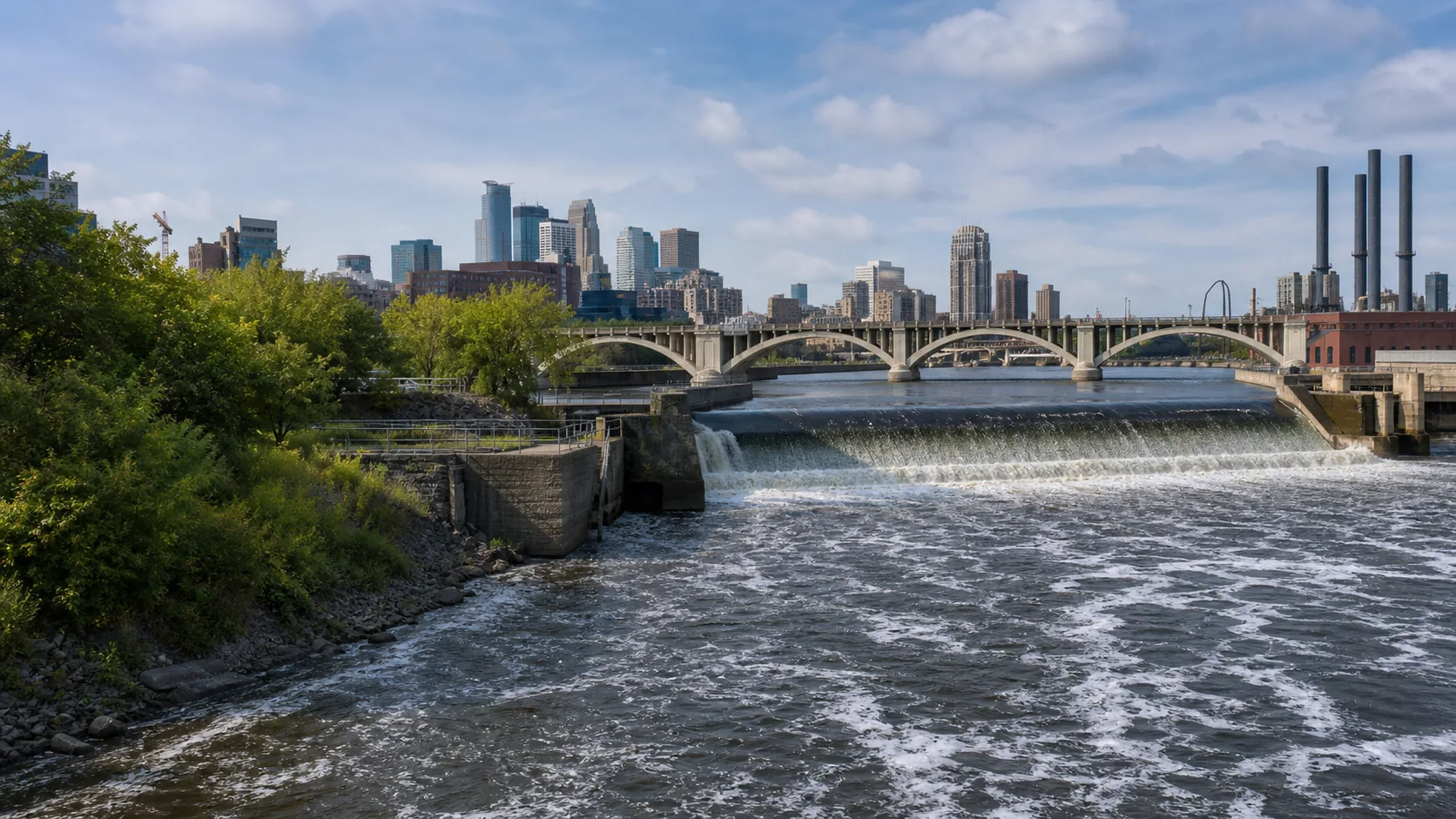
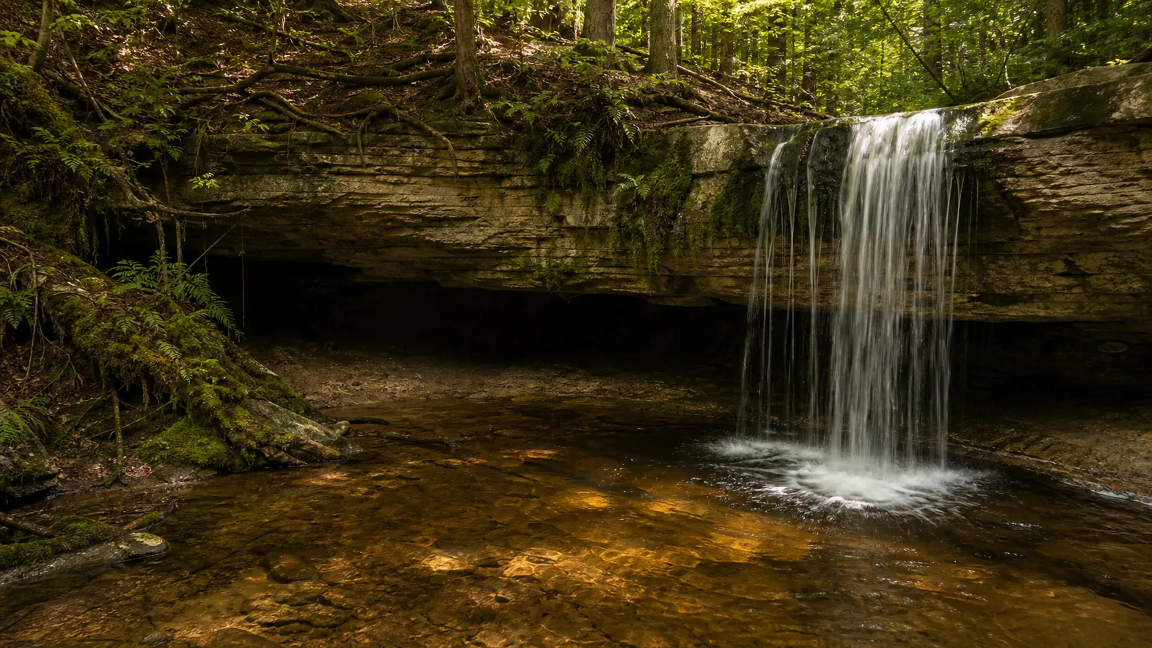
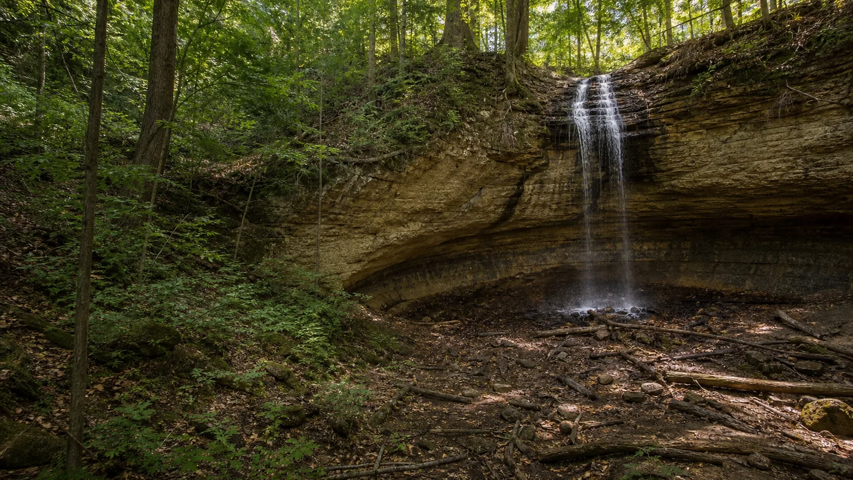
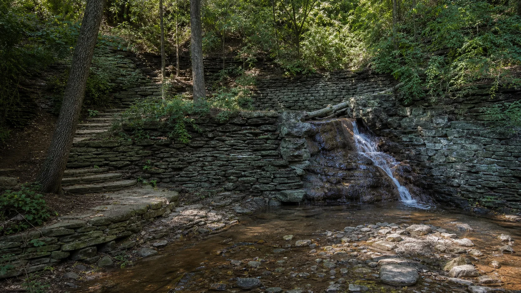
Is Hidden Falls worth visiting today?

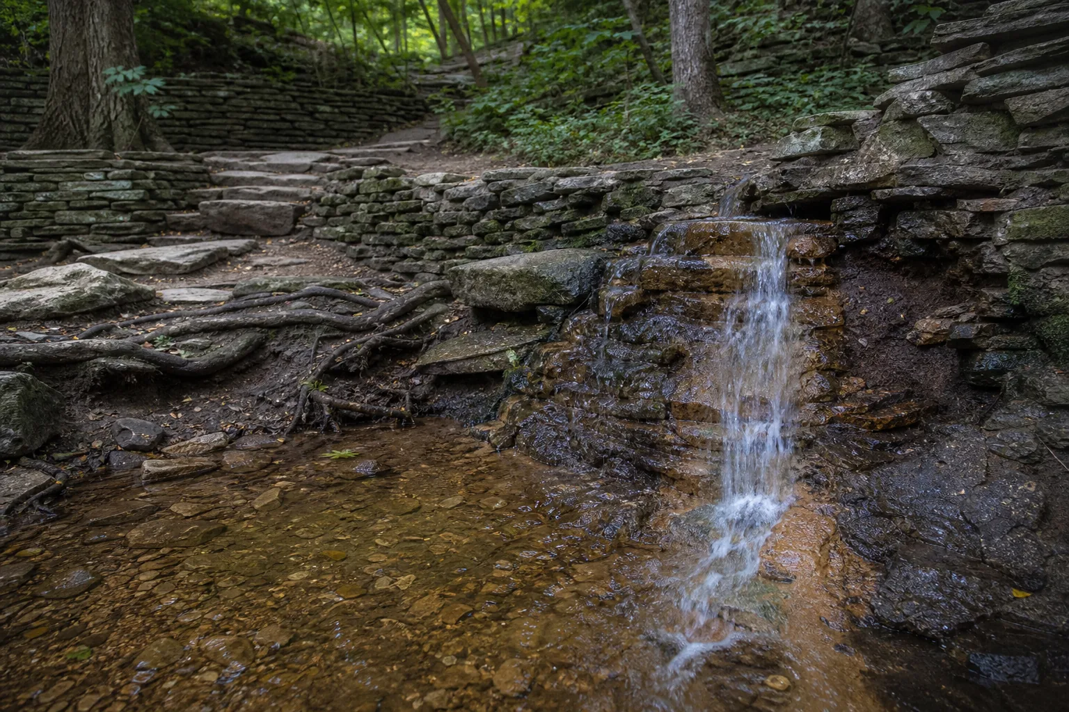
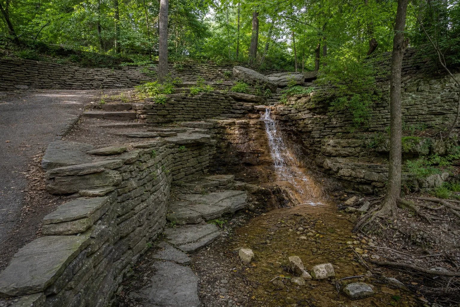
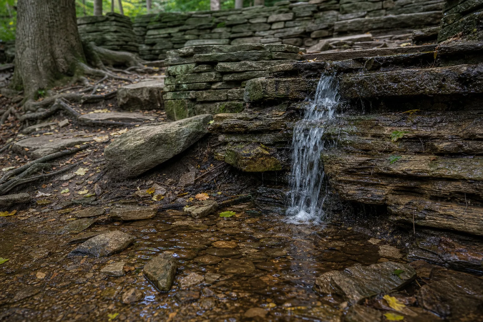
Hidden Falls is most visible in April and May when snowmelt and spring rains push water over the sandstone lip; by July and August the falls is often a thin trickle or barely audible streak. The park itself is free and open year-round from 6 a.m. to 10 p.m., with paved access to the overlook, picnic shelters, a Mississippi River boat launch, and a paved 5-mile riverfront walk south to Crosby Farm Regional Park.

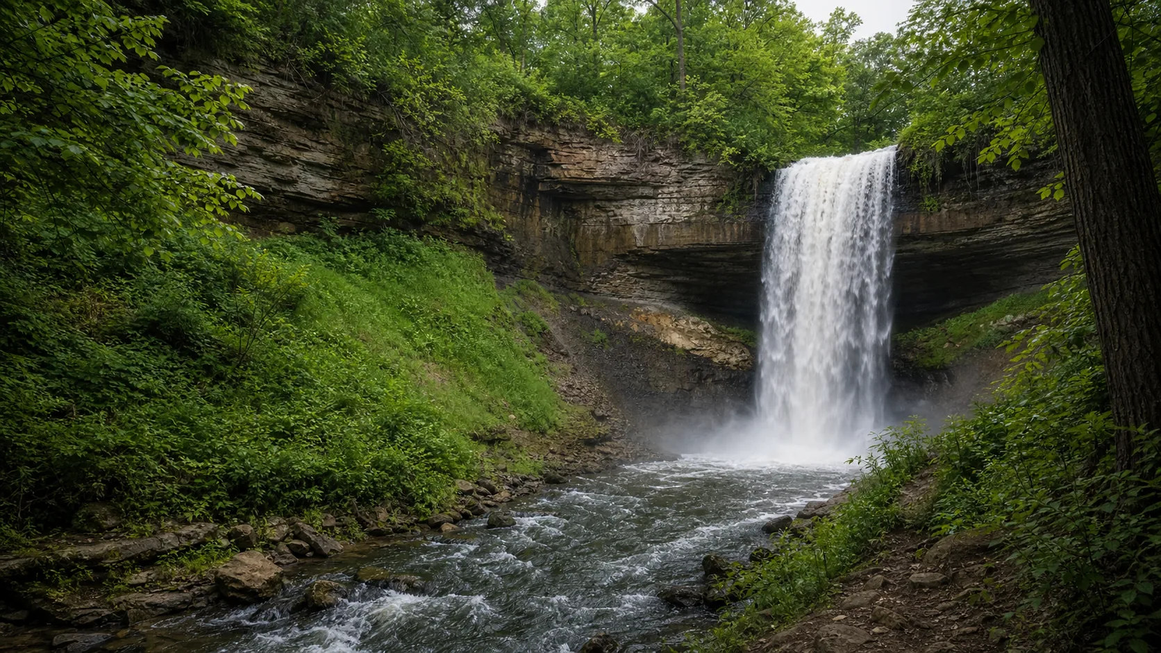
  • 18-foot drop into a Mississippi side channel
  • Saint Paul, MN (not Wyoming or California)
  • Most visible Apr–May during spring snowmelt
  • Paved overlook, accessible from parking lot
  • Free year-round; dogs on leash
  • Boat launch + picnic shelters in same park
Last verified May 12, 2026 Visited 6 sources checked
Distance 1.4 mi 3.0 mi extended
Round trip 35-75 min Mostly paved, gentle slope
Difficulty Easy Mostly paved, gentle slope
Location Saint Paul, MN Hidden Falls Regional Park
Parking Free parking at the entrance lot · Quiet residential roads nearby STP Parks
Transit Metro Transit Bus Route 134 Mississippi River Blvd & Magoffin · 2000 ft
Drive 4 mi 10 min from downtown
Best season Apr–Oct, May–Jun for strongest spring flow May–Jun
Hidden Falls base of hidden falls where spring snowmelt drops over platteville limestone into a mississippi side channel
Photo guide

Three angles of a small Mississippi side-channel waterfall.

Three working viewpoints: the paved overlook from the upper park, the ravine approach where the falls drops over the sandstone, and the Mississippi side-channel context shot from near the boat launch. The falls itself is small, so the captions matter more than the wide frame.

Hidden Falls waterfall and surrounding setting
Hidden Falls, hero composition
Wide view of Hidden Falls in Saint Paul, the small 18-foot drop tucked into a wooded ravine inside Hidden Falls Regional Park along the Mississippi River
Wide ravine setting of Hidden Falls inside Saint Paul's Mississippi-bluff park
Base of Hidden Falls in Saint Paul, Minnesota, with the 18-foot spring flow landing in a shallow side-channel pool below the sandstone ledge
Base of Hidden Falls where spring snowmelt drops over Platteville Limestone into a Mississippi side channel
Detail of water threading across the St. Peter Sandstone and Platteville Limestone contact at Hidden Falls, Saint Paul, Minnesota
Close detail of water threading across the St. Peter Sandstone face at Hidden Falls
01Is Hidden Falls flowing right now?

No live discharge gauge is available for Hidden Falls; the nearby Minnehaha Creek gauge measures a different watershed.

Hidden Falls has no paired USGS gauge in our manifest. The nearby Minnehaha Creek gauge (USGS 05289800) belongs to a different watershed and cannot be used as a flow proxy here. Expect the strongest water in April and May during snowmelt, an intermittent flow after summer thunderstorms, and a thin trickle or dry sandstone in late July and August.

02How long is the walk?

Five minutes from the entrance lot to the falls overlook on a paved approach. The full Hidden Falls Loop is about 1.4 miles and runs roughly 35 minutes. The 3-mile out-and-back south to Crosby Farm Regional Park follows the Mississippi River and is paved most of the way; budget 75 minutes one-way at a walking pace.

03How do you get there?

Main entrance: 1313 Hidden Falls Drive, Saint Paul, MN 55116, off Mississippi River Boulevard just below Lock and Dam 1. From downtown Saint Paul, about 10 minutes by car west on Shepard Road. From MSP airport, about 15 minutes north on Hwy 5 and Mississippi River Boulevard. Metro Transit Route 134 stops on Mississippi River Boulevard at Magoffin, a 5-minute walk to the lot.

04Is there free parking?

Free parking at the main entrance lot off Hidden Falls Drive. Additional free street parking is available on quiet residential roads near Mississippi River Boulevard. The lot rarely fills outside peak summer weekends and reserved-shelter events.

05Does it cost money?

No. Hidden Falls Regional Park and the falls are free. Possible costs are limited to optional picnic-shelter rentals, wedding or large-group permits (starting around $100 through Saint Paul Parks), and a non-resident boat-launch trailer permit if applicable.

06Trail variants

Falls overlook 0.3 mi, 10 min, paved, accessible.
Hidden Falls loop 1.4 mi, 35 min.
Hidden Falls to Crosby Farm 3.0 mi, 75 min, follows Mississippi.

Detailed maps and recent reviews: Falls route on AllTrails · Creek route on AllTrails

07Can you swim?

No. Swimming is prohibited at the falls and in the adjacent Mississippi side channel. The river has a strong current, cold water, and active commercial boat traffic near the lock. For real swimming nearby, head to Lake Como (about 6 miles) or Lake Phalen (about 8 miles).

08Are dogs allowed?

Yes, on leash, throughout the park. Saint Paul ordinances require leashes on all park property and there is no off-leash area at Hidden Falls.

09Is it accessible?

The paved approach to the falls overlook is wheelchair and stroller accessible from the main parking lot. Vault toilets near the main lot are accessible during the open season. The longer Crosby Farm connector is paved along the Mississippi but has gentle grades.

Field notes

Hidden Falls at a glance.

18-foot drop over Platteville Limestone and St. Peter Sandstone, Hidden Falls Regional Park, managed by Saint Paul Parks and Recreation, free to enter, day use 6 a.m. to 10 p.m. Sourced from the Saint Paul Parks page and the Minnesota Geological Survey.

Height 18 ft USGS 3DEP
Type Plunge (small cascade) USGS
County Ramsey Saint Paul, MN
Managed by Saint Paul Parks & Recreation STP Parks
Water source Spring-fed creek USGS
Elevation 730 ft USGS NED
Park area 174 acres STP Parks
Hours 6am to 10pm daily STP Parks
When to visit

Spring snowmelt is the only window that justifies the trip just for the falls.

April and May during snowmelt is when the falls actually runs as a visible curtain. From June through August it is often a trickle. October is best for fall color in the ravine with cottonwoods turning yellow. Winter freezes the sandstone face into ice features. The rest of the year Hidden Falls works better as a quiet river-park visit than as a waterfall destination.

PEAK FLOW

Peak flowMay–Jun
Ice / low flowDec–Feb
Most crowdedWeekends and midday
Best photosSunrise or weekdays

Live water context

Discharge data -- No live discharge gauge is available for Hidden Falls; the nearby Minnehaha Creek gauge measures a different watershed.

Why is it called Hidden Falls?

The name is descriptive rather than commemorative. The falls is tucked into a wooded ravine set back from the Mississippi River bluffs, easy to miss from a boat on the river and from most of the surrounding park until you walk the ravine path. Saint Paul park records use the name Hidden Falls from at least the late 1800s, when the surrounding ground was set aside as one of the city's first riverfront parks.

What else to do at Hidden Falls Regional Park

Hidden Falls Regional Park is a 174-acre Saint Paul city park stretched along the Mississippi River bluffs just below Lock and Dam 1, with a public boat launch, reservable picnic shelters, vault toilets, and grills set under cottonwood and oak. The falls itself is a quiet side attraction; most regulars come for the river access, the shaded picnic grounds, and the paved trail. From the south end of the park a connector trail joins Crosby Farm Regional Park, the largest natural park in Saint Paul, for an out-and-back riverfront walk that can run roughly 5 miles linked end to end.

  • Mississippi River boat launch. Public ramp for trailered and car-top boats; access to the river just below Lock and Dam 1.
  • Reservable picnic shelters. Multiple shelters with grills, water, and tables; reservations through Saint Paul Parks and Recreation.
  • Hidden Falls overlook. Paved approach to the 18-foot drop and the Mississippi side channel.
  • Crosby Farm Regional Park connector. Paved riverfront trail south to Crosby Farm, the largest natural park in Saint Paul; roughly 5 miles linked end to end.
  • Mississippi River Boulevard trail. Connects north along the bluff toward Marshall Avenue and downtown Saint Paul.

Why it looks this way

Hidden Falls sits on the same two-layer geology as Minnehaha Falls and St. Anthony Falls: a hard cap of Platteville Limestone overlying softer St. Peter Sandstone, the Ordovician sequence that underlies the entire Twin Cities waterfall corridor. The creek and seep water at Hidden Falls undercut the sandstone, the limestone overhangs and breaks, and the lip retreats upstream a small amount each century. Hidden Falls essentially marks where the Mississippi River has retreated past Minnehaha Creek's confluence; in geologic terms it is the old position of the bigger falls before 12,000 years of post-glacial headward erosion. The plunge here is shorter than Minnehaha's because the local stream carries far less water than Minnehaha Creek and the cap has been less deeply incised.
Field guide deep dive

What the Saint Paul Parks listing leaves out.

The geology that links Hidden Falls to Minnehaha and St. Anthony, why this falls is smaller than its famous neighbors, when the water is actually running, and how to tell which Hidden Falls you are looking at online.

How Hidden Falls formed

Hidden Falls is the smallest member of a three-falls family that defines the Twin Cities waterfront. The mechanic is the same one that built Minnehaha Falls a half-mile to the west and St. Anthony Falls on the Mississippi to the north: a hard cap of Platteville Limestone sits on top of softer St. Peter Sandstone, water erodes the sandstone faster than the limestone, the limestone overhangs, and once the overhang outruns its own structural strength, a slab fails and lands in the plunge pool below.

What is interesting about Hidden Falls geologically is its position. About 12,000 years ago, when glacial Lake Agassiz drained and the post-glacial Mississippi cut down through the bedrock, a much larger waterfall existed near the modern Mississippi-Minnehaha confluence. That falls migrated upstream on the Mississippi (becoming St. Anthony Falls) and a separate smaller falls migrated upstream on Minnehaha Creek (becoming Minnehaha Falls). Hidden Falls essentially sits at the abandoned downstream position, on a side stream that no longer carries enough water to retreat quickly. It is, in the literal geological sense, the old position of Minnehaha Falls before 12,000 years of headward erosion.

Why Hidden Falls is so much smaller than Minnehaha

The height difference (18 feet versus 53 feet) and the flow difference are almost entirely a watershed story. Minnehaha Creek drains about 176 square miles of suburban and lake-fed terrain through Lake Minnetonka and a chain of smaller lakes; the USGS gauge at Hiawatha Avenue has recorded daily medians around 22 cubic feet per second and spring runoff peaks above 200 cfs. Hidden Falls is fed by a far smaller local drainage and groundwater seeps; the stream is small enough that no continuous USGS gauge is maintained for it, and the falls is frequently a thin trickle from late June through September.

That smaller flow has two visible consequences. First, the caprock at Hidden Falls has not been undercut as deeply, so the falls reads as a short ledge rather than an amphitheater. Second, the falls retreats upstream more slowly than Minnehaha, so it has stayed near the Mississippi confluence rather than migrating a half mile inland like its bigger sibling. If you stand at the overlook in April you can read the same caprock-undercut geometry in miniature: a band of resistant limestone, a wash of softer sandstone, and the new pile of fallen blocks at the base.

When Hidden Falls is actually "visible"

The honest answer about flow at Hidden Falls is that spring is the only time it reads as a full waterfall. From early April through mid-May the snowmelt and spring rains push enough water over the sandstone lip to form a continuous curtain. By the third week of May the flow drops noticeably; by July the falls is often a thin trickle that braids across the rock, and in dry years the sandstone face goes dry between thunderstorms. A heavy rain (anything over about a half inch in a few hours) will produce a temporary rise that lasts a few hours and then drops back.

In October the ravine fills with yellow cottonwood leaves and the water flow does not matter much for photos; the foliage carries the frame. In a normal cold Minnesota winter the sandstone face freezes into ice features with running water continuing underneath, audible from the overlook. Mild winters produce only partial ice. Without a live gauge there is no way to check the current reading remotely; the only reliable signal is recent snowmelt and rainfall in the Twin Cities forecast grid.

The Twin Cities waterfall trio

Hidden Falls is the quietest stop in a three-falls day trip that ties together the entire geology of the Twin Cities riverfront. Start at St. Anthony Falls at the Stone Arch Bridge in Minneapolis; this is the only true waterfall on the main stem of the Mississippi River, the falls that drove flour milling and city formation, and the one that has retreated the farthest (about eight miles since the glacier drained). Drop south about 15 minutes to Minnehaha Falls for the headline 53-foot urban plunge over the same Platteville-over-St. Peter contact.

Then cross the Mississippi by way of the Ford Parkway or the Lake Street bridge and finish at Hidden Falls in Saint Paul, where you can read the abandoned downstream position of the system in a quieter park setting. All three are free, all three sit on the same caprock-and-sandstone contact, and the total drive time across all three is under 45 minutes; budget two to three hours of walking and overlook time. Light rail does not reach Hidden Falls directly (the Blue Line stops near Minnehaha; the Green Line reaches downtown Saint Paul), so plan a car or a bike for the Saint Paul stop.

Hidden Falls is not the Wyoming one (or the California one, or the Texas one)

The Hidden Falls name shows up on a long list of US waterfalls and parks. The most-searched ones in the same SERP cluster as the Saint Paul falls are: Hidden Falls in Grand Teton National Park, Wyoming, a 100-foot cascade off Cascade Creek reached by boat across Jenny Lake or by a 5-mile loop trail; Hidden Falls Regional Park in Placer County, California, a 1,200-acre park north of Auburn with 30 miles of multi-use trails; Hidden Falls Adventure Park in Marble Falls, Texas, a 2,100-acre off-road vehicle park; and smaller named falls in North Carolina, Utah (Big Cottonwood Canyon), Oregon, and South Carolina.

None of those is what you are looking at in Saint Paul. The Saint Paul Hidden Falls is a small 18-foot Twin Cities city-park waterfall along the Mississippi River, free, year-round, and most visible in spring. If you searched for the Wyoming Hidden Falls in Grand Teton, the AllTrails page for that hike runs roughly 5 miles round trip with about 600 feet of elevation gain and is a moderate rather than easy walk. If you searched for the Placer County park, the trail network is far larger and the falls itself is bigger. The Saint Paul falls is the one that comes up for the Saint Paul, Minnesota, and Ramsey County queries.

What the rest of Hidden Falls Regional Park is for

The falls is a side attraction to a 174-acre Mississippi riverfront park that locals use mostly for picnicking, paddling, fishing, and walking the bluff trail. The boat launch at the south end of the park is the closest public ramp to downtown Saint Paul and gives access to the Mississippi just below Lock and Dam 1; it sees regular use by anglers running upstream for smallmouth bass, walleye, and channel catfish. The reservable picnic shelters are big enough for family-reunion-scale groups and are bookable through Saint Paul Parks and Recreation.

The connector trail south to Crosby Farm Regional Park is one of the longest natural-surface riverfront walks inside Saint Paul; linked end to end the Hidden Falls–Crosby Farm corridor runs about 5 miles along the Mississippi through floodplain forest and oxbow ponds. North of the lot, Mississippi River Boulevard climbs the bluff and joins a longer trail system that runs all the way to downtown Saint Paul and into the wider Mississippi National River and Recreation Area. If you want a quick urban nature break and the falls is dry, the park works as a paddle launch or a flat riverfront walk on its own.

Map and route

Ten minutes from downtown Saint Paul along the Mississippi bluffs.

Main entrance: 1313 Hidden Falls Drive, Saint Paul, MN 55116, off Mississippi River Boulevard just below Lock and Dam 1. From downtown Saint Paul, about 10 minutes by car west on Shepard Road. From MSP airport, about 15 minutes north on Hwy 5 and Mississippi River Boulevard. Metro Transit Route 134 stops on Mississippi River Boulevard at Magoffin, a 5-minute walk to the lot.

Wildlife

Great blue herons, wood ducks, and bald eagles along the lower Mississippi.

The Mississippi side channel and the wooded ravine sit inside a major migratory corridor. Wood ducks use the side channel in spring and fall, great blue herons hunt the shallows, and bald eagles roost in the bluff cottonwoods. Easier to spot before leaves and after they drop.

Great Blue Heron
Great Blue Heron
Ardea herodias
Stalks the Mississippi side channel and the shallows below the boat launch from April through October. Easier to spot from the riverbank trail before the cottonwoods leaf out.
Bald Eagle
Bald Eagle
Haliaeetus leucocephalus
Year-round resident along the lower Mississippi corridor. Look for adults in the tall cottonwoods above the boat launch, especially in winter when the open water below Lock and Dam 1 concentrates fish.
Wood Duck
Wood Duck
Aix sponsa
Uses the wooded backwater and the Mississippi side channel in spring and fall migration. Listen for the soft squeal of females flushing from overhanging branches near the falls overlook.
White-tailed Deer
White-tailed Deer
Odocoileus virginianus
Common along the Crosby Farm connector trail south of Hidden Falls. Browse marks on red-osier dogwood and young oak shoots are the easiest field sign at trail edges in winter.
Photography and weddings

Shade ravine, side-channel light, no drones near the lock.

Hidden Falls is an intimate ravine subject, not a landmark hero shot. The best frames are tight: water across the sandstone ledge in spring, the cottonwood canopy above the ravine in October, and the Mississippi side channel in low evening light from the boat-launch path. Set the expectation low for scale and you will leave with better photos.

The ravine sits in canopy shade most of the day, which holds detail in the sandstone but underexposes the water. Bright sky above the ravine blows out quickly; early morning and overcast days are kindest to the highlights. The Mississippi side channel itself takes good late-afternoon backlight from late September through early November.

Personal photography is fine without a permit. Commercial photography, drone use, large equipment, and reserved shoots go through Saint Paul Parks and Recreation; drones in city parks generally require a permit and may be restricted near the Lock and Dam 1 navigation channel.

Permits

Weddings and engagements

Engagement portraits work here if you want wooded, quiet, and informal rather than a big scenic backdrop. The picnic shelters and the boat-launch overlook are the workable group spots; the falls itself is too small to anchor a ceremony shot.

Reserved shelters and ceremonies require a permit from Saint Paul Parks and Recreation. Wedding permits in Saint Paul parks start around $100; shelter rental is a separate fee billed by shelter size and season.

Treat the ravine as fragile: stay on durable surfaces, keep groups small near the water, and avoid climbing wet sandstone ledges, which fracture easily.

Nearby waterfalls

Three Twin Cities waterfalls on the same Platteville-St. Peter geology.

Hidden Falls pairs naturally with Minnehaha Falls across the river and St. Anthony Falls upstream on the Mississippi. All three sit on the same caprock-and-sandstone contact and tell three parts of the same retreat story; all three are free and reachable inside the metro.

Related questions

More questions visitors ask before driving to Hidden Falls.

Location disambiguation from the other Hidden Falls, height, dogs, swimming, fees, accessibility, and the Minnehaha comparison. The full set is also indexed in the FAQ schema for AI answer engines.

01Where is Hidden Falls in St. Paul?

Hidden Falls is inside Hidden Falls Regional Park, a Saint Paul city park along the Mississippi River bluffs just below Lock and Dam 1. The main address is 1313 Hidden Falls Drive, Saint Paul, MN 55116, with free parking at the entrance lot off Mississippi River Boulevard. This is not the Hidden Falls in Grand Teton National Park (Wyoming) or the larger Hidden Falls Regional Park in Placer County, California.

02How tall is Hidden Falls?

Hidden Falls drops about 18 feet over a band of Platteville Limestone and St. Peter Sandstone into a Mississippi River side channel. It is one of the smallest named waterfalls in the Twin Cities and is dwarfed by 53-foot Minnehaha Falls across the river and by St. Anthony Falls on the Mississippi itself.

03Is Hidden Falls worth visiting?

Yes for a quick urban nature stop or a riverfront picnic, no for a destination drive from out of state. The falls itself is small and most visible in April and May during spring snowmelt; in midsummer it often runs as a thin trickle. The surrounding 174-acre park, the Mississippi boat launch, the picnic shelters, and the connector to Crosby Farm Regional Park are the real draws.

04Is Hidden Falls free?

Yes. There is no admission fee for Hidden Falls or Hidden Falls Regional Park, no parking fee at the main lot, and no charge to launch a non-motorized boat. Picnic-shelter reservations and any wedding or large-group permit require a separate fee through Saint Paul Parks and Recreation. The park is open daily from 6 a.m. to 10 p.m.

05How does Hidden Falls compare to Minnehaha Falls?

Minnehaha Falls is the headline waterfall of the Twin Cities at 53 feet, fed by Minnehaha Creek with a 176-square-mile drainage and a public USGS gauge. Hidden Falls is 18 feet, fed by a much smaller stream and seeps, with no live gauge, and frequently runs as a trickle in summer. The two sit on the same Platteville-over-St. Peter geology and Hidden Falls essentially marks the old downstream position of the Mississippi River system before headward retreat pushed the bigger falls upstream.

Sources and data

Where the Hidden Falls guide gets its facts.

Park rules and hours from Saint Paul Parks and Recreation. Geology from the Minnesota Geological Survey. Etymology and historical park records from the Minnesota Historical Society. Trail distance and conditions from AllTrails and Wikipedia.

STP Parks: Hidden Falls Regional Park stpaul.gov
Access, parking, and permit rules: stpaul.gov
Minnesota Geological Survey: Platteville and Glenwood Formations / St. Peter Sandstone sequence: Saint Paul bedrock conservancy.umn.edu
NOAA / NWS Twin Cities forecast grid MPX 110,69 noaa.gov
USGS National Elevation Dataset 3DEP
Google Maps: embedded map and directions maps.google.com
Google Places: nearby restaurants and hotels places API
Saint Paul Parks & Recreation: Hidden Falls Regional Park stpaul.gov
Wikipedia: Hidden Falls (Saint Paul, Minnesota) en.wikipedia.org
Wikipedia: Hidden Falls Regional Park (Saint Paul) en.wikipedia.org
AllTrails: Hidden Falls Trail, Minnesota alltrails.com
Minnesota Historical Society: Saint Paul park system records mnhs.org
TripAdvisor: Hidden Falls Regional Park reviews tripadvisor.com
National Park Service: Mississippi National River and Recreation Area nps.gov
Fact checks
Height audit: 18-foot drop figure comes from Saint Paul Parks & Recreation park listings and the Wikipedia entry for Hidden Falls (Saint Paul, Minnesota); the falls is one of the smallest named waterfalls in the Twin Cities.
Geology audit: the Platteville Limestone over St. Peter Sandstone caprock-undercut sequence is documented for the entire Twin Cities waterfall corridor by the Minnesota Geological Survey; the same contact produces St. Anthony Falls and Minnehaha Falls.
Disambiguation audit: this page covers Hidden Falls in Saint Paul, Minnesota, only. Three other commonly searched falls share the name: Hidden Falls in Grand Teton National Park, Wyoming (a 100-foot cascade reached from Jenny Lake), Hidden Falls Regional Park in Placer County, California (a 1,200-acre park near Auburn), and Hidden Falls Adventure Park in Marble Falls, Texas (an off-road vehicle park). None of these is the Saint Paul falls.
Flow audit: Hidden Falls has no continuous USGS gauge in our manifest; the nearby Minnehaha Creek gauge (05289800) drains a different watershed and is not used as a proxy. Seasonal flow described qualitatively from on-the-ground observation and Saint Paul Parks reporting.
Corrections: [email protected]