Dukes Creek Falls multi-tier cascade dropping into the Dukes Creek gorge
Helen, GA

Dukes Creek Falls

Dukes Creek Falls is a 250-foot multi-tier cascade in the Chattahoochee-Oconee National Forest just north of Helen, Georgia, where Davis Creek drops down a schist-and-gneiss face into Dukes Creek at the bottom of the gorge. The famous viewpoint everyone calls "Dukes Creek Falls" is actually Davis Creek; the named creek is the river it lands in. A 1.0-mile paved-and-boardwalk trail descends from the GoFindOutdoors fee gate on GA-348 to the observation deck.

Last verified May 12, 2026 Visited Desk-verified May 2026 8 sources checked
Trail 1.0 mi 2.4 mi extended
Time 30-90 min Easy to moderate
Best season March-May for flow; mid-October for leaf color March-May after rain
Parking Paved lot at the trailhead. $5 day-use fee per vehicle, collected by GoFindOutdoors concession. America the Beautiful and Interagency Senior passes do not waive this fee. Dukes Creek Falls Recreation Area
Quick answer

Is Dukes Creek Falls worth visiting?

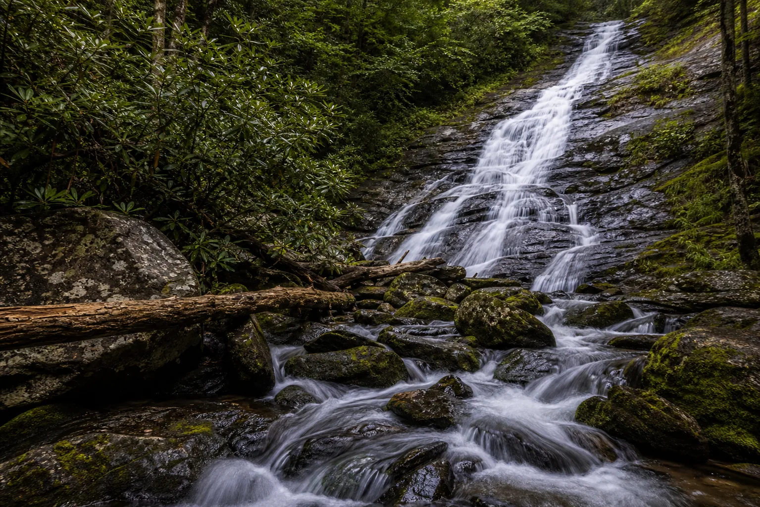
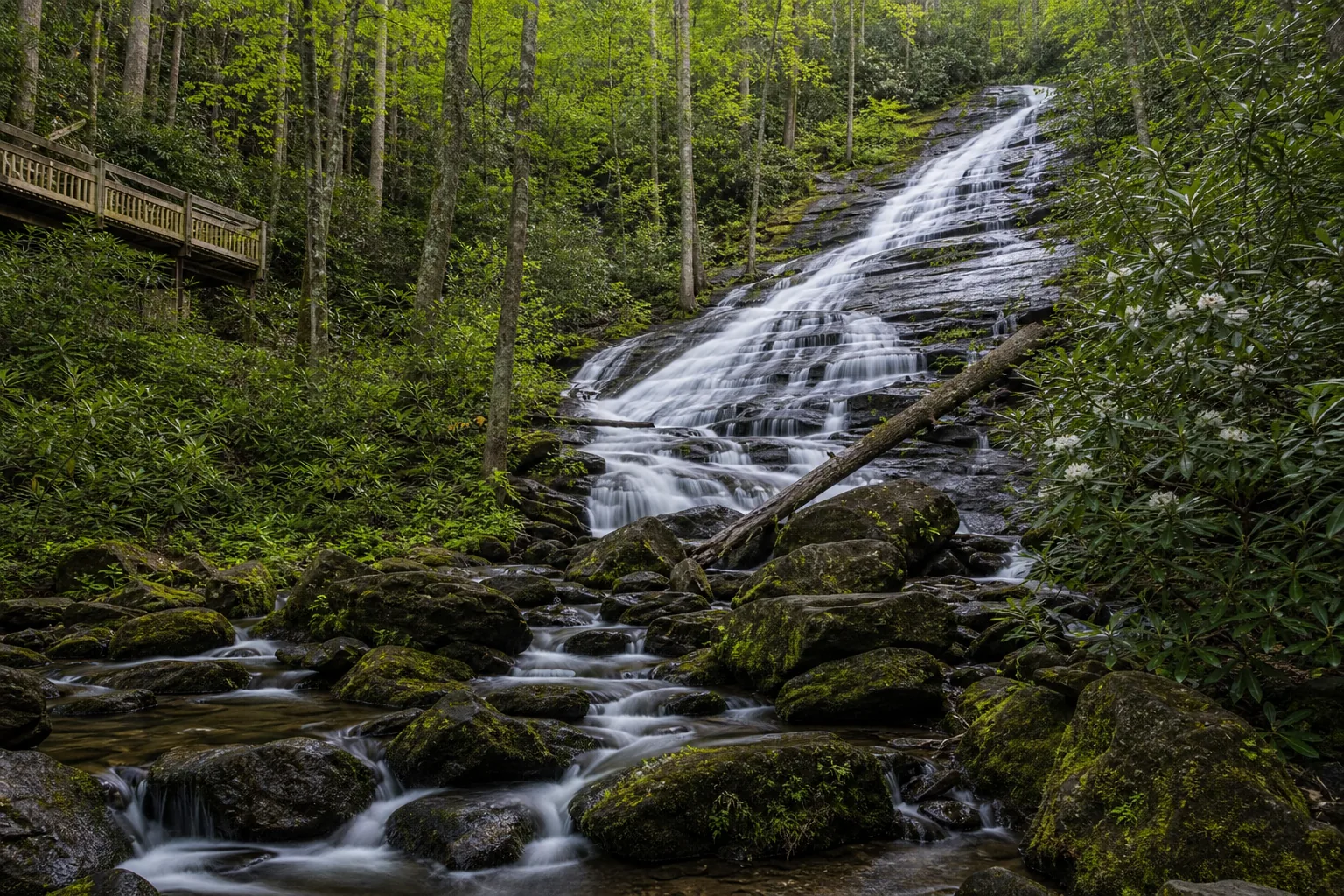
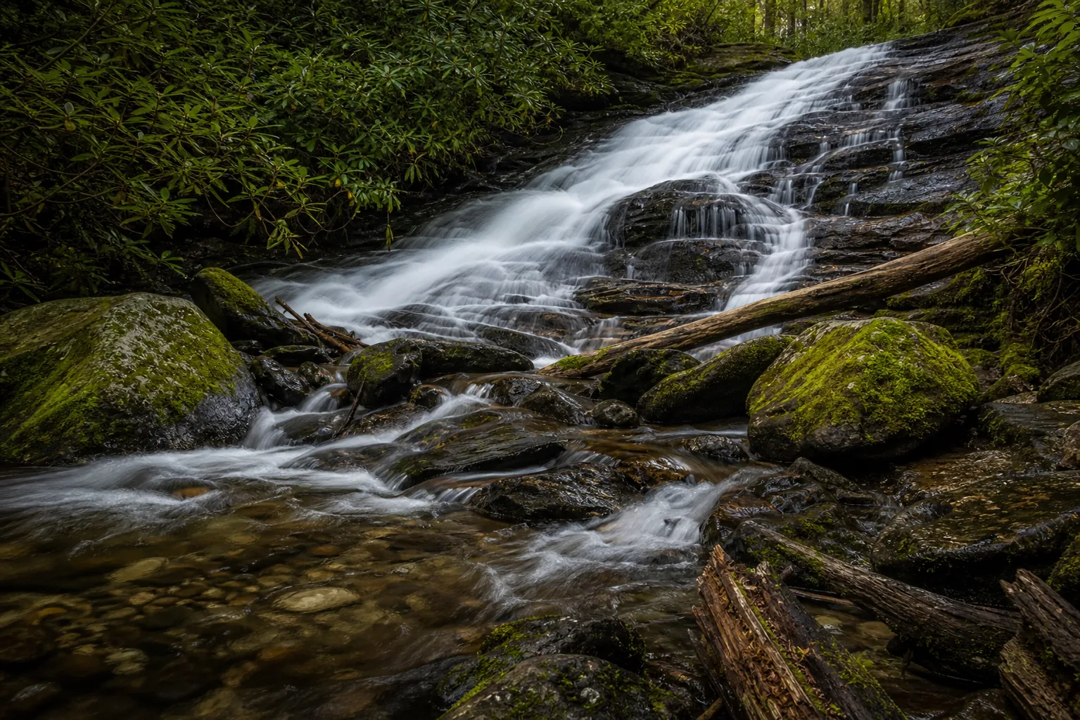
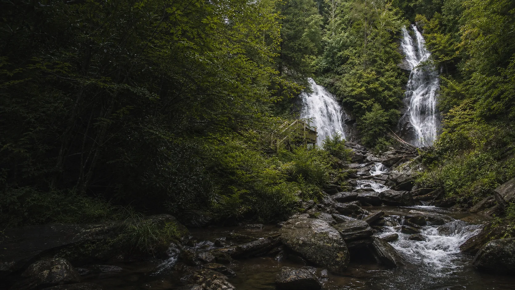
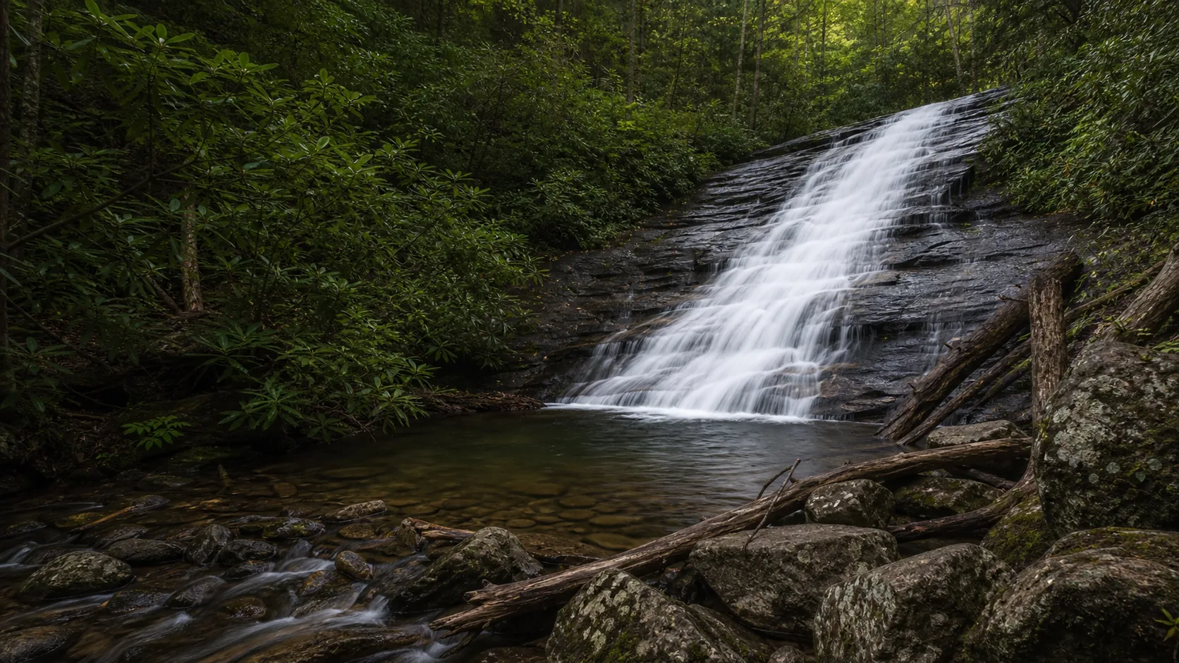
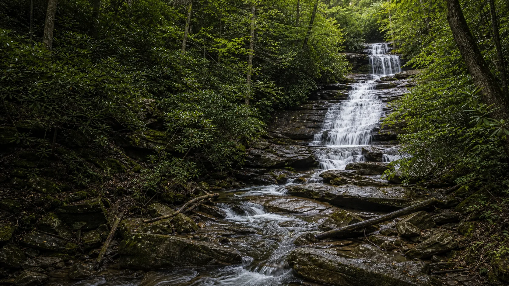
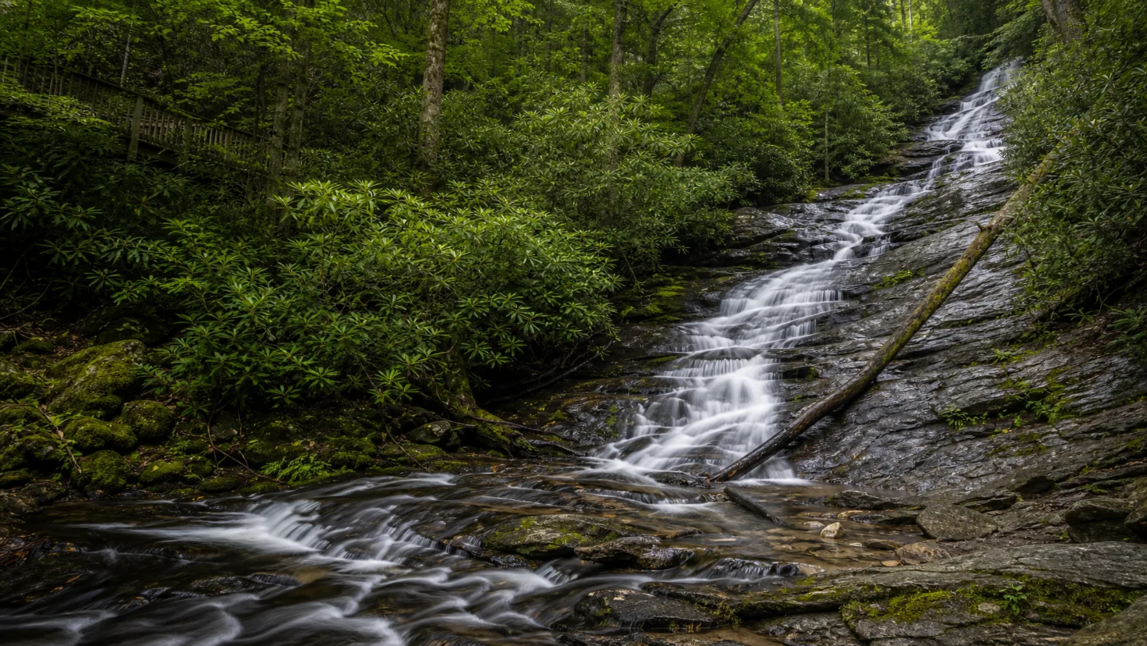
Yes. March through May is the loudest window, when Davis Creek runs at full spring flow and the multi-tier cascade reads as continuous white water down the gorge wall. Mid-October is the second window because the gorge fills with yellow and orange leaves and the lower deck frames the cascade against peak color. Plan around the GoFindOutdoors $5 day-use fee, expect a paved-and-boardwalk descent (steep on the climb back), and skip the trip in drought-stricken late August when the cascade thins to braids.

  • 1.0 mi out-and-back to the observation deck
  • $5 GoFindOutdoors day-use fee (cash or card)
  • Peak flow: March-May; peak color: mid-October
  • Paved upper section + boardwalk descent
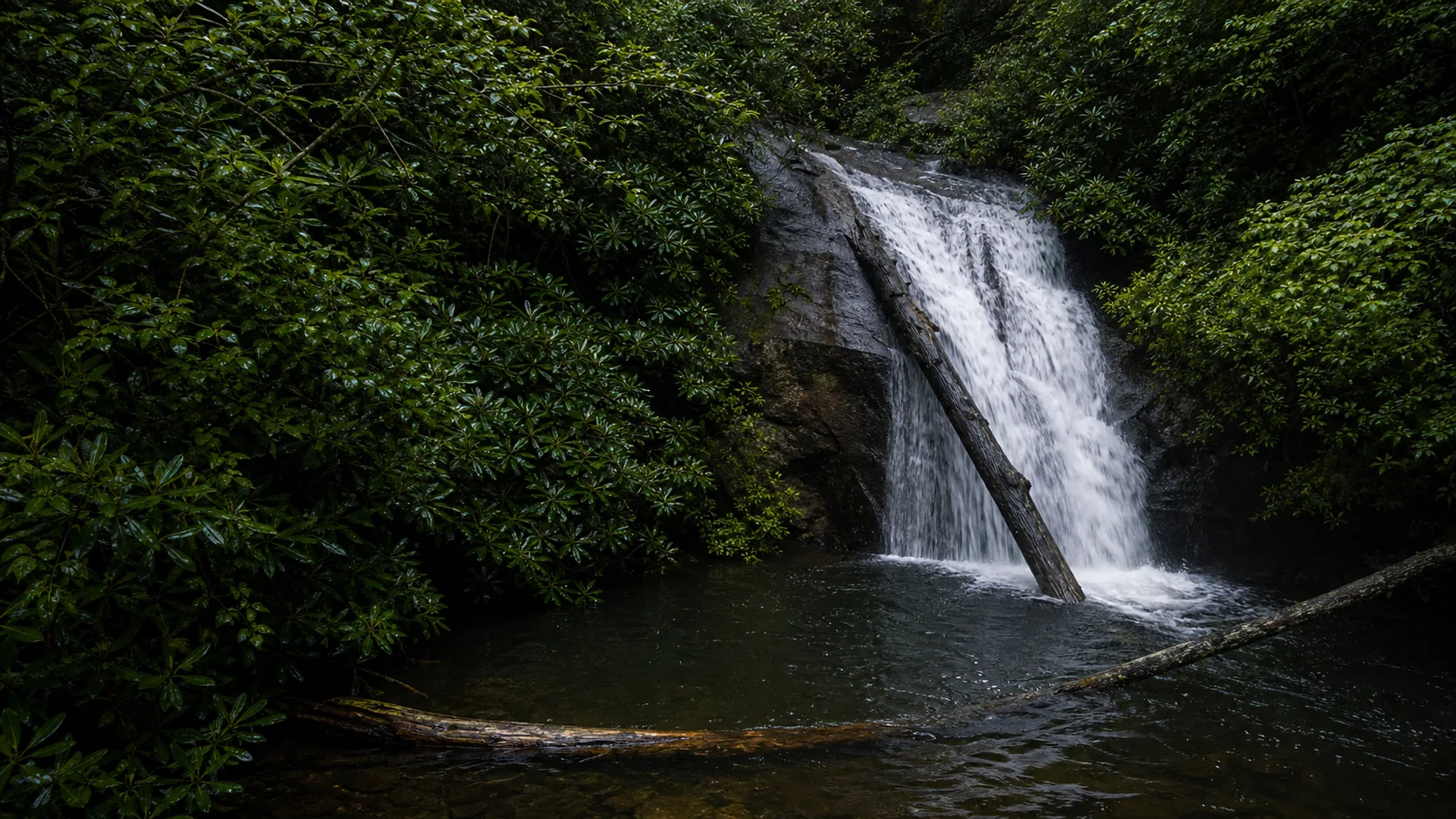
  • Davis Creek (the falls) into Dukes Creek (the gorge)
  • 15 min north of Helen on GA-348
Last verified May 12, 2026 Visited Desk-verified May 2026 8 sources checked
Distance 1.0 mi 2.4 mi extended
Round trip 30-90 min Paved switchbacks and boardwalk on the descent; the return climb is the hard part
Difficulty Easy to moderate Paved switchbacks and boardwalk on the descent; the return climb is the hard part
Location Helen, GA Dukes Creek Falls Recreation Area
Parking Paved lot at the trailhead. $5 day-use fee per vehicle, collected by GoFindOutdoors concession. America the Beautiful and Interagency Senior passes do not waive this fee. USFS
Transit No fixed-route transit Drive only; the trailhead is on GA-348 north of Helen · 0 ft
Drive 8 mi 15 min from downtown
Best season March-May for flow; mid-October for leaf color March-May after rain
Dukes Creek Falls lower tier and base of the cascade
Photo guide

Three angles of a 250-foot multi-tier cascade.

There is really only one composition because the observation deck is fixed and cantilevered: a cross-gorge view of Davis Creek tumbling down the schist-and-gneiss face into Dukes Creek below. The lower spur to creek level adds a boulder-and-water detail frame; the upper trail offers leaf-framed glimpses on the descent. Use the captions to decide how much focal length to pack.

Dukes Creek Falls multi-tier cascade dropping into the Dukes Creek gorge
Dukes Creek Falls, hero composition
Dukes Creek Falls cross-gorge view of Davis Creek tumbling down the multi-tier cascade
Cross-gorge view from the observation deck
Dukes Creek Falls lower tier where Davis Creek meets Dukes Creek in the gorge
Lower tier and base of the cascade
Dukes Creek Falls bedrock detail showing Blue Ridge schist and gneiss in the cascade chutes
Schist-and-gneiss bedrock detail in the cascade
01Is Dukes Creek Falls flowing right now?

This guide does not currently pair Dukes Creek Falls with a verified real-time USGS discharge gauge because Davis Creek is too small to be gauged. Use recent rainfall in the Helen / Robertstown area as the practical proxy.

Davis Creek is a small headwaters stream; flow swings sharply with recent rain. After 0.5 inch or more of rain in the previous 48 hours the multi-tier cascade reads as continuous white water. In late summer and early fall droughts the same face thins to braided ribbons. There is no USGS gauge on Davis Creek; the nearest practical proxy is the Chattahoochee River gauge near Helen.

02How long is the walk?

The Forest Service trail is 1.0 mile out-and-back from the GA-348 parking area to the observation deck. AllTrails lists a longer 2.4-mile variant that follows the older Dukes Creek Trail loop. Elevation drop to the deck is roughly 250 feet; the return climb is the hard part of an otherwise easy hike.

03How do you get there?

From Helen: Take GA-75 N about 1.5 miles to GA-356, then GA-348 W (Richard B. Russell Scenic Highway) about 2 miles to the well-signed Dukes Creek Falls Recreation Area entrance on the right. From Atlanta: I-985 N to GA-365, then US-129 / GA-75 to Helen; total drive time is roughly 2 hours.

04Is there free parking?

Paved Forest Service lot at the trailhead, about 40 spaces. The lot fills on October weekends and during spring break; arrive before 10am for a guaranteed space. There is no overflow lot and parking along GA-348 is unsafe and discouraged.

05Does it cost money?

Yes. $5 day-use fee per vehicle, collected by GoFindOutdoors. Pay at the gate when staffed, or by self-pay envelope when unstaffed. Federal passes (America the Beautiful, Senior, Access) do not waive this fee because the site is run by a concessionaire. Older blog posts and trail reviews still quote $3 or $4; verify the current rate at the gate.

06Trail variants

Observation deck 1.0 mi out-and-back, 30-45 min, paved upper section, boardwalk lower; one short stair flight at the bottom.
Lower deck plus creek detour 1.2 mi out-and-back, 45-60 min, short spur to Dukes Creek below the falls.
AllTrails extended route 2.4 mi, 60-90 min, follows the older Dukes Creek Trail; check current conditions.
Photo-first quick stop 1.0 mi total, 30 min, skip the creek spur; head straight to the deck for the cross-gorge view.

Detailed maps and recent reviews: Falls route on AllTrails · Creek route on AllTrails

07Can you swim?

No. There is no developed swimming area at Dukes Creek Falls. The cascade lands in a steep boulder-strewn section of Dukes Creek with no safe entry point, and the observation deck is well above the water. Downstream in Smithgall Woods State Park, Dukes Creek is a designated catch-and-release trout stream and swimming is not the intended use.

08Are dogs allowed?

Yes, on leash. The paved-and-boardwalk surface is dog-friendly. The short stair flight at the bottom and the steep climb out are the practical limits for older or short-legged dogs.

09Is it accessible?

Partial. The paved upper section is wheelchair-passable but steep enough (about 8% grade) that a power chair or strong companion is recommended. The boardwalk lower section and the final stair flight to the observation deck are not ADA-compliant. There is no fully step-free viewpoint of the falls.

Field notes

Dukes Creek Falls at a glance.

250-foot multi-tier cascade in Blue Ridge schist and gneiss, 1.0-mile out-and-back trail, $5 GoFindOutdoors day-use fee, managed by the USDA Forest Service Chattahoochee-Oconee National Forest. Sourced from the USFS recreation area page and verified against the GoFindOutdoors concession listings.

Height 250 ft USGS 3DEP
Type Multi-tier cascade USGS
County White Helen, GA
Managed by USDA Forest Service, Chattahoochee-Oconee National Forest USFS
Water source Davis Creek (falls) into Dukes Creek (gorge) USGS
Elevation 1860 ft USGS NED
Park area Not listed USFS
Hours Daylight hours; gate hours vary by season and are set by the GoFindOutdoors concessionaire USFS
When to visit

Two windows that justify the trip.

March through May for spring flow when Davis Creek runs continuous and the cascade reads as full white water. Mid-October for the leaf-color window when the gorge canopy turns yellow and orange around the cross-canyon view. Late summer and dry early fall is the window to skip.

PEAK FLOW

Peak flowMarch-May after rain
Ice / low flowRare; freezes only in hard cold snaps
Most crowdedWeekends and midday
Best photosSunrise or weekdays

Live water context

Discharge data -- This guide does not currently pair Dukes Creek Falls with a verified real-time USGS discharge gauge because Davis Creek is too small to be gauged. Use recent rainfall in the Helen / Robertstown area as the practical proxy.

Why is it called Dukes Creek Falls?

Dukes Creek is named for William Dukes, an early settler who is generally credited with finding gold along the creek in 1828. The strike at Dukes Creek (and a parallel one at nearby Bear Creek in Lumpkin County the same year) set off the Georgia Gold Rush, which predates the California rush of 1849 by more than two decades. The creek kept the Dukes name; the waterfall inherited it, even though the water you actually see falling is Davis Creek dropping in from the side.

What else to do at Dukes Creek Falls Recreation Area

Dukes Creek Falls Recreation Area is a USDA Forest Service site on the Russell-Brasstown National Scenic Byway (GA-348), about 15 minutes north of Helen. It is fee-managed by the GoFindOutdoors concession, which operates several Chattahoochee-Oconee day-use areas under Forest Service partnership. Do not confuse it with the adjacent Smithgall Woods State Park, a Georgia DNR property that protects the lower section of Dukes Creek as a catch-and-release trout fishery; Smithgall has its own entrance and its own rules. Helen, the Bavarian-themed alpine town in the Chattahoochee River valley below, is the practical base for everything in the cluster.

  • Observation deck. The end of the 1.0-mile trail is a wooden deck cantilevered out over the Dukes Creek gorge, giving the head-on cross-canyon view of the Davis Creek cascade. This is the photo everyone takes.
  • Paved upper trail and boardwalk descent. The first stretch from the parking area is paved with switchbacks; the lower stretch is boardwalk with one short stair flight at the very bottom.
  • GoFindOutdoors fee gate. $5 day-use fee per vehicle, collected in person or by self-pay envelope depending on staffing. America the Beautiful and Senior passes do not apply at concession-managed sites.
  • Russell-Brasstown National Scenic Byway. GA-348 is itself a designated USFS scenic byway that climbs over Hogpen Gap; the recreation area is one stop on the route.
  • Adjacent Smithgall Woods access. Separate entrance off GA-75 Alt about 2 miles south; do not assume the Smithgall side is reachable from the falls trail.

Why it looks this way

The cascade is cut into Blue Ridge schist and gneiss, the metamorphic basement of the Southern Appalachians. Davis Creek descends a near-vertical face in a sequence of stepped chutes and pools rather than a single plunge; the schist's preferred cleavage planes break into the ledge-and-spill geometry that gives the falls its multi-tier signature. The gorge below was cut by Dukes Creek itself, working the same rock from underneath over millions of years and producing the deep V-shaped valley the observation deck looks across. The contact between the harder gneiss bands and softer schist intervals is what controls where each tier of the cascade pauses on its way down.
Field guide deep dive

What the SERP gets wrong about Dukes Creek Falls.

Which creek is actually falling, why the fee exists, how long the trail really is, and how to fit Dukes Creek into a Helen waterfall day. Skim the headers, read what you need.

Davis Creek vs Dukes Creek: which one is actually falling

This is the single most confused fact on the SERP. The waterfall everyone photographs and calls "Dukes Creek Falls" is actually Davis Creek dropping into the gorge from the side. Dukes Creek is the larger stream at the bottom of the gorge, the one the cascade lands in, the one the trail descends toward. The named creek and the falling creek are not the same water.

The naming convention is older than the photo signage. Dukes Creek was the historically important watercourse because of the 1828 gold strike; Davis Creek was the small tributary that happened to drop spectacularly into it. When the Forest Service developed the recreation area, the existing local name for the whole scene stuck, even though the cascade itself is on Davis. USGS topographic maps still label the falling water Davis Creek; the observation deck signs and the recreation-area name use Dukes Creek Falls. Both are correct in their own way, which is why people keep getting confused.

The practical implication: when you stand on the deck, the cascade in front of you is one creek and the creek you can hear below you is a different creek. The convergence happens out of sight at the base.

The Georgia Gold Rush started here in 1828

Twenty-one years before California, the United States had its first major gold rush, and Dukes Creek was the spark. In 1828, gold was discovered in the creek bed near present-day Helen, generally credited to William Dukes for whom the creek is named. A parallel discovery at Bear Creek in neighboring Lumpkin County the same year set off the broader Georgia Gold Rush, which produced enough metal that the US Mint opened a branch in Dahlonega in 1838 specifically to process it.

The rush had immediate human consequences. The 1830 Indian Removal Act and the 1838 forced removal of the Cherokee Nation along the Trail of Tears were directly downstream of the Georgia gold strikes; the state used the gold discoveries to pressure federal removal policy. The mines closed for good when California opened in 1849 and miners left in a body for the western strike, but operations continued in pockets through the 19th century and the Dukes Creek Mines tourist operation south of Helen still pans the same gravels today.

The recreation-area sign references the gold history briefly. The creek bed below the falls still contains trace placer gold, and panning is legal on the National Forest section under Forest Service rules; you will not get rich, but you can find color in a careful pan.

The 1.0-mile trail and why it feels longer on the climb out

The Forest Service trail is a 1.0-mile out-and-back with about 250 feet of elevation drop to the observation deck. AllTrails sometimes shows a longer 2.4-mile variant that includes the older Dukes Creek Trail loop along the creek itself; the deck-only round trip is what most visitors mean when they ask about the hike.

The descent is paved switchbacks for the upper third, then transitions to boardwalk for the middle section, then ends in one short stair flight down to the observation deck. The boardwalk is wide and well-maintained but gets slick after rain, especially in shaded sections where moss takes hold. The climb back is where the trail earns its "easy to moderate" rating; a steady 8% grade for half a mile feels meaningful even on rested legs.

If you want the shortest possible visit, the descent takes 10 to 15 minutes and the return takes 15 to 20. Plan 45 minutes minimum at the deck if you want to actually look at the falls rather than glance and turn around. Dogs do fine on the surface but the final stair flight is the practical limit for short-legged breeds.

Why GoFindOutdoors charges $5 (and federal passes do not work)

The Forest Service does not run the Dukes Creek Falls Recreation Area directly. It is operated under a concession agreement with GoFindOutdoors, a private outfit that manages several day-use recreation sites across the Chattahoochee-Oconee National Forest. Concessionaires get to charge their own day-use rates and federal passes (America the Beautiful annual, Senior, Access, Military) do not automatically waive concession fees. That is the legal basis for the $5 fee here.

The rate has crept up. Older Forest Service brochures and blog posts still cite $3 or $4; the current rate in 2026 is $5 per vehicle. Payment is taken at the gate when an attendant is on duty (most of the warmer months on weekends) and by self-pay envelope at other times. Cash and card are usually accepted; bring small bills as a backup.

If you object to the model: the Forest Service has a public-comment process for concession agreements and the relevant district is the Chattooga River Ranger District. The complaint many visitors make (federal pass not honored) is a known friction point and is documented across multiple recreation-area review sites.

A half-day Helen waterfall circuit: Dukes + Anna Ruby + Helton Creek

Dukes Creek Falls is one of three signature waterfalls within 15 minutes of Helen, and the practical question is the order. Here is the circuit that works:

Start at Helton Creek Falls (15 minutes northeast of Helen). Shortest trail, two-tier cascade, easiest stop. Plan 45 minutes total. Then drive 25 minutes to Anna Ruby Falls in Unicoi State Park. Twin waterfalls (Curtis Creek and York Creek) on a paved 0.4-mile trail; this one is the most accessible of the three. Plan 60 minutes including the visitor center. Then 20 minutes to Dukes Creek Falls, the longest hike but the most dramatic gorge view, as the closing stop. Plan 75 minutes here.

Total drive time around the loop is about 90 minutes; total visit time is 3 to 3.5 hours; total fees are roughly $15 to $20 depending on whether you have a federal pass that works for Anna Ruby (it does there; Anna Ruby is direct Forest Service, not concession). A larger circuit can add DeSoto Falls off US-129 north toward Dahlonega, but that is a separate half-day in itself.

Photographing a north-facing cascade in October

The single best photographic window at Dukes Creek Falls is mid-October on an overcast afternoon. The cascade faces roughly north and stays in shade most of the day, which is photographically helpful: no highlight blowouts, no dappled sun spots on the white water, no exposure compromises between bright sky and dark gorge. The deciduous canopy on both sides of the gorge turns yellow and orange in the second and third week of October, and a polarizer cuts the leaf glare on overcast days to deepen the color saturation.

Lens choice matters because the deck is fixed. A 24mm or wider takes in the full multi-tier sweep from upper lip to lower base, with leaves filling the foreground. A 70-200mm range isolates individual tiers and lets you compress the cascade against the autumn canopy across the gorge. A tripod is allowed and works at the deck rail, but the deck gets crowded on October weekends; arrive at first light or wait for a weekday.

For spring photography (March-May), the flow story is the lead. Shoot at higher shutter speeds (1/250 or faster) to freeze water texture in the chutes, or drop to 1/4 second with a tripod for the silky-curtain look. The shaded north-face exposure makes both options easy at base ISO without an ND filter.

Map and route

Fifteen minutes north of Helen on the Russell-Brasstown Scenic Byway.

From Helen: Take GA-75 N about 1.5 miles to GA-356, then GA-348 W (Richard B. Russell Scenic Highway) about 2 miles to the well-signed Dukes Creek Falls Recreation Area entrance on the right. From Atlanta: I-985 N to GA-365, then US-129 / GA-75 to Helen; total drive time is roughly 2 hours.

Photography and weddings

North-facing cascade, one working deck, drones prohibited without a Forest Service permit.

The single working composition is the cross-gorge head-on from the observation deck. The deck is fixed, so framing options are limited to lens choice and time of day. A short focal length captures the entire 250-foot multi-tier sweep; a longer focal length isolates the upper tiers above the canopy. The lower spur to Dukes Creek below the falls gives a creek-and-boulders detail frame that most photographers skip.

The cascade faces roughly north and stays in shade much of the day; that is photographically helpful because it eliminates the highlight blowouts that plague south-facing falls. Overcast days are ideal. Bright sunny days produce dappled hotspots on the upper tiers as light filters through the canopy across the gorge. Late afternoon in October is the optimal window: low sun lights the rim leaves above the deck while the cascade itself stays in even shade.

Personal photography from the public observation deck does not require a permit. Drone use is prohibited inside Chattahoochee-Oconee National Forest without a Forest Service special-use permit, and FAA Part 107 rules apply regardless. Tripods are allowed but the deck is narrow and gets crowded on October weekends.

Permits

Weddings and engagements

The observation deck is not a wedding venue. There is no ceremony space, the deck is small and shared, and the access trail is too steep for most setups. For waterfall portrait sessions, the deck can work for a short, low-impact session early on a weekday.

Commercial photography and any organized event require a Forest Service special-use permit through the Chattooga River Ranger District.

If you want a waterfall ceremony nearby, Anna Ruby Falls has a wider deck and a paved approach, and the Unicoi State Park lodge handles small ceremonies a few miles east.

Nearby waterfalls

Three Helen waterfalls in one half-day.

Dukes Creek Falls pairs naturally with Anna Ruby Falls and Helton Creek Falls. All three sit within 15 minutes of Helen, all three are Forest Service (or Forest Service-adjacent) sites, and together they make a comfortable half-day waterfall circuit. Order them by trail length: Helton Creek (shortest), then Anna Ruby (paved), then Dukes Creek (longest descent).

Related questions

More questions visitors ask before driving to Dukes Creek Falls.

Fee amount, hike length, dogs, the Davis-versus-Dukes naming, swimming, and the worth-it question. The full set is also indexed in the FAQ schema for AI answer engines.

01How tall is Dukes Creek Falls?

Dukes Creek Falls is a 250-foot multi-tier cascade. The falling stream is technically Davis Creek, which descends in a sequence of stepped chutes down a schist-and-gneiss face into Dukes Creek at the bottom of the gorge. The named creek at the recreation area and the falling creek you photograph are different waters.

02Where is Dukes Creek Falls?

Dukes Creek Falls is on the Russell-Brasstown National Scenic Highway (GA-348) about 15 minutes north of Helen in White County, Georgia, inside the Chattahoochee-Oconee National Forest. From Helen, take GA-75 N to GA-356 to GA-348 W; the recreation area entrance is well-signed on the right.

03When is the best time to visit Dukes Creek Falls?

March through May is the strongest flow window, when Davis Creek runs continuous and the multi-tier cascade reads as full white water. Mid-October is the second window for North Georgia leaf color in the gorge. Late summer and dry early fall is the window to skip because the cascade thins to braided ribbons.

04Is Dukes Creek Falls worth visiting?

Yes, especially in spring or October. It is one of the most dramatic gorge waterfalls in North Georgia, the 1.0-mile paved-and-boardwalk descent is easier than most multi-tier falls hikes, and it pairs naturally with Anna Ruby Falls and Helton Creek Falls for a half-day Helen waterfall circuit. The $5 fee is the main friction point and the climb back up is the only meaningful exertion.

Sources and data

Where the Dukes Creek Falls guide gets its facts.

Park rules, trail length, and recreation-area description from the USFS Chattahoochee-Oconee site. Fee management and gate hours from GoFindOutdoors. Adjacent state-park context from Georgia State Parks (Smithgall Woods). Gold-rush etymology cross-referenced with Wikipedia and the Georgia Historical Society.

USFS: Dukes Creek Falls Recreation Area fs.usda.gov
Access, parking, and permit rules: fs.usda.gov
USGS Geologic Map of the Blue Ridge Province, Northern Georgia: Helen bedrock pubs.usgs.gov
NOAA / NWS Peachtree City (FFC) forecast grid 72,130 noaa.gov
USGS National Elevation Dataset 3DEP
Google Maps: embedded map and directions maps.google.com
Google Places: nearby restaurants and hotels places API
USDA Forest Service: Dukes Creek Falls Recreation Area fs.usda.gov
Visit Helen GA: Dukes Creek Falls helenga.org
GoFindOutdoors: Chattahoochee-Oconee National Forest recreation areas gofindoutdoors.org
AllTrails: Dukes Creek Trail alltrails.com
Wikipedia: Dukes Creek (1828 gold discovery) en.wikipedia.org
Wikimedia Commons: Dukes Creek image category commons.wikimedia.org
Georgia State Parks: Smithgall Woods (adjacent Dukes Creek trout fishery) gastateparks.org
Explore Georgia: Dukes Creek Falls Recreation Area exploregeorgia.org
Fact checks
Fee audit: the $5 day-use fee is current as of May 2026 and is collected by the GoFindOutdoors concession under a Forest Service partnership agreement; federal interagency passes (America the Beautiful, Senior, Access) do not waive concession fees, which is the legal basis for the $5 charge even with a pass. Older brochures still cite $3 to $4 and are out of date.
Configuration audit: the falling stream is Davis Creek and the receiving stream at the bottom of the gorge is Dukes Creek; USGS topo labels and the Forest Service description both support the distinction. The Forest Service uses Dukes Creek Falls as the developed-recreation name even though the cascade itself is on Davis Creek.
Gold rush audit: the 1828 Dukes Creek discovery is documented in Wikipedia and corroborated by the Georgia Historical Society and the New Georgia Encyclopedia. Some sources credit Frank Logan rather than William Dukes for the initial find; the creek name predates either claim, and the conservative version is that gold was discovered along Dukes Creek in 1828 by settlers including Dukes.
Trail length audit: the Forest Service site lists the trail at 1.0 mile out-and-back to the observation deck; AllTrails shows a 2.4-mile variant that includes the older loop. Visitor reports sometimes round to 0.8 or 1.2 miles depending on what they include; 1.0 mile is the deck-only round trip.
Corrections: [email protected]