Anna Ruby Falls waterfall and surrounding setting
White County, GA

Anna Ruby Falls

Anna Ruby Falls is a rare side-by-side twin waterfall in the Chattahoochee-Oconee National Forest, where Curtis Creek (153 feet) and York Creek (50 feet) drop off the same Tray Mountain headwall and merge into Smith Creek at the base. A 0.4-mile paved trail (0.8 miles round trip) from the visitor center ends at a fenced deck that frames both drops in one shot. The recreation area sits about 11 miles north of Helen, Georgia, in White County; it is open year-round 9 a.m. to 6 p.m. and charges a $3 adult day-use fee (free for kids 15 and younger).

Last verified May 12, 2026 Visited Sources: U.S. Forest Service Chattahoochee-Oconee, Visit Helen GA, GoFindOutdoors operator page, AllTrails, Wikipedia, Explore Georgia, Georgia Geological Survey, NOAA NCEI 8 sources checked
Trail 0.8 mi 4.6 mi extended
Time 30-60 min Easy with steep sections
Best season Spring after rainfall for peak flow; mid-October for fall color After rain or snowmelt
Parking Visitor center lot, $3 covers parking Anna Ruby Falls Recreation Area
Quick answer

Is Anna Ruby Falls worth the drive?

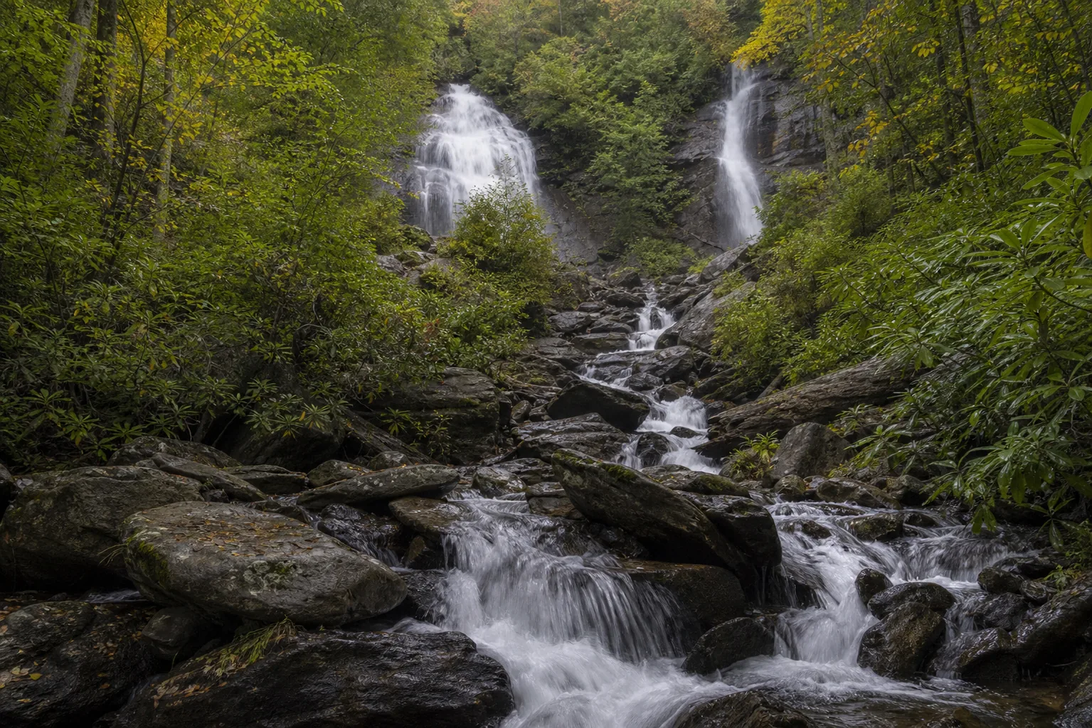
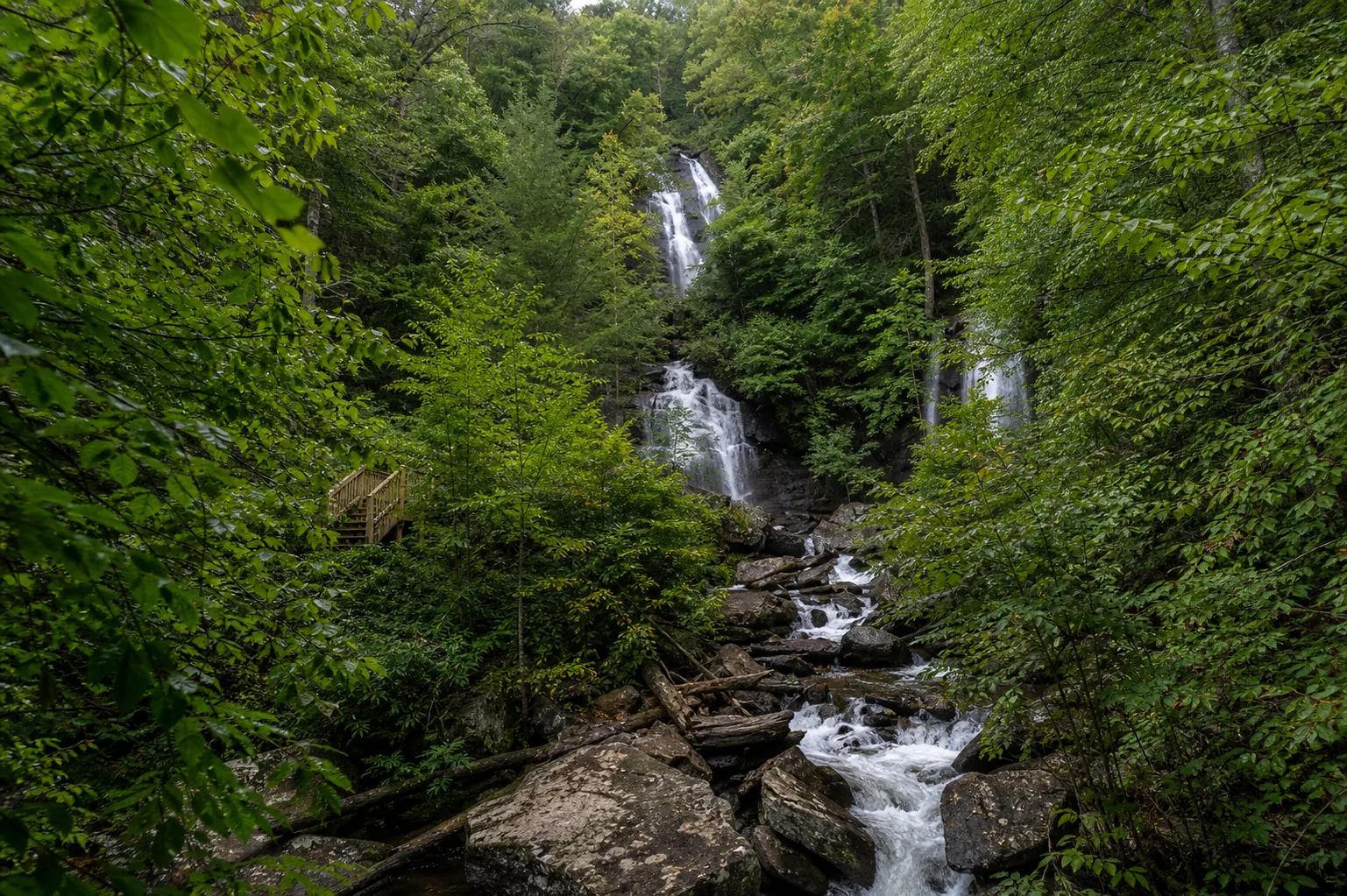
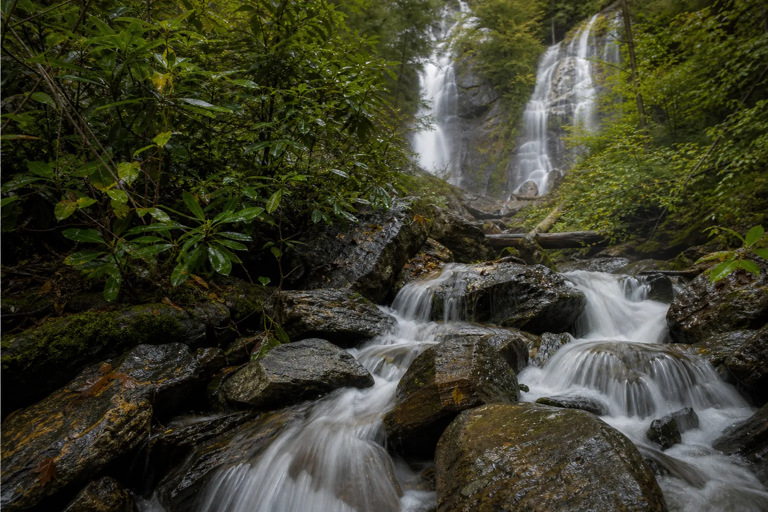
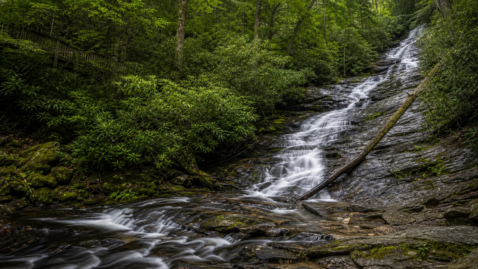
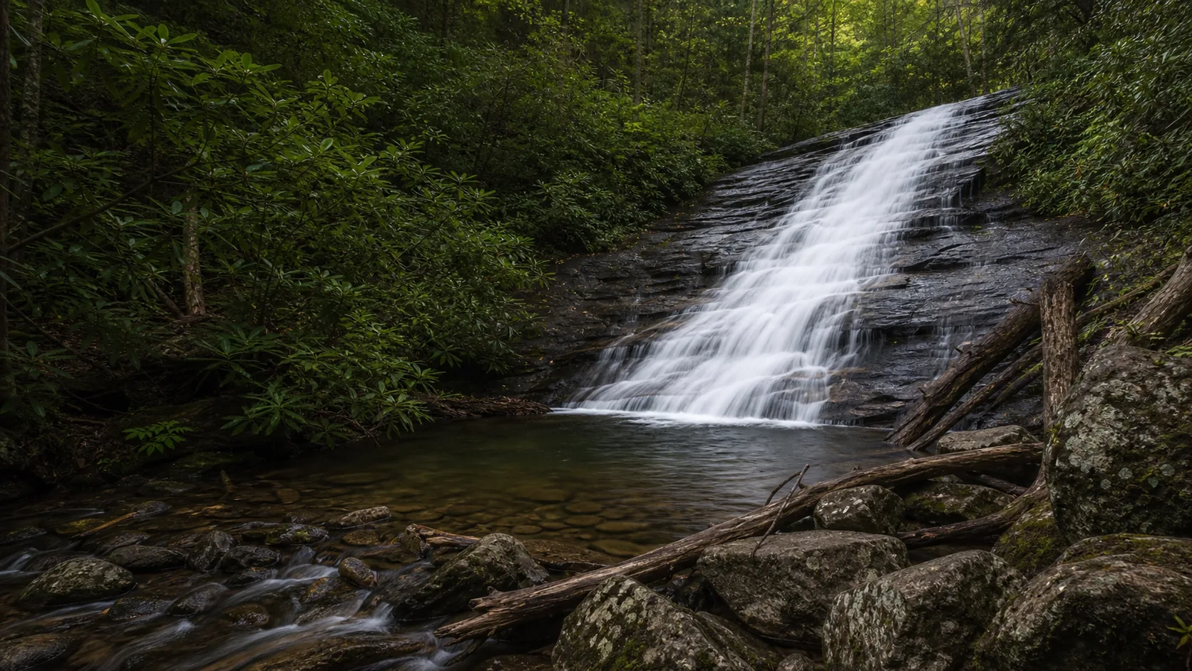
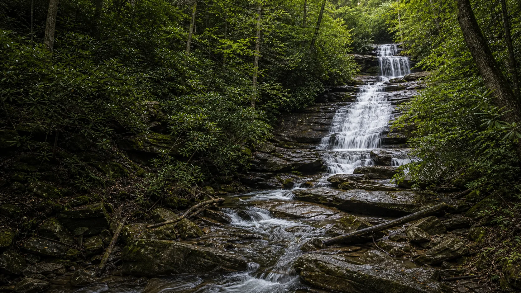
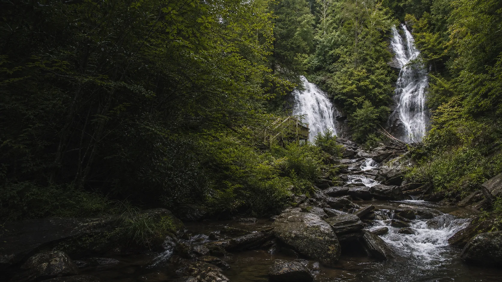
Yes, especially in two windows: mid-March through early May when Curtis Creek and York Creek both run loud after southern Blue Ridge snowmelt and spring storms, and the second and third weeks of October when the Chattahoochee-Oconee canopy peaks for fall color. Operationally it is a $3 adult day-use fee (free under 16) and a 9 a.m. to 6 p.m. window year-round, with last tickets at 5 p.m. The trail is a 0.4-mile paved walk one way with two short steep grades and benches along the way.

  • 0.4-mile paved trail (0.8 mi round trip) with short steep grades
  • $6 adult day-use fee, free for kids under 16
  • Open 9 a.m. to 6 p.m. year-round; closed Thanksgiving, Christmas Eve, Christmas Day
  • Twin falls: Curtis Creek 153 ft + York Creek 50 ft
  • Leashed dogs welcome on the falls trail and Smith Creek Trail
  • Lion's Eye Trail (0.1 mi) is wheelchair accessible with braille signage
Last verified May 12, 2026 Visited Sources: U.S. Forest Service Chattahoochee-Oconee, Visit Helen GA, GoFindOutdoors operator page, AllTrails, Wikipedia, Explore Georgia, Georgia Geological Survey, NOAA NCEI 8 sources checked
Distance 0.8 mi 4.6 mi extended
Round trip 30-60 min Paved 0.4-mile trail one way (0.8-mile round trip) with two short, steep grades; benches every few hundred feet
Difficulty Easy with steep sections Paved 0.4-mile trail one way (0.8-mile round trip) with two short, steep grades; benches every few hundred feet
Location White County, GA Anna Ruby Falls Recreation Area
Parking Visitor center lot, $3 covers parking U.S. Forest Service
Transit No fixed-route transit verified Drive and verify the current trailhead or access point · 0 ft
Drive Verify route Downtown route varies
Best season Spring after rainfall for peak flow; mid-October for fall color After rain or snowmelt
Anna Ruby Falls splash basin where curtis creek and york creek meet to form smith creek; lower tier of the 153-foot curtis cascade
Photo guide

Six angles of a side-by-side twin waterfall.

The fenced deck at the top of the paved trail is the only spot that frames both creeks in one shot, so most of the working positions are micro-shifts within a few feet of each other plus a small set of lower-trail vantages where Curtis Creek and York Creek separate visually. Use the captions to pick a frame before you commit to a lens.

Anna Ruby Falls waterfall and surrounding setting
Anna Ruby Falls, hero composition
Anna Ruby Falls wide view of both Curtis Creek and York Creek dropping into Smith Creek
Twin-falls wide frame: Curtis Creek (153 ft, left) and York Creek (50 ft, right) merging into Smith Creek
Anna Ruby Falls splash basin and lower Curtis Creek tier above Smith Creek
Splash basin where Curtis Creek and York Creek meet to form Smith Creek; lower tier of the 153-foot Curtis cascade
Anna Ruby Falls water flowing over biotite-gneiss bedrock ledges of the Tray Mountain Suite
Water-on-rock detail of biotite-gneiss bedrock at the Curtis Creek tier; the resistant ledge that produces the stepped cascade
01Is Anna Ruby Falls flowing right now?

There is no real-time USGS gauge dedicated to Anna Ruby Falls. The closest gauges are on the Chattahoochee River below Helen and on Smith Creek farther downstream - both are decent rainfall proxies. Use the NWS forecast for Helen and the Chattooga Ranger District alert page for the live answer.

Anna Ruby Falls runs all year because both source streams drain Tray Mountain and the surrounding southern Blue Ridge - Smith Creek seldom dries out completely. Flow is strongest after a multi-day rainfall in spring or after a fall remnant tropical system; late August in a dry summer is the weakest reliable window.

02How long is the walk?

0.4 miles paved one way from the visitor center to the falls deck, 0.8 miles round trip, with two short steep paved sections; figure 30-45 minutes to walk the round trip with a stop at the deck. The longer Smith Creek Trail to Unicoi State Park adds 4.6 miles one way.

03How do you get there?

From Helen, take GA-356 north for 1.5 miles, turn left onto Anna Ruby Falls Road at the brown Forest Service sign, and follow it 3.6 miles past the Unicoi State Park entrance to the Anna Ruby Falls Visitor Center parking lot. The lot is at 3455 Anna Ruby Falls Road, Helen, GA 30545.

04Is there free parking?

Park at the Anna Ruby Falls Visitor Center lot at the trailhead. The $3 adult day-use fee covers parking; there is no separate parking charge and no roadside or overflow option once the lot fills. On peak fall-color weekends in October, arrive before 10 a.m.

05Does it cost money?

$3 per adult, age 16 and up. Children 15 and younger are free. The fee covers parking, trail access, and the visitor center; the America the Beautiful federal pass is not accepted because Cradle of Forestry / GoFindOutdoors operates the site under a special-use permit from the Chattahoochee-Oconee NF.

06Trail variants

Anna Ruby Falls Trail 0.4 mi one way, 0.8 mi round trip, 30-45 min, Paved, short steep sections, ends at the twin-falls viewing deck.
Lion's Eye Trail 0.1 mi loop, 10-15 min, Wheelchair accessible with cable handrail and braille signage; starts at the visitor center.
Smith Creek Trail to Unicoi State Park 4.6 mi one way, 2-3 hr, Backcountry hike along Smith Creek; arrange a shuttle or out-and-back from either end.
Visitor center loop Less than 0.2 mi, 20-30 min, Center, gift shop, restrooms, picnic area; useful in heavy rain or icy conditions.

Detailed maps and recent reviews: Falls route on AllTrails · Creek route on AllTrails

07Can you swim?

Swimming is not allowed at the falls. The viewing deck is fenced, the pool below the drops is off-limits, and the basin floor is unstable wet bedrock. Drive 6 minutes south to Unicoi State Park lake beach for a legal lifeguarded swim or 35 minutes to Helton Creek Falls for an unsupervised pool.

08Are dogs allowed?

Leashed dogs are welcome on both the Anna Ruby Falls Trail and the Smith Creek Trail. Bring a 6-foot leash and waste bags; the steep paved grade is fine for most dogs but skip it if your dog struggles with stairs or warm pavement.

09Is it accessible?

The 0.4-mile main trail has steep paved sections and is not wheelchair accessible. Use the 0.1-mile Lion's Eye Trail at the visitor center instead; it is paved level, has a continuous cable handrail, and includes braille interpretive signs.

Field notes

Anna Ruby Falls at a glance.

Twin drops on Curtis Creek (153 ft) and York Creek (50 ft) on biotite-gneiss bedrock; merged into Smith Creek; 1,600-acre scenic area inside the Chattahoochee-Oconee National Forest; managed by the Chattooga Ranger District; $3 adult day-use fee; 9 a.m. to 6 p.m. year-round; closed Thanksgiving, Christmas Eve, and Christmas Day.

Height Not listed Source pending
Type Waterfall USGS
County White White County, GA
Managed by U.S. Forest Service, Chattooga Ranger District U.S. Forest Service
Water source Local creek or river USGS
Elevation 2562 ft USGS NED
Park area 1,600 acres U.S. Forest Service
Hours Open year-round 9 a.m. to 6 p.m. (last tickets 5 p.m.); closed Thanksgiving, Christmas Eve, and Christmas Day U.S. Forest Service
When to visit

Two windows that justify the drive, one that fills the gap.

Mid-March through early May for peak flow after southern Blue Ridge snowmelt and spring storms. Second and third week of October for fall color in the Smith Creek gorge canopy. December through February for a quieter trail with both creeks still running and a chance of ice fringe on the lower tier of Curtis Creek; the trail is open even when Helen has snow on the ground.

PEAK FLOW

Peak flowAfter rain or snowmelt
Ice / low flowWinter varies
Most crowdedWeekends and midday
Best photosSunrise or weekdays

Live water context

Discharge data -- There is no real-time USGS gauge dedicated to Anna Ruby Falls. The closest gauges are on the Chattahoochee River below Helen and on Smith Creek farther downstream - both are decent rainfall proxies. Use the NWS forecast for Helen and the Chattooga Ranger District alert page for the live answer.

Why is it called Anna Ruby Falls?

The falls is named for Anna Ruby Nichols, the only daughter of Captain James H. Nichols, a Confederate veteran and early Helen-area landowner who acquired much of the surrounding tract in the 1880s. Nichols built a hunting lodge near the base of the cascades and named the twin drops for his daughter after she died young; the family later sold the land, and the U.S. Forest Service absorbed it into the Chattahoochee National Forest in 1925. The two source streams kept their working names from the pre-Nichols era: Curtis Creek (the larger 153-foot drop) and York Creek (the 50-foot drop), both rising on Tray Mountain (4,430 ft), Georgia's sixth-highest peak.

What else to do at Anna Ruby Falls Recreation Area

Anna Ruby Falls Recreation Area sits inside the 1,600-acre Anna Ruby Falls Scenic Area of the Chattahoochee-Oconee National Forest, in the Chattooga Ranger District. It is reached by a paved spur road that climbs about 3.6 miles north from GA-356 past the Unicoi State Park entrance; the visitor center at the top of the road has restrooms, a small Cradle of Forestry gift shop, the fee booth, and the trailhead for both the falls trail and the 4.6-mile Smith Creek backcountry route to Unicoi. Most visitors base out of Helen, Georgia (11 miles south), an Alpine-themed town on the Chattahoochee River that also serves as the regional hub for tubing, lodging, and food.

  • Visitor center. Pay the $3 adult day-use fee, grab a trail map, use the restrooms, and check the trail-condition board before starting up.
  • Anna Ruby Falls Trail. 0.4 miles paved one way to the twin-falls viewing deck, with two short steep sections and benches every few hundred feet.
  • Lion's Eye Trail. 0.1-mile wheelchair-accessible loop at the visitor center with cable handrail and braille interpretive signs; the option for visitors who cannot do the main climb.
  • Smith Creek Trail. 4.6 miles one way down to Unicoi State Park; the only legal way to extend the trip on foot. Out-and-back works if you do not have a shuttle car.
  • Picnic area. Tables and a covered shelter near the visitor center; useful when storms roll through and the falls trail closes.

Why it looks this way

Anna Ruby Falls sits on the southern Blue Ridge Province, where Precambrian metamorphic bedrock (biotite gneiss, mica schist, and granitic gneiss of the Tray Mountain Suite) is cut by two parallel headwater drainages off the same upland. Curtis Creek and York Creek reach the cliff line within about 50 horizontal feet of each other, but their drainage areas are very different: Curtis Creek collects roughly three times the upstream basin that York Creek does, which is why it drops 153 feet in a tiered cascade while York Creek runs as a thinner 50-foot slide. Both creeks step down resistant gneiss ledges rather than free-falling off a single cliff, and they merge in a shared splash basin to form Smith Creek. The side-by-side configuration is rare in the southern Appalachians; most twin waterfall claims in the region are tiered drops on a single stream, not two separate watersheds meeting at a single rock face.
Field guide deep dive

What the brochures leave out about Anna Ruby Falls.

Twin-falls geology, the Nichols family story, the spring vs late-summer flow gap, and the $3 fee mechanics. Skim the headers, read what you need before the drive up GA-356.

How a side-by-side twin waterfall forms here

Anna Ruby Falls is a rare two-watershed waterfall: not one stream split into parallel channels, but two separate creeks from two separate drainages that happen to reach the same cliff line within about 50 horizontal feet of each other. The bedrock is southern Blue Ridge metamorphic rock; Georgia Geological Survey mapping puts it inside the Tray Mountain Suite, dominated by biotite gneiss, mica schist, and granitic gneiss with the foliation tilted enough that both creeks find resistant ledges to step down rather than a single free-fall lip.

The two drainages are very different sizes. Curtis Creek collects roughly three times the upstream basin that York Creek does, draining a larger fan off the north and east flanks of Tray Mountain. That basin difference is the entire reason the falls reads as 153 feet on one side and 50 feet on the other: Curtis Creek has the water and the gradient to cut a deeper, longer tiered cascade through three obvious steps, while York Creek runs as a thinner single slide alongside. Both pour into the same splash basin and merge to form Smith Creek, which then flows downhill to Smith Creek Pond and Unicoi Lake. Most North Georgia twin-falls claims (DeSoto, Long Creek, Issaqueena) are tiered drops on one stream; Anna Ruby is one of the only verified two-watershed configurations on the eastern side of the Blue Ridge.

Spring runoff vs late-summer trickle

There is no live USGS gauge dedicated to Smith Creek at the falls, so flow narrative here is built from regional precipitation rather than discharge. NOAA NCEI normals for the Helen / White County area run roughly 65 to 70 inches of rain per year, with the heaviest months historically being March, April, and July (thunderstorm regime). The practical pattern: from mid-March through early May, multi-day frontal rainfall plus residual snowmelt off the Tray Mountain ridge keeps both Curtis Creek and York Creek loud; the upper tier of Curtis Creek throws audible spray across the deck on the highest flow days.

By late August in a normal summer the situation flips. Without a tropical remnant or a wet front, York Creek can thin to a streak inside its channel and Curtis Creek drops to three discrete ribbons rather than a continuous cascade. If you are visiting in August or September and want the full curtain, check the seven-day Helen NWS forecast; one half-inch storm 24 to 48 hours before your visit is usually enough to push both creeks back to brochure flow. Fall remnant systems (late September through mid-October) often deliver the second peak of the year. Winter rarely freezes either drop completely; the falls keeps running through Helen's typical December-February cold snaps, with thin ice fringe forming on the lower tier of Curtis Creek in deep cold years.

The Helen, Georgia day: Anna Ruby plus tubing plus Bavarian downtown

Most Anna Ruby trips are part of a Helen, Georgia overnight or day trip rather than a stand-alone hike. Helen is an Alpine-themed town on the upper Chattahoochee River about 11 miles south of the visitor center; it was remodeled in the late 1960s as a Bavarian village and still leans into that aesthetic with timber-frame storefronts, bratwurst restaurants, and a German-style biergarten or two. A standard one-day plan: park in Helen, walk the riverfront and grab breakfast, drive 20 minutes up GA-356 and Anna Ruby Falls Road, hike to the deck and back (about 90 minutes including the climb), drive back down to Helen, and finish with afternoon tubing on the Chattahoochee from one of the in-town operators.

If you have a second day, the natural pairings on the same Chattahoochee-Oconee Blue Ridge geology are Dukes Creek Falls (about 20 minutes west in Smithgall Woods, free, 1-mile round trip with a deck view of a two-stream cascade similar to but less famous than Anna Ruby) and Helton Creek Falls (35 minutes northwest, free, with two stacked drops and a shallow legal swim pool). All three together with Helen lunch is a full, well-paced Saturday.

Why $3, why 9 to 6, and why the federal pass does not work

The day-use fee at Anna Ruby Falls is $3 per adult (16+), free for kids 15 and younger. This is unusually low for a federally managed waterfall and reflects how the site is operated: the Chattahoochee-Oconee National Forest holds the underlying land, but the fee booth, gift shop, and trail-condition reporting are run by GoFindOutdoors (the Cradle of Forestry in America Interpretive Association) under a special-use permit. Because the operation is not a direct Forest Service collection, the America the Beautiful interagency pass is not accepted; visitors who expect their National Parks pass to cover entry will need to pay the $3 cash or card at the booth.

Hours run 9 a.m. to 6 p.m. year-round with last tickets sold at 5 p.m. The 9 a.m. opening keeps the gate aligned with daylight at the higher elevation (the visitor center is around 2,560 ft), and the 6 p.m. close gives the operator time to sweep the trail before dusk; the 5 p.m. last-ticket cutoff is the standard one-hour-before-close window common to operator-run NF sites. The recreation area closes Thanksgiving Day, Christmas Eve, and Christmas Day; the trail itself is closed during ice storms and tornado warnings, which is why the visitor center keeps a trail-condition board posted in the lobby.

The 0.4-mile overlook vs the 4.6-mile Smith Creek route

Two legal hikes start at the visitor center. The default is the Anna Ruby Falls Trail, 0.4 miles paved one way (0.8 miles round trip) to the fenced deck at the base of the twin falls. The path follows the right (south) bank of Smith Creek upstream through second-growth hardwood and rhododendron, with two short steep paved grades and benches every few hundred feet. Round-trip walking time is 30 to 45 minutes for most people, plus deck time. The grade is rated easy with steep sections; strollers struggle on the two steep pitches, but a child carrier handles it fine.

The serious alternative is the Smith Creek Trail, 4.6 miles one way from the visitor center down to the Smith Creek campground at Unicoi State Park. The route is a single track that drops about 600 feet along the creek, crossing several footbridges and one open rhododendron tunnel. Most parties run it as a shuttle (drop a car at Unicoi first); without a shuttle, the only legal option is an out-and-back, which makes it a 9.2-mile day with about 1,200 feet of total elevation. The Lion's Eye Trail (0.1-mile wheelchair-accessible loop at the visitor center with braille signage) is the third option and is the only step-free path on site.

Captain James H. Nichols and the naming of Anna Ruby

The falls is named for Anna Ruby Nichols, the only daughter of Captain James H. Nichols, a Confederate cavalry officer who settled in the upper Chattahoochee valley after the Civil War. By the 1880s Nichols had acquired several thousand acres around what is now the recreation area, including the cliff line at the base of Curtis Creek and York Creek. Local accounts (preserved in the Visit Helen GA visitor-center materials and on Wikipedia) say he built a hunting lodge near the splash basin and gave the twin drops his daughter's name after she died young.

The Nichols holdings were sold off in the early 1900s, and the U.S. Forest Service folded the parcel into the new Chattahoochee National Forest in 1925, one year after the Weeks Act-era purchase block that created most of the modern southern-Appalachian national forest system. The Anna Ruby Falls Scenic Area, 1,600 acres surrounding the falls, was formally designated later as a sub-unit inside the larger forest. The creek names predate the Nichols era; Curtis and York were both common northern-Georgia settler surnames in the early 1800s, and the streams kept their original working names even after the falls itself was rebranded.

Map and route

Eleven miles north of Helen, three miles past Unicoi.

From Helen, take GA-356 north for 1.5 miles, turn left onto Anna Ruby Falls Road at the brown Forest Service sign, and follow it 3.6 miles past the Unicoi State Park entrance to the Anna Ruby Falls Visitor Center parking lot. The lot is at 3455 Anna Ruby Falls Road, Helen, GA 30545.

Photography and weddings

Good light, safer footing, fewer surprises.

The fenced viewing deck at the top of the trail is the only place where both Curtis Creek (153 feet) and York Creek (50 feet) frame in a single shot. There is no legal off-trail shooting; the basin is closed.

Overcast mornings give the cleanest separation of white water and dark biotite-gneiss rock. Bright noon sun blows out Curtis Creek's upper tier; come in shade or after 4 p.m. on a clear day.

Personal photography is fine. Tripods at the deck are tolerated when crowds are thin; large lighting setups, drones, and any commercial shoot need a Chattahoochee-Oconee NF special-use permit.

Permits

Weddings and engagements

Engagement portraits work well at the deck on a weekday off-season morning, but the area is fenced and shared with day visitors - there is no reservable ceremony space at the falls themselves.

For a ceremony or anything involving more than two non-paying guests beyond a couple, contact the Chattooga Ranger District for a special-use permit; weekend weddings get pushed to Unicoi State Park's lakeside venues instead.

Plan the smallest possible footprint, schedule before the 9 a.m. opening only with prior permit, and have an indoor Unicoi backup for thunderstorms - this section of the Blue Ridge gets hit hard in summer afternoons.

Nearby waterfalls

Three North Georgia waterfalls within 35 minutes of Anna Ruby.

Anna Ruby pairs naturally with two free Chattahoochee-Oconee NF waterfalls on the same Blue Ridge geology: Dukes Creek in Smithgall Woods (20 minutes west, no fee) and Helton Creek Falls (35 minutes northwest, no fee, with a swimmable pool). Add Helen's Bavarian downtown and tubing on the Chattahoochee for a full one-day plan.

Related questions

More questions before you go.

Fee, hike length, dogs, swimming, winter access, twin-falls height, and the worth-it answer. Indexed in FAQ schema for AI answer engines.

01When does Anna Ruby Falls open?

The recreation area is open year-round, 9 a.m. to 6 p.m. Eastern, with last tickets sold at 5 p.m. The site closes only three days per year: Thanksgiving Day, Christmas Eve, and Christmas Day. The trail itself can close temporarily during ice storms, tornado warnings, or active fire activity; check the trail-condition board in the visitor center lobby.

02How tall is Anna Ruby Falls?

It is a side-by-side twin waterfall on two separate streams. Curtis Creek drops 153 feet in a tiered cascade and York Creek drops 50 feet in a thinner single slide, with the two streams merging in a shared splash basin at the base to form Smith Creek. The height difference reflects the drainage difference: Curtis Creek collects roughly three times the upstream basin that York Creek does.

03Is Anna Ruby Falls open in winter?

Yes. The recreation area runs the same 9 a.m. to 6 p.m. hours year-round, only closing Thanksgiving, Christmas Eve, and Christmas Day. Both creeks keep running through Helen's typical December-February cold snaps; full freeze-up is rare, but thin ice fringe can form on the lower tier of Curtis Creek in deep cold years. Drive Anna Ruby Falls Road carefully after ice storms; the upper switchbacks hold ice longer than GA-356.

04Is Anna Ruby Falls worth visiting?

Yes, especially mid-March through early May for peak flow on both creeks and the second and third weeks of October for fall color in the Smith Creek canopy. The side-by-side twin-watershed geology is genuinely rare in the southern Appalachians, the 0.4-mile paved trail makes it accessible to most visitors, and at $3 per adult the day-use fee is among the lowest of any major federally managed waterfall in the eastern U.S.

Sources and data

Where this guide gets its facts.

Hours and fee from the U.S. Forest Service Chattahoochee-Oconee recreation page and the GoFindOutdoors operator. Trail data cross-referenced with AllTrails. Twin-falls heights and Nichols family history from Wikipedia and the Visit Helen GA visitor-center page. Geology from Georgia Geological Survey mapping of the Blue Ridge Province.

U.S. Forest Service: Anna Ruby Falls Recreation Area fs.usda.gov
Access, parking, and permit rules: fs.usda.gov
Georgia Geological Survey: Geologic Map of the Blue Ridge Province (Tray Mountain Suite, biotite gneiss / mica schist / granitic gneiss): White County bedrock epd.georgia.gov
NOAA / NWS Peachtree City forecast grid FFC 72,134 (Helen / White County, GA) noaa.gov
USGS National Elevation Dataset 3DEP
Google Maps: embedded map and directions maps.google.com
Google Places: nearby restaurants and hotels places API
U.S. Forest Service: Anna Ruby Falls Recreation Area (Chattahoochee-Oconee NF, Chattooga Ranger District) fs.usda.gov
Visit Helen GA: Anna Ruby Falls Visitor Center listing helenga.org
GoFindOutdoors (Cradle of Forestry in America Interpretive Association): Anna Ruby Falls operator page gofindoutdoors.org
AllTrails: Anna Ruby Falls Trail (current conditions and elevation report) alltrails.com
Wikipedia: Anna Ruby Falls en.wikipedia.org
Wikimedia Commons: Anna Ruby Falls image category commons.wikimedia.org
Explore Georgia: Anna Ruby Falls Recreation Area exploregeorgia.org
NOAA NCEI: Helen / White County climate normals (regional precipitation reference) ncei.noaa.gov
Fact checks
Fee verification: $3 adult day-use fee is cross-referenced with the U.S. Forest Service Chattahoochee-Oconee recreation page and the GoFindOutdoors operator page, which runs the gate under a special-use permit. Older blog references to higher amounts were superseded.
Twin-falls heights verification: Curtis Creek 153 ft and York Creek 50 ft are sourced from the Explore Georgia listing, the Wikipedia article, and Explore Georgia's video description; the Forest Service page describes the tallest drop as 'more than 150 feet' which is consistent.
Etymology verification: Anna Ruby Nichols, daughter of Capt. James H. Nichols, is sourced to Wikipedia and the Visit Helen GA visitor-center page; Nichols family land acquisition in the 1880s and the 1925 U.S. Forest Service folding-in are dated to the standard southern-Appalachian Weeks Act timeline.
Flow audit: no live USGS gauge is paired to Anna Ruby Falls; the seasonal flow narrative is built from NOAA NCEI regional precipitation normals for White County, not from discharge data.
Corrections: [email protected]