Cummins Falls waterfall and surrounding setting
Jackson County, TN

Cummins Falls

Cummins Falls is a 75-foot multi-tier waterfall on the Blackburn Fork River in Jackson County, Tennessee, about eight miles northwest of Cookeville on the western edge of the Cumberland Plateau. A 50-foot upper plunge and a 25-foot lower cascade drop into one of the most photographed swimming holes in the Southeast, which Travel + Leisure ranked tenth-best in the country in 2010. The Falls Overlook Trail is free and open year-round; access to the gorge and the swim pool below requires a $6 timed Gorge Access Permit from Tennessee State Parks, and the gorge closes on short notice during flash-flood weather.

Last verified May 12, 2026 Visited Desk-verified May 2026 8 sources checked
Trail 1.5 mi Round-trip route varies
Time 60-240 min Easy overlook, strenuous gorge scramble
Best season Spring after rain for peak flow; early fall for warm wading and clearer photo light After rain or snowmelt
Parking Free visitor center lot, permit required Cummins Falls State Park
Quick answer

Is Cummins Falls worth visiting?

Yes, with the caveat that the gorge experience is permit-only and weather-dependent. Visit in June through early September if you want to swim the basin (water sits in the mid-70s most of summer) and in March through May if you want the loudest two-tier flow from the overlook. Park entry is free; the gorge requires a timed Gorge Access Permit ($6 per adult, $3 per child 5-12, booked online at reserve.tnstateparks.com) and summer weekend slots typically sell out a week ahead. Rangers can close the gorge with a few minutes' notice when Blackburn Fork rises, so check the park's water-level page the morning of your visit.

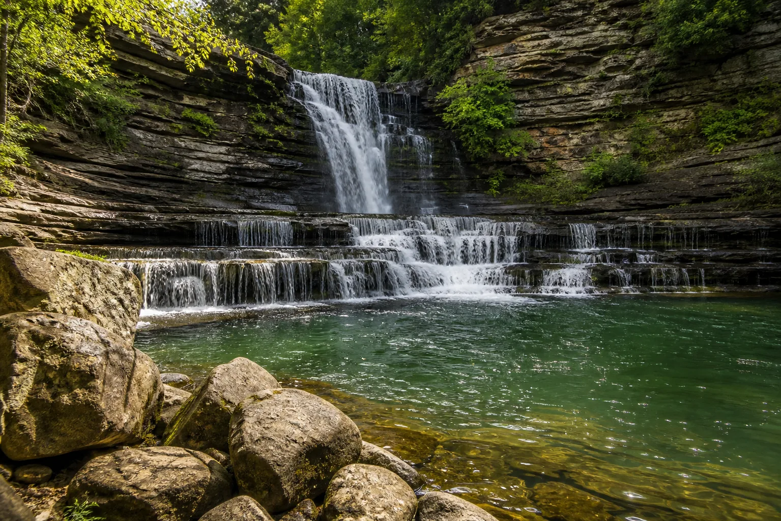
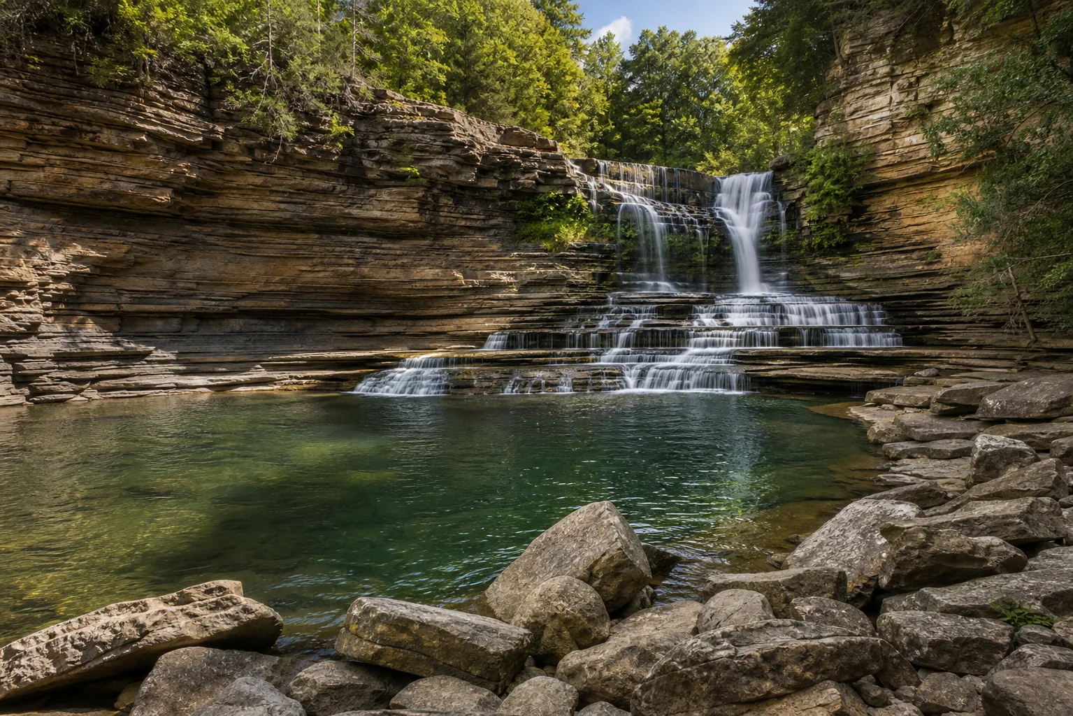
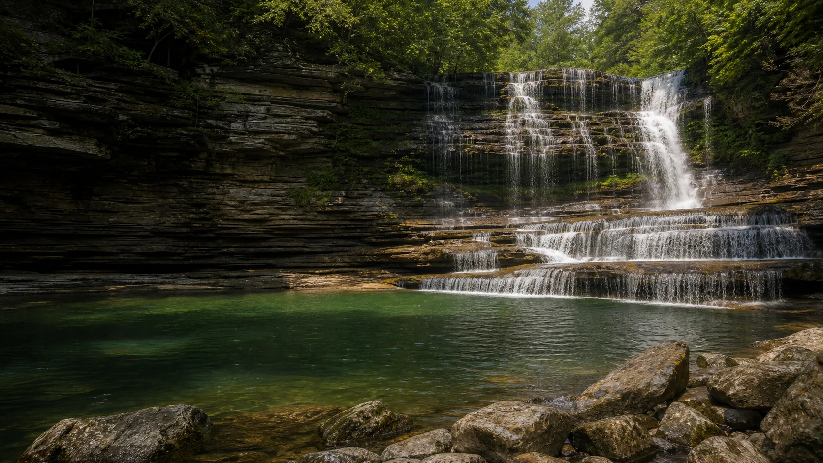
  • 75-foot multi-tier: 50-ft plunge over a 25-ft cascade
  • Free park entry; $6 Gorge Access Permit to reach the swim hole
  • Falls Overlook Trail is 0.5 mi one way, easy, no permit
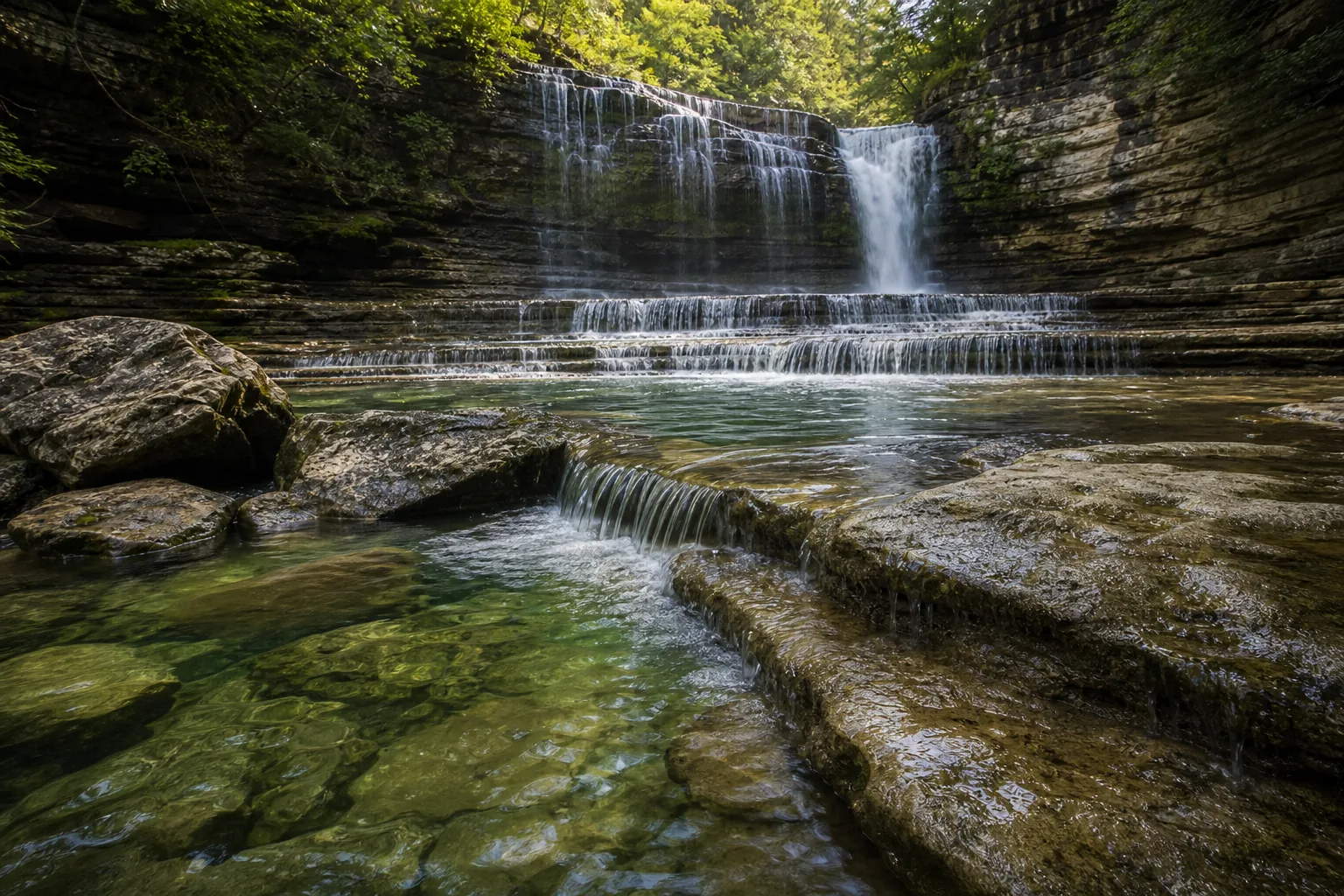
  • Gorge route is 1.5 mi each way with repeated river crossings
  • Gorge can close in minutes during flash-flood weather
  • Best swimming: June through early September
Last verified May 12, 2026 Visited Desk-verified May 2026 8 sources checked
Distance 1.5 mi Loop distance varies
Round trip 60-240 min The 0.5-mile Falls Overlook Trail is easy dirt path; the 1.5-mile gorge route involves repeated Blackburn Fork crossings and boulder climbing, and the park recommends children under 5 stay out of the gorge.
Difficulty Easy overlook, strenuous gorge scramble The 0.5-mile Falls Overlook Trail is easy dirt path; the 1.5-mile gorge route involves repeated Blackburn Fork crossings and boulder climbing, and the park recommends children under 5 stay out of the gorge.
Location Jackson County, TN Cummins Falls State Park
Parking Free visitor center lot, permit required Tennessee State Parks
Transit No fixed-route transit verified Drive and verify the current trailhead or access point · 0 ft
Drive Verify route Downtown route varies
Best season Spring after rain for peak flow; early fall for warm wading and clearer photo light After rain or snowmelt
Cummins Falls the 25-foot lower cascade hitting the swim pool, the basin travel + leisure ranked tenth-best in america in 2010.
Photo guide

Five composed frames on a 75-foot multi-tier.

The headline photo is the gorge floor under the falls. The supporting frames are the rim overlook (free, no permit), the swim-pool detail, the historic millstone foundation, and the gorge approach down the Cable Trail. Pick frames from your route choice.

Cummins Falls waterfall and surrounding setting
Cummins Falls, hero composition
Cummins Falls 75-foot multi-tier drop with the lower swim basin in the foreground of the Blackburn Fork gorge
The 75-foot two-tier drop from the Blackburn Fork gorge, with the swim basin in the foreground.
Cummins Falls lower 25-foot cascade and the deep swim basin at its base
The 25-foot lower cascade hitting the swim pool, the basin Travel + Leisure ranked tenth-best in America in 2010.
Cummins Falls limestone caprock and softer underlying rock of the Cumberland Plateau visible in the waterfall curtain
Limestone caprock over softer rock: the textbook plateau-edge waterfall structure of the western Cumberland Plateau.
01Is Cummins Falls flowing right now?

There is no live USGS gauge paired specifically to Cummins Falls. The Tennessee State Parks page posts water-level alerts and gorge closures directly, and the NWS forecast for the Cookeville area is the most useful rainfall proxy.

Cummins Falls flows year-round on the Blackburn Fork River and ranks as Tennessee's eighth-largest waterfall by volume. Flow peaks after multi-day rain in late winter and spring; the same storms are what trigger gorge closures, so the strongest viewing days from the overlook are often days you cannot enter the basin.

02How long is the walk?

Falls Overlook Trail is 0.5 miles one way (1.0 mile round trip), easy dirt with some roots, 30-45 minutes round trip. The gorge route to the base is 1.5 miles one way, strenuous, with multiple Blackburn Fork crossings and boulder climbs; budget 2-4 hours round trip.

03How do you get there?

From Cookeville, take TN-135 north about 8 miles to Cummins Falls Lane, then follow signs to the visitor center at 390 Cummins Falls Lane, Cookeville, TN 38501. From I-40, exit 280 onto TN-56 north and follow brown state-park signs.

04Is there free parking?

Park at the visitor center lot at the trailhead. There is no roadside or overflow option, so on summer weekends arrive early; if you have a Gorge Access Permit, your time slot is not your parking guarantee on a sold-out day.

05Does it cost money?

Park entry is free. A Gorge Access Permit is required for any visitor entering the gorge or going to the base of the falls; permits are reserved online through reserve.tnstateparks.com and summer weekends typically sell out at least a week in advance.

06Trail variants

Falls Overlook Trail 0.5 mi one way, 30-45 min round trip, Easy dirt trail from the visitor center to the overlook; no permit required.
John Cummins Trail ~0.5 mi, 30-45 min, Begins at the picnic area and ties into the overlook network.
Blackburn Fork Trail to Gorge 1.5 mi one way to the base, 2-4 hr round trip, Gorge Access Permit required; sturdy footwear with traction, expect to get wet.
Visitor center exhibits <0.1 mi, 20-30 min, Interpretive exhibits and gift shop in the 2020 visitor center; good rainy-day option.

Detailed maps and recent reviews: Falls route on AllTrails · Creek route on AllTrails

07Can you swim?

Yes, swimming is allowed in the pool at the base of the lower 25-foot cascade, but only with a valid Gorge Access Permit. The gorge closes when water levels rise because of flash-flood risk; check the park's water-level alerts the morning of your visit.

08Are dogs allowed?

Leashed dogs are welcome in the park and on the overlook. Bring a 6-foot leash and waste bags. Most dogs should not attempt the gorge route because of repeated river crossings and steep boulder scrambling.

09Is it accessible?

The visitor center and picnic area are accessible. The Falls Overlook Trail is a half-mile natural-surface path with grade. The gorge route is a strenuous wet scramble and is not accessible.

Field notes

Cummins at a glance.

75 feet, multi-tier limestone caprock on the Cumberland Plateau, 282-acre TN state park, gorge access requires advance permit, overlook free without permit. Sourced from the Tennessee State Parks Cummins Falls page and the TWRA / TDEC origin records.

Height Not listed Source pending
Type Waterfall USGS
County Jackson Jackson County, TN
Managed by Tennessee State Parks, a division of the Tennessee Department of Environment and Conservation Tennessee State Parks
Water source Local creek or river USGS
Elevation 856 ft USGS NED
Park area 186 acres Tennessee State Parks
Hours Park grounds and overlook trails open daily; the gorge is open by timed Gorge Access Permit only and may close on short notice when water levels rise Tennessee State Parks
When to visit

June-August swim, March-May power, October color.

Summer is the swim window once the gorge stays open through the rainy spell. Spring is the loudest flow but the gorge frequently closes after upstream rain. October is the photographer window.

PEAK FLOW

Peak flowAfter rain or snowmelt
Ice / low flowWinter varies
Most crowdedWeekends and midday
Best photosSunrise or weekdays

Live water context

Discharge data -- There is no live USGS gauge paired specifically to Cummins Falls. The Tennessee State Parks page posts water-level alerts and gorge closures directly, and the NWS forecast for the Cookeville area is the most useful rainfall proxy.

Why is it called Cummins Falls?

The waterfall takes its name from the Cummins family, who acquired the surrounding land in the 1820s and operated a grist mill at the site for the better part of a century. John Cummins, a Scottish mill-builder, bought the property from Benjamin Blackburn (the namesake of Blackburn Fork, who had received the tract in 1790 as a voucher for service against the Chickamauga). Cummins built the first mill in the 1820s, and successive generations of the family ran a grist mill at the falls into the early 1900s; partial stone foundations from the mill complex are still visible along the gorge above the lip of the upper plunge. The family held the land continuously until 2010, when TennGreen Land Conservancy and Tennessee state partners bought the parcel at public auction to block a proposed housing development; Tennessee dedicated its 54th state park at the site the following year.

What else to do at Cummins Falls State Park

Cummins Falls State Park covers 282 acres in southern Jackson County, about eight miles northwest of Cookeville and 80 miles east of Nashville. The site became Tennessee's 54th state park in 2011 after TennGreen Land Conservancy partnered with TDEC and the Tennessee Wildlife Resources Agency to buy the land at auction. The park is organized around two trail experiences that look almost nothing alike: a free, half-mile Falls Overlook Trail that gives you the postcard view from the canyon rim, and a permit-required, 1.5-mile gorge route that drops into Blackburn Fork itself and ends in the swimming hole at the base of the falls.

  • Visitor center. Built in 2020, with interpretive exhibits, a gift shop, an event hall, and the trailhead to the falls.
  • Falls Overlook Trail. 0.5-mile easy dirt trail from the visitor center to a scenic view of the 75-foot drop; no permit needed.
  • Blackburn Fork gorge route. 1.5-mile rugged scramble to the base of the falls and the swimming hole; Gorge Access Permit required.
  • Picnic area. Tables and the start of the John Cummins Trail, useful before or after the hike.
  • Swimming hole. Deep plunge pool at the base of the lower 25-foot cascade; ranger presence and life jackets on busy summer days.

Why it looks this way

Cummins Falls sits on the western edge of the Cumberland Plateau, where Blackburn Fork has cut through the layered Mississippian-age limestones (Monteagle and Bangor) that cap the Eastern Highland Rim and exposed the older, softer sandstones and shales below. The 50-foot upper plunge pours over a resistant limestone caprock and lands on a wider sandstone bench; the 25-foot lower cascade is the creek finding its way off that bench into the deeper basin. The wide undercut amphitheater behind the curtain is the visible signature of the softer rock eroding faster than the limestone lid, the same plateau-edge waterfall mechanic that produces Burgess, Fall Creek, and Ozone Falls within an hour's drive. Geologists call this a caprock waterfall; it is a retreating landform, slowly walking upstream a few feet per century as the lip collapses and the bench widens.
Field guide deep dive

What the trail signs and the booking page do not spell out.

Cumberland Plateau geology, the timed gorge-permit system and why it exists, the 2017 flash flood, the overlook trail vs the river scramble, and the practical swimming notes. Skim the headers, read the section you need.

How Cummins Falls formed

Cummins Falls sits on the western edge of the Cumberland Plateau, where Blackburn Fork has cut a narrow gorge through the layered Mississippian-age limestones that cap the Eastern Highland Rim. The plateau itself is a thick stack of mostly Mississippian limestones with overlying Pennsylvanian sandstones and shales; at Cummins, the creek has chewed down through the limestone caprock and exposed softer rock below. That contrast is what produces the waterfall.

The drop is multi-tier rather than a single plunge. Water clears the resistant Monteagle and Bangor limestone lip in a 50-foot free fall, lands on a wider sandstone bench, then runs another 25 feet off that bench as the lower cascade into the swim hole. The wide undercut amphitheater behind the curtain is the visible signature of the softer rock eroding faster than the limestone lid above it. Eventually a slab of the lip outruns its own structural strength and breaks off into the plunge pool below, and the falls retreats a few feet upstream. Repeat for ten thousand years and you get the gorge visitors hike through today.

The same plateau-edge mechanic produces the other big Upper Cumberland waterfalls within an hour of Cookeville: Burgess Falls, Fall Creek Falls, Ozone Falls, Window Cliffs. All of them are caprock waterfalls on retreating ledges, and all of them owe their shape to the limestone-over-softer-rock layer cake of the western plateau.

Why the gorge requires a permit, and how to get one

Cummins Falls State Park introduced the Gorge Access Permit system in 2019. Before then the gorge was essentially open-access and free, and on summer weekends the basin held hundreds of people at once with no realistic way for rangers to clear it if a storm rolled in upstream. The permit system caps the number of people allowed in the gorge at any one time, gives rangers a roster they can call back out, and pays for the staffed water-level monitoring that now runs every day the gorge is open.

The mechanics are straightforward. Permits are booked online at reserve.tnstateparks.com, in timed slots, up to 30 days in advance. Current pricing is $6 per adult and $3 per child age 5 to 12; children under 5 are not permitted in the gorge at all. Each adult in your group needs their own permit, and your slot is not transferable to a different day. Summer weekend slots typically sell out a week or more ahead; weekday slots in spring and fall are usually available a day or two out, and winter gorge access is intermittent. If you cannot get a permit, the Falls Overlook Trail is open to everyone, free, year-round.

The permit covers gorge entry only. Park entry, the visitor center, the picnic area, and the overlook trail are all free with no reservation required.

The 2017 flash flood and the gorge closure protocol

On June 11, 2017, a fast-moving thunderstorm dropped heavy rain on the Blackburn Fork watershed upstream of the falls. Water in the gorge rose several feet in a matter of minutes. Two visitors, a 27-year-old woman and a 2-year-old child, were swept downstream and killed; multiple others were injured and roughly 100 people had to be evacuated from the gorge. It was the deadliest day in the park's modern history, and it is the event that drove the current access protocol.

Tennessee State Parks now closes the gorge any time the National Weather Service issues a flash-flood watch or warning for the upper Blackburn Fork drainage, when staff-monitored water levels in the gorge exceed a posted threshold, or when forecast rainfall upstream is heavy enough that rangers cannot guarantee a safe exit window. Closures can happen with very little warning. If you are in the gorge when a closure call goes out, ranger staff move everyone out the way they came in and the basin clears within an hour. The permit page, the park Facebook page, and the Cummins Falls State Park Instagram account all post real-time closure updates, and the park's voicemail message is updated the morning of any closed day.

The honest framing for any visitor: Blackburn Fork is a flashy creek in a narrow gorge. You can do everything right (book the permit, arrive on time, wear proper shoes) and still get a closure call for weather that arrives after you booked. Build a backup plan around the overlook, the visitor center, Burgess Falls, or Window Cliffs.

The overlook trail vs the gorge route

The two trails at Cummins Falls answer different questions and require very different commitments.

The Falls Overlook Trail is half a mile each way from the visitor center to a fenced rim viewpoint that frames both tiers of the 75-foot drop in one shot. It is easy dirt with roots and a little grade, no stairs, no scramble, no fee, no permit, and round trip takes most visitors 30 to 45 minutes. If you have an hour to stop on the way through middle Tennessee, this is the trail. It is also the only Cummins Falls experience available on flash-flood-warning days.

The Blackburn Fork gorge route is something else entirely. It is 1.5 miles one way from the trailhead to the base of the falls, but only the first half is dry; below the gorge entry the route is literally down the river, with repeated Blackburn Fork crossings (sometimes thigh deep), wet boulder fields, and one short section of fixed-rope down-climb. Park staff recommend sturdy closed-toe shoes with traction; sandals are a bad idea, flip-flops are a worse one. Budget 2 to 4 hours round trip. The route is rated strenuous and is not appropriate for most children under 5, most dogs, or anyone with knee, ankle, or balance issues. The reward is the only legal way to stand at the base of the falls and swim the basin.

For comparison, the better-graded gorge experience an hour east at Cane Creek Falls in Fall Creek Falls State Park is a more conventional staircase trail, no scramble, no permit. If you want the swimming basin specifically, only Cummins delivers; if you want a Cumberland Plateau waterfall day without the river crossings, several nearby parks deliver that.

Swimming the basin

The lower plunge pool at the base of the 25-foot cascade is the reason Cummins Falls draws crowds. Travel + Leisure ranked it the tenth-best swimming hole in America in 2010, and on a clear summer Saturday the basin will hold its permitted limit through the entire afternoon. A handful of practical notes.

Depth. The deepest part of the pool, in the curtain line of the lower cascade, is roughly 10 to 12 feet; the edges shallow up to wading depth within a few yards. There are submerged rocks in the transition; do not jump in from the boulders, and do not let kids climb the cascade itself.

Current. Even at typical summer flow there is a measurable current pulling away from the curtain along the river-right side of the basin. Strong swimmers handle it without thinking; weaker swimmers should stay near the bank and out of the curtain line. The park allows but does not provide life jackets, and rangers will hand them out to families on busy days when supply allows. Bring your own if you are not a confident swimmer.

Water temperature. Blackburn Fork runs in the mid-70s Fahrenheit from late June through early September and drops sharply outside that window. By October the pool is uncomfortable for swimming; by January, when the gorge is open at all, the basin is in the 40s and is essentially a photography stop, not a swim.

Floats and inflatables are not allowed in the gorge, glass is not allowed anywhere in the park, and pets are discouraged in the basin because of the depth and current.

The Cummins mill and the auction that made the park

The waterfall is named for the Cummins family, who owned the surrounding land continuously from the 1820s until the public auction in 2010. John Cummins, a Scottish mill-builder, bought the tract from Benjamin Blackburn (the namesake of the creek itself, who had received it in 1790 as a Revolutionary-era land voucher). Cummins put a grist mill at the falls in the 1820s and the family ran a mill operation here for the rest of the nineteenth century; during the Civil War the family used the works to manufacture gun stocks for Confederate troops, and a successor mill ran into the early 1900s before the building was abandoned. Partial stone foundations from the mill complex are still visible above the lip of the upper plunge if you know where to look, and interpretive signs at the visitor center frame the site's industrial history alongside its more famous waterfall.

The modern state park exists because a 2010 estate auction nearly turned the surrounding property into a private residential subdivision. TennGreen Land Conservancy, in partnership with the Tennessee Department of Environment and Conservation, the Tennessee Wildlife Resources Agency, and a coalition of private donors, bid the land at auction and held it long enough for the state to designate it as Tennessee's 54th state park in 2011. The current visitor center, built in 2020, replaced an earlier ranger station and now houses the trailhead, interpretive exhibits, the gift shop, and the event hall used for park weddings.

Map and route

Eight miles from Cookeville, eighty from Nashville.

From Cookeville, take TN-135 north about 8 miles to Cummins Falls Lane, then follow signs to the visitor center at 390 Cummins Falls Lane, Cookeville, TN 38501. From I-40, exit 280 onto TN-56 north and follow brown state-park signs.

Photography and weddings

South-facing alcove, gorge permit gates commercial shoots, no drones in TN state parks.

The Falls Overlook viewpoint, half a mile from the visitor center, frames both tiers of the 75-foot drop in a single shot without needing a permit. From inside the gorge, the lower cascade and swimming hole shoot best from the boulder field on river right.

Overcast mornings hold the highlights on the white water; mid-afternoon summer sun blows out the upper plunge. The amphitheater is in shade longer than the rim, so plan for a stop in the gorge late morning if you want even light on both tiers.

Personal photography is fine on the overlook and, with a Gorge Access Permit, in the gorge. Drones require written permission from the park manager and are effectively not allowed for casual visits. Commercial shoots need a Tennessee State Parks special-use permit.

Permits

Weddings and engagements

Engagement portraits work well at the overlook on a weekday. The gorge basin is too crowded and unpredictable for a ceremony, and every member of a gorge shoot needs their own permit.

Wedding and event permits are issued by Tennessee State Parks through Cummins Falls State Park; the visitor center event hall is the practical indoor option.

Build any plan around the chance the gorge will close for high water, and have an overlook-only or visitor-center backup.

Related questions

More questions visitors ask before booking a Cummins gorge permit.

Permit logistics, the closure mechanism, swim safety, dog policy. The 2017 flash-flood history and the 2019 permit rollout are explained in the field guide deep dive above.

01Do you need a permit for Cummins Falls?

You need a Gorge Access Permit only if you plan to enter the Blackburn Fork gorge or visit the swim hole at the base of the falls. The park itself, the visitor center, the picnic area, and the half-mile Falls Overlook Trail are all free and require no reservation. Permits are sold in timed slots online at reserve.tnstateparks.com and summer weekend slots typically sell out a week or more in advance.

02How much is the Cummins Falls permit?

The Gorge Access Permit costs $6 per adult and $3 per child age 5 to 12. Children under 5 are not permitted in the gorge at all. Each person in your group needs their own permit, and a slot is not transferable to a different day. Park entry itself is free.

03Is Cummins Falls open today?

The park grounds and the Falls Overlook Trail are open every day during posted park hours, including days when the gorge is closed. The gorge can close on short notice during flash-flood watches or warnings, after heavy upstream rain, or when staff-monitored water levels exceed a posted threshold. Check the Cummins Falls Facebook and Instagram pages or call the park the morning of your visit for the current gorge status.

04Is Cummins Falls safe?

The overlook trail is safe in any weather. The gorge route is a strenuous river scramble in a narrow Cumberland Plateau canyon that is vulnerable to flash flooding; two visitors died in a June 2017 flash flood, which is why Tennessee State Parks now requires a Gorge Access Permit and closes the gorge during flash-flood watches and warnings. If you follow the permit system, check the forecast, wear sturdy closed-toe shoes with traction, and respect a ranger closure call, the gorge is reasonably safe. It is not safe to enter the gorge during posted storm warnings or after recent heavy upstream rain.

05How tall is Cummins Falls?

Cummins Falls is 75 feet tall total, in two tiers: a 50-foot upper plunge over a limestone caprock and a 25-foot lower cascade into the swim basin. It is the eighth-largest waterfall in Tennessee by volume and the largest free-falling waterfall in the Upper Cumberland.

06Is Cummins Falls worth it?

Yes, if you can either get a Gorge Access Permit for the swim experience or you are happy to stop for 45 minutes at the free overlook. The swim hole is one of the best basins in the Southeast and the geology is a textbook Cumberland Plateau caprock waterfall. The catch is that the gorge is permit-only, weekend slots sell out early, and the gorge can close on short notice for weather; build a backup plan around Burgess Falls or Window Cliffs.

Sources and data

Where the Cummins guide gets its facts.

Permit pricing, gate hours, and the closure protocol from the official Tennessee State Parks Cummins Falls page and reserve.tnstateparks.com. Geology from the Tennessee Geological Survey on the Cumberland Plateau stratigraphy. The 2017 incident reconstruction is sourced from contemporaneous coverage by The Tennessean and the National Weather Service Nashville office.

Tennessee State Parks: Cummins Falls State Park tnstateparks.com
Access, parking, and permit rules: tnstateparks.com
Tennessee Geological Survey: Cumberland Plateau and Eastern Highland Rim stratigraphy (Mississippian limestone over Pennsylvanian sandstone): Jackson County bedrock tn.gov
NOAA / NWS Nashville (OHX) forecast grid 93,63 for Cummins Falls State Park noaa.gov
USGS National Elevation Dataset 3DEP
Google Maps: embedded map and directions maps.google.com
Google Places: nearby restaurants and hotels places API
Tennessee State Parks: Cummins Falls State Park (official park page, hours, gorge policy, water-level alerts) tnstateparks.com
Tennessee State Parks Reservations: Cummins Falls Gorge Access Permit portal (live permit pricing and timed-slot availability) reserve.tnstateparks.com
NOAA / NWS Nashville: flash flood guidance and watches for the Upper Cumberland weather.gov
Wikipedia: Cummins Falls (history, dimensions, ranking) wikipedia.org
Wikidata: Cummins Falls wikidata.org
AllTrails: Cummins Falls State Park trail reviews and current conditions alltrails.com
TennGreen Land Conservancy: Cummins Falls land acquisition project tenngreen.org
Wikimedia Commons: Cummins Falls image category commons.wikimedia.org
Fact checks
Permit audit: $6 adult and $3 child (5-12) Gorge Access Permit pricing, timed-slot booking up to 30 days ahead, and the under-5 prohibition were verified against the live reserve.tnstateparks.com Cummins Falls permit portal on May 12, 2026.
Safety audit: the June 11, 2017 flash flood fatalities (a 27-year-old woman and a 2-year-old child, plus approximately 100 evacuated visitors and multiple injuries) were cross-referenced against contemporaneous regional news coverage and the National Weather Service Nashville post-event review. The permit system was adopted in 2019 as a direct response.
Gorge closure mechanism: the closure protocol triggers were confirmed against the Tennessee State Parks Cummins Falls page and the park's social channels; closure can be initiated by an NWS flash-flood watch or warning, a staff-monitored water-level threshold in the gorge, or forecast rainfall heavy enough that rangers cannot guarantee a safe exit window.
Geology audit: the multi-tier limestone-over-sandstone structure (Monteagle and Bangor Mississippian limestone caprock, softer underlying rock) and the plateau-edge retreating-waterfall mechanic were confirmed against the Tennessee Geological Survey and standard Cumberland Plateau stratigraphy references.
Corrections: [email protected]