Fish Creek Falls plunging in two tiers through a Precambrian gneiss canyon outside Steamboat Springs, Colorado
Routt County, CO

Fish Creek Falls

Fish Creek Falls is a 280-foot two-tier plunge on Fish Creek, four miles east of downtown Steamboat Springs in the Routt National Forest. A quarter-mile paved boardwalk delivers the headline view; ambitious hikers continue four miles to the Upper Falls or eight to Long Lake in the Mount Zirkel Wilderness. The drop sits on Precambrian gneiss of the Park Range and reads as one of the most accessible big waterfalls in northwest Colorado.

Last verified May 12, 2026 Visited Desk-verified May 2026 7 sources checked
Trail 0.5 mi 8.0 mi extended
Time 15-360 min Easy to strenuous
Best season Late May through October for full trail; winter for ice viewing from lower deck Late May through June
Parking USFS day-use lot: $5/vehicle or interagency pass. Lot fills before 10 a.m. summer weekends. Fish Creek Falls Recreation Area, Routt National Forest
Quick answer

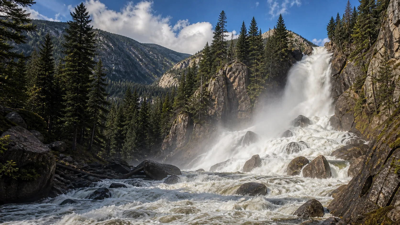
Is Fish Creek Falls worth visiting today?

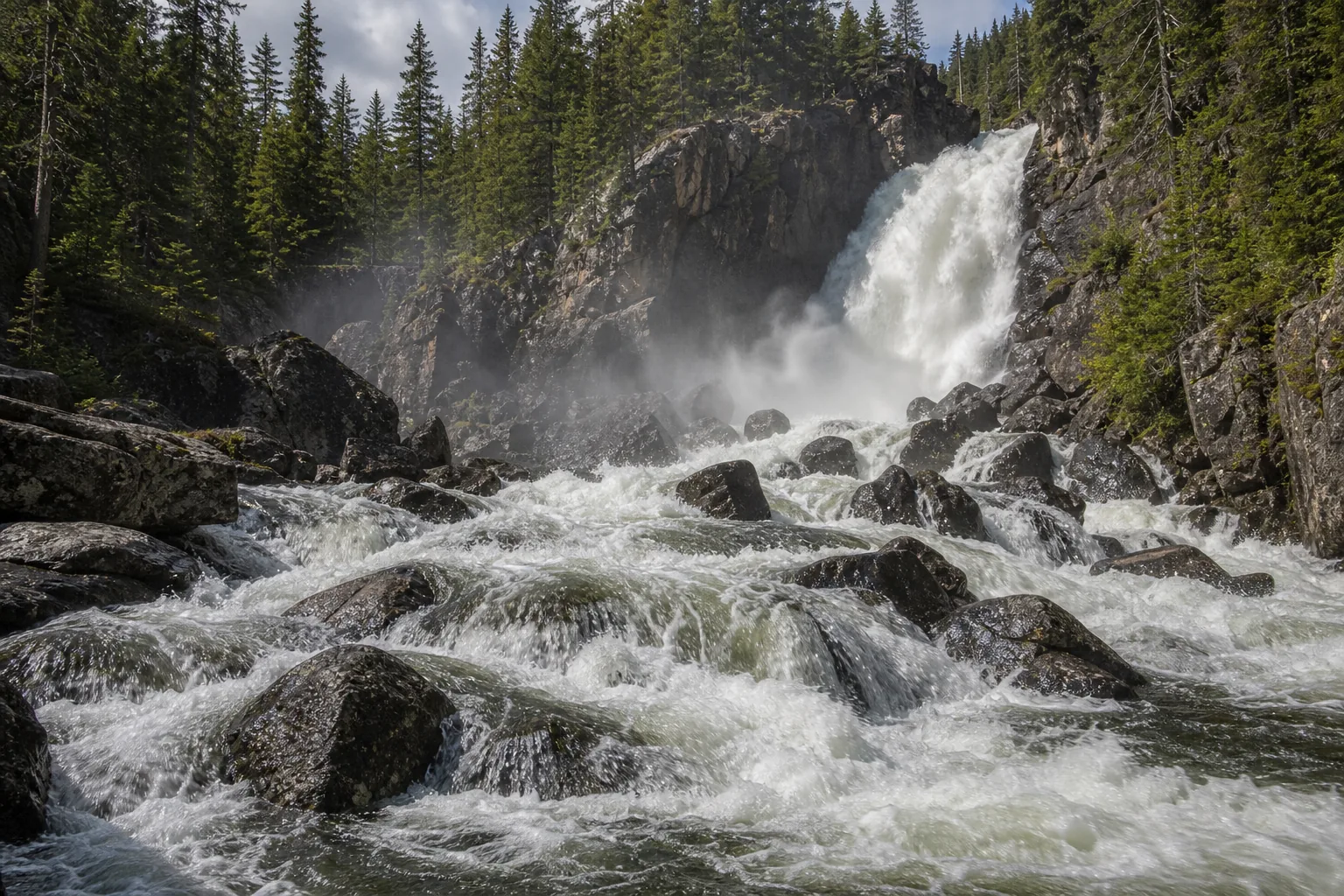
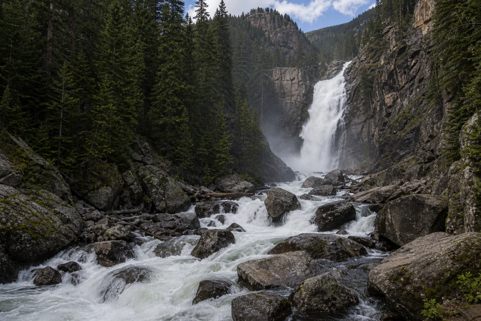
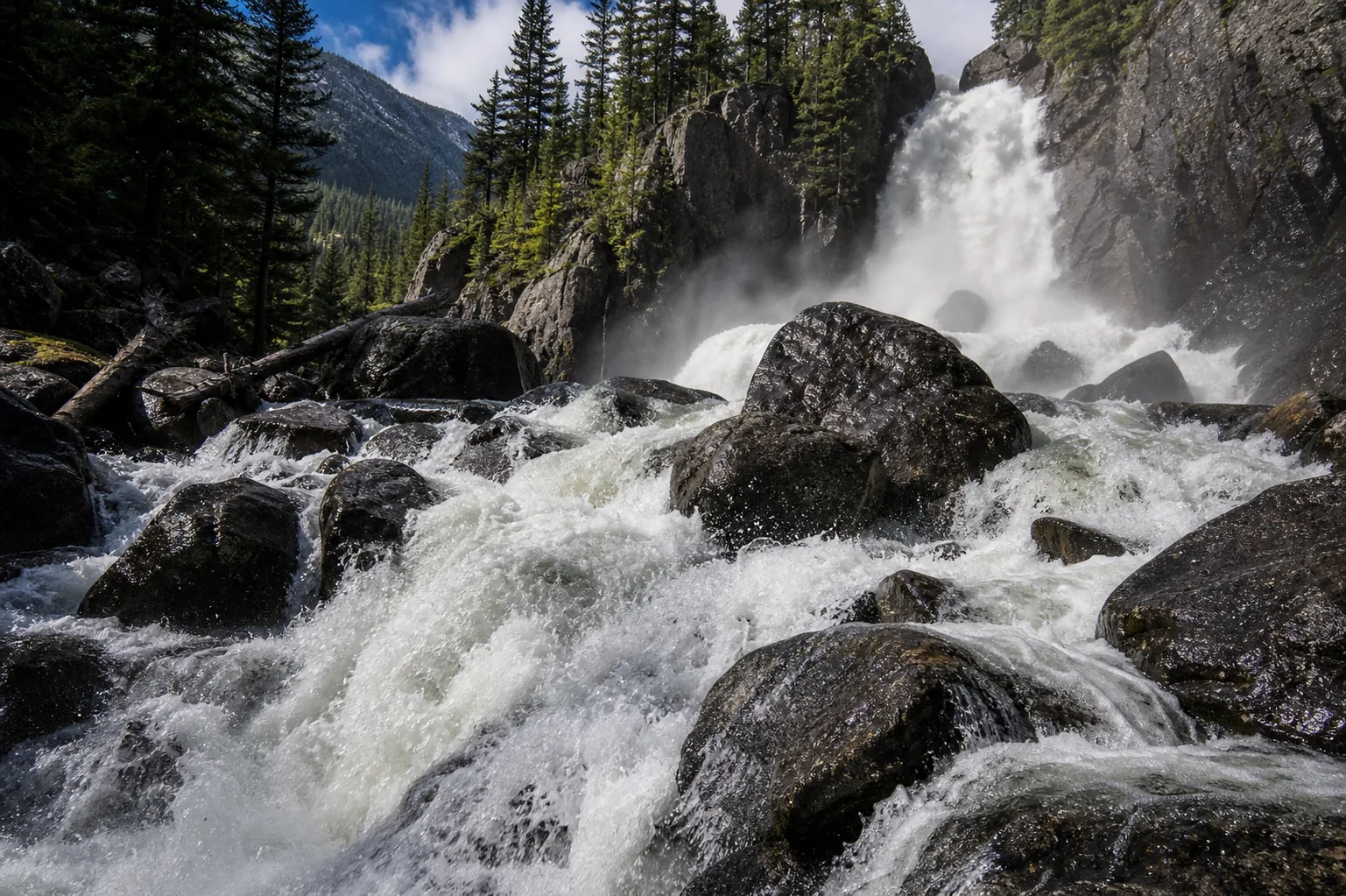
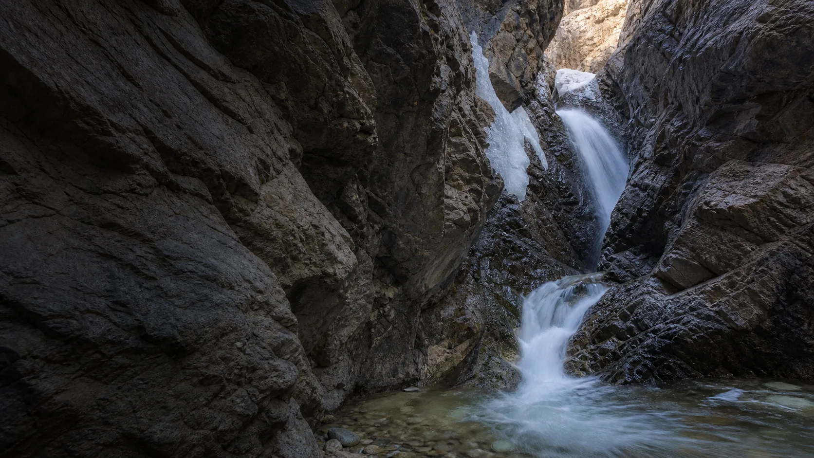
Yes, in two distinct windows. Late May through June is when Fish Creek runs above its 30-year median of 10 cfs and the 280-foot face turns into a continuous roaring sheet (75th percentile flow is 34 cfs, 90th is 211 cfs). Late December through February freezes the face into mixed ice and free-flowing water, which is when local ice climbers show up and the lower boardwalk doubles as a winter overlook. July through October the falls is a clean two-tier drop on lower flow; January in a mild winter is the only stretch that consistently underdelivers.

  • 10 minutes from downtown Steamboat
  • 0.25 mi paved boardwalk to the lower overlook
  • $5 USFS day-use fee or interagency pass
  • Peak flow: late May through June
  • Ice cover: late December through February
  • Upper Falls is a 4-mile out-and-back add-on
Last verified May 12, 2026 Visited Desk-verified May 2026 7 sources checked
Distance 0.5 mi 8.0 mi extended
Round trip 15-360 min Lower overlook is short and accessible; Upper Falls and Long Lake add real elevation
Difficulty Easy to strenuous Lower overlook is short and accessible; Upper Falls and Long Lake add real elevation
Location Routt County, CO Fish Creek Falls Recreation Area, Routt National Forest
Parking USFS day-use lot: $5/vehicle or interagency pass. Lot fills before 10 a.m. summer weekends. USFS
Transit No fixed-route transit to trailhead Steamboat Springs Transit serves town; drive Fish Creek Falls Road from there · 0 ft
Drive 4 mi 10 min from downtown
Best season Late May through October for full trail; winter for ice viewing from lower deck Late May through June
Fish Creek Falls spring runoff hitting the lower bowl after the gneiss bench split the column into two tiers
Photo guide

Three working angles on a 280-foot two-tier plunge.

A lower boardwalk overlook, a base-of-falls bridge, and a four-mile climb to the Upper Falls cleft. Use the captions to decide which angles fit your time and fitness.

Fish Creek Falls plunging in two tiers through a Precambrian gneiss canyon outside Steamboat Springs, Colorado
Fish Creek Falls, hero composition
Wide canyon view of Fish Creek Falls dropping in two tiers through Precambrian gneiss outside Steamboat Springs
Two-tier 280-foot drop through Fish Creek Canyon, viewed from the lower boardwalk overlook
Powerful base of Fish Creek Falls during snowmelt with whitewater hitting gneiss boulders below the lower tier
Spring runoff hitting the lower bowl after the gneiss bench split the column into two tiers
Detailed view of Fish Creek Falls upper tier with water striking polished gneiss before the lower plunge
Close-up of the upper tier where Fish Creek strikes the Park Range gneiss step before plunging again
01Is Fish Creek Falls flowing right now?

Live data: USGS gauge 09238900 (Upper Station near Steamboat Springs), daily discharge since 1996. The 30-year daily-flow median is 10 cfs; the 75th percentile is 34 cfs; the 90th percentile is 211 cfs; the maximum recorded reading is 1,500 cfs.

02How long is the walk?

Five minutes from the lot to the lower boardwalk overlook on a paved 0.25-mile path. The full base-of-falls descent adds another short, steep section. The Upper Falls trail is 4 miles round trip with about 1,400 feet of elevation gain. The Long Lake trail extends to 8 miles round trip into the Mount Zirkel Wilderness.

03How do you get there?

From downtown Steamboat Springs, take 3rd Street east, turn right on Fish Creek Falls Road, and follow it 4 miles to the Forest Service day-use lot. From Yampa Valley Regional Airport (HDN) in Hayden, allow 40 minutes via US-40 east. The lot ends at the trailhead; there is no through road.

04Is there free parking?

The USFS lot charges $5 per vehicle (cash at the iron ranger or any interagency pass: America the Beautiful, Senior, Access, Military, 4th Grade). Overflow on Fish Creek Falls Road is signed and limited. The lot fills before 10 a.m. on summer weekends and during ice-climbing windows in February.

05Does it cost money?

Yes. $5 per vehicle day-use fee at the iron ranger, or any federal interagency pass. No additional entry fee beyond parking. Upper Falls and Long Lake are inside Routt National Forest with no extra charge; the Mount Zirkel Wilderness portion requires self-issue wilderness registration at the trailhead.

06Trail variants

Lower overlook 0.25 mi out-and-back, 15-30 min, paved boardwalk, accessible viewpoint of the 280-foot falls.
Base of falls 0.5 mi out-and-back, 30-45 min, drops to the bridge near the base; rocky and steep in places.
Upper Fish Creek Falls 4 mi out-and-back, 2-3 hr, switchbacks climb roughly 1,400 ft to the upper falls in a rocky cleft.
Long Lake 8 mi out-and-back, 5-6 hr, continues into the Mount Zirkel Wilderness past Upper Falls.

Detailed maps and recent reviews: Falls route on AllTrails · Creek route on AllTrails

07Can you swim?

No. Fish Creek is cold, fast, and channeled through a boulder field below the falls. There is no sanctioned swimming area. For warm water, Strawberry Park Hot Springs (7 mi from town) or the indoor Old Town Hot Springs in Steamboat are the local alternatives.

08Are dogs allowed?

Yes, on leash. The Routt National Forest requires dogs under physical control; the short boardwalk is leash-only by practice. On the Upper Falls and Long Lake trails, leash discipline still applies because of wildlife corridors and other hikers.

09Is it accessible?

The 0.25-mile lower boardwalk is paved and graded for wheelchair and stroller access to the main overlook. Restrooms at the trailhead are accessible. The base-of-falls bridge, Upper Falls trail, and Long Lake trail are not accessible.

Field notes

Fish Creek Falls at a glance.

280-foot two-tier plunge over Park Range gneiss, USGS gauge 09238900 since 1996, managed by USDA Forest Service (Routt National Forest), $5 per vehicle day-use fee, paved 0.25-mile overlook trail.

Height 280 ft USGS 3DEP
Type Plunge (two tier) USGS
County Routt Routt County, CO
Managed by USDA Forest Service, Medicine Bow-Routt National Forests USFS
Water source Fish Creek USGS
Elevation 7546 ft USGS NED
Park area Not listed USFS
Hours Day use, generally sunrise to sunset; verify current alerts before driving USFS
When to visit

Two windows that justify the trip, one that fills the gap.

Late May through June for peak snowmelt and the full continuous curtain (gauge typically above 100 cfs). Late December through February for the ice-encased face and the local ice-climbing season. July through October works for clean two-tier flow on lower water; mild Januarys are the only stretch that consistently underdelivers.

PEAK FLOW

Peak flowLate May through June
Ice / low flowLate December through February
Most crowdedWeekends and midday
Best photosSunrise or weekdays

Live water context

Discharge data -- Live reading from Fish Creek at Upper Station near Steamboat Springs, CO (USGS 09238900) refreshes on the next build. Open the gauge link below for the current cubic-feet-per-second reading.

USGS 09238900 · Fish Creek at Upper Station near Steamboat Springs, CO

Why is it called Fish Creek Falls?

Fish Creek is the literal English name for the trout-bearing stream that drains the western flank of the Park Range and joins the Yampa River in downtown Steamboat Springs. The creek and the falls share the name because the creek is the only one of consequence in this drainage; the falls is simply the spot where Fish Creek loses 280 feet of elevation in two steps. There are other Fish Creek Falls in the United States (Wisconsin, Idaho, Oregon, New York), so include Steamboat Springs or Routt County in any search.

What else to do at Fish Creek Falls Recreation Area, Routt National Forest

The Fish Creek Falls Recreation Area is a small Forest Service day-use site on the western edge of the Routt National Forest, four miles east of Steamboat Springs by paved road. It is not a state park or a federal park, and it does not have a visitor center; it is a picnic site with restrooms, a $5 fee booth, a paved 0.25-mile boardwalk to the main overlook, and a trail register where the longer hikes to Upper Falls and Long Lake begin. The site sits at 7,546 feet, the falls drops to roughly 7,200 feet, and the trail continues into the Mount Zirkel Wilderness above the Upper Falls.

  • Lower boardwalk overlook. 0.25 mile of paved, wheelchair-accessible trail leads to a railed overlook of the full 280-foot two-tier drop. This is what most visitors come for and it works in any season.
  • Base-of-falls bridge. A short, rocky spur drops from the overlook to a pedestrian bridge below the lower tier. Closer to the spray; steeper footing.
  • Upper Fish Creek Falls trail. A 4-mile round-trip switchback hike climbs roughly 1,400 feet to a smaller upper drop tucked in a rocky cleft. Real elevation gain, real reward.
  • Long Lake trail. An 8-mile out-and-back continues past the Upper Falls into the Mount Zirkel Wilderness to Long Lake, which sits in a glacial basin at about 9,800 feet.
  • Picnic area. Tables, restrooms, and aspen and oak shade above the lower overlook. Popular with Steamboat families on summer weekends.

Why it looks this way

Fish Creek Falls drops across the Precambrian gneiss and schist of the Park Range, the same 1.7-billion-year-old metamorphic basement that forms the spine of the Mount Zirkel Wilderness east of Steamboat Springs. The two-tier shape is a geometry of joint planes in the gneiss: an upper drop where the creek strikes a near-vertical joint face, a short bench where the water reorganizes against a more resistant band, then a lower plunge into the boulder field. Unlike a sedimentary caprock waterfall (which retreats by overhang collapse), a gneiss waterfall like Fish Creek erodes much more slowly because the rock is uniformly hard. The canyon walls were sculpted by Pleistocene alpine glaciation that hung Fish Creek's valley above the broader Yampa Valley below.
Field guide deep dive

What the trail signs do not tell you.

Park Range geology, the gauge math behind the curtain, the three viewpoints, and the winter ice-climbing reality. Skim the headers, read what you need.

Why the falls drops in two tiers across Park Range gneiss

Fish Creek Falls sits on the western flank of the Park Range, the high spine that runs north from Rabbit Ears Pass into the Mount Zirkel Wilderness. The bedrock here is Precambrian gneiss and schist, metamorphic rock about 1.7 billion years old that forms the basement of the northern Colorado Rockies. Unlike the sedimentary caprock waterfalls of the Midwest (Platteville limestone over St. Peter sandstone, for example), a gneiss waterfall does not retreat by overhang collapse. The rock is uniformly hard, and the falls erodes only at the speed the creek can grind quartz.

The two-tier shape comes from joint planes in the gneiss. Joints are near-vertical fractures, often spaced regularly through a metamorphic body, that water exploits preferentially. At Fish Creek the upper drop pours over a steep joint face, hits a more resistant band that creates a short bench where the water reorganizes, then continues into the lower plunge to the boulder field below. Total drop is 280 feet by the Forest Service description; AllTrails and Wikipedia carry 283 feet, which appears to include additional cascades upstream of the main face. The canyon itself was carved during Pleistocene alpine glaciation; Fish Creek's valley is a classic hanging tributary, perched well above the broader Yampa Valley below and forced to drop steeply over the lip to reach base level in town.

Reading the USGS gauge: what 10, 34, and 211 cfs actually look like

The USGS gauge at Upper Station (09238900) has been recording daily discharge here since 1996. The 30-year daily-flow median is 10 cfs, the 25th percentile is 5.4 cfs, the 75th percentile is 34 cfs, the 90th percentile is 211 cfs, and the maximum on record is 1,500 cfs. Those numbers are smaller than the absolute discharge of larger Colorado rivers because Fish Creek's drainage above the gauge is modest, but they map cleanly onto what you see at the lip.

The visual transition that matters: at about 5 cfs the lower tier breaks into separate ribbons and the upper tier is a streak. At 10 cfs (the 30-year median, a typical August day) it is a thin but continuous two-tier drop. From 30 to 100 cfs (75th percentile territory, typical late May through mid-June) it is a single roaring curtain across both tiers and the lower bridge gets wet. Above 200 cfs (90th percentile, peak snowmelt years) the upper tier reads as a unified column, the lower bowl recirculates, and mist reaches the boardwalk overlook. The 1,500-cfs maximum corresponds to extreme rain-on-snow events on the Park Range and is the reading you do not chase in person.

Three viewpoints in one trail register: boardwalk, bridge, Upper Falls

The 0.25-mile lower boardwalk is paved, wheelchair-accessible, and gives the full head-on view of both tiers from a railed overlook. It is the only step-free angle, it is what the Forest Service signage calls the accessible overlook, and it is enough for most visitors. A short spur from the boardwalk descends to a pedestrian bridge near the base of the lower tier; the footing turns rocky and steep but the upward-looking frame from the bridge is the dramatic shot.

The four-mile out-and-back to the Upper Falls is a different hike. Switchbacks climb roughly 1,400 feet through aspen and lodgepole pine on the south wall of the canyon, then traverse to a rocky cleft where Fish Creek drops in a tighter, less photographed cascade. The Long Lake extension continues past Upper Falls another two miles into the Mount Zirkel Wilderness to a glacial-basin lake at roughly 9,800 feet, for a total of 8 miles round trip. Self-issue wilderness registration is required at the trailhead for anything past the Upper Falls.

The winter ice-climbing reality and what the boardwalk shows in February

From late December through February the 280-foot face partially or fully encases in ice. The upper tier typically freezes first because the column is more exposed; the lower tier often retains free-flowing water through most of the winter because of the volume hitting the bench. Local ice climbers work the lower face and the columns to the side of the main drop when conditions are reliable, usually January through early March in a normal cold year. This is not a beginner objective and the Forest Service does not promote it; treat any descent below the boardwalk in winter as backcountry travel.

For non-climbers, the lower boardwalk is the winter overlook. It is plowed irregularly, microspikes or snowshoes are usually required past the parking area, and the railing is the appropriate boundary. In mild winters the face does not fully freeze and the climbing season is short; in cold winters with sustained subfreezing weather through January, the ice column holds through February. The most reliable winter viewing window is mid-February in years where the previous month has stayed below freezing for at least 10 consecutive days.

How the falls fits a Steamboat Springs day

Fish Creek Falls is four miles from downtown Steamboat by paved road, ten minutes by car, and it is the only natural attraction in town that can be done in 30 minutes with a stroller or wheelchair. That makes it the easy morning stop for almost every Steamboat itinerary. Add the base-of-falls bridge for another 20 minutes; add Upper Falls for half a day; add Long Lake for a full day.

Pair the falls with Strawberry Park Hot Springs (7 miles, 25 minutes by road from the trailhead) for a morning-falls-then-afternoon-soak day. Pair with the Yampa River Core Trail through downtown for an easy in-town afternoon, or with Rabbit Ears Pass viewpoints (20 minutes south on US-40) for a wider Park Range introduction. The Yampa Valley Regional Airport in Hayden is 40 minutes west; Steamboat Springs proper has full lodging, restaurants, and a free in-town bus that does not reach the falls trailhead. The falls itself requires a car or a rideshare for the last four miles.

When to point a camera, and from where

The lower face reads roughly west. Late-afternoon light is the cleanest because the sun clears the eastern canyon rim and lights both the white water and the dark gneiss together; the contrast holds and the gneiss reads as charcoal rather than black. Morning leaves the face in canyon shadow until the sun gets high. Overcast days are forgiving for both the bright water and the dark rock and are often the best photographic weather here, especially after a summer thunderstorm when the spray is fresh.

In June, runoff spray creates a near-permanent rainbow visible from the overlook between roughly 2 and 4 p.m. on clear days. In October the canyon walls fill with yellow aspen and the lower flow lets you see the joint pattern in the gneiss clearly. In February the ice column reads cleanly against the dark wall in mid-morning light, which is the rare exception to the late-afternoon rule. Tripods are tolerated at the overlook but should not block traffic; drone use is prohibited inside the Mount Zirkel Wilderness boundary above Upper Falls regardless of Part 107 status.

Map and route

Ten minutes east of downtown Steamboat Springs.

From downtown Steamboat Springs, take 3rd Street east, turn right on Fish Creek Falls Road, and follow it 4 miles to the Forest Service day-use lot. From Yampa Valley Regional Airport (HDN) in Hayden, allow 40 minutes via US-40 east. The lot ends at the trailhead; there is no through road.

Photography and weddings

West-facing face, three working positions, late-afternoon light wins.

There are three working positions at Fish Creek Falls. The lower boardwalk overlook is the head-on framing of both tiers and is the only step-free angle. The base-of-falls bridge sits below the lower tier and is the dramatic upward-looking frame with rock detail. The Upper Falls cleft, four miles up the trail, gives you a separate waterfall in a tight rocky alcove that very few day visitors see.

The lower face reads roughly west, so the cleanest light is late afternoon when the sun clears the eastern rim and lights the white water and gneiss together. Early morning leaves the face in shadow until the sun gets high. Overcast days are forgiving because the contrast between bright water and dark gneiss flattens. In June, runoff spray creates a near-permanent rainbow visible from the overlook between 2 and 4 p.m. on clear days.

Personal photography from public overlooks does not require a permit. Commercial shoots, drone flights inside the Mount Zirkel Wilderness boundary above Upper Falls, large-group portraits, and tripods that block the boardwalk require Forest Service coordination. The Mount Zirkel Wilderness boundary prohibits drone flight regardless of FAA Part 107 rules.

Permits

Weddings and engagements

Fish Creek Falls is occasionally used for small ceremonies and engagement portraits at the lower overlook. The site is small and busy on summer weekends; Forest Service rules require not blocking public access, so groups are usually weekday-morning or shoulder-season affairs.

Special-use permits for ceremonies, commercial photography, or large group portraits go through the Hahns Peak/Bears Ears Ranger District. Fees vary by group size and impact and start at low three figures for small ceremonies.

Keep groups small, choose weekday mornings, and have a Steamboat Springs town backup for weather or crowd issues; the lot fills before 10 a.m. on summer weekends.

Related questions

More questions visitors ask before driving to Fish Creek Falls.

Hike length, height, fees, dogs, winter access, and whether it is worth the trip. The full set is indexed in the FAQ schema for AI answer engines.

01How tall is Fish Creek Falls?

Fish Creek Falls is a 280-foot two-tier plunge according to the USDA Forest Service site description. AllTrails and Wikipedia list 283 feet, which appears to include small cascades upstream of the main face. The drop crosses Precambrian gneiss of the Park Range and is one of the tallest accessible waterfalls in northwest Colorado.

02Where is Fish Creek Falls?

Fish Creek Falls is in the Routt National Forest, 4 miles east of downtown Steamboat Springs in Routt County, Colorado. The trailhead is at the end of Fish Creek Falls Road. From Yampa Valley Regional Airport (HDN) in Hayden, allow about 40 minutes by US-40 east. Coordinates: 40.4815, -106.7714.

03What is the best time to visit Fish Creek Falls?

Two windows. Late May through June is peak snowmelt when the gauge typically runs above 100 cfs and the falls is a continuous roaring curtain. Late December through February is the ice-cover window, when the 280-foot face freezes into mixed ice and free-flowing water and local climbers work the columns. July through October works for clean lower flow and aspen color in late September.

04Is Fish Creek Falls open in winter?

Yes. Fish Creek Falls Road and the trailhead lot are kept open year-round, though plowing is irregular and the lot can be packed snow. The 0.25-mile boardwalk to the lower overlook is usable in winter with microspikes or snowshoes. The Upper Falls and Long Lake trails are a serious winter undertaking and require backcountry navigation, avalanche awareness, and proper gear.

05Is Fish Creek Falls worth visiting?

Yes. A 280-foot two-tier waterfall reached by a quarter-mile paved boardwalk is rare; that it sits 4 miles from a real ski town with full services makes it one of the easiest big-waterfall stops in Colorado. Peak runoff in June and the ice-cover window in February are the trip-justifying windows; July through October is a reliable, less crowded backup.

Sources and data

Where the Fish Creek Falls guide gets its facts.

Live discharge from USGS NWIS gauge 09238900. Trail and fee data from the USDA Forest Service Fish Creek Falls Picnic Site page. Geology from Colorado Geological Survey and USGS Park Range basement descriptions. Wilderness boundary and drone rules from the Mount Zirkel Wilderness file.

USGS Streamflow: 09238900 Fish Creek at Upper Station near Steamboat Springs, CO waterdata.usgs.gov
USFS: Fish Creek Falls Recreation Area, Routt National Forest fs.usda.gov
Access, parking, and permit rules: fs.usda.gov
Colorado Geological Survey: Park Range Precambrian basement (gneiss and schist): Routt County bedrock coloradogeologicalsurvey.org
NOAA / NWS Grand Junction forecast grid GJT 163,160 noaa.gov
USGS National Elevation Dataset 3DEP
Google Maps: embedded map and directions maps.google.com
Google Places: nearby restaurants and hotels places API
USDA Forest Service: Fish Creek Falls Picnic Site, Medicine Bow-Routt National Forests fs.usda.gov
USGS National Water Information System: Gauge 09238900 (Fish Creek at Upper Station near Steamboat Springs) waterdata.usgs.gov
Wikimedia Commons: Fish Creek Falls image category commons.wikimedia.org
Wikipedia: Fish Creek Falls (Colorado) en.wikipedia.org
AllTrails: Fish Creek Falls Trail (current trail reviews and conditions) alltrails.com
Colorado Trails Explorer: Fish Creek Falls featured route trails.colorado.gov
Steamboat Springs Chamber: Fish Creek Falls hiking steamboatchamber.com
Fact checks
Height audit: 280 feet matches the USDA Forest Service Fish Creek Falls Picnic Site description; AllTrails and Wikipedia carry 283 feet, which appears to include cascades upstream of the main face. The 280-foot figure is used throughout this guide.
Flow stats audit: 30-year daily-discharge values come from USGS NWIS gauge 09238900 daily values (1996 onward). Median 10 cfs, p25 5.4 cfs, p75 34 cfs, p90 211 cfs, max 1,500 cfs.
Distance audit: lower boardwalk 0.25 mi paved, Upper Falls 4 mi out-and-back, Long Lake 8 mi out-and-back; figures cross-reference the USFS site and the Routt National Forest trail map.
Access audit: $5 per vehicle day-use fee and interagency pass acceptance come from current USFS site text; Mount Zirkel Wilderness boundary applies to Upper Falls and Long Lake portions.
Photo audit: visible gallery slots show the waterfall itself, grounded in the local Wikimedia Commons reference board for Fish Creek Falls.
Corrections: [email protected]