Wadsworth Falls State Park waterfall and surrounding setting
Middletown, CT

Wadsworth Falls State Park

Wadsworth Falls State Park holds two waterfalls on the Coginchaug River in Middletown, Connecticut: a 30-foot horseshoe block called Main Falls (often signed as Big Falls) and a 10-foot stepped cascade called Little Falls about a mile upstream. Both are reachable on flat, easy walks inside a free state park, which makes the pair one of the most accessible waterfall stops in the Connecticut River Valley.

Last verified May 12, 2026 Visited Desk-verified May 2026 8 sources checked
Trail 0.6 mi 2.4 mi extended
Time 15-120 min Easy
Best season Mar-May runoff; mid-Oct foliage; Jan-Feb ice Mar-May runoff
Parking Two CT DEEP lots, free weekdays. Weekend Passport-style fees: $10 CT-plate vehicles, $15 out-of-state (some sources cite up to $20 with surcharges). Wadsworth Falls State Park
Quick answer

Is Wadsworth Falls State Park worth visiting?

Yes, especially from late March through mid-May for spring runoff over Main Falls or in the second and third weeks of October for foliage along the Coginchaug. The park is free for Connecticut residents and free for everyone on weekdays; weekend and holiday parking runs $10 for CT plates and roughly $15 to $20 for out-of-state vehicles from Memorial Day through Labor Day. Swimming is prohibited at Main Falls and enforced; a separate park swim pond is the legal alternative.

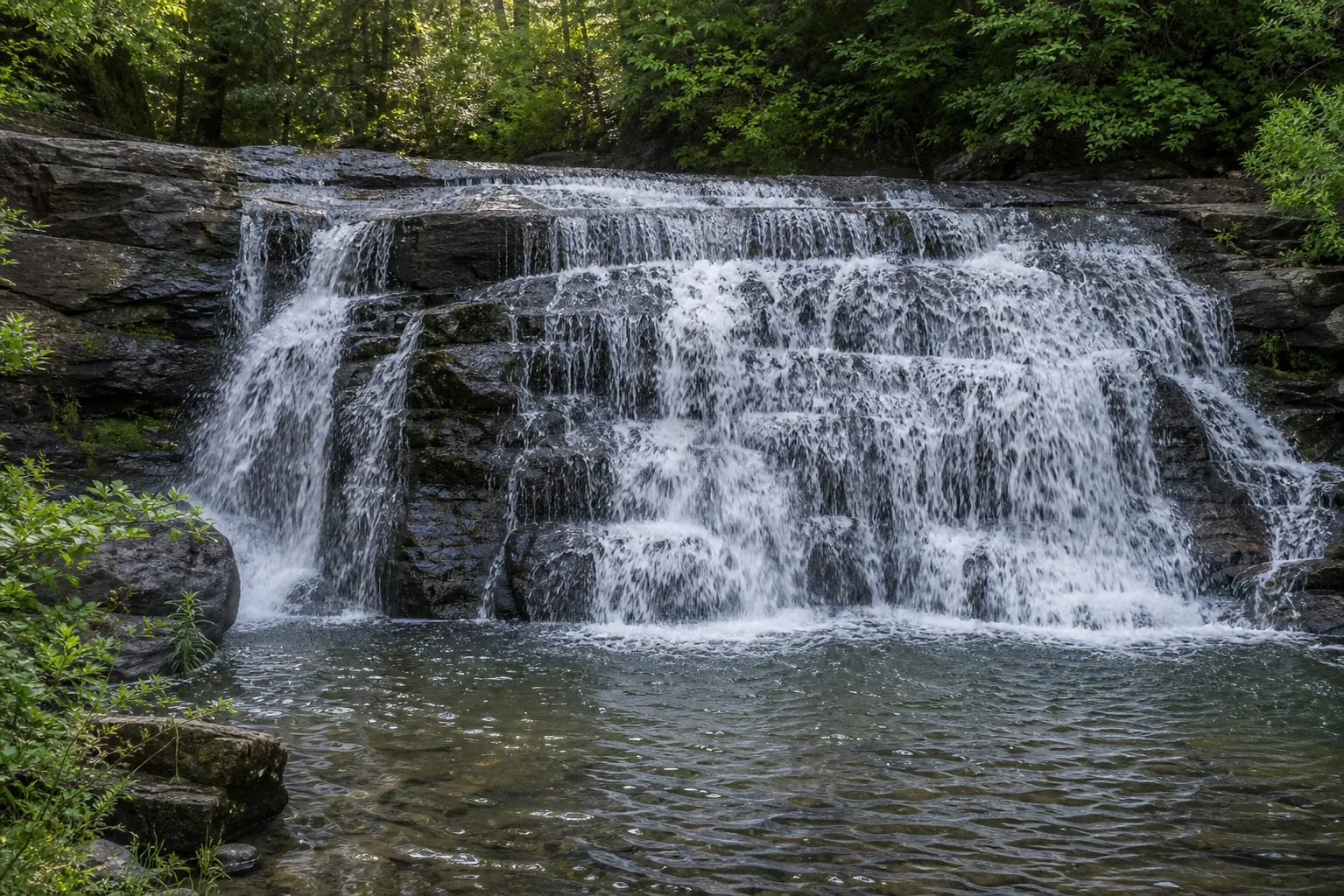
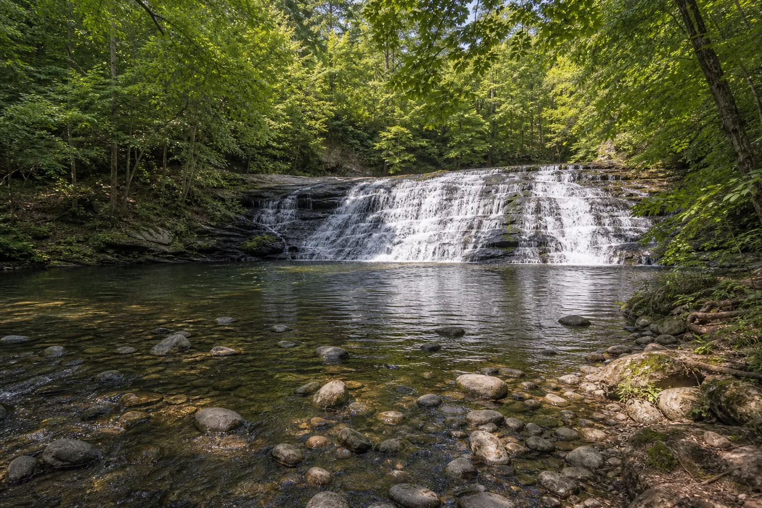
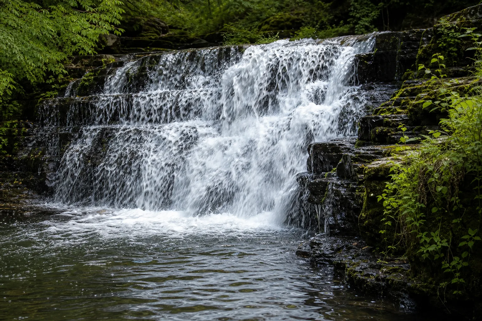
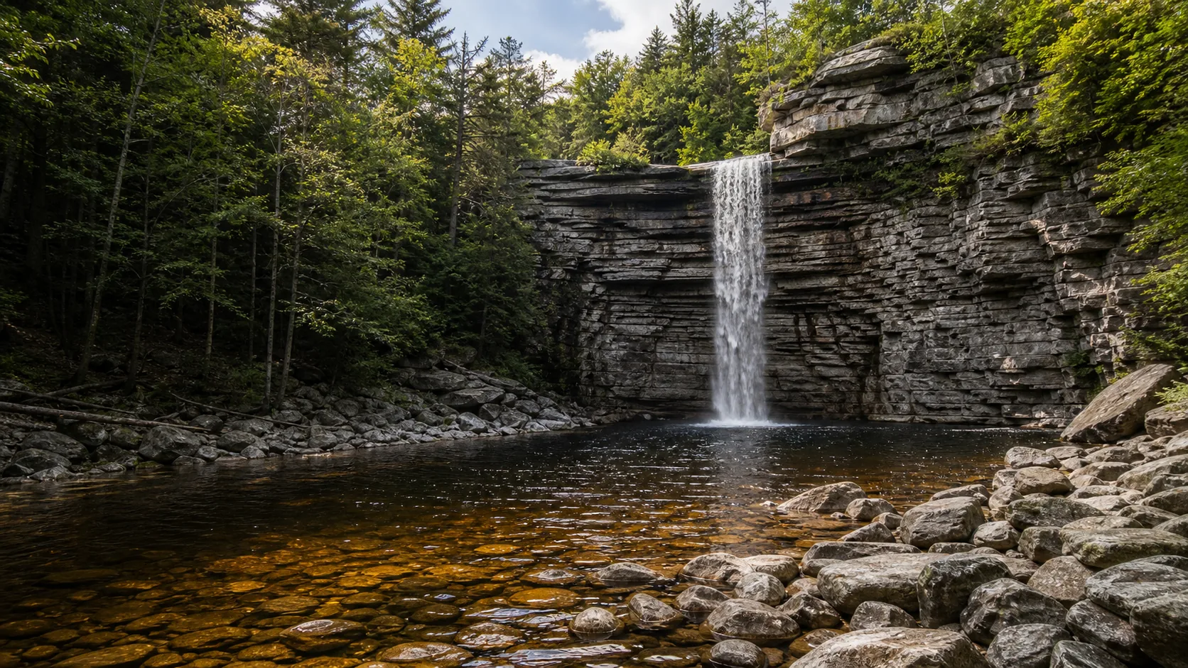
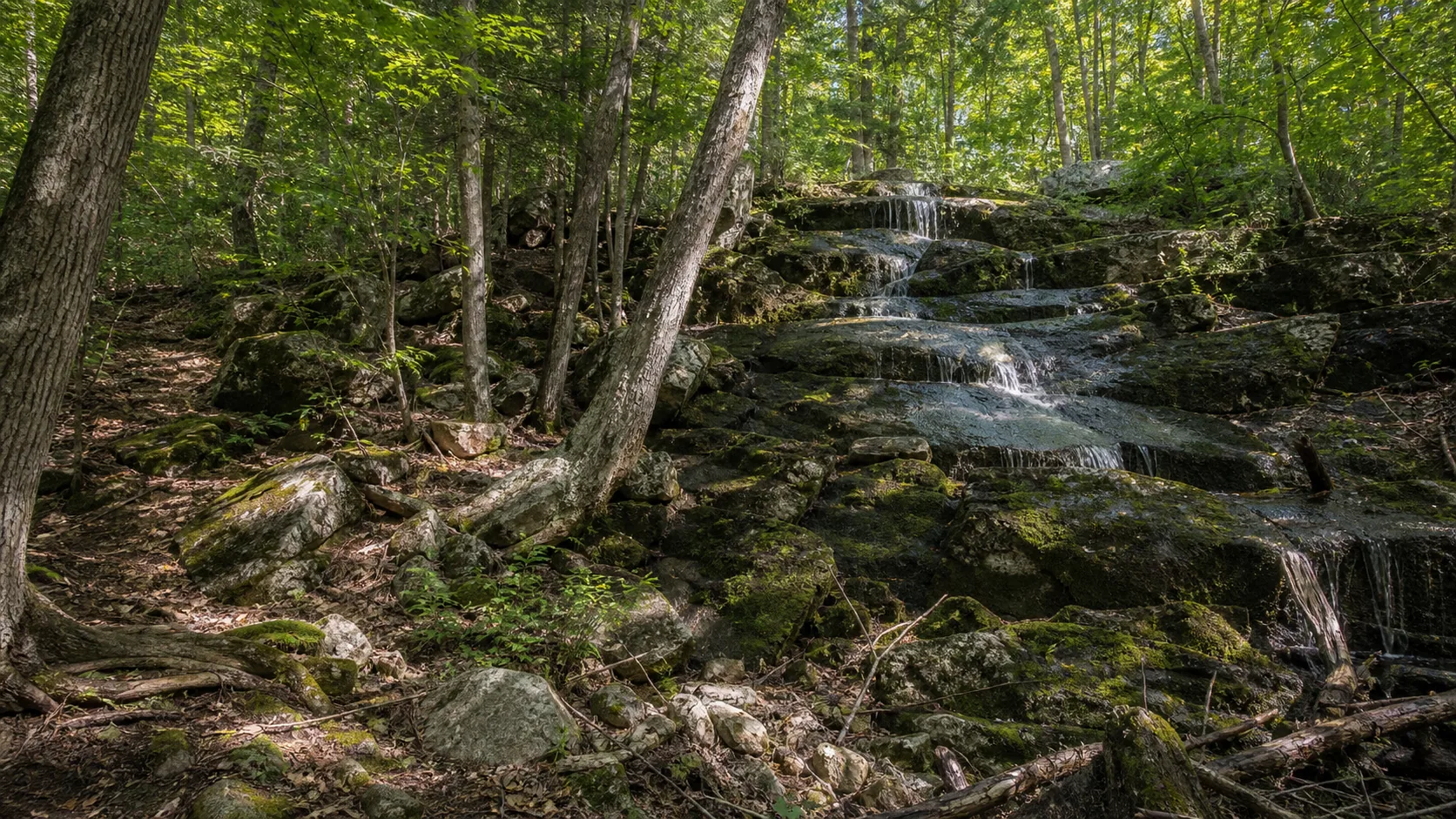
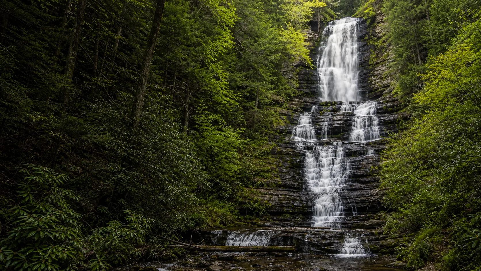
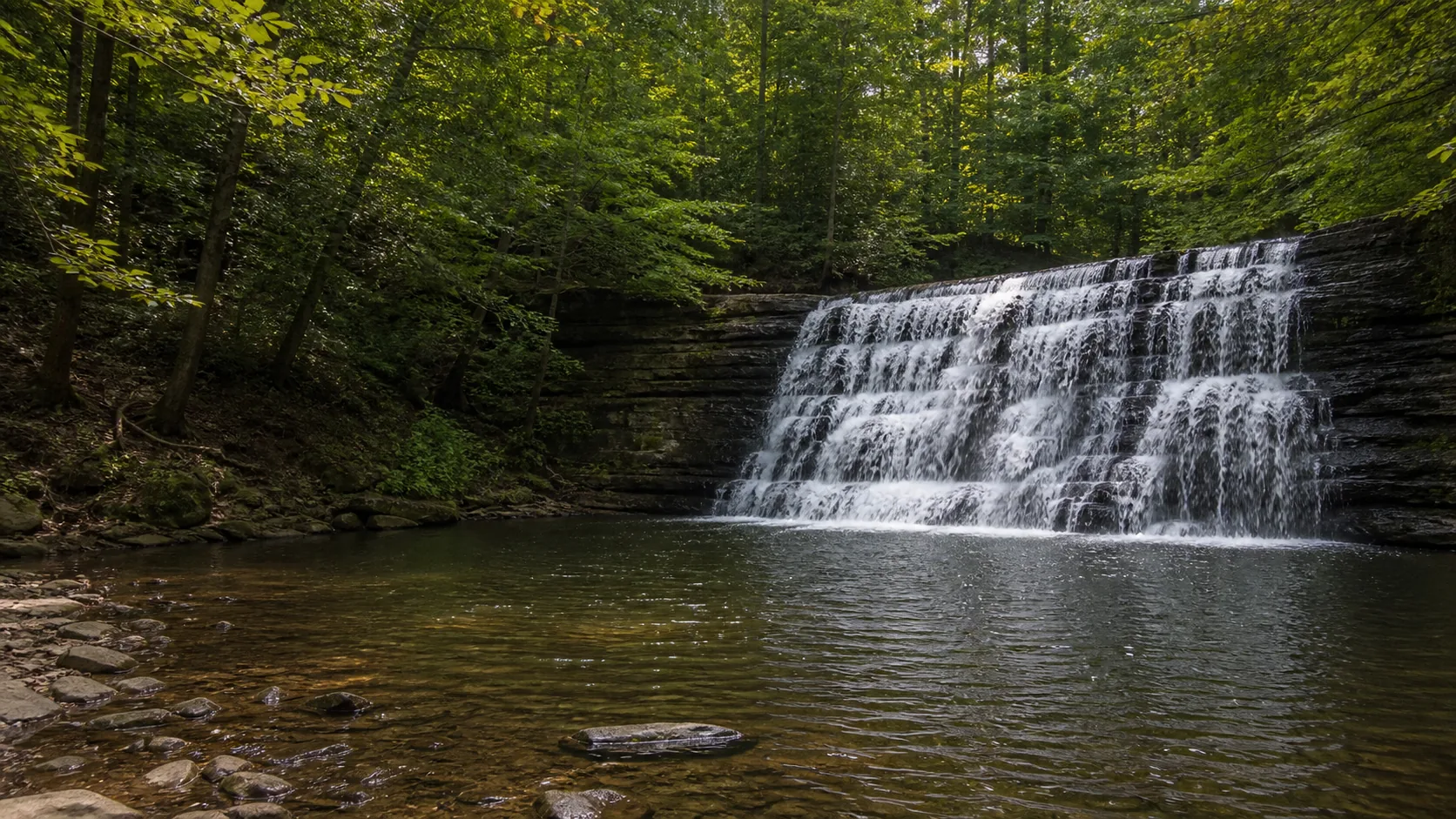
  • Two falls on the Coginchaug: 30-ft Main and 10-ft Little
  • Free weekdays; $10-$20 weekends Memorial Day-Labor Day
  • Peak flow: late March through mid-May runoff
  • Swimming prohibited at Main Falls (enforced)
  • Dogs welcome on a 7-ft leash on all trails
  • USGS gauge 01192883 reads upstream of Main Falls
Last verified May 12, 2026 Visited Desk-verified May 2026 8 sources checked
Distance 0.6 mi 2.4 mi extended
Round trip 15-120 min Short, mostly flat walks on woods roads and footpaths; one set of stairs to the lower viewpoint at Main Falls
Difficulty Easy Short, mostly flat walks on woods roads and footpaths; one set of stairs to the lower viewpoint at Main Falls
Location Middletown, CT Wadsworth Falls State Park
Parking Two CT DEEP lots, free weekdays. Weekend Passport-style fees: $10 CT-plate vehicles, $15 out-of-state (some sources cite up to $20 with surcharges). CT DEEP
Transit CT Transit Middletown local bus Washington Street stops in downtown Middletown; no direct service to the park · 13200 ft
Drive 3 mi 8 min from downtown
Best season Mar-May runoff; mid-Oct foliage; Jan-Feb ice Mar-May runoff
Wadsworth Falls State Park base and water force
Photo guide

Three working positions at Main Falls and a footbridge view at Little Falls.

Main Falls reads cleanest from the lower stairway overlook on the south rim; the upper rim gives the wide horseshoe; the downstream river-level frame works in winter when banks are frozen. Little Falls is best from the wooden footbridge directly above the cascade about a mile upstream.

Wadsworth Falls State Park waterfall and surrounding setting
Wadsworth Falls State Park, hero composition
Wadsworth Falls State Park wide setting view
Wide setting view
Wadsworth Falls State Park base and water force
Base and water force
Wadsworth Falls State Park water and rock detail
Water and rock detail
01Is Wadsworth Falls State Park flowing right now?

Live data: USGS gauge 01192883 (Coginchaug River at Middlefield), period of record 1996 to present. The 30-year daily-discharge median is 36 cfs, the 75th percentile is 75 cfs, the 90th percentile is 146 cfs, and the recorded maximum is 1,480 cfs after a 2011 tropical storm.

02How long is the walk?

Main Falls from the Cherry Hill Road lot is about 0.1 mile and 5 minutes one way on a paved path with one stairway to the lower viewpoint. The Little Falls Trail from the main 721 Wadsworth Street lot is 1.0 mile out-and-back, 30 to 45 minutes, mostly flat on an old woods road along the Coginchaug. The combined two-falls loop using the Orange, Purple, and Blue trails is about 2.4 miles, 60 to 90 minutes.

03How do you get there?

Main address: 721 Wadsworth Street, Middletown, CT 06457. From Route 9 take exit 13 (Randolph Road) and follow Wadsworth Street west about 1.5 miles. For Main Falls direct, continue past the main entrance to Cherry Hill Road in Rockfall (Middlefield) and use the Waterfall Parking lot. From Hartford it is 25 minutes south on I-91 and Route 9; from New Haven, 30 minutes north on the same route.

04Is there free parking?

Two CT DEEP lots: the main entrance at 721 Wadsworth Street (closer to Little Falls and the swim pond) and the Cherry Hill Road / Waterfall Parking lot (closer to Main Falls). Both are free Monday through Friday year-round. From Memorial Day through Labor Day on weekends and holidays, CT-plate vehicles pay $10 at the gate and out-of-state vehicles pay around $15 (some signage cites up to $20 with surcharges). Reserve America offers an advance day pass.

05Does it cost money?

Free for Connecticut residents (the Passport to Parks program covers CT-plate parking statewide). Free for everyone Monday through Friday. Out-of-state vehicles pay roughly $15 to $20 on summer weekends and holidays. No entry fee beyond parking.

06Trail variants

Main Falls quick stop 0.1 mi, 5-10 min, From the Cherry Hill Road lot; paved path and short stairway to the overlook.
Little Falls Trail (Blue) 1.0 mi out-and-back, 30-45 min, From the main 721 Wadsworth Street lot; woods road follows the Coginchaug River to the 10-foot cascade.
Main plus Little Falls loop 2.4 mi, 60-90 min, Combine Blue, Orange (Main), and Purple Bridge Trail to link both falls without a car shuffle.
Cedar Loop and White Birch extension 4.5 mi network, 2 hr, Add the Red and White-blazed loops north of the river for a longer hike.

Detailed maps and recent reviews: Falls route on AllTrails · Creek route on AllTrails

07Can you swim?

Prohibited at Main Falls and enforced. The plunge pool has a documented drowning history; CT DEEP signage is explicit and rangers issue citations. The legal alternative is the lifeguarded swim pond inside the park near the main entrance (seasonal, separate parking).

08Are dogs allowed?

Yes, on a 7-foot leash, year-round on all trails. Owners must clean up after their dogs. Dogs are not allowed at the swim pond or its surrounding grass area when the pond is open in season.

09Is it accessible?

The Cherry Hill Road overlook for Main Falls is reached by a short paved path with one stone stairway to the lower viewpoint; the upper overlook is roughly step-free. The Little Falls Trail is a firm-surface unpaved woods road, generally manageable with mobility devices for short distances. The 721 Wadsworth Street picnic area and restrooms are accessible.

Field notes

Wadsworth Falls at a glance.

30-foot Main Falls and 10-foot Little Falls on the Coginchaug River, Triassic Newark Supergroup sandstone, 267-acre Connecticut state park, managed by CT DEEP, free on weekdays, gates open 8 a.m. to sunset. Sourced from the CT DEEP park page and USGS NWIS gauge 01192883.

Height 30 ft USGS 3DEP
Type Block / horseshoe ledge (Main Falls) plus stepped cascade (Little Falls) USGS
Rock Newark Supergroup red sandstone and arkose (Triassic, Hartford Basin) Conservative geology note
County Middlesex Middletown, CT
Managed by Connecticut DEEP State Parks Division CT DEEP
Water source Coginchaug River USGS
Elevation 279 ft USGS NED
Park area 267 acres CT DEEP
Hours Open daily sunrise to sunset; gates 8 a.m. to sunset CT DEEP
When to visit

Three windows that justify the drive.

Late March through mid-May for spring runoff over Main Falls (gauge typically 75-200 cfs). Mid-October for the foliage frame in the Coginchaug gorge. Late January through February for partial ice and quiet trails. Summer weekends are crowded and trigger the out-of-state weekend fee.

PEAK FLOW

Peak flowMar-May runoff
Ice / low flowLate Jan-Feb
Most crowdedWeekends and midday
Best photosSunrise or weekdays

Live water context

Discharge data -- Live reading from Coginchaug River at Middlefield, CT (USGS 01192883) refreshes on the next build. Open the gauge link below for the current cubic-feet-per-second reading.

USGS 01192883 · Coginchaug River at Middlefield, CT

Why is it called Wadsworth Falls State Park?

The park is named for Colonel Clarence Seymour Wadsworth (1871-1941), a wealthy Middletown landowner, linguist, and conservationist who assembled the 267-acre estate around Long Hill and the Coginchaug ledges over the early 20th century. On his death, the land passed to the Rockfall Foundation he had founded, and in 1942 Rockfall transferred it to the State of Connecticut to be opened as a public park. The falls themselves were historically called Big Falls and Little Falls; the Wadsworth name attached to the park and then to the larger drop after the 1942 dedication.

What else to do at Wadsworth Falls State Park

Wadsworth Falls State Park is a 267-acre CT DEEP property straddling Middletown and Middlefield, about three miles southwest of downtown Middletown and Wesleyan University. The Coginchaug River cuts diagonally through the park; the trail network is built around it, with the Orange Main Trail and Purple Bridge Trail connecting the main 721 Wadsworth Street picnic area to Main Falls, and the Blue Little Falls Trail running upstream to the smaller cascade. A separate Cherry Hill Road lot in Rockfall puts you within a hundred feet of Main Falls if you only have time for one stop.

  • Main Falls (Big Falls). 30-foot horseshoe block on the Coginchaug River. Reached in about two minutes from the Cherry Hill Road / Waterfall Parking lot, or about ten minutes via the Orange Trail from the main 721 Wadsworth Street lot.
  • Little Falls. 10-foot stepped cascade about a mile upstream of Main Falls, reached by the Blue Little Falls Trail along an old woods road. Quieter and dog-friendly.
  • Swim pond. Lifeguarded pond in season, the only legal swimming location inside the park. Separate parking off Wadsworth Street near the picnic area.
  • CT DEEP trail network. About 4.5 miles of marked trails: Orange (Main), Blue (Little Falls), Purple (Bridge), Red (Cedar Loop), White (White Birch). All open to hiking and mountain biking; cross-country skiing in winter.

Why it looks this way

Wadsworth Falls sits on the eastern edge of the Hartford Basin, a Triassic-Jurassic rift valley filled with red sandstone, arkose, and shale of the Newark Supergroup. The Coginchaug River cut down through the New Haven Arkose and crossed a more resistant sandstone bed; differential erosion left that harder layer standing as the lip of Main Falls, with the softer beds wearing back to form the broad horseshoe plunge pool. The red color is iron oxidation in the original sediments, deposited when the rift basin was a hot, oxygen-rich semi-arid floodplain about 220 million years ago. Little Falls upstream drops over the same sequence at a smaller, stepped offset.
Field guide deep dive

What the CT Parks listing leaves out.

Two falls, Triassic red sandstone, a swim ban with teeth, and the practical difference between the two parking lots. Skim the headers, read what you need.

How Wadsworth Falls formed

Wadsworth Falls sits inside the Hartford Basin, the southern end of a long rift valley that opened when North America began pulling away from Africa about 220 million years ago. The basin filled with thousands of feet of red sandstone, arkose, and shale belonging to the Newark Supergroup. The Coginchaug River flows roughly south across these tilted beds and crosses a more resistant sandstone layer at the site of Main Falls. The river cuts the softer beds upstream and downstream faster than that resistant layer, which leaves the harder rock standing as the lip of the falls.

The horseshoe shape is the visible signature of that differential erosion: the central, harder bed has held its position while the softer rock around it has worn back into a broad plunge pool. Little Falls upstream drops over the same sandstone sequence but at a smaller, stepped offset, where the river has not yet cut deeply enough to expose a single thicker bed. Both falls are still actively retreating upstream; the position of the lip has shifted measurably over the past century, especially after large floods like Tropical Storm Irene in 2011, which sent a recorded peak of 1,480 cfs over the ledge.

Main Falls vs Little Falls (and how to reach both)

The two falls are about a mile apart on the Coginchaug River. Main Falls (sometimes signed as Big Falls) is the 30-foot horseshoe block that gets the photographs. The fast way in is the Cherry Hill Road lot in Rockfall, labeled Waterfall Parking on Google Maps; the upper overlook is roughly a hundred feet from the lot, and a short stairway drops to a lower viewpoint. Allow 10 to 20 minutes if Main Falls is your only goal.

Little Falls is the 10-foot stepped cascade about a mile upstream, reached by the Blue-blazed Little Falls Trail from the main 721 Wadsworth Street lot. It is a flat 0.5-mile walk along an old woods road to the footbridge above the cascade, then turn around. To combine both without a car shuffle, take the Orange Main Trail and Purple Bridge Trail south from the Wadsworth Street lot to Main Falls, return on the Blue Little Falls Trail through the swim pond area, about 2.4 miles and 60 to 90 minutes. The Orange and Purple corridors cross the Coginchaug on a wooden bridge that doubles as a useful upstream view of the river itself.

The swim ban at Main Falls

Swimming is prohibited at Main Falls and the prohibition is actively enforced. The plunge pool at the base looks calm in low water but has a hydraulic recirculating current at the base of the 30-foot drop and submerged ledges that cannot be seen from the surface. Multiple drowning deaths have been recorded over the decades, and CT DEEP posts conspicuous signage at both the upper and lower overlooks. Rangers issue citations, and on summer weekends with the gate attended, enforcement is consistent.

The legal alternative is the swim pond inside the park, off the main 721 Wadsworth Street entrance near the picnic area. It is lifeguarded in season (Memorial Day through Labor Day), free for CT residents, and separated from the river system. It is the only place in the park where swimming is allowed. For real river or lake swimming, Black Pond State Park in Middlefield is 10 minutes south, and the Salmon River near East Hampton is 25 minutes east.

Why the rock is red

The cliff walls behind both falls are the rust-red of iron-oxidized arkose and sandstone. The color is original, baked into the sediment when the Hartford Basin was a hot, oxygen-rich semi-arid floodplain in the Late Triassic. Streams draining the basin's uplifted edges deposited gravels and sands that contained iron-bearing minerals; in the warm, oxygen-rich climate those minerals oxidized to hematite, the same compound that colors Mars and a rusted nail. The red beds of the Hartford Basin run from the southern edge of Massachusetts down through Connecticut to Long Island Sound and are one of the defining rocks of the Connecticut Valley.

The Newark Supergroup is also famous for its dinosaur footprints, preserved most spectacularly at Dinosaur State Park in Rocky Hill, 20 minutes north of Wadsworth. The Coginchaug ledges at Main Falls do not preserve trackways themselves, but the rock you are looking at is the same age and depositional environment as the famous Eubrontes tracks at Dinosaur State Park. The reddish color in the gorge is the most photogenic when wet, which is why an overcast day after rain often produces the best Main Falls photographs.

The Cromwell Hills and Cedar Loop extensions

The CT DEEP trail network at Wadsworth covers about 4.5 marked miles, and the route most casual visitors miss is the Red-blazed Cedar Loop and the White Birch Trail on the north side of the Coginchaug. Both leave from the main 721 Wadsworth Street lot and add a 1.5- to 2-mile loop through second-growth oak and hemlock on the north ridge, with a few quiet overlooks back toward the river. The grades are easy, the surface is dirt singletrack, and the route is open to mountain biking.

For a longer day, the network connects informally to a local greenway running north toward the Cromwell Hills, although the connector trails are unmarked and not maintained by DEEP. Most hikers extend the day by driving 15 minutes to Powder Ridge for views over the basin, or 25 minutes south to Bluff Head on the Mattabesett Trail for one of the best ridgeline panoramas in central Connecticut. For more waterfall ideas in the broader region, see Spirit Falls in Massachusetts and Awosting Falls in New York's Shawangunks.

Family-friendly and accessible reality

Wadsworth is one of the easier waterfall stops in Connecticut for families and visitors with limited mobility, with two important caveats. The Cherry Hill Road approach to Main Falls is a short paved path from the lot to the upper overlook, roughly step-free, and works for strollers and most mobility devices to that point. The lower viewpoint adds one stone stairway and is not step-free. The Little Falls Trail is a flat, firm-surface woods road, generally manageable with off-road strollers and many mobility devices for short distances, though there are no benches and surface conditions vary by season.

The picnic area and restrooms at the 721 Wadsworth Street entrance are accessible. The swim pond has paved approaches but a grass and sand entry. For a stroller-friendly waterfall day, combine the Cherry Hill overlook for Main Falls with a short out-and-back on the Little Falls Trail rather than the full 2.4-mile loop; total time is about 60 minutes and total walking is under a mile. Dogs are welcome on a 7-foot leash on all trails year-round.

Map and route

Two lots, two falls, three miles from downtown Middletown.

Main address: 721 Wadsworth Street, Middletown, CT 06457. From Route 9 take exit 13 (Randolph Road) and follow Wadsworth Street west about 1.5 miles. For Main Falls direct, continue past the main entrance to Cherry Hill Road in Rockfall (Middlefield) and use the Waterfall Parking lot. From Hartford it is 25 minutes south on I-91 and Route 9; from New Haven, 30 minutes north on the same route.

Photography and weddings

North-facing curtain, three working positions, $100 minimum permit for staged sessions.

Main Falls works from three positions: the upper overlook on the south rim (eye-level with the lip), the lower stairway viewpoint (head-on across the plunge pool), and a winter-only river-level frame downstream when the bank is frozen and safe. Little Falls is best from the wooden footbridge directly above the cascade.

Main Falls faces roughly north-northwest, so direct sun rakes the ledge in the late afternoon and gives a backlit spray rim from May through August. Overcast light is the cleanest because the red sandstone behind the curtain is darker than it photographs in direct sun. Mid-October leaves frame the gorge in yellow and red maple.

Personal photography from public viewpoints does not require a permit. Drone use, commercial shoots, weddings, and any session involving tripods at busy overlooks need a CT DEEP State Parks Special Use Permit ($100 minimum for small-group photography).

Permits

Weddings and engagements

The upper overlook at Main Falls and the picnic area near the swim pond are both used for small ceremonies and engagement portraits. CT DEEP requires a Special Use Permit and prefers shoulder-season dates to keep public access open.

CT DEEP State Parks charges a Special Use Permit fee starting at $100 for small ceremonies and portrait sessions. Larger events, amplified sound, or staging require a higher tier and proof of insurance.

Avoid summer weekends when the parking lot fills and out-of-state fees apply. Have a weather backup; the lower overlook is closed informally when stairs are icy.

Related questions

More questions visitors ask before driving to Wadsworth Falls.

Fees, hours, dogs, swimming, the two falls, and the worth-visiting question, indexed in the FAQ schema for AI answer engines.

01How do you get to Wadsworth Falls State Park?

Use the map for orientation, then verify the current Wadsworth Falls State Park trailhead, parking area, and legal public access before driving.

02What is the best time to visit Wadsworth Falls State Park?

The best time to visit Wadsworth Falls State Park is usually spring, after rain, and fall foliage season, with overcast light often best for photos.

03Are the photos on this page really Wadsworth Falls State Park?

Yes. The photo set is selected to match Wadsworth Falls State Park, and the photo audit keeps unrelated park-context images out of the waterfall slots.

04Is Wadsworth Falls State Park good for families?

Wadsworth Falls State Park can be a good family stop when the official route is open and conditions are dry, but check distance, barriers, footing, and water safety first.

Sources and data

Where the Wadsworth Falls guide gets its facts.

Live discharge from USGS NWIS gauge 01192883 on the Coginchaug at Middlefield. Park rules and fees from CT DEEP and Reserve America. Geology from the CT Geological and Natural History Survey on the Hartford Basin. History from the Rockfall Foundation and Connecticut state park records.

USGS Streamflow: 01192883 Coginchaug River at Middlefield, CT waterdata.usgs.gov
CT DEEP: Wadsworth Falls State Park portal.ct.gov
Access, parking, and permit rules: portal.ct.gov
Conservative geology note: Middletown bedrock ctparks.com
NOAA/NWS forecast grid OKX/72,86 noaa.gov
USGS National Elevation Dataset 3DEP
Google Maps: embedded map and directions maps.google.com
Google Places: nearby restaurants and hotels places API
Wikimedia Commons - Wadsworth Falls State Park images commons.wikimedia.org
NOAA/NWS forecast grid weather.gov
SERP reference - ctparks.com ctparks.com
SERP reference - tripadvisor.com tripadvisor.com
SERP reference - massdaytripping.com massdaytripping.com
Fact checks
Keyword pass: page targets Wadsworth Falls State Park guide, Wadsworth Falls State Park trail, Wadsworth Falls State Park photos, Wadsworth Falls State Park map, parking, directions, and best time to visit.
Photo audit: waterfall slots use exact Wikimedia Commons files matched to Wadsworth Falls State Park; unrelated park context photos are excluded from waterfall slots.
Flow audit: no live flow chip is shown unless a gauge is manually paired and verified.
Access audit: fee, swimming, dog, and accessibility copy is conservative unless the page has a specific source.
Corrections: [email protected]