Roaring Fork Falls 100-foot stairstep cascade over Blue Ridge gneiss in Pisgah National Forest
Yancey County, NC

Roaring Fork Falls

Roaring Fork Falls is a 100-foot stairstep cascade on Roaring Fork Creek in the Pisgah National Forest, reached by a 0.6-mile out-and-back along an old logging road off Forest Service Road 472 in Yancey County. The trail is gentle, the falls are free, and the road in connects directly to the Blue Ridge Parkway near Burnsville, which makes this one of the easiest big-cascade stops in the Black Mountains.

Last verified May 12, 2026 Visited Desk-verified May 2026 8 sources checked
Trail 0.6 mi 1.3 mi extended
Time 25-60 min Easy
Best season March-May for snowmelt and rainfall; mid to late October for fall color March through May
Parking Free roadside gravel pullout on FS 472; no fee, no pass required, no gate Pisgah National Forest
Quick answer

Is Roaring Fork Falls worth visiting?

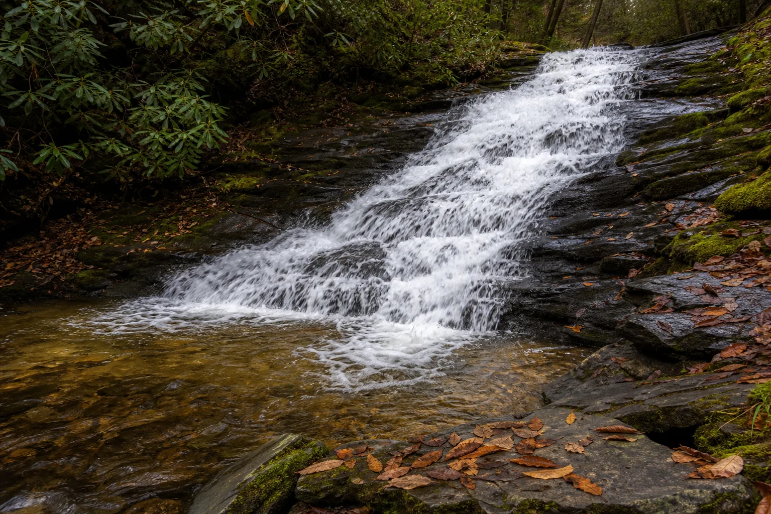
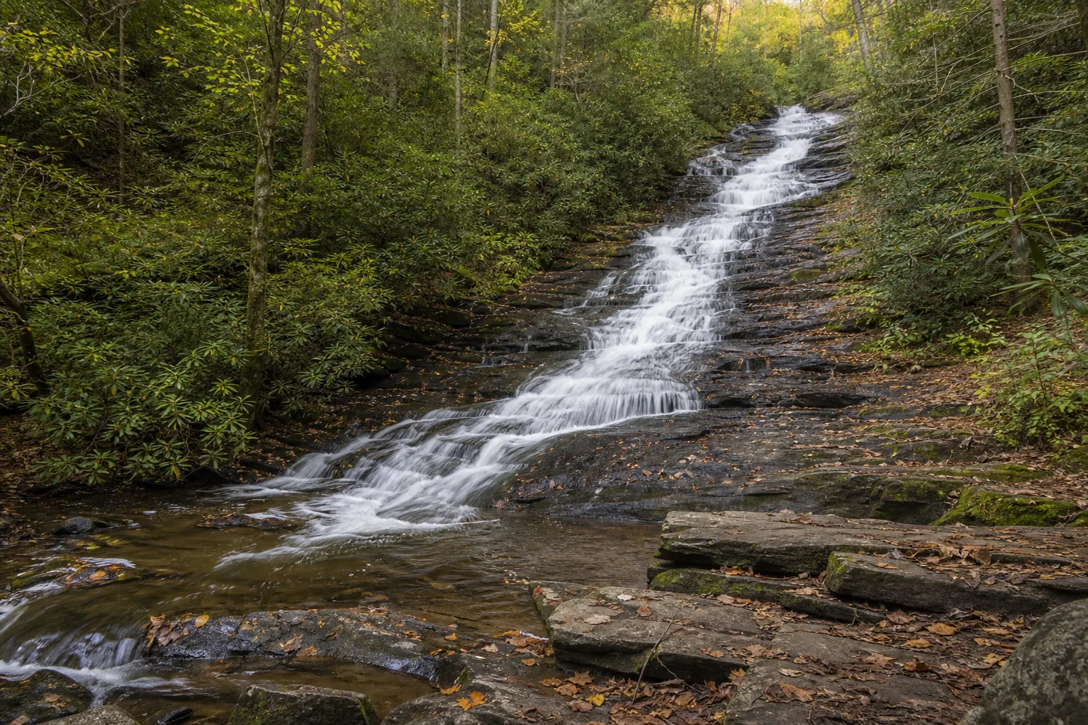
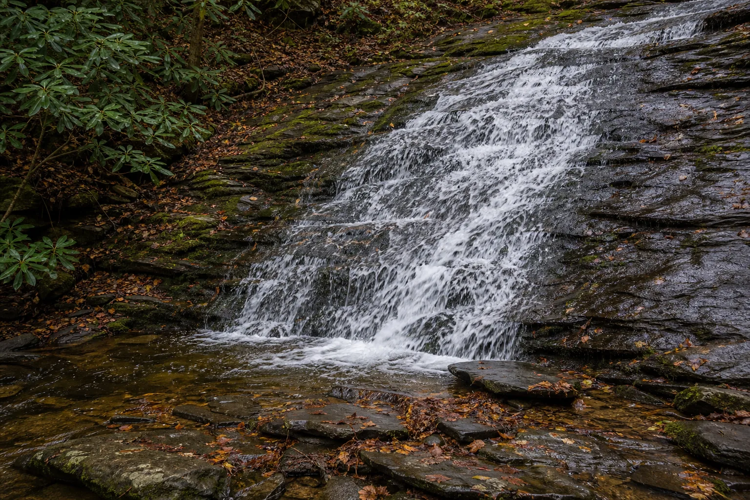
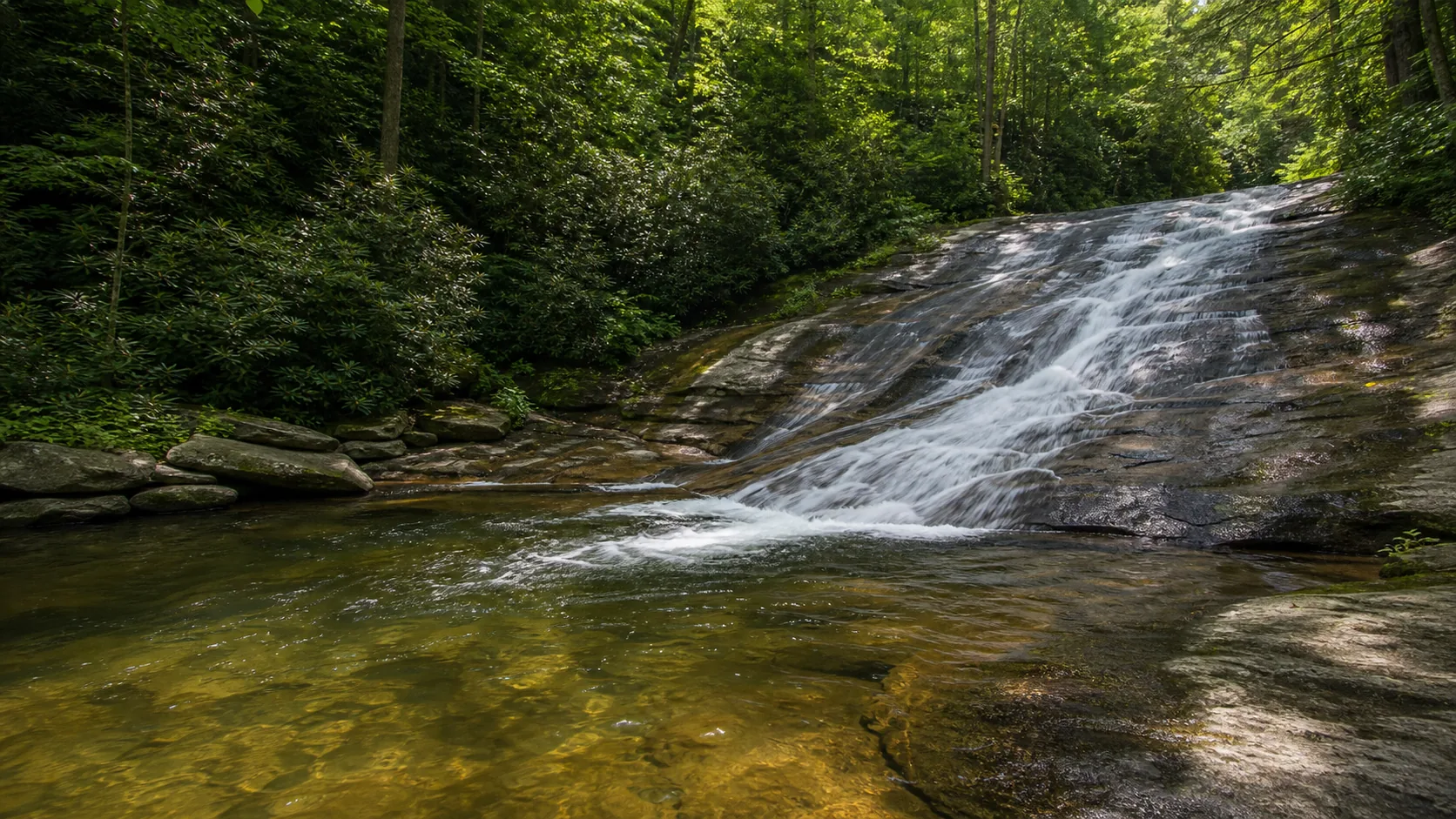
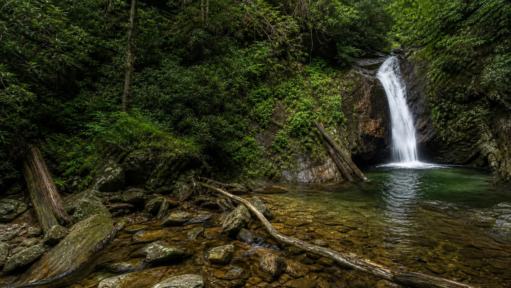
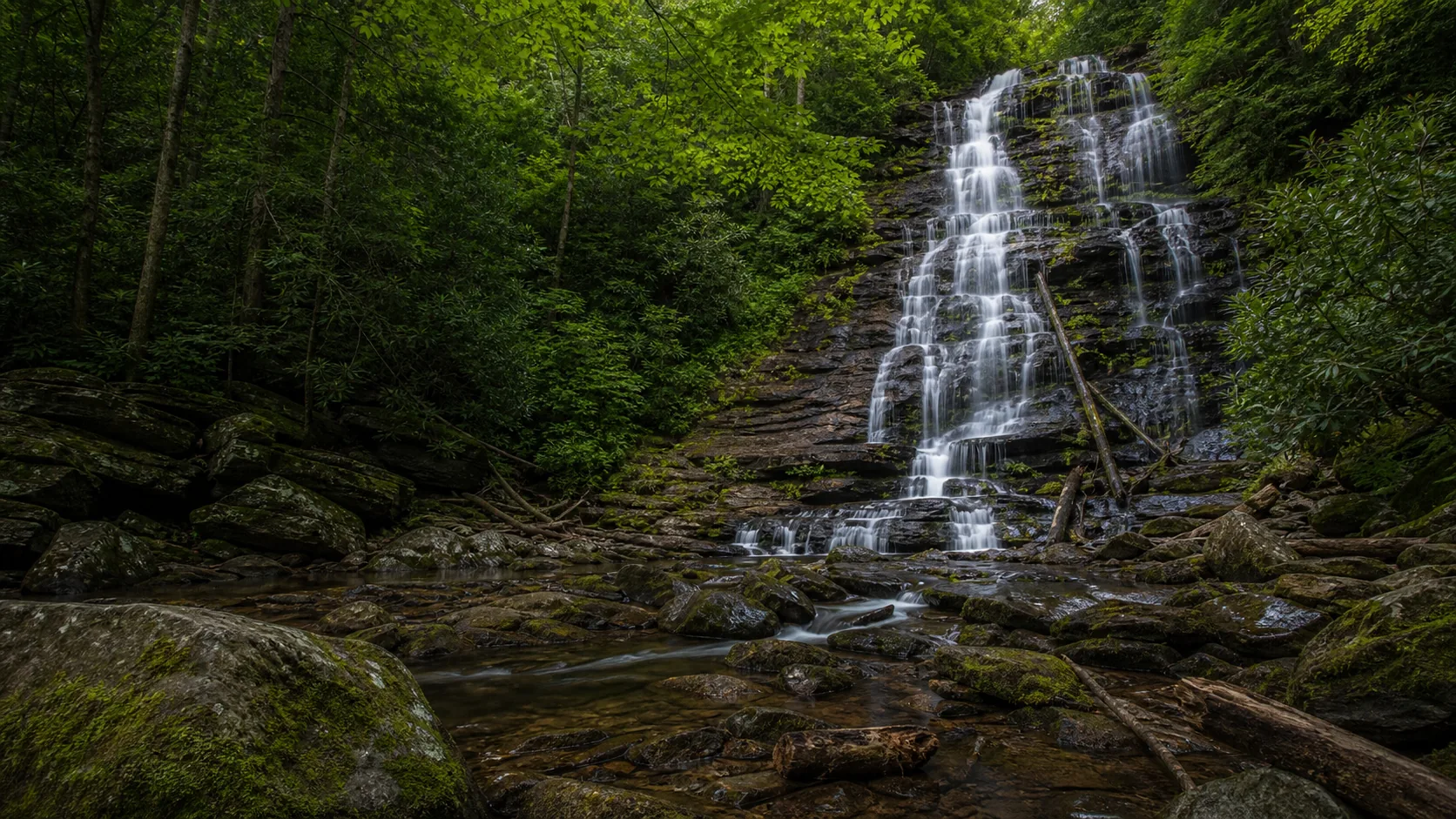
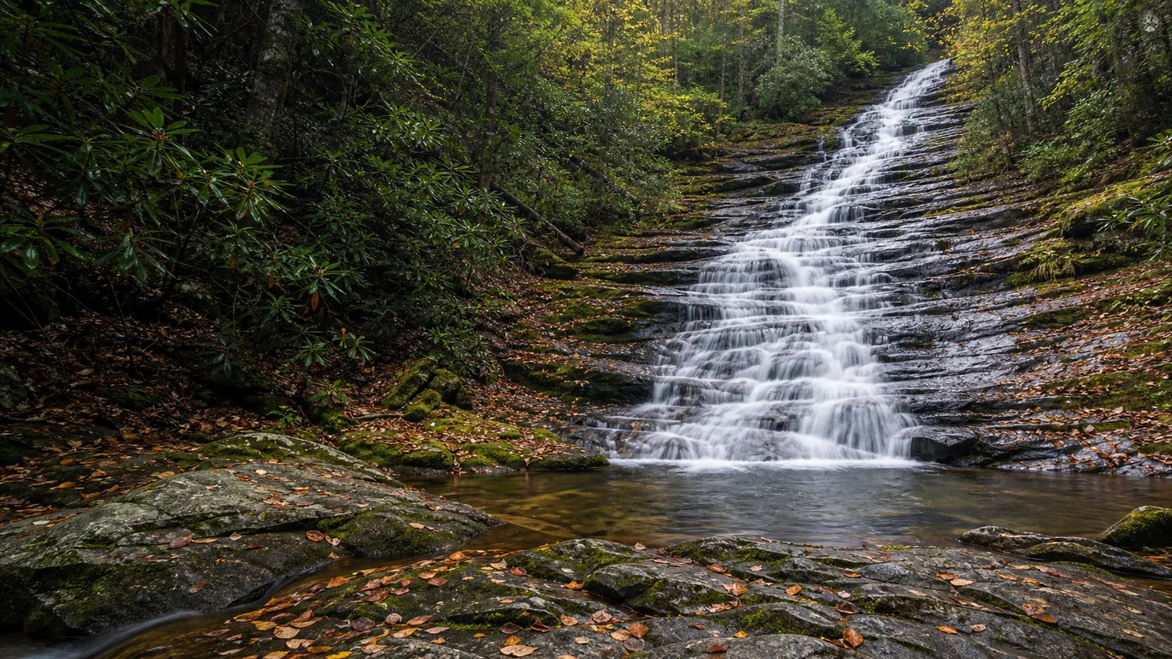
Yes. The two best windows are March through May, when Black Mountain snowmelt and spring rain push the cascade across its full width, and the second half of October, when the gorge fills with yellow and orange around the white water. The hike is a 0.6-mile out-and-back on a packed gravel old road bed with a mild incline, parking is free at a roadside pullout on FS Road 472, and there is no entry fee or pass. The gravel road in is the limiting factor in winter and after heavy rain.

  • 0.6 mi out-and-back on an old logging road
  • Free parking on FS Road 472 (gravel)
  • Peak flow March through May
  • Fall color second half of October
  • 100-ft stairstep cascade over Blue Ridge gneiss
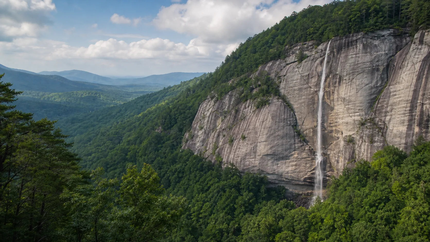
  • Pairs with Blue Ridge Parkway milepost 344
Last verified May 12, 2026 Visited Desk-verified May 2026 8 sources checked
Distance 0.6 mi 1.3 mi extended
Round trip 25-60 min Mild incline on an old logging road bed, with a brief rocky scramble near the base
Difficulty Easy Mild incline on an old logging road bed, with a brief rocky scramble near the base
Location Yancey County, NC Pisgah National Forest
Parking Free roadside gravel pullout on FS 472; no fee, no pass required, no gate USFS
Transit No fixed-route transit verified Drive in from NC-80 via Forest Service Road 472 · 0 ft
Drive 14 mi 25 min from downtown
Best season March-May for snowmelt and rainfall; mid to late October for fall color March through May
Roaring Fork Falls base of the cascade where the water regroups across the boulder pile
Photo guide

Three angles on a stairstep cascade.

Three working positions: a straight-on frame at the base for all 100 feet of stairstep, a low frame from the creek edge for the bottom ledges and boulder pile, and a wider cove frame from 20 yards back on the trail for fall color. The cove is small enough that side angles do not add much; the work is in light and flow, not in finding new viewpoints.

Roaring Fork Falls 100-foot stairstep cascade over Blue Ridge gneiss in Pisgah National Forest
Roaring Fork Falls, hero composition
Roaring Fork Falls wide cove view showing the full stairstep cascade framed by hemlock and rhododendron
Wide cove view of the 100-foot stairstep cascade in its hemlock and rhododendron walls
Roaring Fork Falls base where the cascade meets the boulder pile and creek bed
Base of the cascade where the water regroups across the boulder pile
Roaring Fork Falls detail of the water threading the foliated gneiss ledges of the cascade
Detail of the white water threading the Blue Ridge gneiss ledges
01Is Roaring Fork Falls flowing right now?

This guide does not pair Roaring Fork Falls with a verified real-time USGS discharge gauge, so the flow chip is intentionally hidden. Use recent rainfall and the seasonal note instead.

There is no paired USGS discharge gauge at Roaring Fork Creek. As a proxy, check the nearest Toe River gauges and the National Weather Service GSP forecast grid; the cascade carries enough water to read as a full ribbon any time recent rainfall has been moderate or higher. Late summer drought reduces it to a streak across the upper ledges.

02How long is the walk?

0.6 miles one way on an old logging road from the FS 472 pullout to the base, with a brief rocky section at the end. Round trip is 1.2 miles, 30 to 45 minutes at a walking pace, with about 120 feet of elevation gain on a steady mild incline.

03How do you get there?

From Burnsville, take NC-80 South about 12 miles. Just past the Carolina Hemlocks Recreation Area, turn left onto Forest Service Road 472 (gravel). The signed pullout for Roaring Fork Falls is about 0.7 miles up FS 472, just past the bridge over the creek. The trailhead is on the right; parking is on the left.

04Is there free parking?

Free gravel roadside pullout on FS 472, with room for roughly 8 to 10 cars. No fee, no pass, no gate. The lot fills early on October weekends; arrive before 10 a.m. or use a weekday.

05Does it cost money?

Free. Pisgah National Forest does not charge a fee at this trailhead, and no America the Beautiful pass is required. There is no Forest Service vehicle entry station on FS 472.

06Trail variants

Out-and-back to the base 0.6 mi one way (1.2 mi round trip), 30-45 min, follows old logging road on a gentle grade.
Photo-first visit 1.2 mi round trip, 45-60 min, step off the main path onto the rock approach for the full 100-foot cascade frame.
Blue Ridge Parkway pairing drive plus walk, half day, combine with the Crabtree Falls overlook at Parkway milepost 339.5.
Black Mountain Campground extension varies, 1-2 hr, continue up FS 472 to Black Mountain Campground and the Mount Mitchell trailheads.

Detailed maps and recent reviews: Falls route on AllTrails · Creek route on AllTrails

07Can you swim?

No. The plunge pool is shallow, the rock is angular, and there is no recovery zone above the cascade lip. Wet gneiss is slick. Wading at the base is informally tolerated but discouraged in cold months.

08Are dogs allowed?

Yes, on a leash. Pisgah National Forest allows dogs on trails; keep the leash at 6 feet or shorter and keep dogs off the cascade rock and out of the plunge pool. Pack out waste.

09Is it accessible?

Not wheelchair accessible. The trail is a packed gravel and dirt old road bed with a mild incline and a brief rocky scramble at the base. Strollers work for most of the route but not the final approach to the falls.

Field notes

Roaring Fork Falls at a glance.

100-foot stairstep cascade over Blue Ridge gneiss, 0.6-mile out-and-back from FS Road 472, free entry, no pass required, managed by the USDA Forest Service Toecane Ranger District in Pisgah National Forest. Sources: USFS Toecane district page and romanticasheville.com.

Height 100 ft USGS 3DEP
Type Stairstep cascade (multi-tier) USGS
County Yancey Yancey County, NC
Managed by USDA Forest Service, Toecane Ranger District USFS
Water source Roaring Fork Creek USGS
Elevation 3038 ft USGS NED
Park area 512,000 acres USFS
Hours Open daily, sunrise to sunset recommended; no gate USFS
When to visit

Two clear windows, one shoulder season.

March through May for spring snowmelt and rainfall, when the cascade fills its full width. The second half of October for fall color in the cove. June through September works on cooler weekday mornings but the falls thins by late August. Winter is the gamble: the road in is the limiting factor, not the trail.

PEAK FLOW

Peak flowMarch through May
Ice / low flowLate January to mid-February in cold winters
Most crowdedWeekends and midday
Best photosSunrise or weekdays

Live water context

Discharge data -- This guide does not pair Roaring Fork Falls with a verified real-time USGS discharge gauge, so the flow chip is intentionally hidden. Use recent rainfall and the seasonal note instead.

Why is it called Roaring Fork Falls?

Roaring Fork Falls takes its name plainly from Roaring Fork Creek, the small tributary that audibly fills the cove long before you reach the base. Roaring Fork is one of the most common stream names in the eastern United States; there is also a well-known Roaring Fork in the Great Smoky Mountains of Tennessee (along the Roaring Fork Motor Nature Trail near Gatlinburg) and a much larger Roaring Fork River in Colorado that joins the Colorado River at Glenwood Springs. When searching, pair the name with Yancey County or Burnsville, North Carolina to avoid those two.

Wikipedia and older Forest Service literature occasionally list this site as Roaring Creek Falls, which is the same waterfall under a slightly different stream-name form. The trail itself is signed as Roaring Fork Creek Falls Trail (Trail 195) on Forest Service maps.

What else to do at Pisgah National Forest

Roaring Fork Falls sits in the Toecane Ranger District of Pisgah National Forest, the same district that holds Mount Mitchell's east-side trailheads, Black Mountain Campground, and the lower Roaring Fork drainage. The Blue Ridge Parkway runs the ridge just to the south; the closest Parkway access is the Crabtree Falls overlook at milepost 339.5, and the road segment around milepost 344 puts you within a 20-minute drive of the trailhead. Burnsville (county seat of Yancey County, 14 miles northwest) and Spruce Pine (15 miles east in Mitchell County) are the practical bases for food, gas, and lodging. Marion and Asheville are farther but in range for a long day trip.

  • 0.6-mile old logging road approach. The trail follows the bed of a Depression-era timber road into the cove. Grade is gentle and the surface is packed gravel and dirt, which makes this one of the easier 100-foot cascades to reach in the region.
  • Stairstep cascade over Blue Ridge gneiss. The waterfall is not a single plunge; it is a sequence of ledges in metamorphic rock that give the falls its long, ribboned look and the audible white-noise hiss that names the creek.
  • Blue Ridge Parkway access. The Crabtree Falls overlook at Parkway milepost 339.5 sits a short drive south, and FS 472 continues uphill to Black Mountain Campground and the trail systems leading to Mount Mitchell, the highest peak east of the Mississippi.
  • Year-round, free, no gate. There is no entry fee, no day-use pass, and no closing time. The gravel pullout on FS 472 holds eight to ten cars; arrive before mid-morning on October weekends to claim a spot.

Why it looks this way

Roaring Fork Falls drops over Blue Ridge gneiss and schist, the metamorphic backbone of the Black Mountains and most of the Pisgah and Nantahala high country. The stairstep form is not a single plunge but a series of sub-horizontal ledges where slightly more resistant bands of gneiss have held while weaker layers in between eroded faster. The result is a long, ribboned cascade rather than a free fall: roughly 100 feet from lip to base across multiple steps, with the water fanning, regrouping, and dropping again at each ledge. Granite-style boulders at the base, mentioned in the Forest Service trail description, are blocks calved off the cascade face as the creek cut down through the joint system.
Field guide deep dive

What a 0.6-mile walk and 100 feet of stairstep cascade actually buys you.

Blue Ridge gneiss, old logging-road grade, Parkway pairing at milepost 339.5, and disambiguation from the better-known Roaring Forks in Tennessee and Colorado. Skim the headers, read what you need.

How Roaring Fork Falls formed

Roaring Fork Falls is a stairstep cascade on Blue Ridge gneiss and schist, the metamorphic backbone of the Black Mountains and the high country of western North Carolina. The stairstep form is not accidental. The bedrock here is foliated metamorphic rock with sub-horizontal layering, and slightly more resistant bands of gneiss have held while weaker layers in between eroded faster. The creek does not fall freely from a single lip; it drops, regroups on a ledge, slides across, and drops again. The cumulative vertical relief is roughly 100 feet from the upper lip to the boulder pile at the base, although the visible vertical drop is closer to half that. Different sources count it differently depending on whether they include the upper slides above the obvious cascade.

Granite-style boulders at the base, mentioned in the Forest Service trail description, are blocks that calved off the cascade face as the creek cut down through the joint system in the rock. The cove itself is the long-term signature of the cascade slowly retreating upstream as the creek removes rock from the lip faster than the surrounding ridge weathers away. That same mechanic shapes most of the cascades in this part of Pisgah, including the longer Crabtree Falls just over the ridge.

The 0.6-mile trail and why it is so easy

The trail to Roaring Fork Falls is short, gentle, and oddly flat for a Black Mountains drainage. The reason is that the route is not really a trail; it is the bed of a Depression-era logging road that switchbacked into the cove to extract timber. Old road grades top out around 8 percent because that was what a loaded wagon could climb, and that grade survives today as the mild incline you walk. From the gravel pullout on Forest Service Road 472, the path climbs gradually through a hemlock and rhododendron understory, crosses a couple of small drainages, and ends with a brief rocky section near the base where the road bed gives out at the boulders.

Round trip is 1.2 miles in 30 to 45 minutes at a walking pace, with about 120 feet of elevation gain spread across the ascent. AllTrails lists the route at 1.3 miles round trip, which counts the rocky approach at the base; the Forest Service trail card lists Trail 195 as a short trail following an old road bed. Strollers work on most of the route but not the final approach. The trail is shaded for almost its entire length, which makes it a reasonable summer option even on hot days.

Pairing with the Blue Ridge Parkway

Roaring Fork Falls is one of the easiest waterfall stops you can fold into a Blue Ridge Parkway day. From the cascade, drive back to NC-80 and head south; the Parkway crosses NC-80 at milepost 344, with the well-known Crabtree Falls overlook at milepost 339.5 a short drive to the south. Crabtree is a 70-foot horsetail in a much larger cove than Roaring Fork, with a longer (2.5 mile) loop trail. The two together make a strong half-day double feature, especially in mid-October.

Heading the other direction on FS 472 from the Roaring Fork trailhead leads to Black Mountain Campground and the Mount Mitchell trail system. The east-side approach to Mitchell, the highest peak east of the Mississippi at 6,684 feet, starts here; the full hike to the summit and back is a serious day, but the lower trail stretches are pleasant out-and-backs from the campground area. Treat Roaring Fork as the warm-up and Mitchell as the main event if you have the legs and the weather.

A western North Carolina waterfall day

Roaring Fork sits on the eastern edge of the dense waterfall country that defines western North Carolina. If you are building a full day or weekend, the natural pairings push southwest into Transylvania County: Sliding Rock on Looking Glass Creek is a 60-foot natural waterslide with a small fee in summer and a free off-season visit; Courthouse Falls drops into a green plunge pool in a tight gorge off NC-215. East of Asheville, Hickory Nut Falls inside Chimney Rock State Park drops 404 feet in a single ribbon and pairs with the Chimney Rock viewpoint.

The honest geometry: Roaring Fork is in the Black Mountains north of Asheville, the Transylvania waterfalls are an hour southwest of Asheville, and Chimney Rock is 30 minutes southeast. You can do Roaring Fork plus Crabtree Falls in a half day. To string together Roaring Fork with Sliding Rock or Courthouse Falls, plan a two-day weekend out of Asheville, Brevard, or a rental in the Mills River area.

The other Roaring Forks

Roaring Fork is one of the most common stream names in the eastern United States, which makes search results messy. Two famous ones to disambiguate: the Roaring Fork Motor Nature Trail in Great Smoky Mountains National Park near Gatlinburg, Tennessee, is a one-way scenic loop past historic cabins and small cascades on a different Roaring Fork stream, about 90 minutes west of the Yancey County falls; and the Roaring Fork River in Colorado, a 70-mile Class III-IV tributary of the Colorado River that joins the main stem at Glenwood Springs, is a completely separate drainage on the western slope of the Rockies.

This guide is about Roaring Fork Falls on Roaring Fork Creek in Yancey County, North Carolina, also occasionally listed in older Forest Service materials as Roaring Creek Falls. The Forest Service trail is officially Roaring Fork Creek Falls Trail (Trail 195). When searching for directions or trip reports, include North Carolina, Yancey County, or Burnsville to filter out the Tennessee and Colorado results.

Photography in practice

The cove is east-facing and shaded by ridge and canopy through most of the day, which is favorable for waterfall photography. Direct sun blows out the white water against the dark gneiss, so the best windows are soft overcast, light rain, and the first or last hour of daylight. Mid to late morning gives even light at the base. Late afternoon in October backlights the upper ledges through the canopy and is the strongest single window for color photography here.

Three practical settings: a polarizer to cut wet-rock glare; a tripod for shutter speeds in the 1/4 to 2-second range to keep the stairstep texture readable rather than turning the whole cascade to milk; and a wide enough lens (24 to 28 mm full-frame equivalent) to fit all 100 feet of cascade in a single frame from the base. The rocky approach at the end is the only viewpoint; there are no working side angles, and the cove is too tight for telephoto compression. Yield to other photographers at the base, because everyone is shooting from the same spot.

Map and route

Twenty minutes from the Blue Ridge Parkway, fourteen from Burnsville.

From Burnsville, take NC-80 South about 12 miles. Just past the Carolina Hemlocks Recreation Area, turn left onto Forest Service Road 472 (gravel). The signed pullout for Roaring Fork Falls is about 0.7 miles up FS 472, just past the bridge over the creek. The trailhead is on the right; parking is on the left.

Photography and weddings

East-facing cove, three working positions, no permit for casual photos.

Three working positions. The straight-on frame from the rocky approach at the base captures all 100 feet of the stairstep, top to bottom. A lower frame from the creek edge isolates the bottom two ledges and the boulder pile where the water regroups. The wider cove frame, taken from 20 yards back on the trail, sets the cascade inside its hemlock and rhododendron walls and is the best fall-color composition.

The cove faces roughly east and is shaded by ridge and canopy through most of the day, which is favorable for waterfall photography. Soft overcast is the best light because the rock is dark gneiss and direct sun blows out the white water. Mid to late morning gives even light at the base; late afternoon backlights the upper ledges through the canopy in October. Avoid midday in summer when patchy sun creates harsh contrast across the cascade.

Casual personal photography from the trail and the base does not require a permit. Drones for recreational use are not prohibited in this section of Pisgah but require FAA Part 107 for any non-recreational footage; commercial productions need a Forest Service special use permit. Tripods are fine but yield to other visitors at the base, which is the only viewpoint.

Permits

Weddings and engagements

Roaring Fork Falls works for elopement and engagement photos in shoulder season, particularly weekday mornings in March and April or mid-October weekdays for the color. The cove is small and there is no ceremony platform, only the rocky approach at the base.

Pisgah National Forest does not charge a base permit for very small, non-commercial ceremonies, but commercial photography, ceremonies that block the trail, amplified sound, or groups larger than 75 require a Forest Service special use permit through the Toecane District office.

Keep parties under 10 people, choose a weekday morning, leave no decorations behind, and have a poor-weather fallback. The gravel road in is the most common reason a planned shoot has to move.

Nearby waterfalls

Three more western NC waterfalls for the same day.

Roaring Fork pairs naturally with the bigger names on the Brevard side of Pisgah for a long western NC waterfall day. Sliding Rock for a swim or slide, Courthouse Falls for a quiet plunge into a green pool, and Hickory Nut Falls inside Chimney Rock State Park for the long single drop. All are free or low-cost; all are within a day's drive of Burnsville.

Related questions

More questions visitors ask before driving to Roaring Fork Falls.

Distance, height, fees, dogs, winter, and the worth-the-drive answer. Indexed for FAQ schema and AI answer engines.

01Where is Roaring Fork Falls?

Roaring Fork Falls is in the Pisgah National Forest (Toecane Ranger District) in Yancey County, North Carolina, about 14 miles southeast of Burnsville and roughly 20 minutes from the Blue Ridge Parkway near milepost 344. The trailhead is on Forest Service Road 472, a gravel road off NC-80, just past Carolina Hemlocks Recreation Area.

02How tall is Roaring Fork Falls?

Roaring Fork Falls is a stairstep cascade with about 100 feet of total relief from the upper lip to the boulder pile at the base. The visible vertical drop is closer to 50 feet because the water steps down across multiple ledges in Blue Ridge gneiss rather than dropping in a single plunge.

03Is Roaring Fork Falls free to visit?

Yes. Roaring Fork Falls is free. There is no entry fee, no day-use fee, and no America the Beautiful pass required at the trailhead. Parking on Forest Service Road 472 is free and there is no gate.

04What is the best time to visit Roaring Fork Falls?

March through May for the highest flow, when Black Mountain snowmelt and spring rain push the cascade across its full width. The second half of October for fall color in the cove. Summer mornings work but the falls thins by late August. Overcast or shaded light is best for photos in any season.

05Is Roaring Fork Falls open in winter?

The trail itself is open year-round and the falls do not normally freeze solid. The limiting factor is Forest Service Road 472, which is gravel and not plowed; after snow or ice, the drive in can be difficult or impassable. The rocky approach at the base is also slick in winter.

06Is Roaring Fork Falls worth visiting?

Yes. It is one of the easiest 100-foot cascades in the Black Mountains: free, no pass, a gentle 0.6-mile walk on an old logging road, and a short drive from the Blue Ridge Parkway near Burnsville. The best windows are March through May for the loudest flow and mid to late October for fall color. Pair it with the Crabtree Falls overlook at Parkway milepost 339.5 for a strong half day.

Sources and data

Where the Roaring Fork Falls guide gets its facts.

Trail data and jurisdiction from the USDA Forest Service Toecane Ranger District. Geology from the North Carolina Geological Survey Blue Ridge belt mapping. Cross-checks from romanticasheville.com, AllTrails, and Wikipedia (Yancey County entry). Photos AI-original grounded in the local reference set.

USFS: Pisgah National Forest fs.usda.gov
Access, parking, and permit rules: fs.usda.gov
North Carolina Geological Survey: Blue Ridge belt geologic map and bedrock descriptions: Yancey County bedrock deq.nc.gov
NOAA / NWS Greenville-Spartanburg forecast grid GSP 68,84 noaa.gov
USGS National Elevation Dataset 3DEP
Google Maps: embedded map and directions maps.google.com
Google Places: nearby restaurants and hotels places API
USDA Forest Service: Roaring Fork Creek Falls Trail (Trail 195), Toecane Ranger District fs.usda.gov
RomanticAsheville: Roaring Fork Creek Falls trail and cove description romanticasheville.com
AllTrails: Roaring Fork Falls Trail (1.3-mile out-and-back, recent reviews) alltrails.com
Wikipedia: Roaring Fork Falls (Yancey County) en.wikipedia.org
Blue Ridge Parkway: Crabtree Falls overlook (milepost 339.5) and visitor information nps.gov
Wikimedia Commons: Roaring Fork Falls image category commons.wikimedia.org
Fact checks
Height audit: 100-foot stairstep cascade is corroborated by romanticasheville.com and Tripadvisor; the 50-foot vertical-drop figure (used by AllTrails and easywaterfallhikes.com) measures only the obvious vertical face and is not contradictory.
Trail audit: 0.6-mile one-way / 1.2-mile round trip from the FS 472 pullout matches Forest Service Trail 195 and the YouTube and locationscout walkthroughs; AllTrails lists 1.3 miles when the rocky base approach is included.
Jurisdiction audit: Pisgah National Forest, Toecane Ranger District, confirmed against the USDA Forest Service trail card and the Wikipedia entry.
Geology audit: Blue Ridge gneiss and schist follows the North Carolina Geological Survey belt mapping for the Black Mountains; no site-specific bedrock survey exists for this drainage, so a single named formation is not claimed.
Disambiguation audit: distinct from the Roaring Fork Motor Nature Trail in Great Smoky Mountains NP (Tennessee) and the Roaring Fork River (Colorado); also occasionally listed as Roaring Creek Falls in older USFS materials.
Photo audit: waterfall slots use AI-original visuals grounded in the local Roaring Fork Falls reference set; no Commons files from unrelated Roaring Fork sites are used in waterfall slots.
Corrections: [email protected]