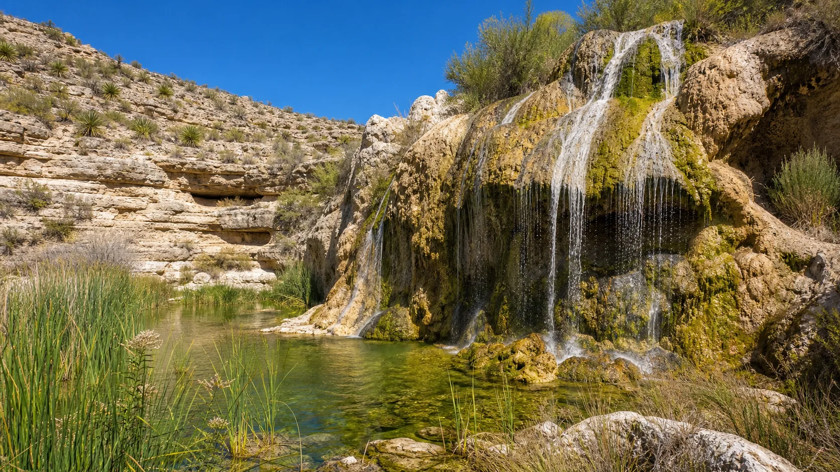
Shasta County, California
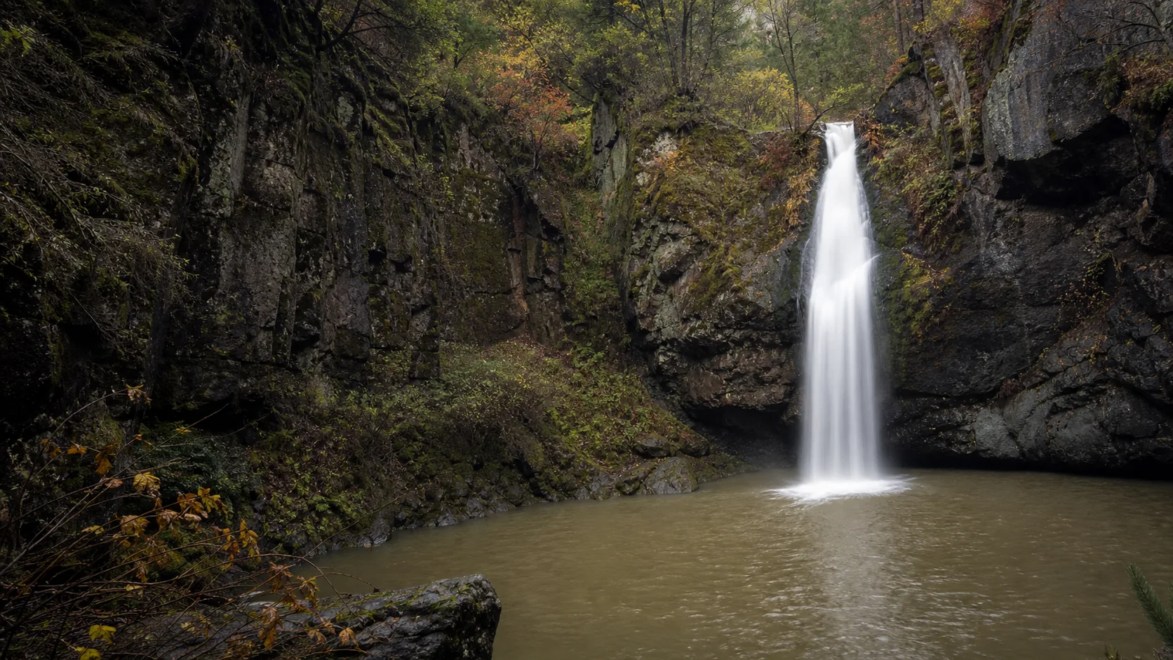
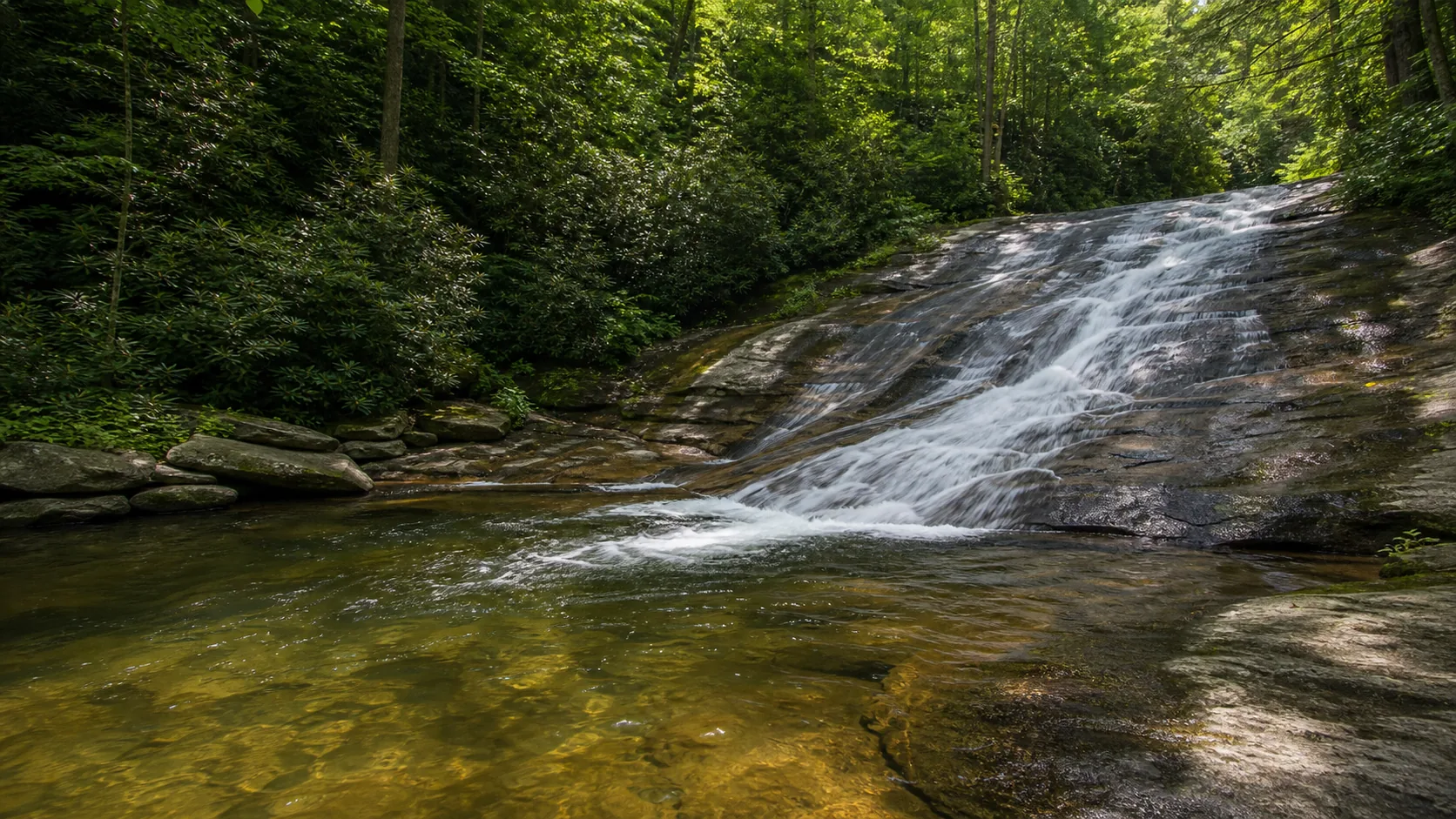
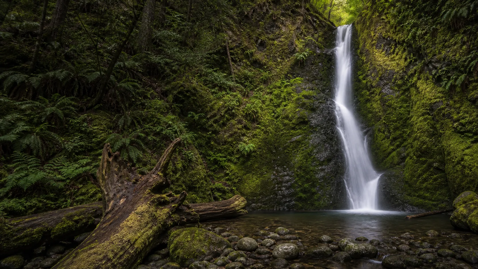
Potem Falls
Plan Potem Falls in Shasta County, California: 0.4 mi route details, parking and directions, best time to visit, safety notes, and 4 waterfall photos.
70 ft0.4 mi4 photos
Waterfall hikes under 1.5 miles with verified trail length, fees, dog rules, and accessibility. Paved, urban, and family-friendly picks called out.
An easy waterfall hike is a trip you can do without trekking poles, without a backpack heavier than a water bottle, and without arguing about whether anyone needs to turn around. On this list that means under 1.5 miles round trip or rated Easy to Moderate by the land manager. We do not pad the count by including 3-mile loops with one paved section; if a guide is here, the actual walk to the falls is short.
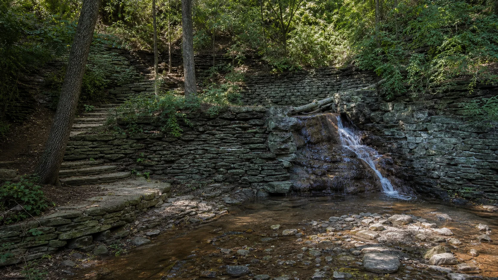
Inside that bar, there are real tradeoffs. Munising Falls, Madison Creek Falls, and Ocqueoc Falls are fully paved and step-free from the lot to the viewing platform; a wheelchair user or a stroller-bound 2-year-old reaches the deck without help. Toketee Falls is also a 0.4-mile trail, but the trip includes roughly 200 cedar stairs and a fenced overlook with no legal route to the pool; the distance number alone is misleading. Minnehaha Falls reads as paved on the rim and unusable below it, because the glen descent is 162 WPA-era stone steps that the city has not modernized for ADA access. The same caveat applies at Miners Falls (64 wooden steps to the deck) and Anna Ruby Falls (paved but with two short steep grades that turn the trail strenuous for some visitors with mobility limits).
The other tradeoffs are fee, dogs, and crowds. Anna Ruby charges $6 per adult, with children 15 and younger free; Madison Creek sits inside Olympic National Park, where the $30 per-vehicle entrance fee buys 7 days. Most of the rest on this list are free. National Park Service trails ban dogs, which knocks out Madison Creek, Munising, Marymere, and Plaikni if you are bringing the dog; almost every Forest Service, state park, and city park guide on this list welcomes leashed dogs. Urban falls (Minnehaha, St. Anthony, Hidden Falls) are reachable by light rail and are open year-round; forest falls usually mean a drive, a Forest Service gate that can close in winter, and patchy cell service at the trailhead.
This page is the list a friend who actually hikes would send if you asked for a low-effort waterfall trip. The criteria below are explicit. The comparison note that follows is where to start if you are deciding between two of them.
If the trip is for a wheelchair user, a stroller, or a grandparent with bad knees, start with Ocqueoc Falls (Michigan, the only ADA-certified waterfall in the state with a boardwalk to a pool-level overlook), Munising Falls (Pictured Rocks, paved 0.4 mile from the visitor center to the lower deck), or Madison Creek Falls (Olympic NP, 0.2 mile of pavement to a wooden viewing porch). Those three are the cleanest accessible visits on the site.
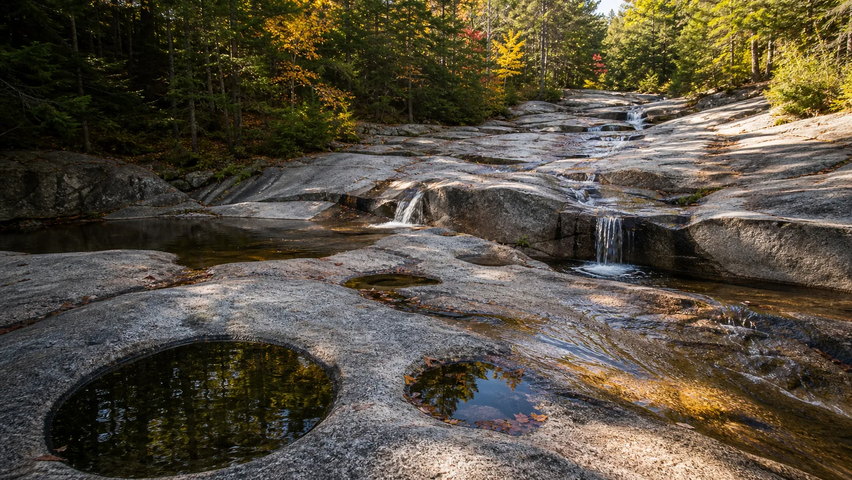
If the trip is a family with kids under 5, the calculus shifts. Sliding Rock is a paved overlook stop with a designated swim area in summer (lifeguards Memorial Day through Labor Day, $5 per person fee in season, no tubes). Ocqueoc has the only legal wade-in pools on this list. Diana's Baths is a flat 0.6-mile gravel walk to a stack of granite-ledge swimming pools that run cold (about 60 to 65 F midsummer) but are knee to chest deep.
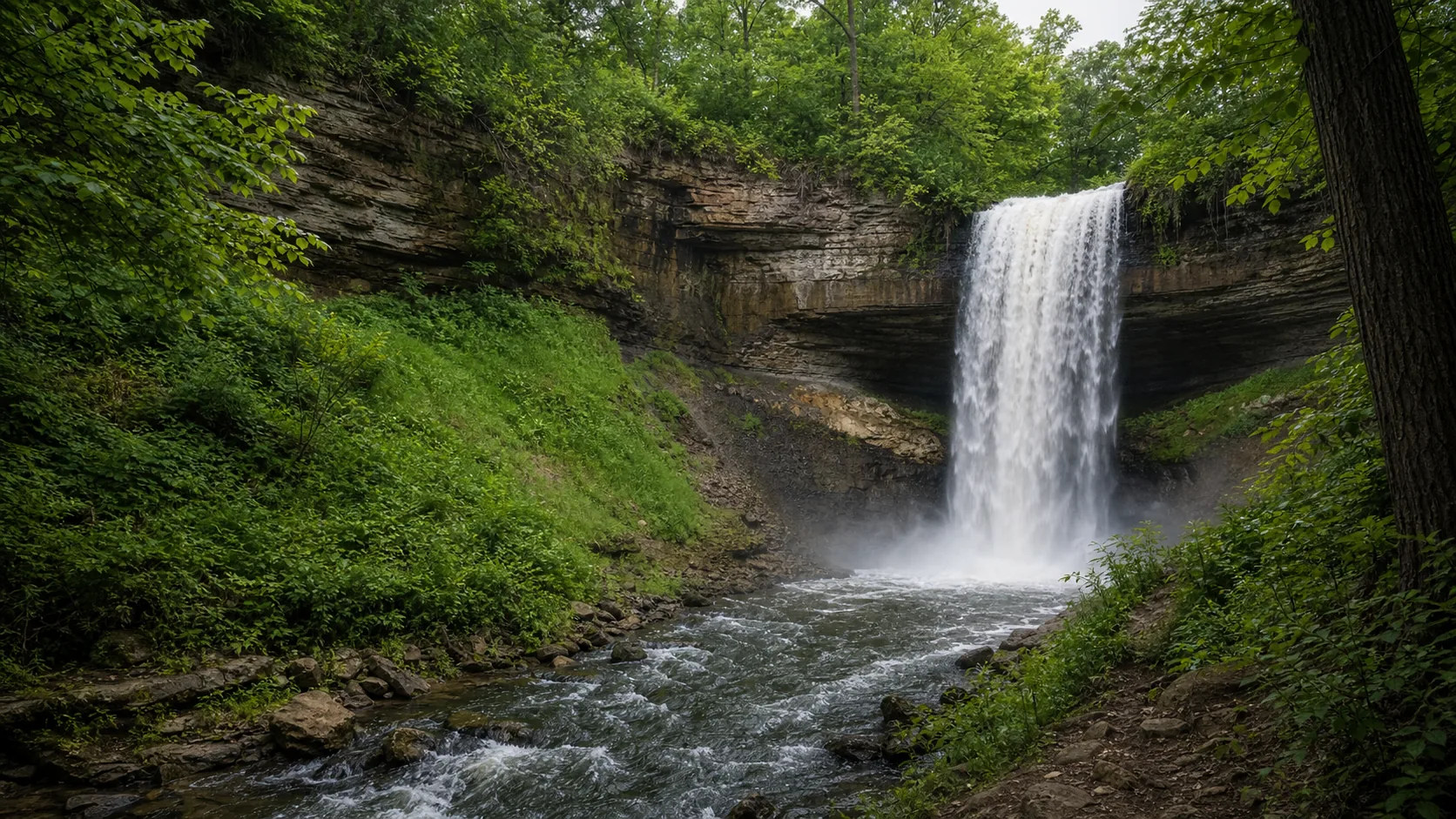
If the kids are 8 and up and can handle stairs, the trips with the most payoff per minute of effort are Toketee (0.4 mi plus 200 stairs to a postcard double-tier basalt amphitheater) and Minnehaha (0.9 mi loop plus 162 stairs into a 50-foot urban gorge). Both are short but neither is paved-easy.
If you want the urban version (no gear, no drive, dog welcome, food and a bathroom nearby), the three Twin Cities falls (Minnehaha, St. Anthony, Hidden Falls) are all under 2 miles, all free, all reachable by METRO light rail, and all on the same Platteville-St. Peter caprock geology.
On this list, easy means under 1.5 miles round trip or rated Easy to Moderate by the land manager (USFS, NPS, state park, or municipal park). A few entries are short but include significant stairs; we flag those individually so the distance number does not mislead. Toketee Falls in Oregon is the clearest example: 0.4 miles of trail plus roughly 200 cedar stairs.
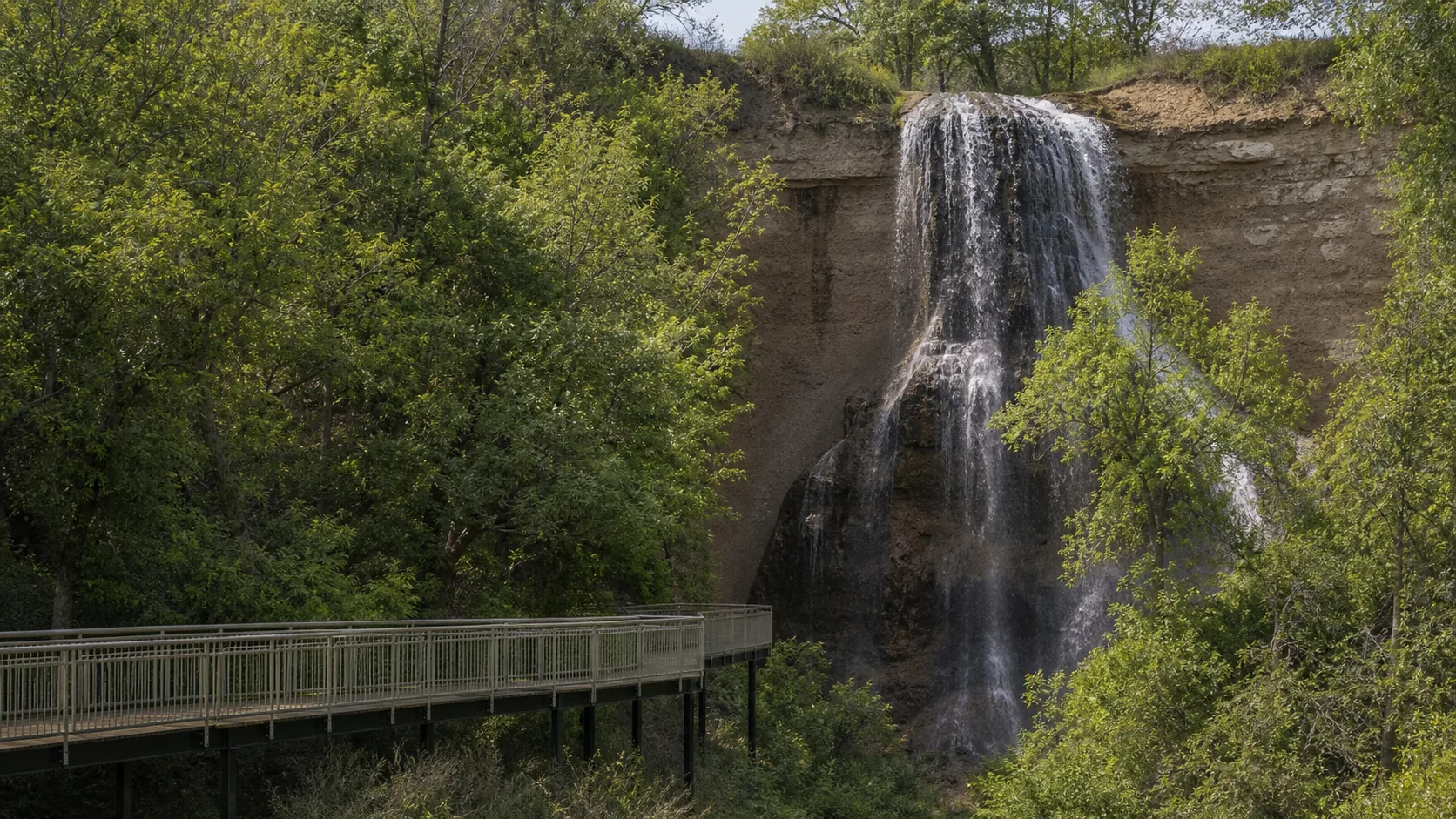
Five guides on this list are paved end to end from the lot to the viewing platform: Munising Falls (Michigan, 0.4 mi), Madison Creek Falls (Washington, 0.2 mi), Ocqueoc Falls (Michigan, 0.3 mi boardwalk), Anna Ruby Falls (Georgia, 0.4 mi each way with two short steep grades), and the rim overlook at Minnehaha Falls (Minneapolis, 0.2 mi paved out-and-back from the lot). St. Anthony Falls in Minneapolis is also paved and step-free along the Stone Arch Bridge.
Yes. Ocqueoc Falls in Michigan is the only fully ADA-accessible waterfall in the state, with a paved path and boardwalk to a pool-level overlook (one of the few setups in the country that puts a wheelchair user at the water with the falls directly in front of them). Munising Falls is paved and near-level out-and-back from the Pictured Rocks visitor center. Madison Creek Falls in Olympic National Park is wheelchair-accessible along the 0.2-mile paved trail to a wooden porch. The upper rim at Minnehaha Falls is paved and accessible, but the descent into the glen is by 162 stone steps and is not.
Moose Falls in Yellowstone, Nooksack Falls in Washington, and Scott Falls in Michigan are all about 0.1 mile from car to deck. Sliding Rock in Pisgah National Forest is also a 0.1-mile paved walk from the parking lot to the upper viewing deck. Sitting Bull Falls (New Mexico) and Madison Creek (Olympic NP) are 0.2 miles round trip. For the shortest trip that still feels like a hike, Ocqueoc Falls is 0.3 mi on boardwalk, and Munising Falls is 0.4 mi paved.
Most are. Sliding Rock is the most kid-focused entry (a paved overlook plus a designated summer swim area with lifeguards), and Ocqueoc Falls has the only legal wade-in pools on the list. Diana's Baths in New Hampshire is a flat 0.6-mile gravel path to a stack of shallow granite pools. For kids who can handle 160-plus stone steps, Minnehaha Falls and Toketee Falls deliver the biggest visual payoff. Avoid Toketee with toddlers (200 stairs and a fenced overlook with no pool access) and avoid Cummins Falls (Tennessee) with anyone under 8 because the gorge route is strenuous and has a permitted-entry system after the 2017 flash flood fatalities.
Most of this list, yes. Forest Service, state park, and city park trails generally allow leashed dogs. National Park Service trails do not: dogs are banned from Madison Creek Falls (Olympic NP), Marymere Falls (Olympic NP), Munising Falls (Pictured Rocks lower deck is the one paved NPS exception, where leashed dogs are allowed), Plaikni Falls (Crater Lake NP), and most other NPS trails. Diana's Baths, Helton Creek Falls, DeSoto Falls, Minnehaha, Hidden Falls, St. Anthony, Anna Ruby, and Sliding Rock all allow dogs on a 6-foot leash.
For a paved 0.2 to 0.6-mile trail, the kit is light: water, sturdy walking shoes (not flip-flops on wet sandstone or limestone), a phone with offline maps because trailhead cell service is unreliable, and the correct pass if the trailhead needs one (Northwest Forest Pass for several Oregon and Washington Forest Service trails, America the Beautiful for any National Park entry). For trails with stairs (Minnehaha, Toketee, Miners), add real hiking shoes with grip. For trails where swimming is legal (Ocqueoc, Sliding Rock, Diana's Baths), add a towel, water shoes for slick rock, and the awareness that mountain water runs cold even in July.
Plan Potem Falls in Shasta County, California: 0.4 mi route details, parking and directions, best time to visit, safety notes, and 4 waterfall photos.
Plan Wadsworth Falls State Park near Middletown, Connecticut: 0.6 mi route details, parking and directions, best time to visit, safety notes, and 8 waterfall photos.
Plan Smalls Falls near Township E, Maine: 0.5 mi route details, parking and directions, best time to visit, safety notes, and 4 waterfall photos.
Plan Miners Falls near Munising Township, Michigan: 1.2 mi route details, parking and directions, best time to visit, safety notes, and 8 waterfall photos.
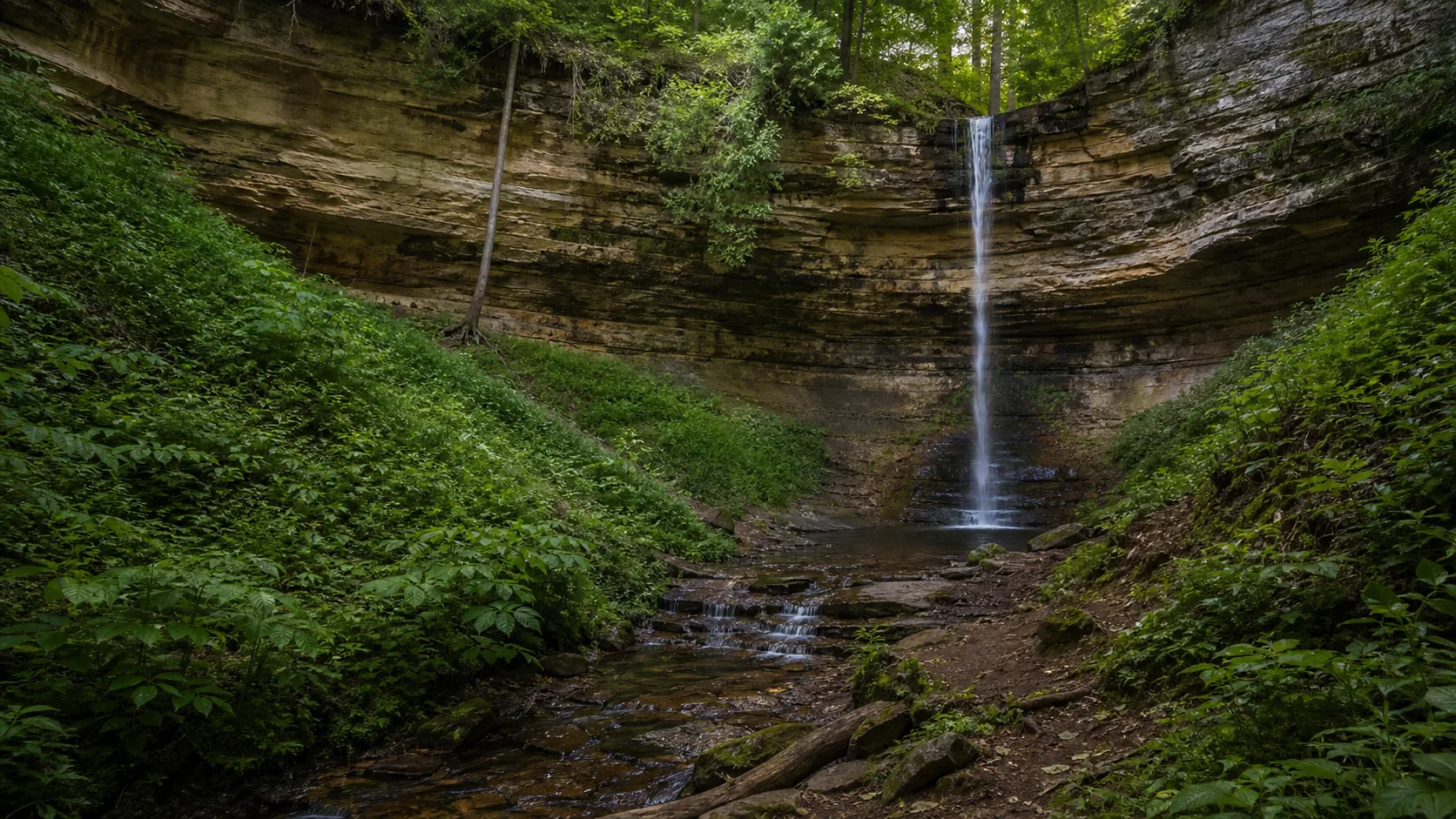
Plan Munising Falls near Munising, Michigan: 0.4 mi route details, parking and directions, best time to visit, safety notes, and 8 waterfall photos.
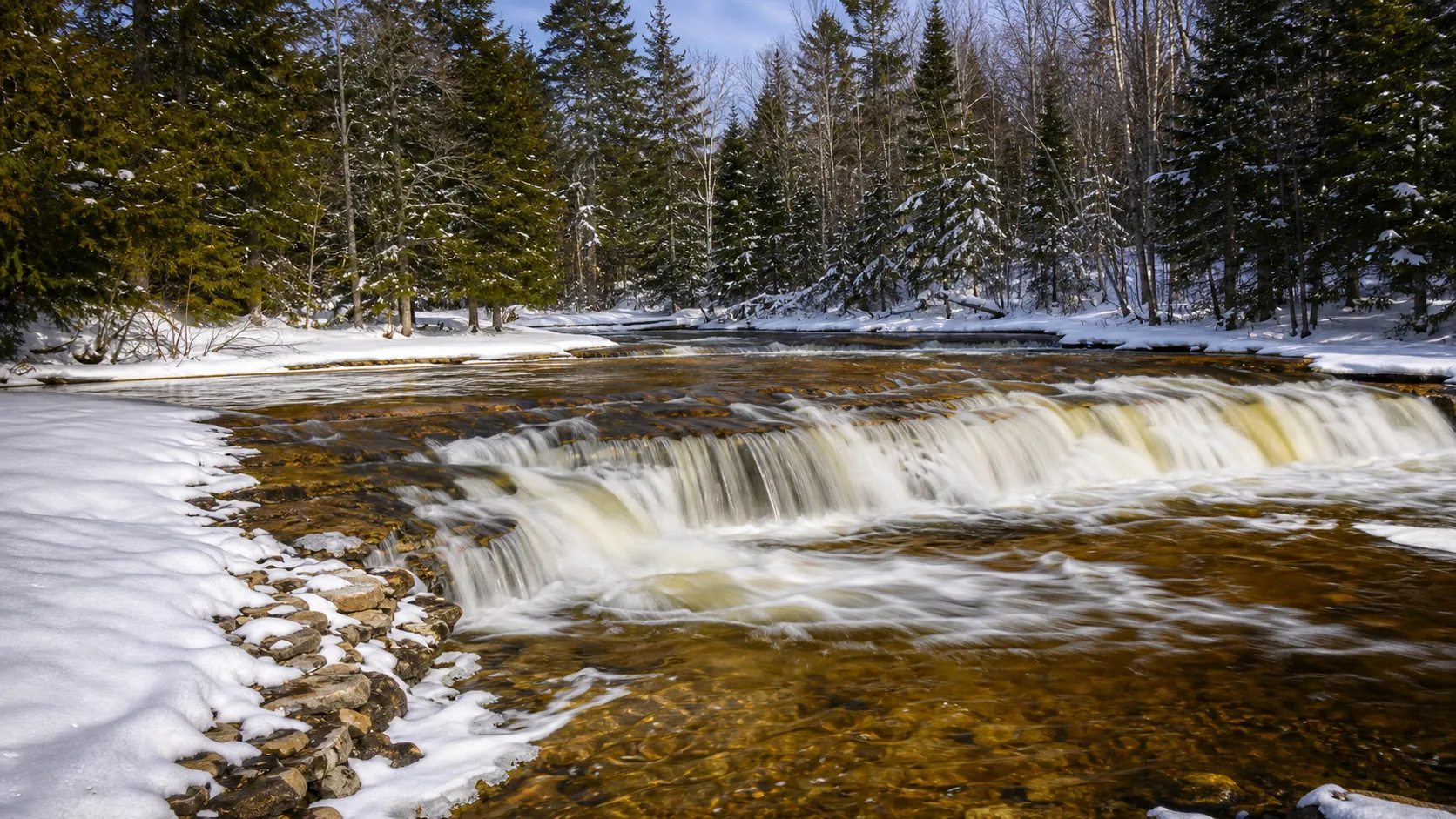
Plan Ocqueoc Falls near Ocqueoc Township, Michigan: 0.3 mi route details, parking and directions, best time to visit, safety notes, and 4 waterfall photos.
Plan Scott Falls near Au Train Township, Michigan: 0.1 mi route details, parking and directions, best time to visit, safety notes, and 4 waterfall photos.
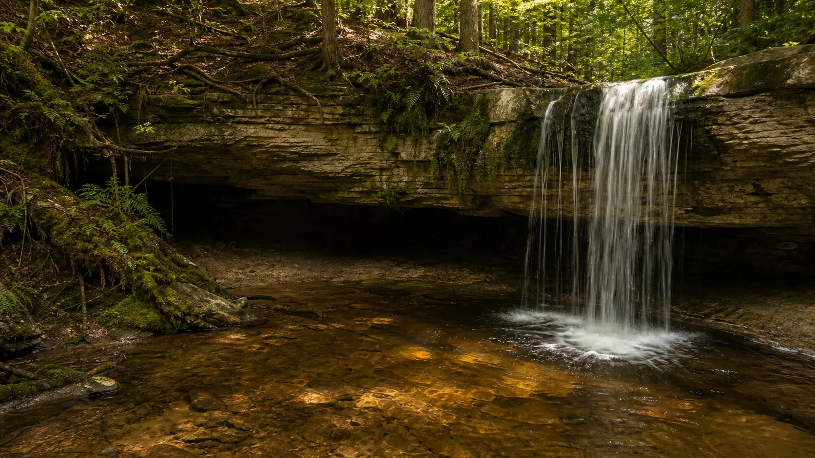
Plan Tannery Falls near Munising, Michigan: 0.4 mi route details, parking and directions, best time to visit, safety notes, and 8 waterfall photos.
Plan Hidden Falls near Saint Paul, Minnesota: 1.4 mi route details, parking and directions, best time to visit, safety notes, and 7 waterfall photos.
Plan Minnehaha Falls near Minneapolis, Minnesota: 0.9 mi route details, parking and directions, best time to visit, safety notes, and 8 waterfall photos.
Plan Smith Falls in Cherry County, Nebraska: 0.8 mi route details, parking and directions, best time to visit, safety notes, and 8 waterfall photos.
Plan Diana's Baths near Bartlett, New Hampshire: 1.2 mi route details, parking and directions, best time to visit, safety notes, and 8 waterfall photos.
Plan Sitting Bull Falls near Carlsbad, New Mexico: 0.2 mi route details, parking and directions, best time to visit, safety notes, and 8 waterfall photos.
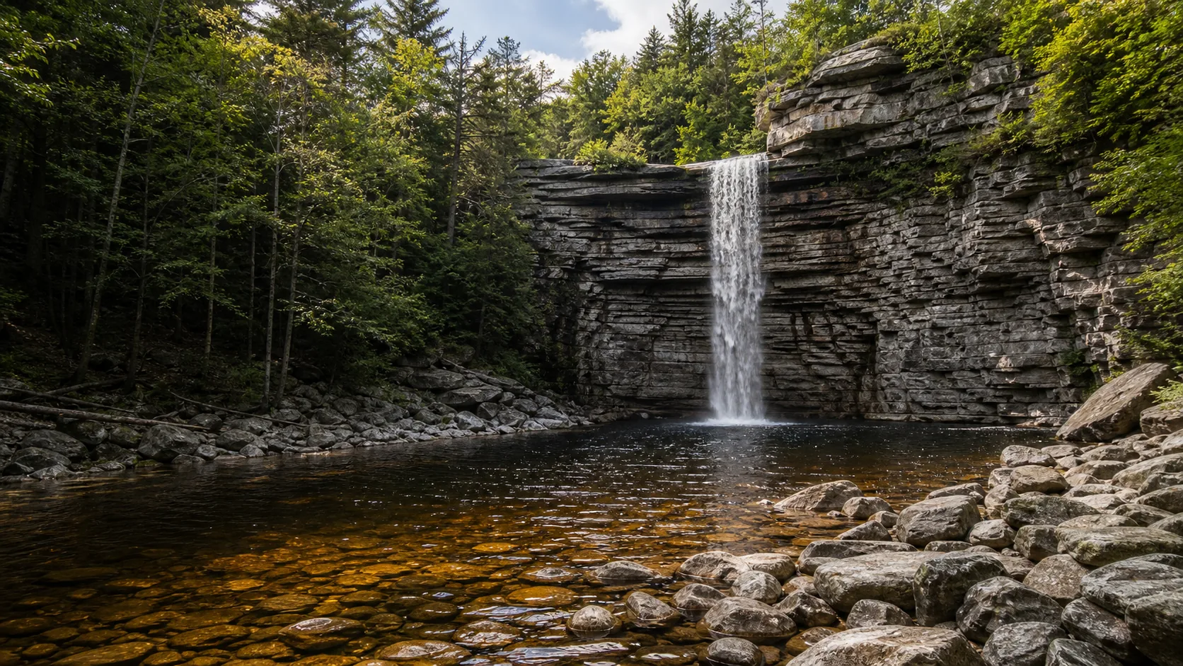
Plan Awosting Falls near Kerhonkson, New York: 0.5 mi route details, parking and directions, best time to visit, safety notes, and 8 waterfall photos.
Plan Courthouse Falls in Transylvania County, North Carolina: 0.8 mi route details, parking and directions, best time to visit, safety notes, and 4 waterfall photos.
Plan Roaring Fork Falls in Yancey County, North Carolina: 0.6 mi route details, parking and directions, best time to visit, safety notes, and 8 waterfall photos.
Plan Sliding Rock in Transylvania County, North Carolina: 0.1 mi route details, parking and directions, best time to visit, safety notes, and 8 waterfall photos.
Plan Benham Falls near Sunriver, Oregon: 1.4 mi route details, parking and directions, best time to visit, safety notes, and 8 waterfall photos.
Plan Dingmans Falls near Dingmans Ferry, Pennsylvania: 0.4 mi route details, parking and directions, best time to visit, safety notes, and 8 waterfall photos.
Plan Issaqueena Falls near Walhalla, South Carolina: 0.3 mi route details, parking and directions, best time to visit, safety notes, and 4 waterfall photos.
Plan Madison Creek Falls near Port Angeles, Washington: 0.2 mi route details, parking and directions, best time to visit, safety notes, and 4 waterfall photos.
Plan Nooksack Falls near Glacier, Washington: 0.1 mi route details, parking and directions, best time to visit, safety notes, and 8 waterfall photos.
Plan Moose Falls in Teton County, Wyoming: 0.1 mi route details, parking and directions, best time to visit, safety notes, and 8 waterfall photos.