White County, Georgia
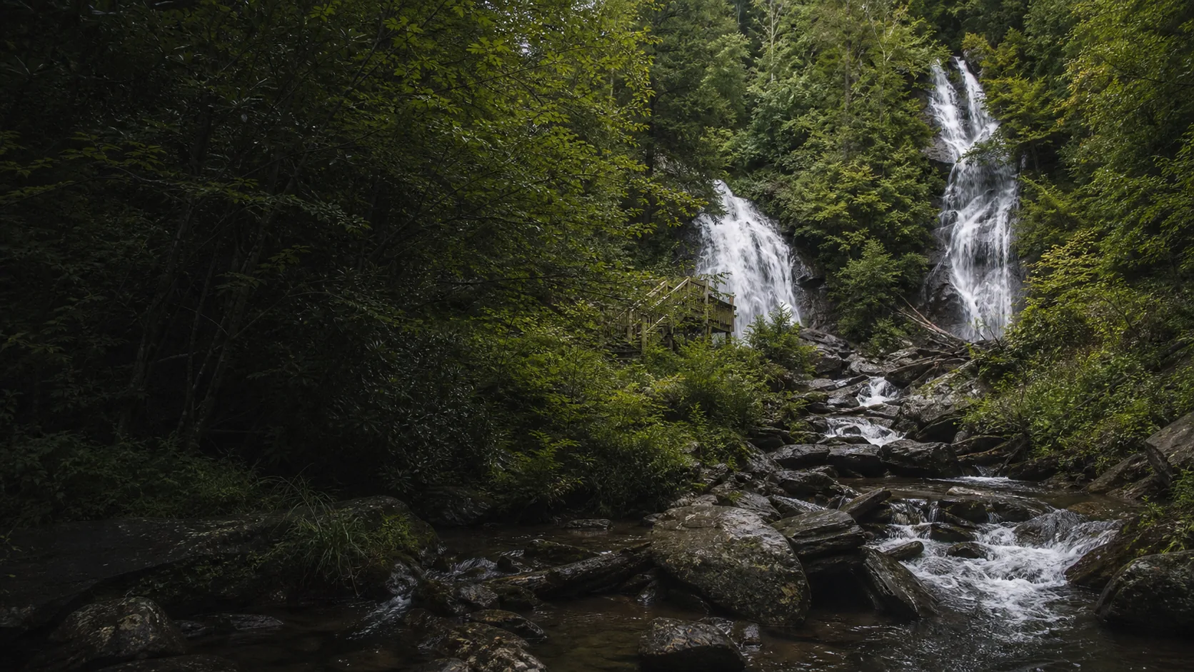
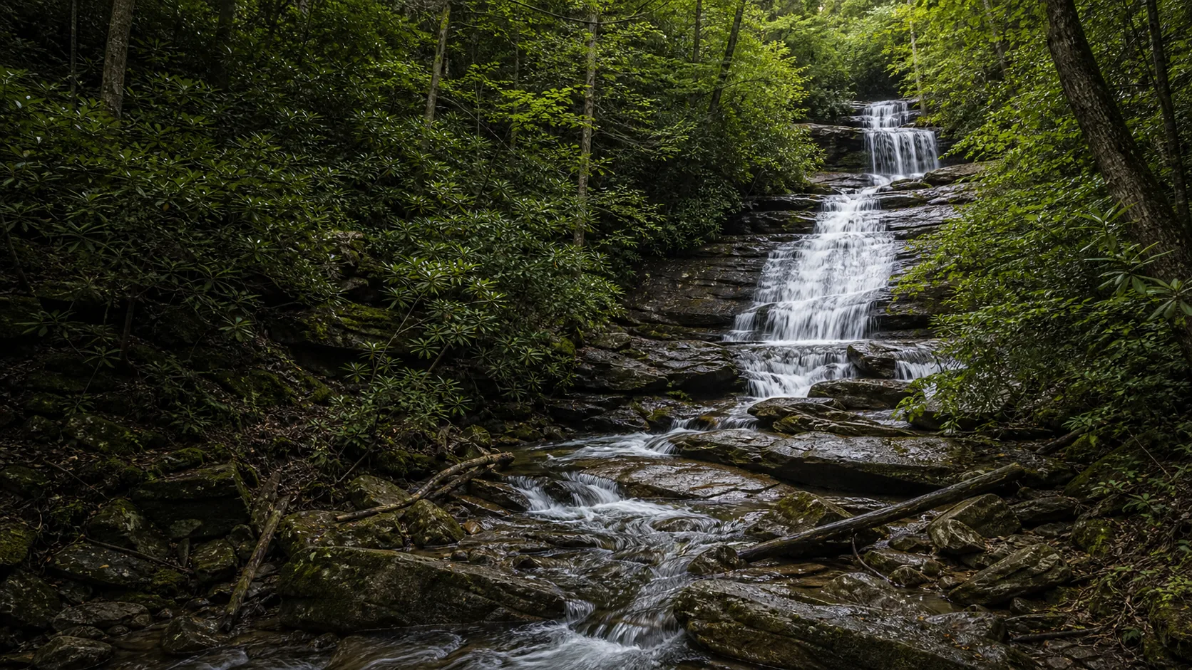
Anna Ruby Falls
Plan Anna Ruby Falls in White County, Georgia: 0.8 mi route details, parking and directions, best time to visit, safety notes, and 8 waterfall photos.
height not listed0.8 mi8 photos
Six published guides covering the cluster of cascades within an hour of Helen, Dahlonega, and Blue Ridge. Trail length, fee mechanics, swim notes, and the geology behind the drops.
Almost every Georgia waterfall search starts in the same place: a hotel room in Helen, a cabin near Blue Ridge, or a weekend rental outside Dahlonega. The state's headline cascades are clustered tightly in the southern Blue Ridge, packed into the Chattahoochee-Oconee National Forest across White, Lumpkin, Union, and Fannin counties. Six of those drops are published here, and four of them sit inside a 35-minute drive of downtown Helen.
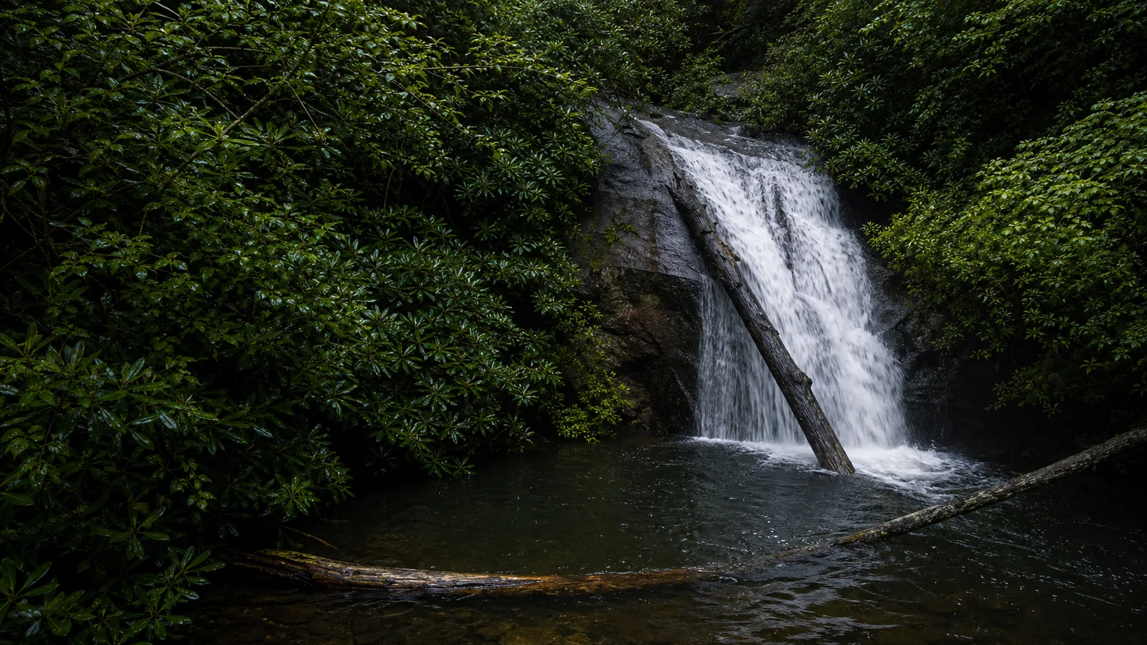
The geology under all six is the same: Blue Ridge metamorphic terrane, mostly biotite gneiss and mica schist with some granitic gneiss thrown in. Streams off Tray Mountain, Blood Mountain, and the upper Chattahoochee watershed find resistant ledges in that bedrock and step down rather than free-falling. The visual result is a regional house style: tiered cascades over foliated rock rather than single ribbon plunges, with rhododendron tunnels and second-growth hardwood on either side.
The other thing visitors learn quickly is the mixed fee structure. Anna Ruby Falls charges $6 per adult, with children 15 and younger free and specific interagency pass categories listed by the Forest Service. Dukes Creek and Blue Hole share a $5 per-vehicle GoFindOutdoors concession fee that federal passes do not waive. DeSoto Falls is a separate $5 per-vehicle fee site. Helton Creek and Long Creek remain free. Check the specific gate before assuming one pass covers the day.
Waterfalls Guide treats Georgia the way the state actually reads on the ground: a tight cluster of trips planned around Helen lunches and Blue Ridge cabins, with seasonality more than mileage as the planning constraint. Below: three quick picks for first-time visitors, when to come, how the falls sort by region, and the questions most visitors ask before they drive up GA-348 or GA-356.
Side-by-side twin waterfall on two separate creeks (153 ft + 50 ft) at the end of a 0.4-mile paved trail. $6 adult admission, free for kids 15 and younger. Eleven miles north of downtown Helen on GA-356; the highest reward per minute of effort in the state.
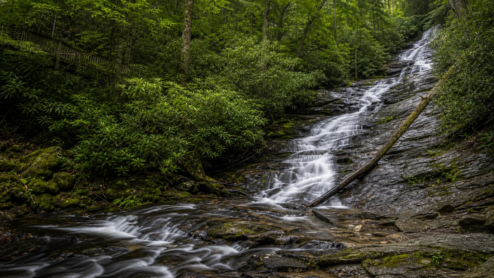
A 250-foot multi-tier drop into a slot gorge, reached by a 1-mile paved-and-boardwalk descent. Same GA-348 lot serves the Blue Hole pool 0.5 mile away, so the $5 GoFindOutdoors fee covers both stops.
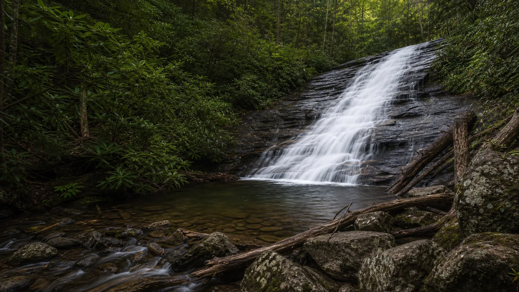
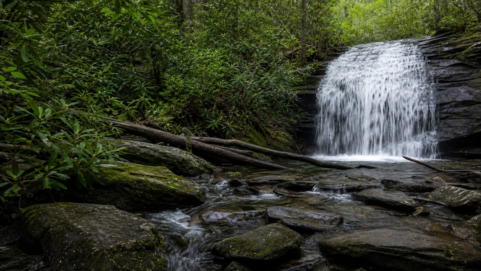
Two stacked drops (30 ft + 50 ft) on a 0.3-mile path in Union County. No fee, rock-rimmed pools at the base, and the only one of the six with an unsupervised swim window in summer.
Georgia waterfall timing has two real peaks. The first is mid-March through early May, when southern Blue Ridge snowmelt off Tray Mountain and Blood Mountain pairs with the wettest months on the NOAA precipitation record. Curtis Creek runs loud at Anna Ruby, Davis Creek throws a curtain at Dukes Creek, and Long Creek pushes hard at the AT junction. Spring is also the cleanest light: thin canopy, water moving fast, no summer haze.
The second peak is the second and third weeks of October for fall color. The Chattahoochee-Oconee canopy turns red and yellow against gneiss and schist, and the Smith Creek gorge above Anna Ruby and the Frogtown Creek loop at DeSoto both photograph at their best. Mid-summer (late July through August) is the weakest reliable window for flow: York Creek can thin to a streak and Long Creek runs as braids rather than a sheet. The exception is Blue Hole, where the 55 to 65 F pool is the whole point and the drier cascade is acceptable. Winter is quieter and surprisingly workable: full freeze-up is rare, but ice fringe forms on the lower tier of Curtis Creek in deep cold years, and the trails stay open except during active ice storms.
Helen is the Bavarian-themed mountain town that drives most Georgia waterfall search traffic, and four of the six published falls sit within a 35-minute drive of the river. Anna Ruby is north on GA-356, Dukes Creek and Blue Hole share a GA-348 trailhead 8 miles northwest, and Helton Creek is the longer drive up to Union County. The classic one-day plan: morning at Dukes Creek and the Blue Hole, lunch in Helen, afternoon at Anna Ruby, drinks back in town.
Dukes Creek Falls, Blue Hole Falls, Anna Ruby Falls, Helton Creek Falls
DeSoto Falls is the obvious anchor here, a multi-tier cascade on Frogtown Creek 15 miles north of Dahlonega on US-129/19. Helton Creek pairs naturally with it on the same northern loop, and the Toccoa Ranger District bedrock is the same Blue Ridge gneiss-and-schist as the Helen falls. Note the disambiguation: this is DeSoto Falls in Georgia, not the much taller DeSoto Falls in Mentone, Alabama.
Long Creek Falls is the outlier of the six, an hour west of Helen at the point where the Appalachian Trail and the Benton MacKaye Trail split apart. Park at the Three Forks pull-offs on Forest Service Road 58, walk the white-blazed AT north, then take the short blue-blazed spur. Free, quiet, and the only published Georgia fall reached on a thru-hiker route rather than a paved tourist loop.
Yes, and Helen is the most logical base for Georgia waterfall trips in general. Anna Ruby Falls is 11 miles north on GA-356, Dukes Creek Falls and the Blue Hole share a trailhead 8 miles northwest on GA-348, and Helton Creek Falls is about 35 minutes northwest in Union County. All four sit on Chattahoochee-Oconee National Forest land. A full Helen waterfall day is genuinely doable: Dukes Creek and the Blue Hole in the morning, lunch in town, Anna Ruby in the afternoon.
Anna Ruby Falls has the most accessible payoff in the state: a 0.4-mile paved trail (0.8 miles round trip) ends at a fenced deck with both twin drops in one frame. The Lion's Eye Trail at the same visitor center is a 0.1-mile wheelchair-accessible loop with cable handrail and braille interpretive signs. Dukes Creek Falls has a paved upper boardwalk that is wheelchair-passable but runs at about an 8 percent grade. Helton Creek's 0.3-mile dirt path and Long Creek's 2-mile AT approach are not ADA accessible.
Because the fee rules vary by site. Anna Ruby Falls charges $6 per adult, with children 15 and younger free and specific interagency pass categories listed by the Forest Service. Dukes Creek and Blue Hole share a $5 per-vehicle GoFindOutdoors concession fee that federal passes do not waive. DeSoto Falls is a separate $5 per-vehicle fee site. Helton Creek Falls and Long Creek Falls remain free.
Two of the six. The Blue Hole on Dodd Creek is the most famous Georgia swimming hole, a deep blue-green pool below a 25-foot cascade, used informally for decades; the water is cold year-round (55 to 65 F even in August) and the Forest Service does not certify depth or post lifeguards. Helton Creek Falls has shallower rock-rimmed pools at the base of each tier that work for cooling off in summer. Swimming is prohibited or strongly discouraged at Anna Ruby, Dukes Creek, DeSoto, and Long Creek; the basin floors are unstable wet bedrock and the splash zones are off-limits.
Anna Ruby Falls is the cleanest family pick: paved trail, benches every few hundred feet, fenced viewing deck at the top, $6 per adult and free for kids 15 and under. Helton Creek Falls is the runner-up for older kids because the 0.3-mile path is short and the shallow pools are swim-friendly. Skip Long Creek Falls with young kids; it is a 2-mile out-and-back on a section of the Appalachian Trail with no facilities at the trailhead.
The second and third weeks of October are the reliable peak across the Chattahoochee-Oconee. Smith Creek gorge above Anna Ruby and the Frogtown Creek loop at DeSoto both photograph at their best in that window; the Dukes Creek descent reads as a yellow tunnel through hickory and tulip poplar. Arrive at trailheads before 10 a.m. on October weekends because parking lots fill, especially at Anna Ruby and Dukes Creek where the GoFindOutdoors gates cap capacity at the lot size.
No. Two different waterfalls, two different states. DeSoto Falls in Georgia is a multi-tier cascade on Frogtown Creek inside the Chattahoochee-Oconee National Forest, about 15 miles north of Dahlonega in Lumpkin County, reached by a 2.2-mile loop trail. DeSoto Falls in Alabama is a 104-foot single-drop waterfall in DeSoto State Park near Mentone, on Little River. Both are named for the Spanish explorer Hernando de Soto. The Georgia one is the smaller of the two but pairs naturally with the rest of the North Georgia cluster.
Plan Anna Ruby Falls in White County, Georgia: 0.8 mi route details, parking and directions, best time to visit, safety notes, and 8 waterfall photos.
Plan Blue Hole Falls near Helen, Georgia: 1 mi route details, parking and directions, best time to visit, safety notes, and 4 waterfall photos.
Plan DeSoto Falls in Lumpkin County, Georgia: 2.2 mi route details, parking and directions, best time to visit, safety notes, and 8 waterfall photos.
Plan Dukes Creek Falls near Helen, Georgia: 1 mi route details, parking and directions, best time to visit, safety notes, and 8 waterfall photos.
Plan Helton Creek Falls in Union County, Georgia: 0.6 mi route details, parking and directions, best time to visit, safety notes, and 4 waterfall photos.
Plan Long Creek Falls near Blue Ridge, Georgia: 1.9 mi route details, parking and directions, best time to visit, safety notes, and 4 waterfall photos.