Helton Creek Falls waterfall and surrounding setting
Union County, GA

Helton Creek Falls

Helton Creek Falls is a two-tier waterfall in the Chattahoochee-Oconee National Forest in Union County, Georgia, with an upper drop of roughly 30 feet and a lower drop of roughly 50 feet reached by a 0.3-mile forest trail. A pair of clear, rock-rimmed pools sits at the base of each tier and is the unofficial swimming hole the falls is best known for in summer. Admission is free, the trailhead sits 11 miles south of Blairsville off US-19/129, and the final 2.2 miles is gravel Forest Road 118 (Helton Creek Road).

Last verified May 12, 2026 Visited Desk-verified May 2026 7 sources checked
Trail 0.6 mi Round-trip route varies
Time 30-60 min Easy with short steep sections
Best season Spring after rainfall for peak flow; mid-October for fall color in the surrounding hardwoods After rain or snowmelt
Parking Free gravel pullout, fills on weekends Chattahoochee National Forest, Blue Ridge Ranger District
Quick answer

Is Helton Creek Falls worth visiting?

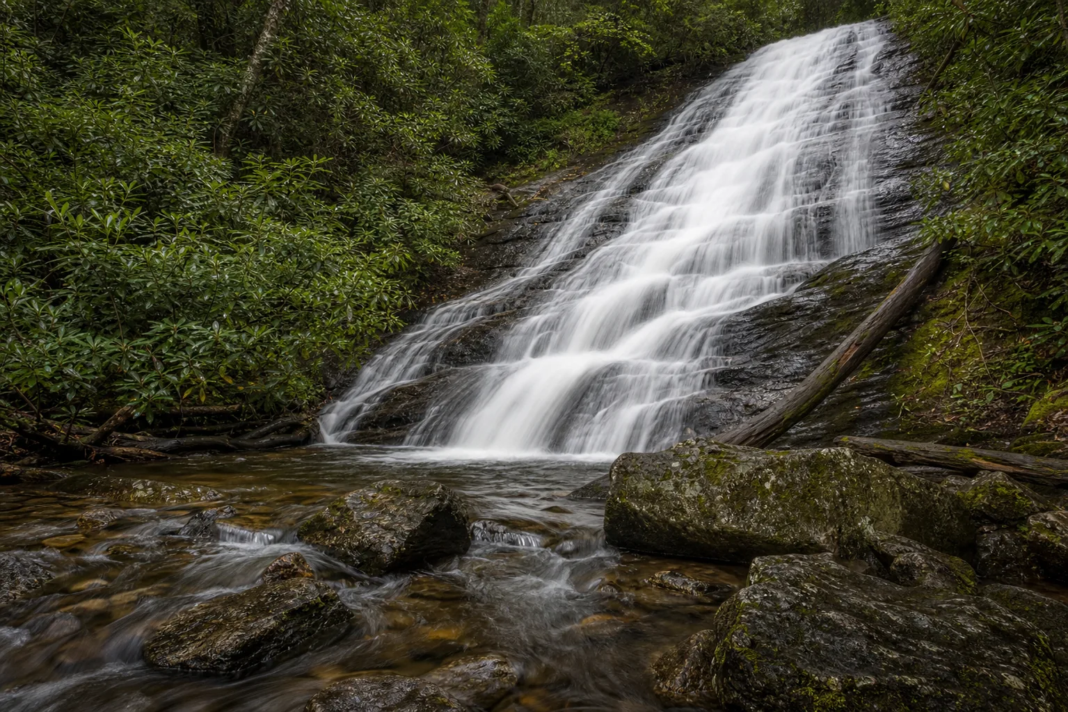
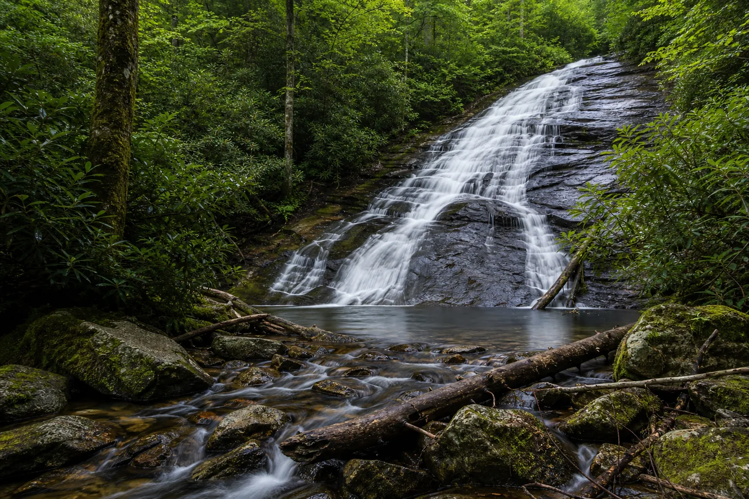
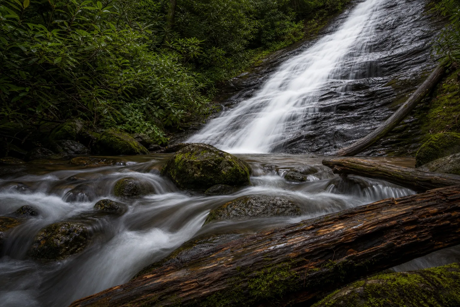
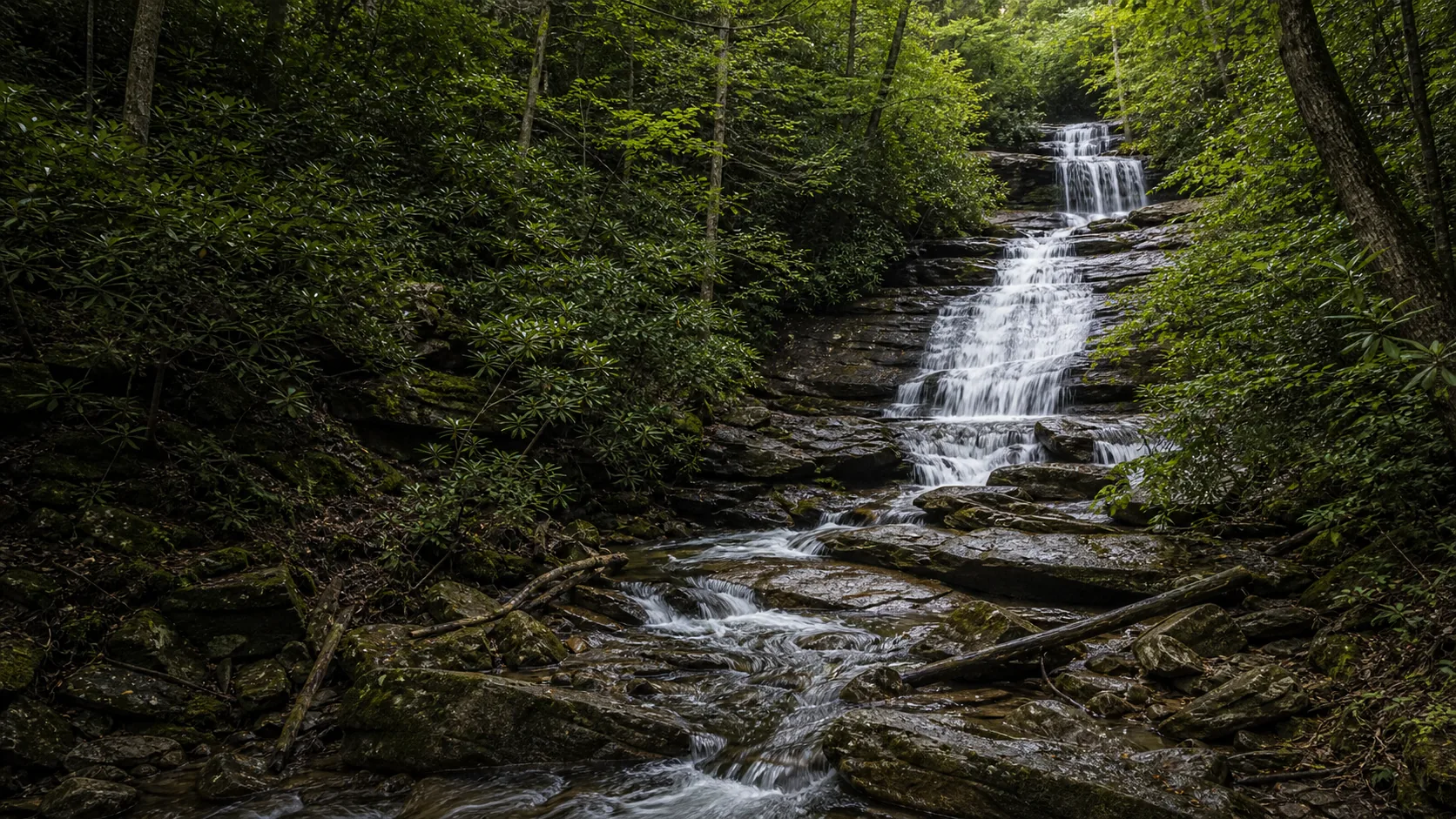
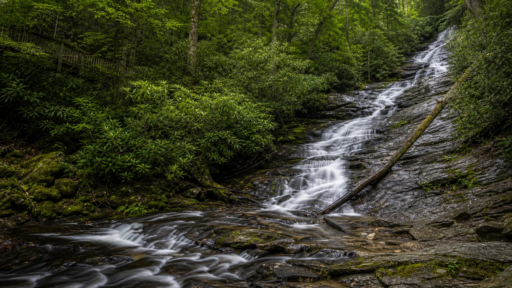
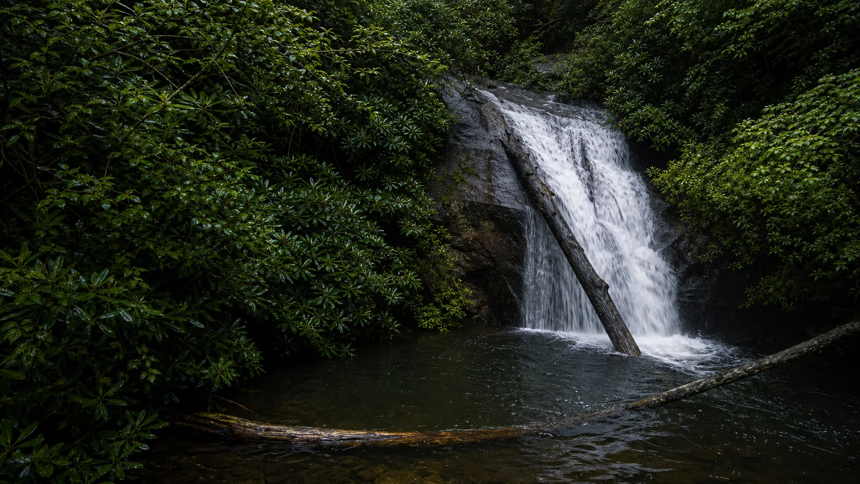
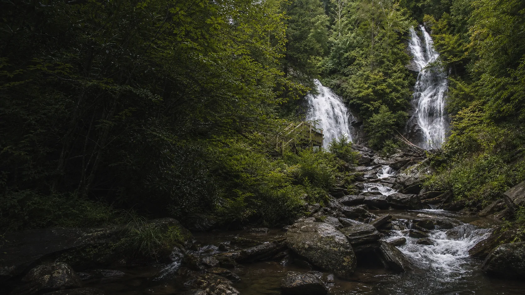
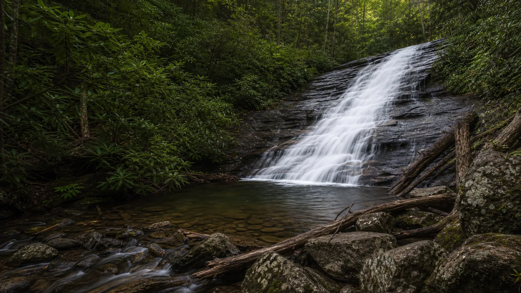
Yes. Helton Creek Falls is the rare North Georgia stop where a 0.3-mile walk gets you to two waterfalls (an upper 30-foot drop and a lower 50-foot drop) plus two clear pools that locals use as summer swimming holes. Plan March through May for the loudest spring runoff over the gneiss, and June through August for warm-water swimming and wading. The 2.2-mile gravel access (Forest Road 118 / Helton Creek Road) is rough but passenger-car friendly when dry; potholes deepen after heavy rain and the road can be slick or impassable in winter ice.

  • Upper falls ~30 ft, lower falls ~50 ft, both reached by a 0.3 mi trail
  • Two clear pools at the base; summer swimming hole
  • Free admission, free gravel pullout parking
  • 11 mi south of Blairsville on US-19/129, then 2.2 mi gravel on FR 118
  • Passenger-car OK in dry weather; slick after rain or ice
  • Leashed dogs welcome; rocks are deceptively slippery
Last verified May 12, 2026 Visited Desk-verified May 2026 7 sources checked
Distance 0.6 mi Loop distance varies
Round trip 30-60 min About 0.3 mile each way (0.6 mi round trip) on a forest path with abrupt grade changes and wooden stairs down to the lower falls; suitable for kids who can handle stairs.
Difficulty Easy with short steep sections About 0.3 mile each way (0.6 mi round trip) on a forest path with abrupt grade changes and wooden stairs down to the lower falls; suitable for kids who can handle stairs.
Location Union County, GA Chattahoochee National Forest, Blue Ridge Ranger District
Parking Free gravel pullout, fills on weekends U.S. Forest Service
Transit No fixed-route transit verified Drive and verify the current trailhead or access point · 0 ft
Drive Verify route Downtown route varies
Best season Spring after rainfall for peak flow; mid-October for fall color in the surrounding hardwoods After rain or snowmelt
Helton Creek Falls lower falls: the 50-foot angled slide into the chest-deep swimming pool at the trail base
Photo guide

Two waterfalls, two wooden decks, six working angles.

The upper observation deck frames the curved-rock 30-foot drop; the lower deck reached by wooden stairs frames the 50-foot slide and its chest-deep pool. Side-on angles from the connecting trail catch the hemlock canopy. Captions identify each viewpoint so you can pick angles before you commit to the stairs.

Helton Creek Falls waterfall and surrounding setting
Helton Creek Falls, hero composition
Upper tier of Helton Creek Falls, a 30-foot drop over curved Blue Ridge gneiss into a small pool
Upper falls: the 30-foot curved-rock drop into its small bench pool, from the wooden observation deck
Lower tier of Helton Creek Falls, a 50-foot angled slide into the chest-deep pool used as a summer swimming hole
Lower falls: the 50-foot angled slide into the chest-deep swimming pool at the trail base
Detail of Helton Creek Falls water flowing over biotite gneiss and mica schist of the southern Blue Ridge
Water and rock detail: biotite gneiss and mica schist of the southern Blue Ridge under the lower-tier slide
01Is Helton Creek Falls flowing right now?

There is no live USGS gauge paired directly to Helton Creek. The nearest rainfall proxy is the NOAA/NWS forecast for the Blairsville/Vogel area; for live conditions, check the Chattahoochee-Oconee National Forest alerts page.

Helton Creek runs year-round and is at its strongest after multi-day rains in spring or following a fall tropical remnant. Late summer in a dry year is the weakest reliable window; winter flows are steady but the gravel access road can be slick.

02How long is the walk?

About 0.3 mile each way (0.6 mile round trip) on a forest path with abrupt grade changes and wooden stairs down to the lower falls. Plan 30-60 minutes including time at both observation decks.

03How do you get there?

From Blairsville, take US-19/129 south for 11 miles. Turn left onto Helton Creek Road, the first road past the entrance to Vogel State Park. Follow the gravel road 2.2 miles; the small trailhead pullout is on the right. GPS coordinates: 34.753167, -83.894233.

04Is there free parking?

A small free gravel pullout at the trailhead. There is no overflow lot; on summer weekends and fall-color Saturdays, arrive before 10 a.m. or expect to wait for a space.

05Does it cost money?

Free. There is no admission fee, no parking fee, and no pass requirement.

06Trail variants

Lower falls spur Short side trail off the main path, 10-15 min, Wooden stairs descend to a viewing area at the base of the lower cascade and its shallow pool.
Upper falls platform 0.3 mi one way, 20-30 min, Main trail ends at the wooden observation deck below the larger upper drop.
Full out-and-back 0.6 mi round trip, 30-60 min, Hits both waterfalls and both observation decks.
Pair with DeSoto Falls or Dukes Creek Drive itinerary, Half day, DeSoto Falls and Dukes Creek Falls are both within 30 minutes for a multi-waterfall day.

Detailed maps and recent reviews: Falls route on AllTrails · Creek route on AllTrails

07Can you swim?

Helton Creek Falls is widely used as a summer swimming hole, but the Forest Service does not officially sanction it: the agency posts waterfall danger warnings and asks visitors to stay on the trail and observation decks. In practice, the pool at the base of the lower falls is the deeper of the two (visitor reports describe it as roughly chest-deep) and the water stays cold (Tripadvisor reviews report water temperatures around 55 degrees even at the height of summer). Rocks are deceptively slippery, kids and weak swimmers should wade only in the shallow upper pool, and the strong current directly under the falls is dangerous. For a lifeguarded swim with a sand beach, drive 10 minutes back up the road to Lake Trahlyta at Vogel State Park.

08Are dogs allowed?

Leashed dogs are welcome on the trail and decks. Use a 6-foot leash, pack out waste, and watch dogs on the wet wooden stairs.

09Is it accessible?

The trail is not wheelchair accessible. It has abrupt changes in grade and wooden stairs to the lower falls. For accessible waterfall viewing in the area, the Lion's Eye Trail at Anna Ruby Falls is the closest paved alternative.

Field notes

Helton Creek Falls at a glance.

Upper ~30 ft, lower ~50 ft, roughly 80 ft combined drop over Blue Ridge biotite gneiss; 0.3 mi trail one way; free to enter; managed by the U.S. Forest Service, Blue Ridge Ranger District of the Chattahoochee-Oconee National Forest. Sourced from the USFS Helton Creek Falls page and AllTrails.

Height Not listed Source pending
Type Waterfall USGS
County Union Union County, GA
Managed by U.S. Forest Service, Blue Ridge Ranger District U.S. Forest Service
Water source Local creek or river USGS
Elevation 2349 ft USGS NED
Park area Not listed U.S. Forest Service
Hours Open year-round, 24 hours; the trail is not gated but the gravel access road can be slick or impassable in winter ice U.S. Forest Service
When to visit

Two windows that justify the trip.

March through May for the loudest spring runoff and the cleanest two-tier curtain. June through August for warm-weather wading and swimming in the lower pool. Mid-October pulls fall color through the hardwoods against the evergreen hemlock and rhododendron. Winter is the weakest window: ice on Forest Road 118 closes access more often than the trail.

PEAK FLOW

Peak flowAfter rain or snowmelt
Ice / low flowWinter varies
Most crowdedWeekends and midday
Best photosSunrise or weekdays

Live water context

Discharge data -- There is no live USGS gauge paired directly to Helton Creek. The nearest rainfall proxy is the NOAA/NWS forecast for the Blairsville/Vogel area; for live conditions, check the Chattahoochee-Oconee National Forest alerts page.

Why is it called Helton Creek Falls?

Helton Creek Falls takes its name from Helton Creek, the watercourse that drops through the upper and lower cascades before flowing south to join the Nottely River drainage. The creek, the falls, the trail, and the Forest Service access road (FR 118, signed as Helton Creek Road) all share the name, which traces to the Helton family who settled this valley of the southern Blue Ridge in the 1800s. There is a separate Helton Creek in Avery County, North Carolina with its own waterfalls; the Georgia falls are sometimes written without the trailing s (Helton Creek Fall), which is the same place, just an older labeling convention used on a few topographic maps and trail listings.

What else to do at Chattahoochee National Forest, Blue Ridge Ranger District

Helton Creek Falls sits inside the Chattahoochee-Oconee National Forest, Blue Ridge Ranger District, in Union County, Georgia, about a mile south of Vogel State Park. The cluster around it is the heart of North Georgia mountain country: Brasstown Bald (the highest point in Georgia at 4,784 feet) is 20 minutes east, Blood Mountain on the Appalachian Trail is 10 minutes south on US-19/129, and Lake Trahlyta at Vogel State Park is 5 minutes back up the road. Blairsville is the closest base town for fuel, groceries, and lunch; Helen, the Bavarian-themed village on the Chattahoochee, is 35 minutes south and a common alternate base.

  • Trailhead pullout. A small free gravel pullout on Helton Creek Road, 2.2 miles from US-19/129; no restrooms, no water, no fee.
  • Lower falls deck. A wooden observation platform reached by a short side trail and wooden stairs; the lower falls slides into a shallow pool here.
  • Upper falls deck. The main 0.3-mile trail ends at a second wooden observation deck below the larger upper cascade.
  • Hemlock and rhododendron valley. The creek corridor is mossy, ferny, and shaded, which keeps the trail cool even in summer.
  • Vogel State Park nearby. The trailhead road turns off US-19/129 just past Vogel's entrance, making it easy to pair the falls with the lake, beach, and campground.

Why it looks this way

Helton Creek slides over the metamorphic bedrock of the southern Blue Ridge physiographic province, the same Precambrian-age biotite gneiss and mica schist that underlies most of the Chattahoochee-Oconee National Forest. The reason the falls drops in two distinct tiers rather than one continuous slide is structural: a more resistant gneiss layer holds the upper lip and a softer schist horizon beneath it weathers and undercuts faster, producing the bench and pool between the upper and lower cascades. The upper drop (about 30 feet) slips over a curved rock face into a small pool; the lower drop (about 50 feet) angles down a smoother slab into the larger pool at the base. Combined vertical drop is roughly 80 feet, occasionally cited at 100 feet in older sources that included intermediate runs between the two main tiers.
Field guide deep dive

What the SERP listings leave out.

The two-tier geology, the real story on Forest Road 118, which pool is the swimming hole, and how to chain Helton Creek with Anna Ruby and Dukes Creek into a North Georgia waterfall day. Skim the headers, read what you need.

How Helton Creek Falls formed

Helton Creek drains the southern Blue Ridge in the heart of the Chattahoochee-Oconee National Forest, and the rock under it is the same Precambrian-age biotite gneiss and mica schist that underlies most of North Georgia's high country. The reason the creek drops in two distinct tiers rather than one continuous slide is structural rather than scenic accident: a more resistant gneiss layer holds the upper lip, and a softer schist horizon below it weathers and undercuts faster, producing the bench and pool between the upper and lower cascades.

The upper falls (about 30 feet) slips over a curved gneiss face into a small, shallow pool perched on the bench. The lower falls (about 50 feet) angles down a smoother slab into the larger, deeper pool at the trail base. Combined vertical drop is roughly 80 feet, sometimes cited at 100 feet in older sources that included intermediate runs between the two main tiers. The same caprock-undercut mechanic produces the dozens of mid-sized two-tier waterfalls on the Blue Ridge escarpment, including Anna Ruby Falls 35 minutes south and Dukes Creek Falls half an hour west.

The Forest Road 118 access (and whether your car can do it)

From Blairsville, the drive is simple: US-19/129 south for 11 miles, then a left turn onto Helton Creek Road (signed as Forest Road 118) one mile past the main entrance to Vogel State Park. The pavement ends almost immediately and the final 2.2 miles is gravel that drops down into the creek valley with a couple of hairpin turns and a few washboard sections.

The honest read: the road is passenger-car passable in dry weather if you take it slow. RAV4s, Subarus, sedans, and minivans all do it routinely on summer weekends. After heavy rain the potholes deepen and the corners get soft; after winter ice storms the road can be impassable for two-wheel drive cars for several days at a time. The Forest Service does not plow it. The trailhead pullout at the bottom is a small gravel turnout on the right with maybe a dozen informal spaces; arrive before 10 a.m. on summer weekends or expect to circle, and do not block the road itself, which is still active Forest Service access.

GPS coordinates for the trailhead: 34.753167, -83.894233. Cell service drops out a mile in from US-19, so load your map before you turn off the highway.

Upper falls vs lower falls (which pool is the swimming hole)

The 0.3-mile trail reaches both drops, with the lower falls first as you descend from the pullout. A short wooden staircase drops to a viewing platform below the angled 50-foot slide; this is the deeper and more commonly used pool, described in visitor reports as roughly chest-deep at the base with a flat shelf where most people wade in. Water temperature stays around 55 degrees even in July and August, which is colder than it looks and the reason most swims here are short.

Continue up the connecting trail another 100 yards to the upper observation deck. The upper falls is a curved-rock 30-foot drop into a smaller, shallower pool perched on the geologic bench between the tiers. It is the calmer of the two pools and the right choice for small kids who want to splash without contending with current. The hydraulic directly under either falls is dangerous, and the Forest Service does not officially sanction swimming at the site; the lower pool is used at visitors' own risk.

Helton Creek + Anna Ruby + Dukes Creek: a North Georgia waterfall day

Three short waterfalls within a 35-minute radius can fill a satisfying single day in the Chattahoochee-Oconee National Forest. Start at Helton Creek Falls first thing in the morning while the gravel pullout is still open. Allow 45 to 60 minutes for the upper deck, the lower deck, and a quick wade if it is summer.

Drive 30 minutes south through Helen to Dukes Creek Falls in the Smithgall Woods area off the Russell-Brasstown Scenic Byway. The 1-mile paved-to-boardwalk descent leads to a viewing deck across from the 150-foot cascade where Davis and Dodd creeks meet. Allow 90 minutes round trip.

Finish at Anna Ruby Falls at the head of Smith Creek above Unicoi State Park, 20 minutes east of Dukes Creek. The paved Lion's Eye Trail is the easiest waterfall walk in the region and the only one of the three with a fee station and a flush-restroom visitor center. Combined drive time across all three is about 80 minutes; total walking is under 3 miles; total cost is the Anna Ruby fee plus parking at Unicoi. Helen is the obvious lunch base in between.

Why some maps drop the 's' (etymology variants)

The official Forest Service name is Helton Creek Falls, plural, because the site is a series of two waterfalls on Helton Creek rather than a single drop. Wikipedia and AllTrails use the same plural form. A handful of older topographic maps and a few trail guides write the name as Helton Creek Fall (singular), which is the same place and an older labeling convention.

The creek itself takes its name from the Helton family, who settled this valley of the southern Blue Ridge in the 1800s as part of the broader Scotch-Irish and English migration into the Georgia mountains after the Cherokee land lotteries. There is a separate Helton Creek in Avery County, North Carolina with its own waterfalls; the two are unrelated despite the shared name. The Forest Service access road, which is officially Forest Road 118 on agency maps, is signed locally as Helton Creek Road; navigation apps recognize both names.

Summer swimming and the practical realities

Helton Creek Falls is one of the most-searched swimming holes in North Georgia in July, with cluster search volume climbing past 18,000 in peak summer months. The reality on the ground is more measured. The lower pool is shallow at the edges and roughly chest-deep at the base of the slide, with a flat shelf of gravel and small rounded gneiss cobbles. The upper pool is shallow throughout, more wading than swimming.

Water temperature is the limiting factor: visitor reports put it around 55 degrees even in late summer, because the creek runs through a shaded cove the sun never directly reaches and is sourced from springs at higher elevation in the Blood Mountain Wilderness. Plan a short swim, bring a quick-dry towel, and budget a warm-up walk back up to the truck.

The site has no restrooms, no potable water, no fee station, and no lifeguard. The Forest Service does not officially permit swimming and the rocks immediately under both falls are slippery and unpredictable in current. Families looking for a sanctioned swim with a sand beach should consider Lake Trahlyta at Vogel State Park (10 minutes back up Helton Creek Road and US-19/129) or Lake Winfield Scott Recreation Area (25 minutes south on Wolfpen Gap Road). Both have designated swim areas inside the same national forest, with the trade-off being a small day-use fee or a Georgia State Parks pass.

Map and route

Eleven miles south of Blairsville, one mile past Vogel.

From Blairsville, take US-19/129 south for 11 miles. Turn left onto Helton Creek Road, the first road past the entrance to Vogel State Park. Follow the gravel road 2.2 miles; the small trailhead pullout is on the right. GPS coordinates: 34.753167, -83.894233.

Photography and weddings

East-facing two-tier curtain, two wooden decks, one Forest Service drone policy.

The two wooden observation decks are the cleanest vantages: the lower deck for the angled slide and pool, the upper deck for the curved-rock cascade. Side angles from the connecting trail catch the hemlock canopy.

Overcast days are ideal because the narrow valley is shaded and high-contrast sun on white water blows out the highlights. Late morning gives the most even light at the upper falls.

Personal photography is fine. Tripods on the decks are tolerated when the trail is not crowded; commercial shoots and drone flights require Forest Service authorization through the Blue Ridge Ranger District.

Permits

Weddings and engagements

Engagement portraits work on a weekday off-season morning, but the decks are small and shared with day visitors and there is no reservable ceremony space.

A special-use permit from the Chattahoochee-Oconee National Forest, Blue Ridge Ranger District, is required for ceremonies; most parties end up moving the ceremony itself to nearby Vogel State Park.

Plan small, plan early, and have a Vogel State Park backup; the gravel access road and tight parking will not accommodate a wedding caravan.

Nearby waterfalls

A North Georgia three-waterfall day, all within 35 minutes.

Helton Creek pairs naturally with two other Chattahoochee-Oconee National Forest waterfalls: Dukes Creek Falls in the Smithgall Woods area near Helen, and Anna Ruby Falls in the Smith Creek watershed above Helen. All three are short hikes, all three are free or low-fee, and all three sit on the same Blue Ridge gneiss-and-schist bedrock.

Related questions

More questions visitors ask before driving to Helton Creek Falls.

Hike length, hours, dogs, swimming, road conditions, fees, and the worth-visiting question. The full set is indexed in the FAQ schema for AI answer engines.

01Where is Helton Creek Falls?

Helton Creek Falls is in the Chattahoochee-Oconee National Forest in Union County, Georgia, about a mile south of Vogel State Park. From Blairsville, take US-19/129 south for 11 miles, turn left onto Helton Creek Road (Forest Road 118) one mile past Vogel's main entrance, and follow gravel 2.2 miles to the trailhead pullout on the right. GPS for the trailhead: 34.753167, -83.894233.

02Is the road to Helton Creek Falls paved?

The first 11 miles from Blairsville are paved US-19/129. The final 2.2 miles is gravel Forest Road 118 (Helton Creek Road) with washboard sections and a few hairpin turns. The road is passable for passenger cars (sedans, RAV4s, minivans) in dry weather if you take it slow, but potholes deepen after heavy rain and the road can be impassable in winter ice. The Forest Service does not plow it.

03Is Helton Creek Falls free?

Yes. There is no entry fee, no parking fee, and no required pass for Helton Creek Falls. The trailhead pullout off Forest Road 118 is unstaffed; the entire site is a roadside Forest Service waterfall stop rather than a developed recreation area.

04When is the best time to visit Helton Creek Falls?

Two windows. March through May after steady rainfall pushes both the upper 30-foot and lower 50-foot cascades to peak flow over the gneiss bedrock. June through August for warm-weather wading and swimming in the lower pool, with mid-October as a bonus window for fall color in the hardwoods against the evergreen hemlock and rhododendron. Winter ice on Forest Road 118 is the main reason to skip the trip.

05Is Helton Creek Falls worth visiting?

Yes. Few short trails in North Georgia get you to two waterfalls of this size (an upper 30-foot drop and a lower 50-foot drop) plus a usable swimming pool, all for free and inside 0.3 miles each way. The trade-offs are the 2.2 miles of gravel Forest Service road to reach it and the lack of facilities at the trailhead. If you are already visiting Vogel State Park, Brasstown Bald, or Helen, the detour is straightforward.

Sources and data

Where the Helton Creek Falls guide gets its facts.

Trail length, grade-change warning, and observation-deck policy from the USFS Chattahoochee-Oconee National Forest Helton Creek Falls page. Trail stats from AllTrails. Geology from the Georgia Geological Survey overview of the Blue Ridge province. Weather forecast from NOAA / NWS forecast grid FFC 65,133.

U.S. Forest Service: Chattahoochee National Forest, Blue Ridge Ranger District fs.usda.gov
Access, parking, and permit rules: fs.usda.gov
Georgia Geological Survey: Blue Ridge physiographic province overview (biotite gneiss and mica schist of the southern Appalachians): Union County bedrock epd.georgia.gov
NOAA / NWS Peachtree City (FFC) forecast grid 65,133 (Blairsville / Vogel corridor, Union County GA) noaa.gov
USGS National Elevation Dataset 3DEP
Google Maps: embedded map and directions maps.google.com
Google Places: nearby restaurants and hotels places API
U.S. Forest Service: Chattahoochee-Oconee National Forest, Helton Creek Falls fs.usda.gov
AllTrails: Helton Creek Falls Trail (current reviews, distance, elevation gain) alltrails.com
Visit Blairsville, GA: Helton Creek Falls and Union County waterfalls visitblairsvillega.com
Explore Georgia: Helton Creek Falls trail entry exploregeorgia.org
Wikipedia: Helton Creek Falls en.wikipedia.org
Wikimedia Commons: Helton Creek Falls image category commons.wikimedia.org
Wikidata: Helton Creek Falls wikidata.org
Georgia State Parks: Vogel State Park (Lake Trahlyta beach, swim alternative) gastateparks.org
Fact checks
Trail length audit: 0.3 mile one way reflects the AllTrails distance and the figure used by Explore Georgia. The USFS page lists 0.2 mile, which appears to measure to the closer of the two observation decks rather than to the upper-tier endpoint.
Height audit: upper falls cited at ~30 ft and lower falls at ~50 ft per the user brief and consistent with hikingtheappalachians.com trail-report measurements; combined drop is described in older sources as exceeding 100 feet because they include intermediate runs between the two main tiers.
Swimming audit: USFS does not officially sanction swimming. Pool depth (chest-deep) and water temperature (around 55 degrees) come from Tripadvisor visitor reports rather than agency data; copy reflects this nuance rather than asserting it as an agency-published figure.
Road audit: Forest Road 118 / Helton Creek Road is gravel, unstaffed, and not plowed by the USFS; passenger-car passable in dry weather per atlantatrails.com and consistent Tripadvisor reviews. Winter ice and post-rain potholes are noted in multiple recent reviews.
Corrections: [email protected]