Munising Township, Michigan
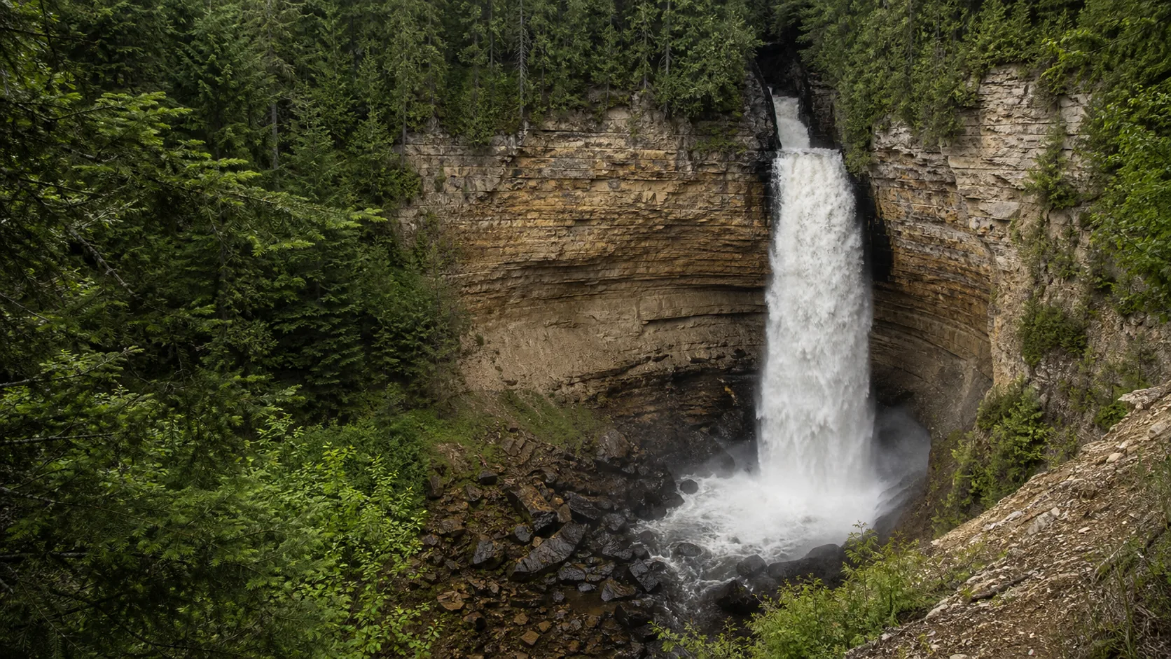
Miners Falls
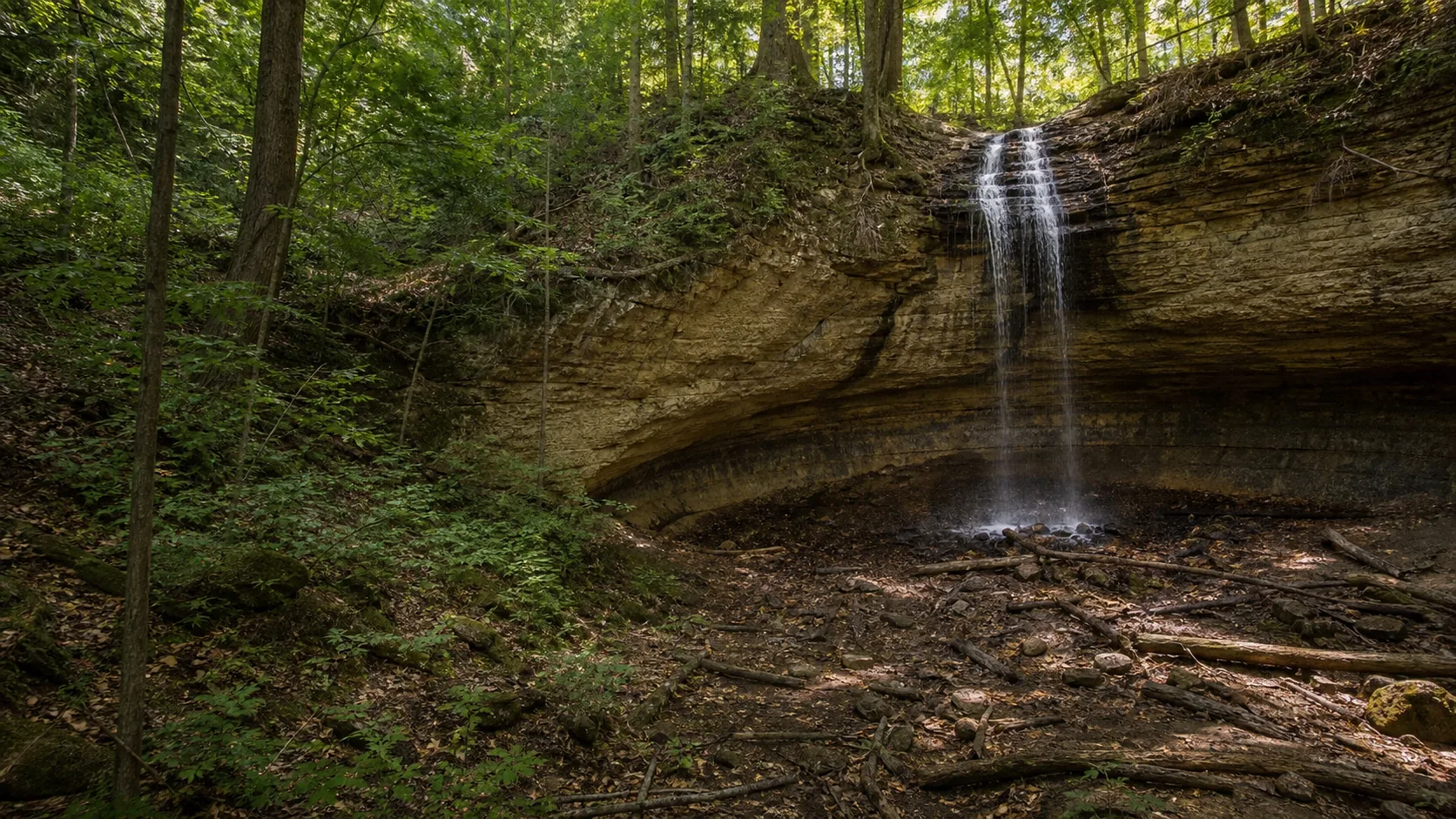
Plan Miners Falls near Munising Township, Michigan: 1.2 mi route details, parking and directions, best time to visit, safety notes, and 8 waterfall photos.
50 ft1.2 mi8 photos
Photos, maps, trail notes, parking, and access details for Michigan waterfalls in the Pictured Rocks region of the Upper Peninsula and at Ocqueoc Falls in the Lower Peninsula.
Michigan has more than 200 named waterfalls and almost all of them sit in the Upper Peninsula, where the soft Cambrian Munising Formation sandstone undercuts into wide alcoves that rivers can drop over and, in many cases, that you can walk behind. The Lower Peninsula has limestone shelves instead of cliffs and only one waterfall most visitors would call substantial: Ocqueoc Falls.
This hub covers five published Michigan guides. Four of them cluster around Munising in the Pictured Rocks waterfall belt (Munising, Miners, Tannery, Scott). The fifth, Ocqueoc Falls, anchors the Lower Peninsula side and happens to be the only fully ADA-accessible waterfall in the state.
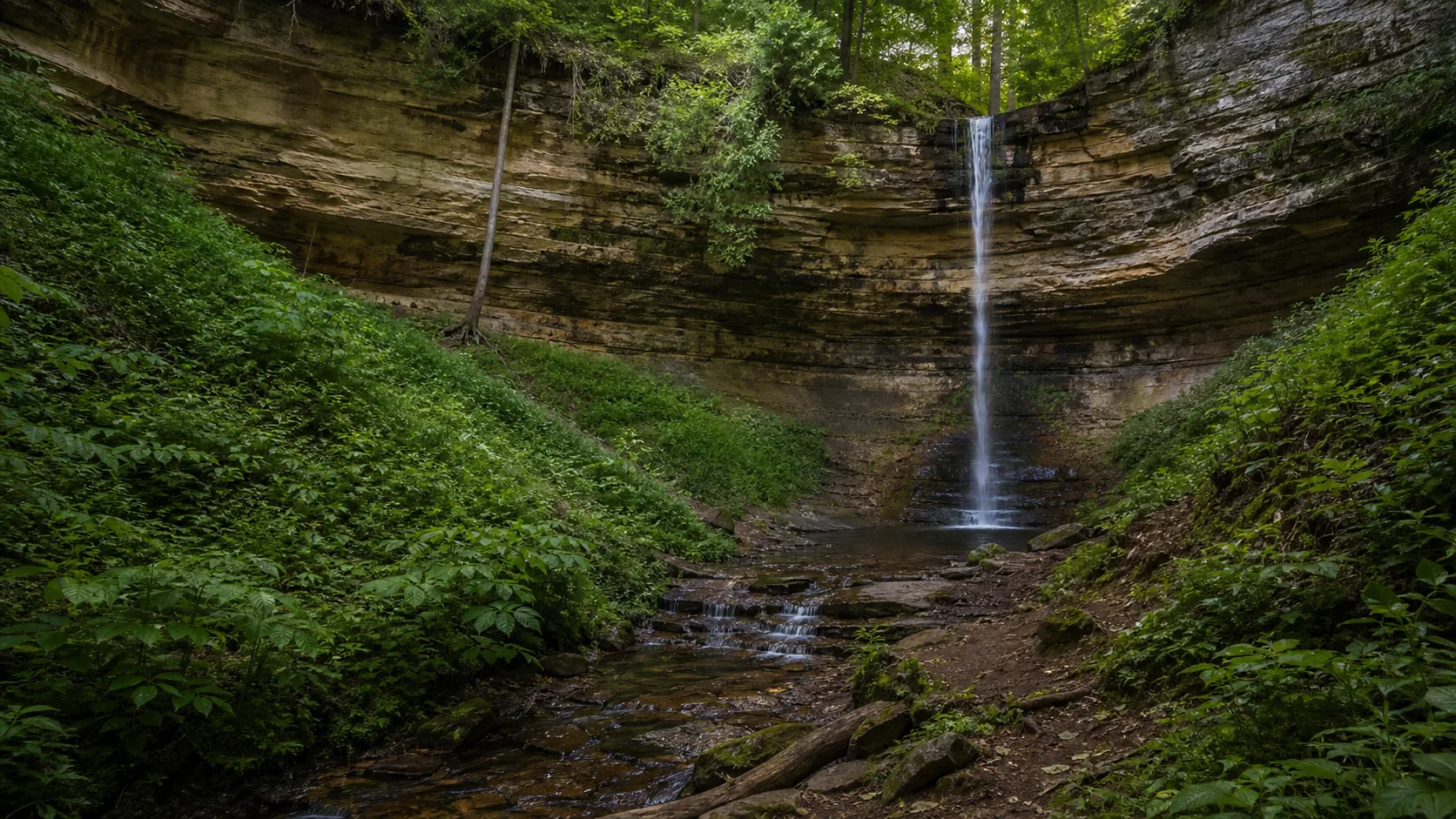
Fifty-foot plunge over Cambrian sandstone on a paved, ADA-accessible 0.4-mile out-and-back from the Pictured Rocks visitor center. The walk-behind alcove opens in summer; a full ice column forms most years in late January and February.
The NPS calls Miners the most powerful waterfall in Pictured Rocks. A 1.2-mile forested out-and-back ends at a lower platform reached by 64 steps. Holds a full curtain into late summer because the Miners River drains a larger area than most Munising-area creeks.
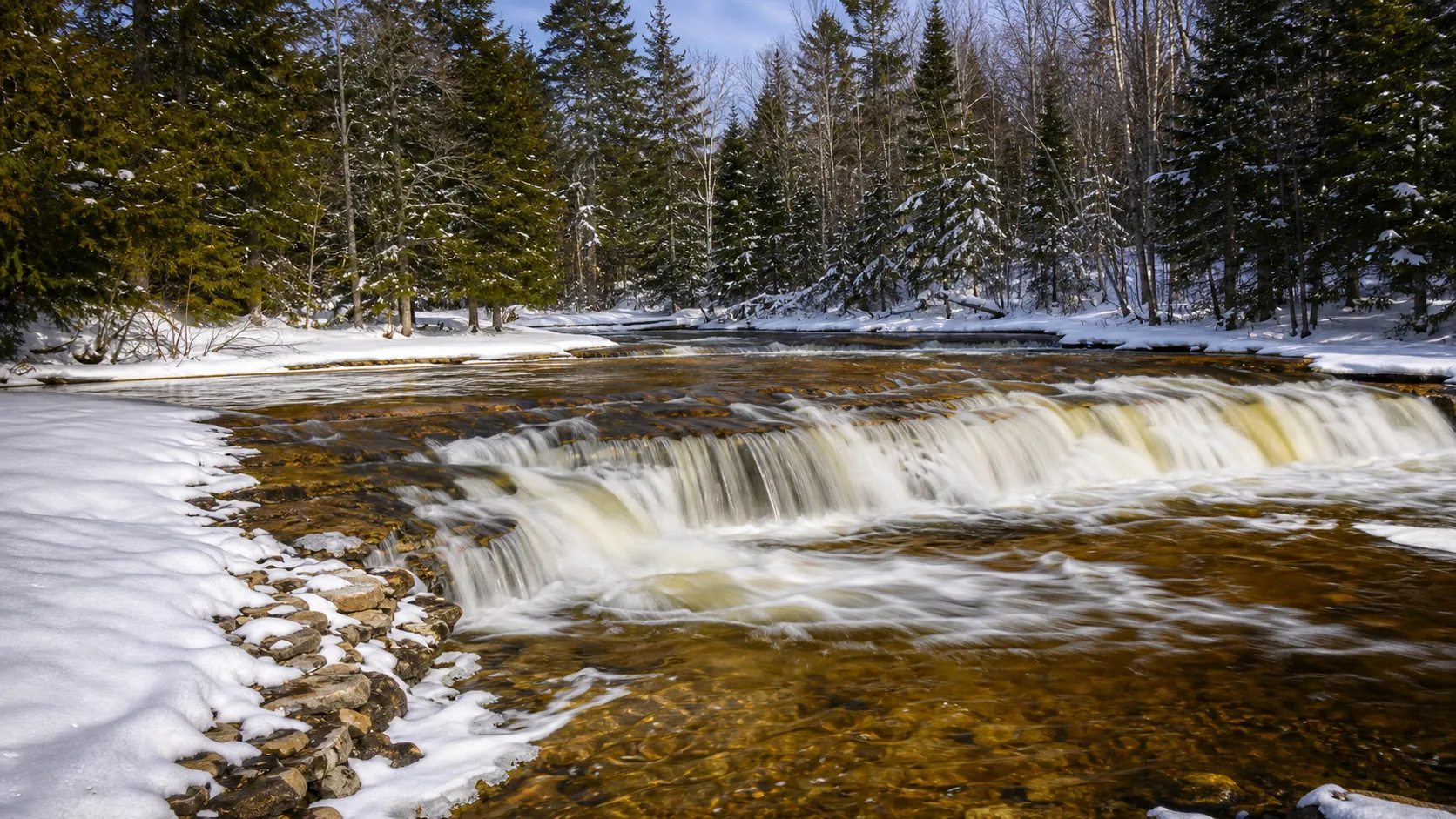
The only fully ADA-accessible waterfall in Michigan. A paved path and boardwalk put a wheelchair user at the water with the falls directly in front. The drop is short (about five feet of stepped limestone) but the pools below are the closest swimming hole in northeast Michigan.
Late April through May is the loudest window across the state. Spring snowmelt in the Upper Peninsula pushes the Munising-area creeks to full curtain, and Ocqueoc runs at its highest stepped volume in the Lower Peninsula. Roads to the Pictured Rocks falls are typically open by mid-April but plowing varies year to year.
Mid-June through early October is the standard visitor window. Walk-behind paths at Munising and Scott are open and dry; Miners holds a full curtain through late summer when most other Upper Peninsula falls thin to ribbons. Pictured Rocks parking lots fill before 11 a.m. on July and August weekends.
Late January through mid-February is the ice window. The 50-foot alcove falls (Munising, Miners) typically freeze into full ice columns in deep cold, and the soft-rock undercuts make the columns hollow with running water audible inside. Ocqueoc usually freezes into stepped ice shelves rather than a true column. Bring traction devices; the paved Munising trail is plowed inconsistently and the Miners path is not plowed at all.
Early October is the unofficial peak for color around all four Pictured Rocks falls; the Upper Peninsula hardwood turn runs about two weeks earlier than the Lower Peninsula.
Four falls within a fifteen-minute radius of downtown Munising, all on the same Cambrian Munising Formation sandstone that gives Pictured Rocks the region its name. The soft-rock undercut produces the recessed alcoves and walk-behind geometry that are the signature of the Munising-area falls. There is no entrance fee at Pictured Rocks National Lakeshore. Treat this as a single trip rather than four separate ones; the longest drive between any two is under twenty minutes.
The Lower Peninsula sits on Ordovician and Silurian carbonate rock that produces shelves and ledges rather than the high cliffs of the Upper Peninsula. Ocqueoc Falls is the largest waterfall in this half of the state and the only substantial drop most visitors will stop for. It is also the only fully ADA-accessible waterfall in Michigan, with paved path and boardwalk access to both the upper view and a pool-level overlook. Worth a stop on the Mackinaw drive between I-75 and the Lake Huron coast.
For most visitors it is Munising Falls in Pictured Rocks National Lakeshore. The 50-foot plunge over Cambrian sandstone is one of the few waterfalls in the country you can reach by a paved, ADA-accessible 0.4-mile trail and walk behind in summer. If you want the most powerful flow, Miners Falls (also in Pictured Rocks) holds a full curtain into late summer when other Upper Peninsula falls thin to ribbons.
Almost all of Michigan's substantial waterfalls are in the Upper Peninsula, with the highest concentration in the Pictured Rocks region around Munising. The geology is the reason: soft Cambrian Munising Formation sandstone undercuts into alcoves that rivers can drop over. The Lower Peninsula has limestone shelves and only one waterfall most visitors would call substantial, Ocqueoc Falls in the northeast.
Yes. Ocqueoc Falls in the Lower Peninsula is fully ADA-accessible, with a paved path and boardwalk that reach both the upper view and a pool-level overlook. It is the only waterfall in the state that puts a wheelchair user at the water with the falls directly in front. Munising Falls is partially accessible: the 0.4-mile paved out-and-back from the visitor center to the lower viewing platform meets ADA standards, but the upper deck and walk-behind path involve stairs.
The 50-foot alcove falls in the Pictured Rocks region (Munising, Miners) typically freeze into full ice columns in late January through mid-February in a normal cold winter. The soft-rock undercut makes the columns hollow, with running water audible inside. Ocqueoc Falls in the Lower Peninsula usually freezes into stepped ice shelves rather than a true column because the drop is short. The reliable window across the state is the second and third week of February after a sustained cold snap.
Yes. Munising Falls and Scott Falls both have walk-behind paths that work in summer when the undercut alcoves are dry. Both sit on the same Cambrian Munising Formation sandstone that undercuts faster than the caprock and produces the recessed shelf the path follows. The Munising walk-behind is closed in winter when the ice column blocks the route; the Scott Falls alcove is open year-round but the M-28 highway crossing is the bigger safety concern than the alcove itself.
No. None of the published Michigan waterfalls on this site charge an entrance fee. Pictured Rocks National Lakeshore (Munising, Miners, Tannery, and Scott) does not have an entrance fee, and Ocqueoc Falls is on Michigan state forest land managed for free public access. Possible costs are limited to drone permits, wedding permits, and any commercial photography or filming approvals through the National Park Service or Michigan DNR.
Michigan has more than 200 named waterfalls, with the vast majority in the Upper Peninsula. The Pictured Rocks region around Munising holds the highest concentration of accessible falls; Tahquamenon, Bond, and Agate are larger named falls further west and east that are not yet published on this site. The Lower Peninsula has only one waterfall most visitors would call substantial, Ocqueoc, plus several smaller dam-related drops not included here.
Plan Miners Falls near Munising Township, Michigan: 1.2 mi route details, parking and directions, best time to visit, safety notes, and 8 waterfall photos.
Plan Munising Falls near Munising, Michigan: 0.4 mi route details, parking and directions, best time to visit, safety notes, and 8 waterfall photos.
Plan Ocqueoc Falls near Ocqueoc Township, Michigan: 0.3 mi route details, parking and directions, best time to visit, safety notes, and 4 waterfall photos.
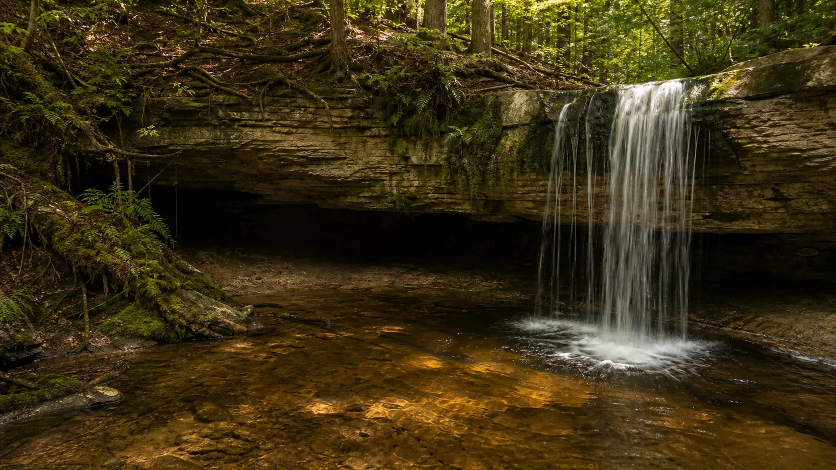
Plan Scott Falls near Au Train Township, Michigan: 0.1 mi route details, parking and directions, best time to visit, safety notes, and 4 waterfall photos.
Plan Tannery Falls near Munising, Michigan: 0.4 mi route details, parking and directions, best time to visit, safety notes, and 8 waterfall photos.